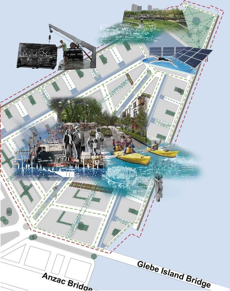
“LIVE TOGETHER ON THE EDGE” - URBAN CANAL PROGRAM
Wenrui Zhang (Tammy) z5210751
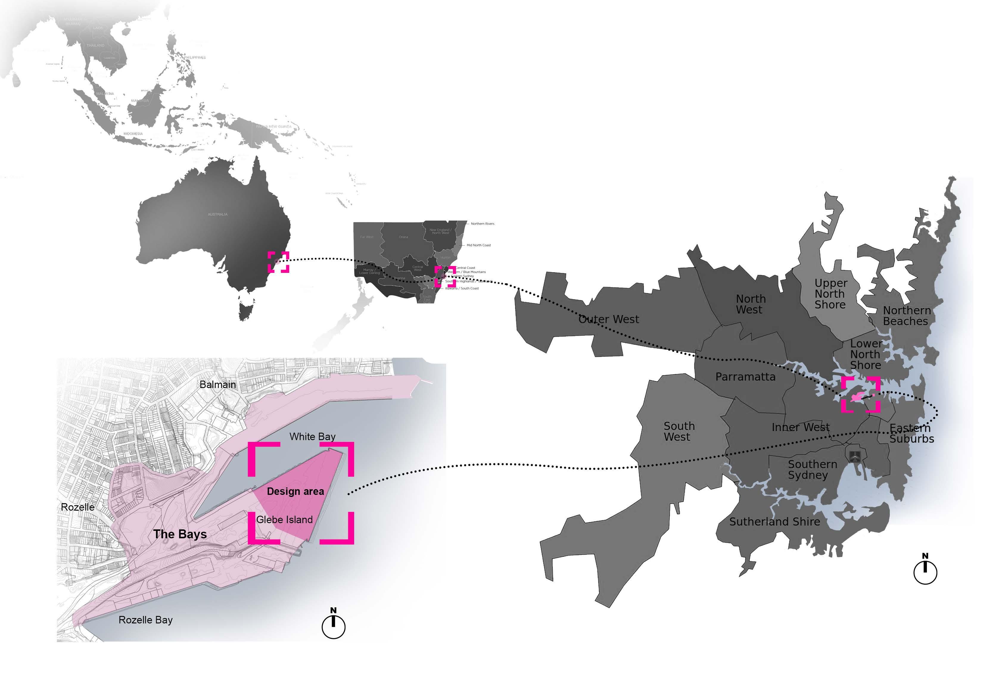
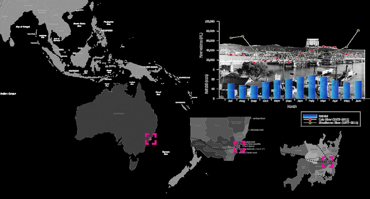
Sydney Catchment Australia
New South
Wales
Sydney
Sydney CBD
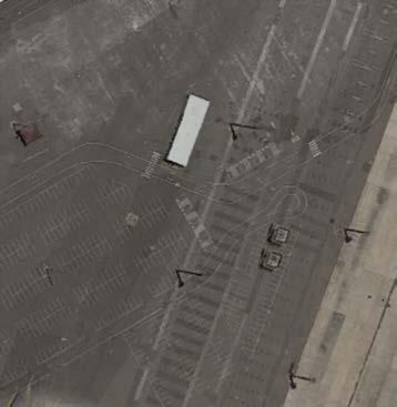
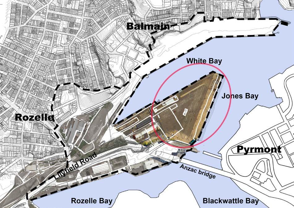
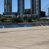
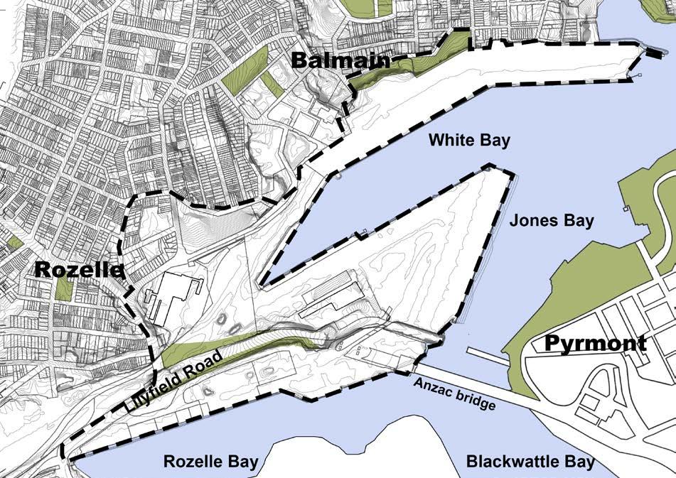
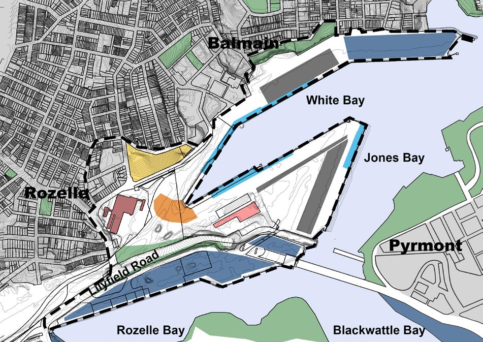
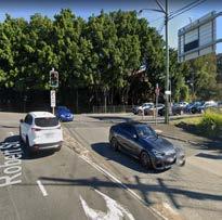
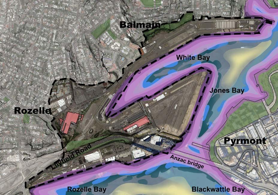
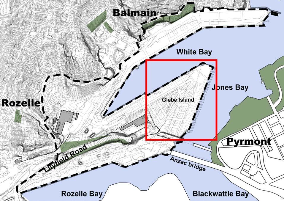
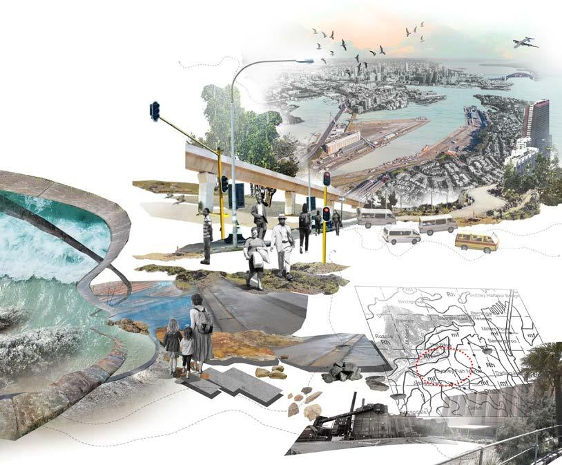
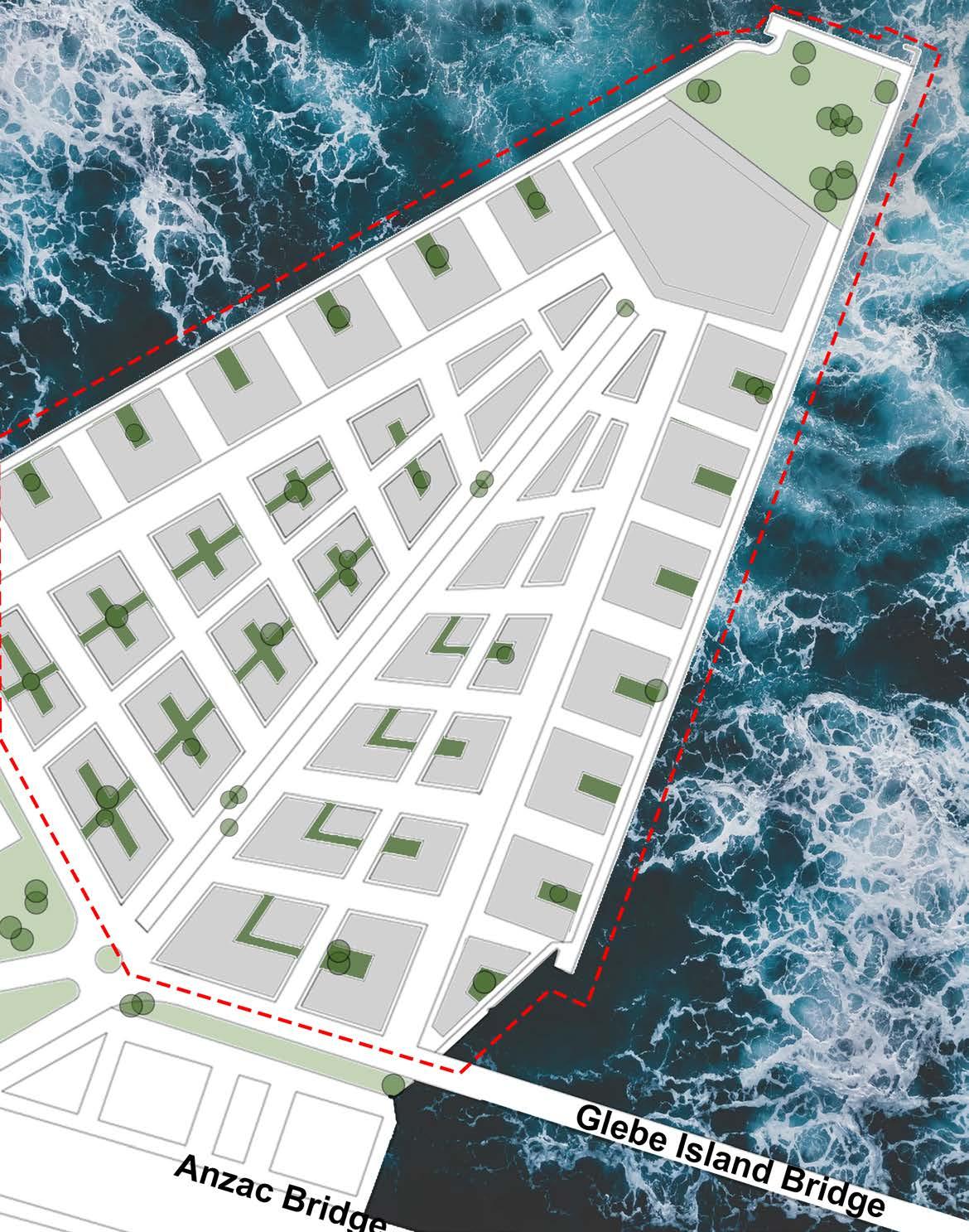
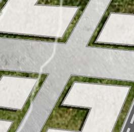
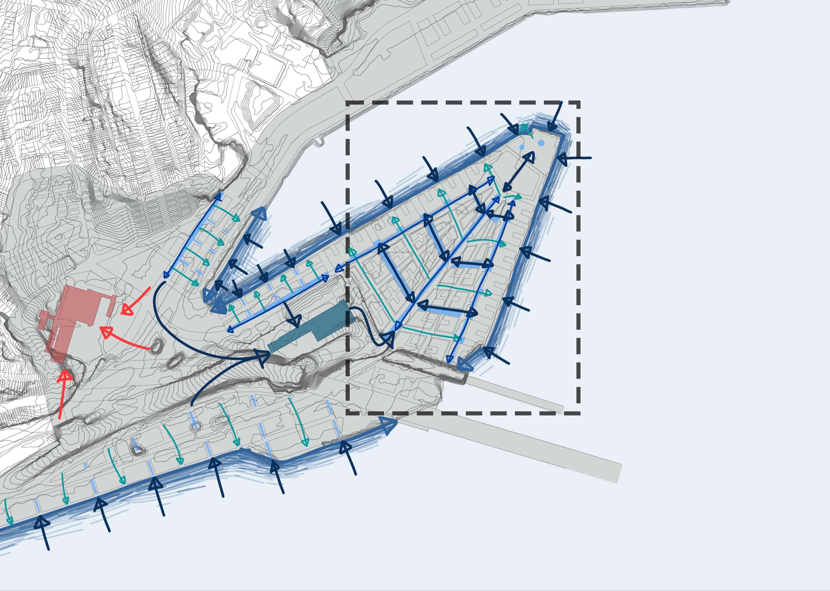
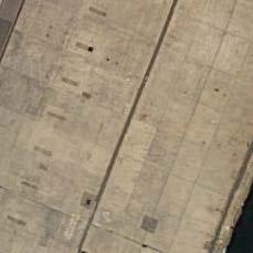
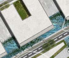
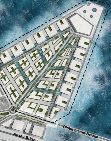
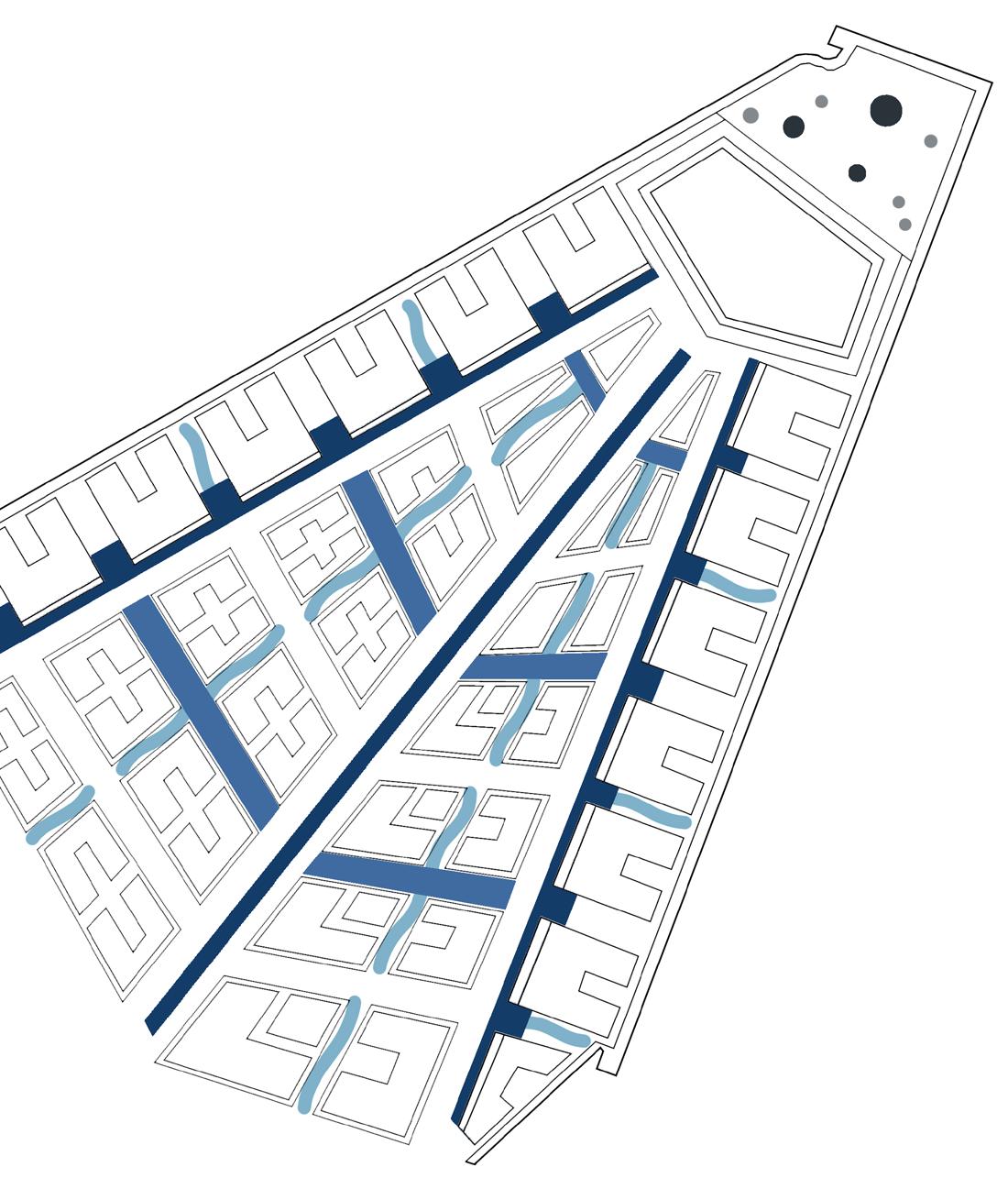
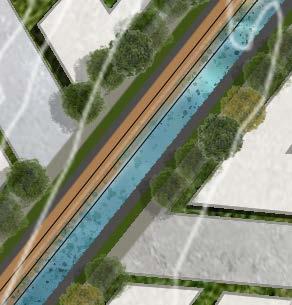
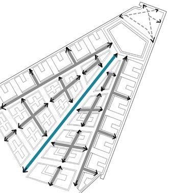
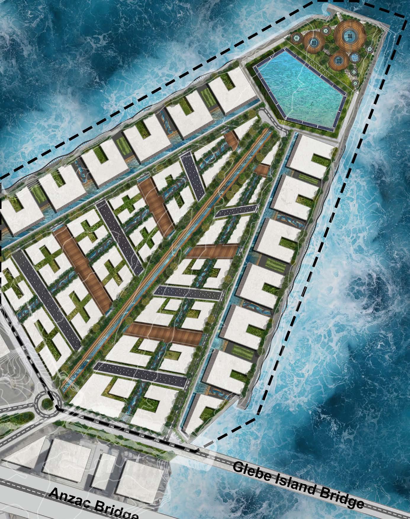
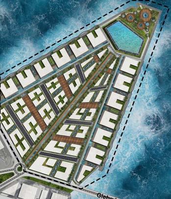
The Bays 2.4km
“LIVE TOGETHER ON THE EDGE” - URBAN CANAL PROGRAM


How does waterfront landscape activate the function of high-density cities?
Guiding principle of waterfront landscape is in line with the theoretical framework of green infrastructure, involving strategic wetlands, sand dunes, mangroves and coral reefs. It reduces the threat of catastrophic floods and coastal erosion with minimal design intervention, while also revitalizing the land.
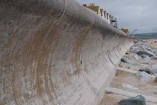
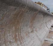
In contrast, "grey infrastructure", such as edge and seawalls used to control sea water, is often insufficient and sometimes even destructive.
Today, waterfront landscape and its surrounding vegetation cover have been proved to affect the landscape quality and overall landscape of coastal areas. This well-designed "second nature" is the second opportunity to deal with urbanization.
Green infrastructure (Herrington, 2016) exp. strategic waterfront landscape


Grey infrastructure


Research Question
How does waterfront landscape activate the function of high-density cities?
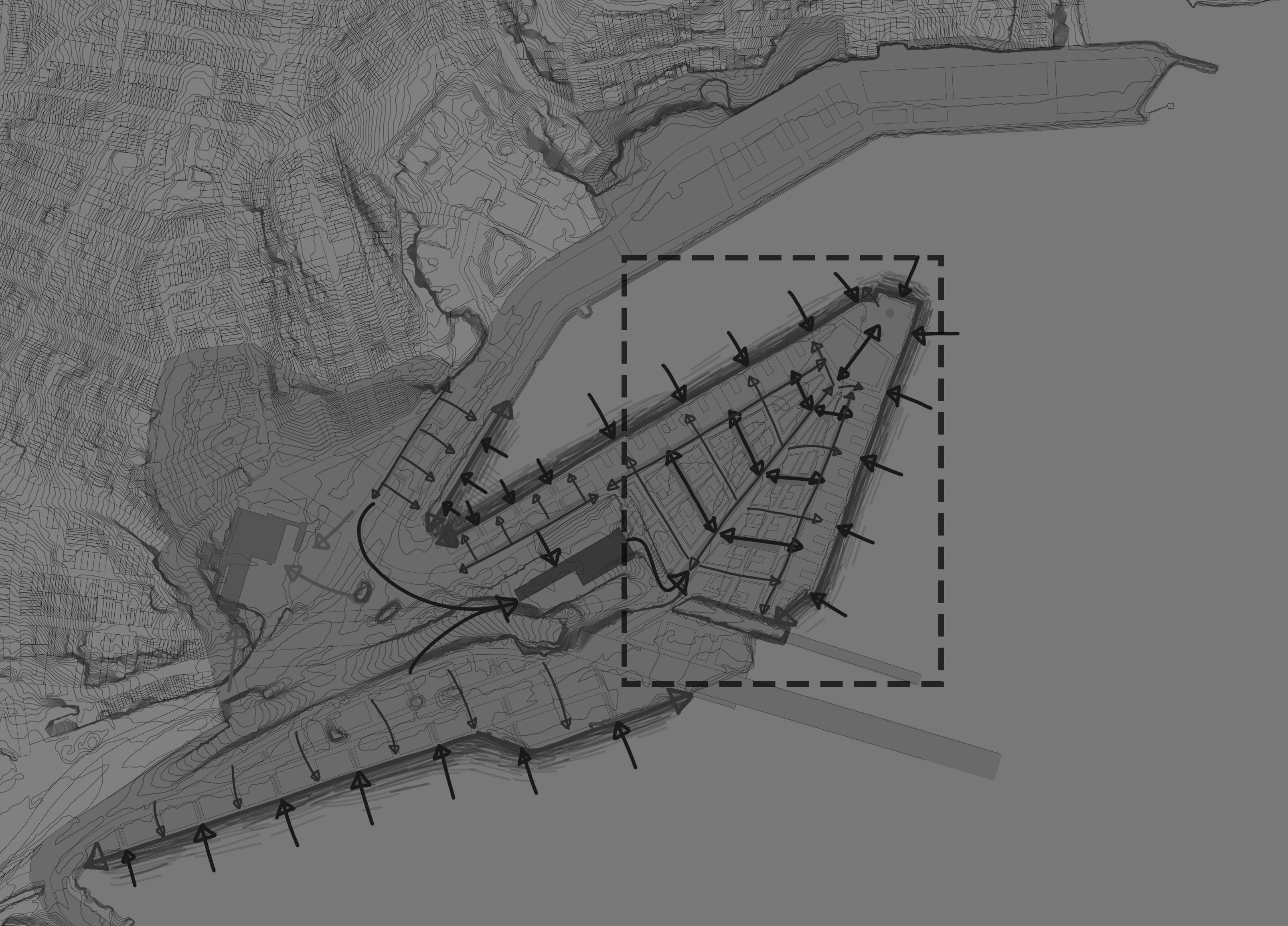
In the bustling city of Sydney, the morning peak is in the city center and the evening peak is in the suburbs, which itself is a predictable cycle. Waterfront landscape is also a predictable cycle for urban development.
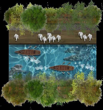
Precedent
In

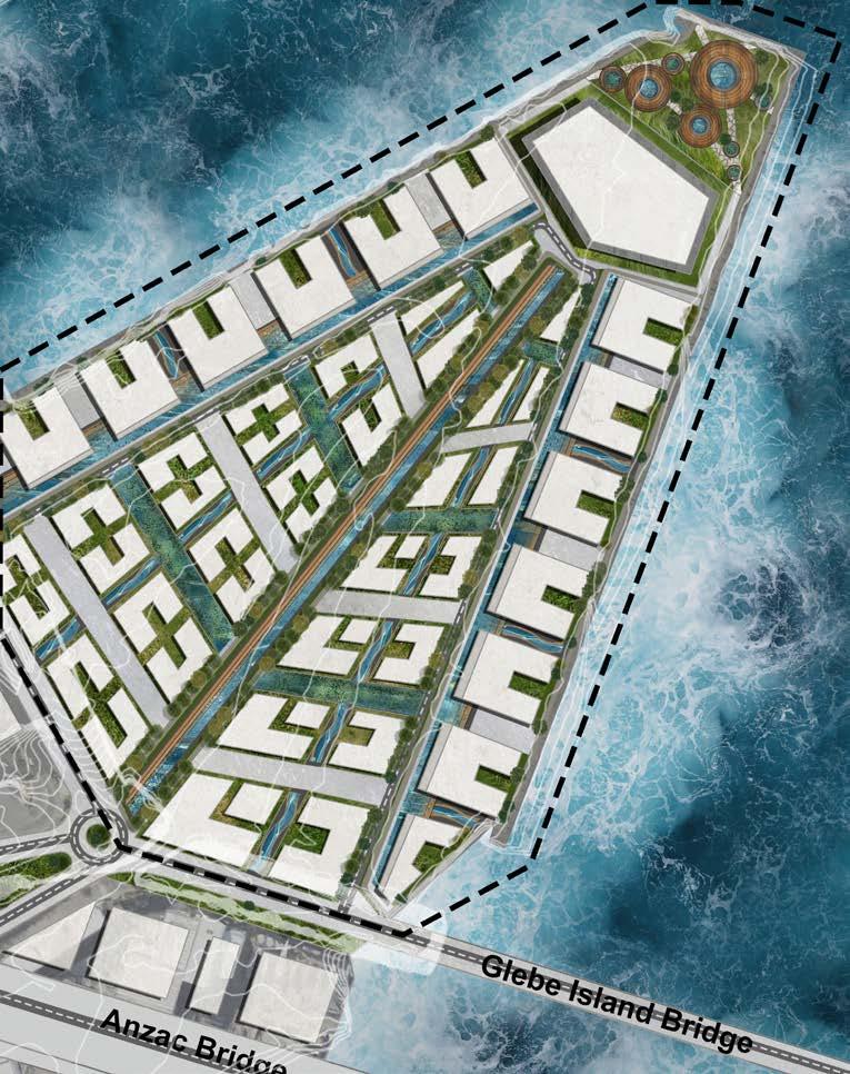
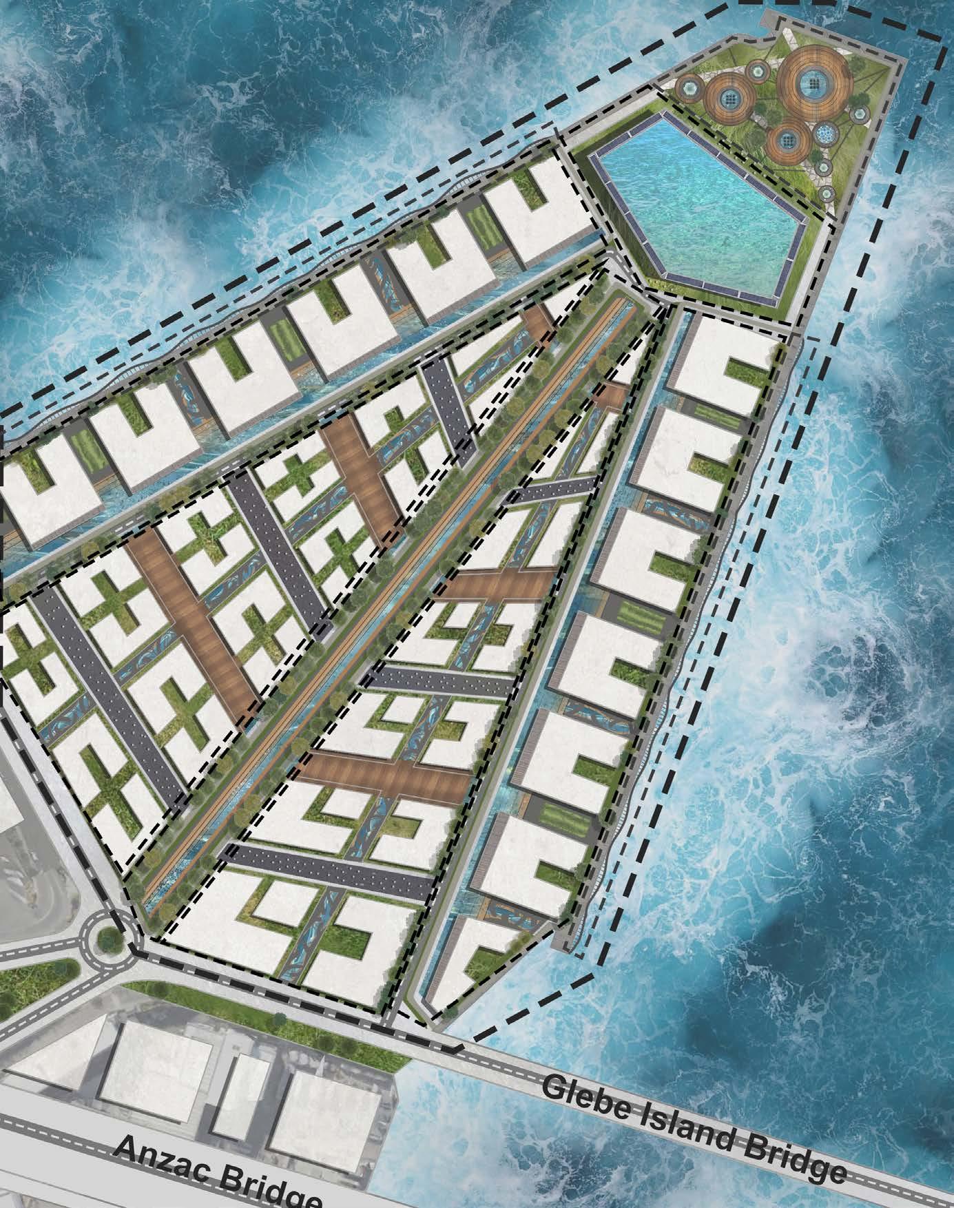
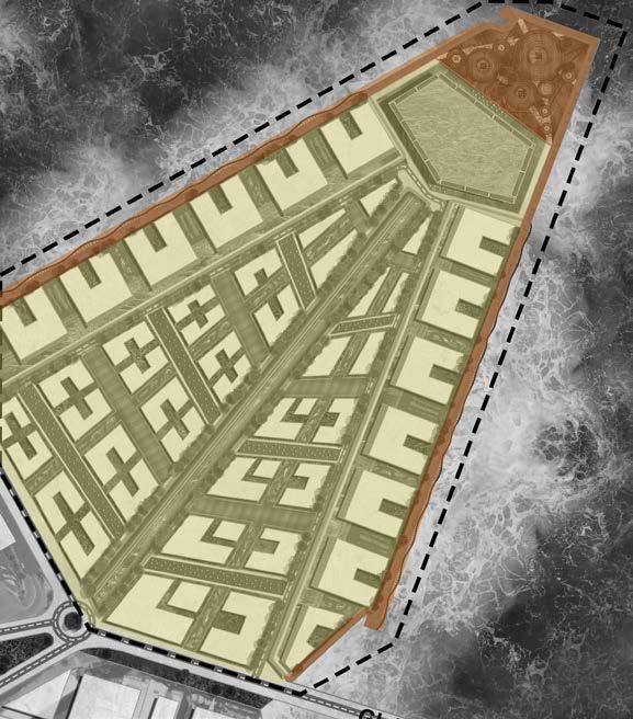
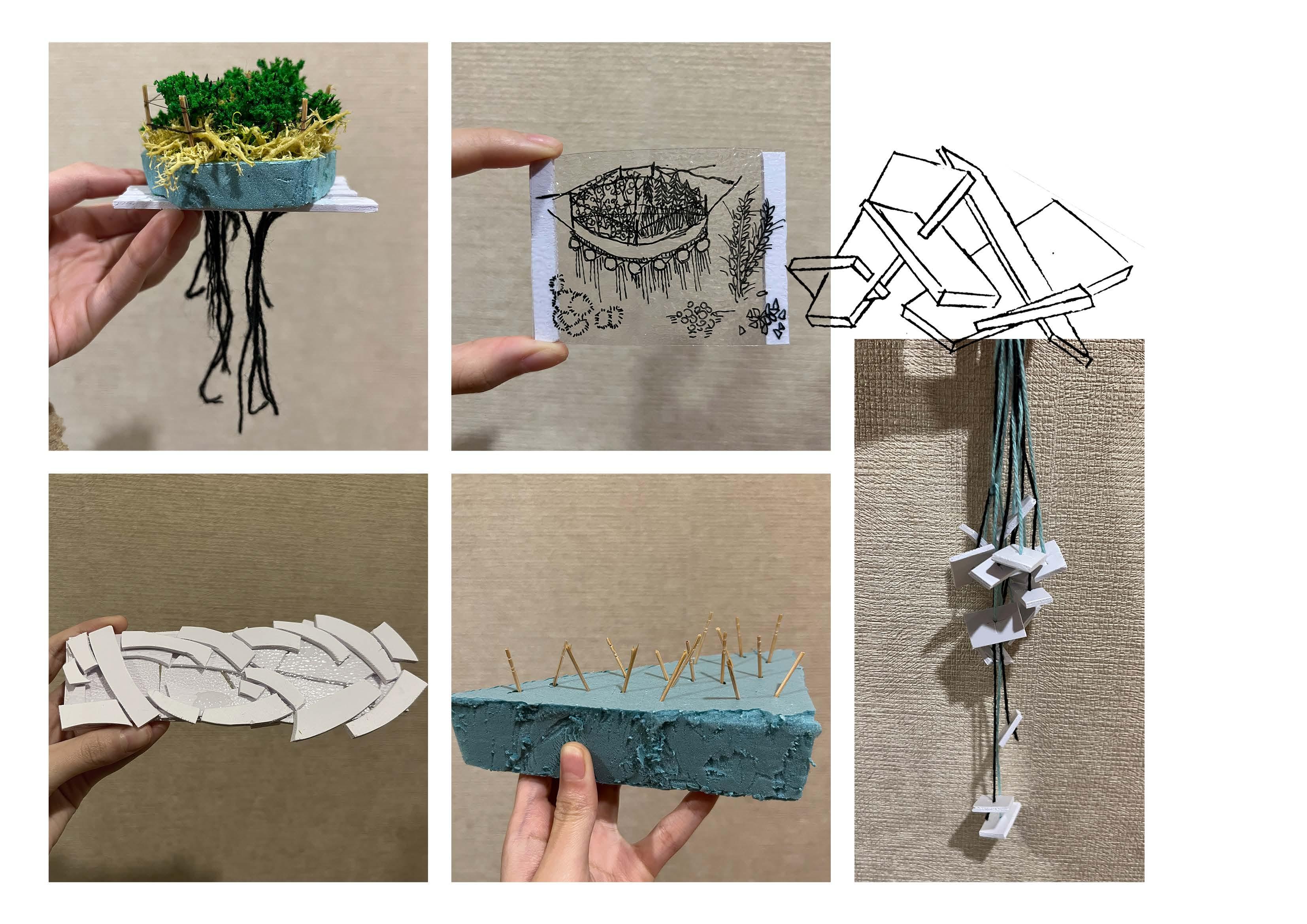
Develop successional design strategies of planting, habitat and hydrology for Glebe Island to break the harsh edge of the harbour, create urban waterfront and stimulate a new ecological and social narrative.
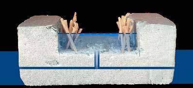
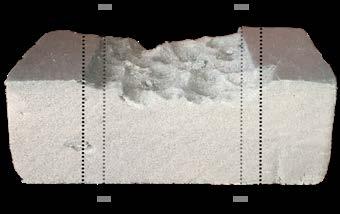
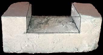
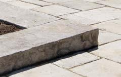
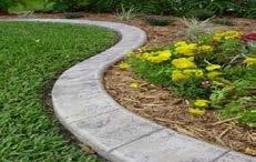
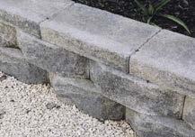
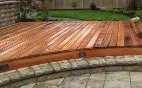
“Edge restraints help define each space…Each edge section can be joined to the next in a variety of ways, creating many design possiwbilities.” (Oldcastle Infrastructure, 2019)
Principle

Natural Succession

Topic Driven


Process Driven

“Natural succession not interfering with land so that plants can grow back as they will, and animals return at their own rate It doesn’t cost anything...” (Facemire, 2021)


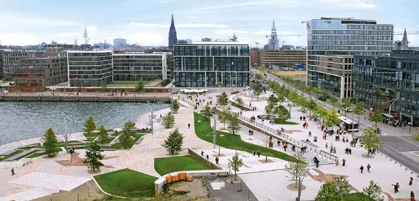
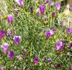
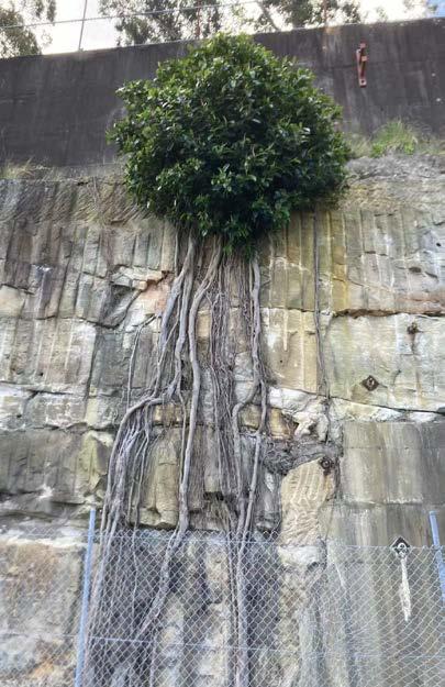
“Waterfront landscape are the most attractive landscapes…people always love to live close to water, and the famous ancient cities are all located in waterfront areas. Water is a good natural defense as well.” (Hou, 2009)


Landscape Narrative
"Narratives… intersect with sites , accumulate as layers of history, organize sequences, and inhere in the very materials and processes of the landscape. In various ways, stories 'take place.'" (Potteiger, 1998) Story Driven
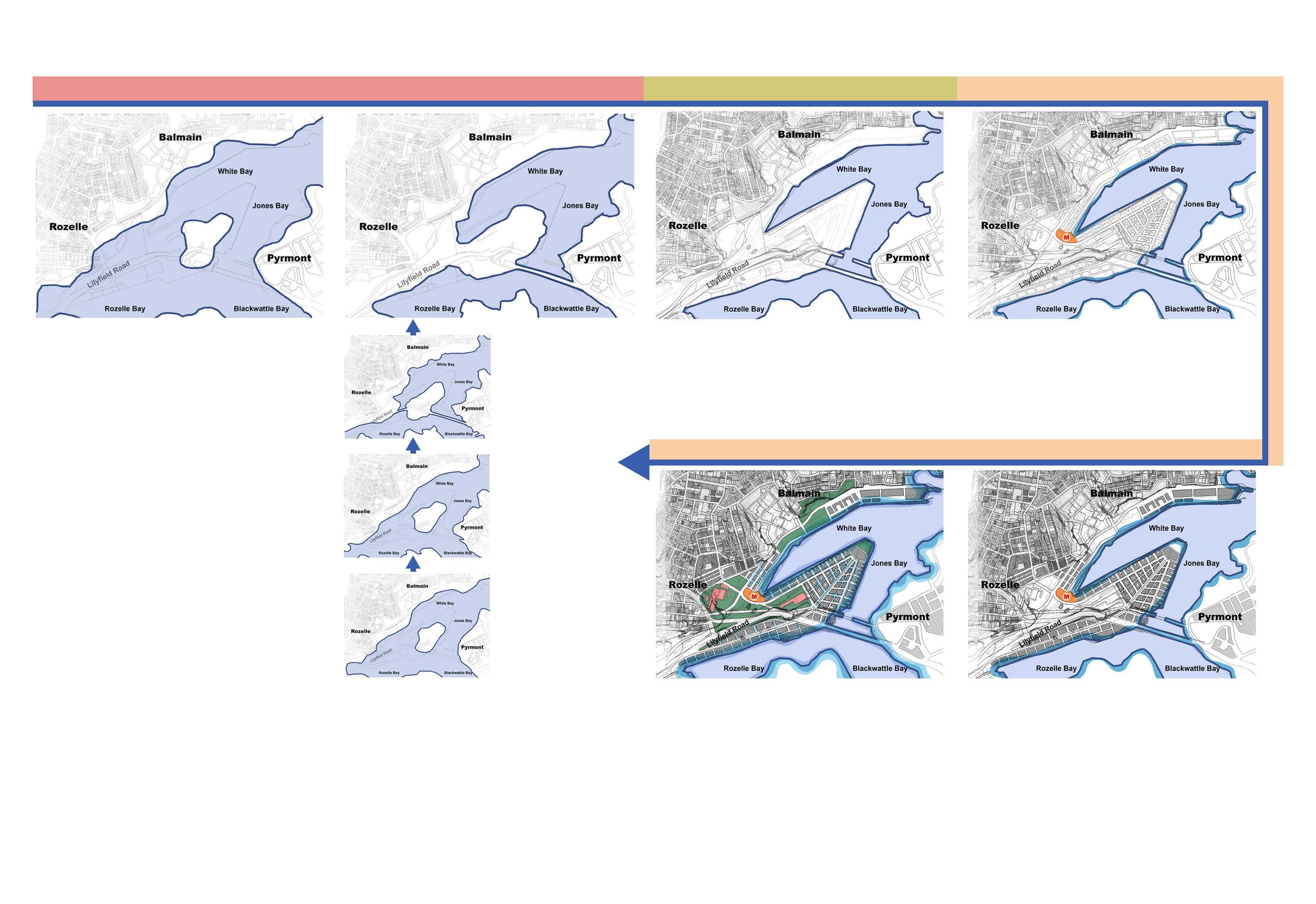
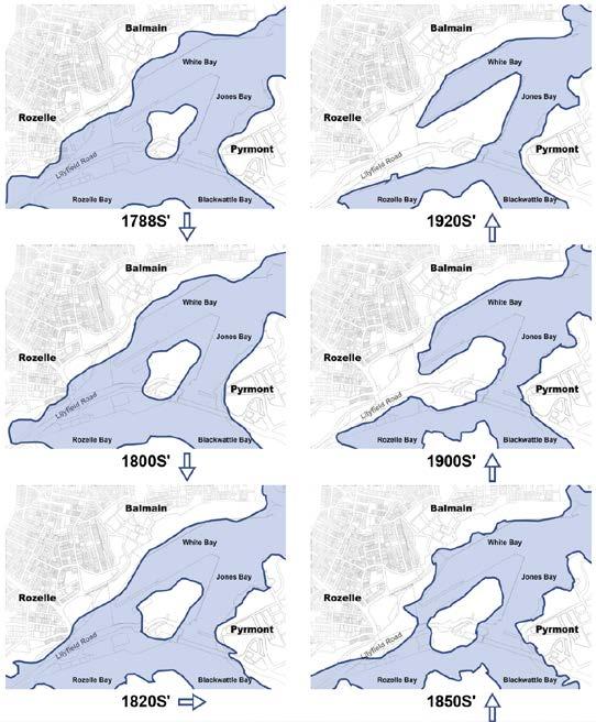
Most of the foreshore was composed of water before land reclamation in the Bays.
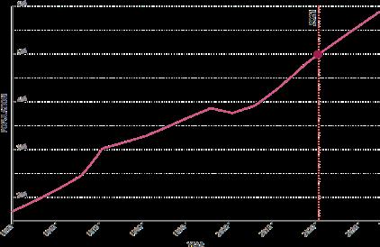
At least 40% of the population now live within 100 kilometers of the water body.
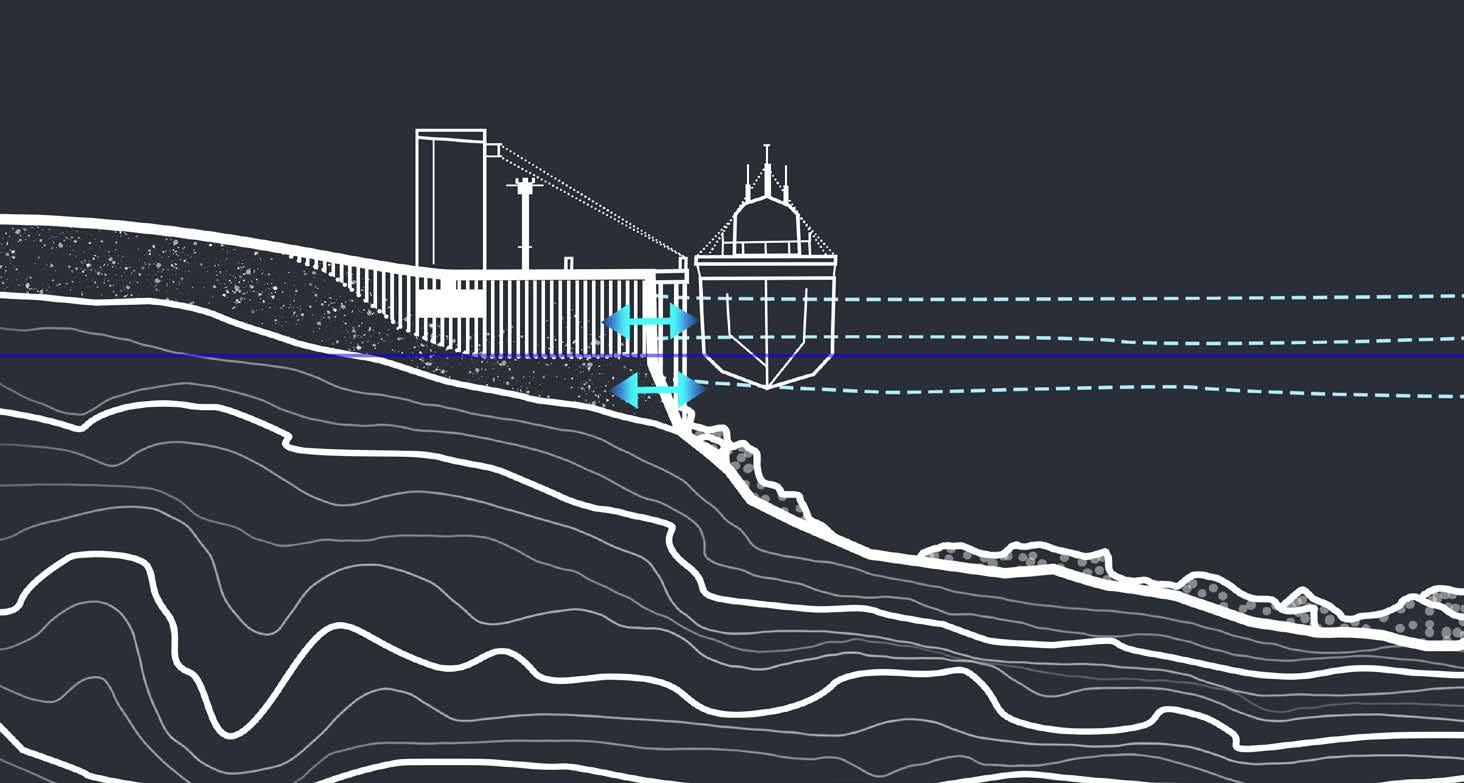
With global warming, sea level is rising year by year. Flood events from the ocean are expected to increase.
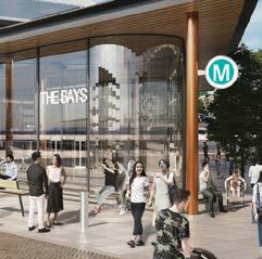
2030: Metro Station open
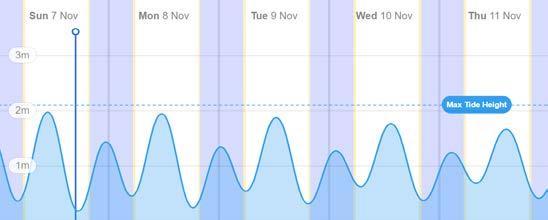
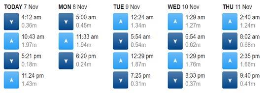
Sea level will rise by 0.2m... Sydney's population continues to rise...
Sea level will rise by 1m...
Sea level will rise by 0.5m... Projected increase in flooding events from the sea.
City will have different climates and spaces, so waterfront landscape design will become a popular choice for planning high-density cities.
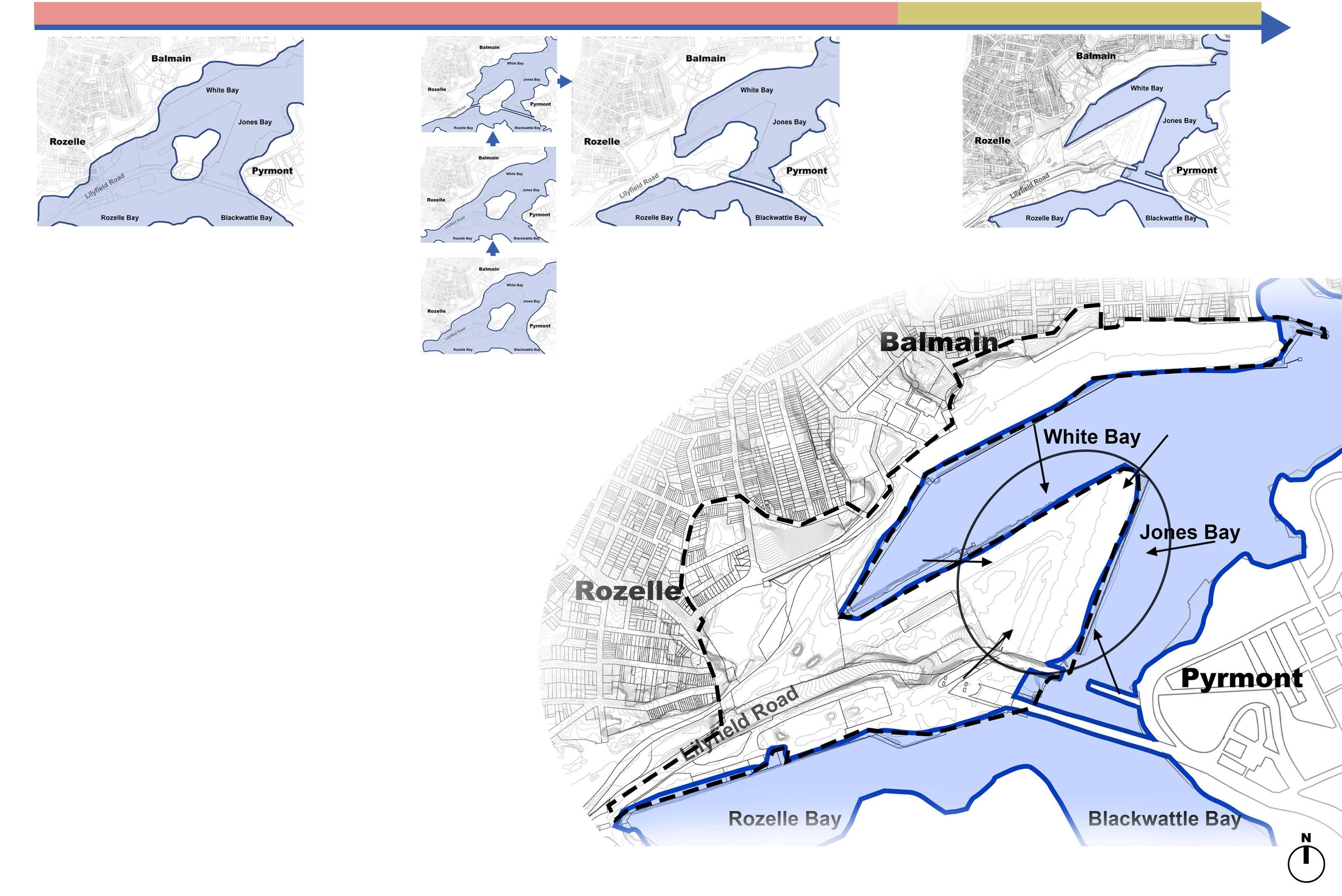
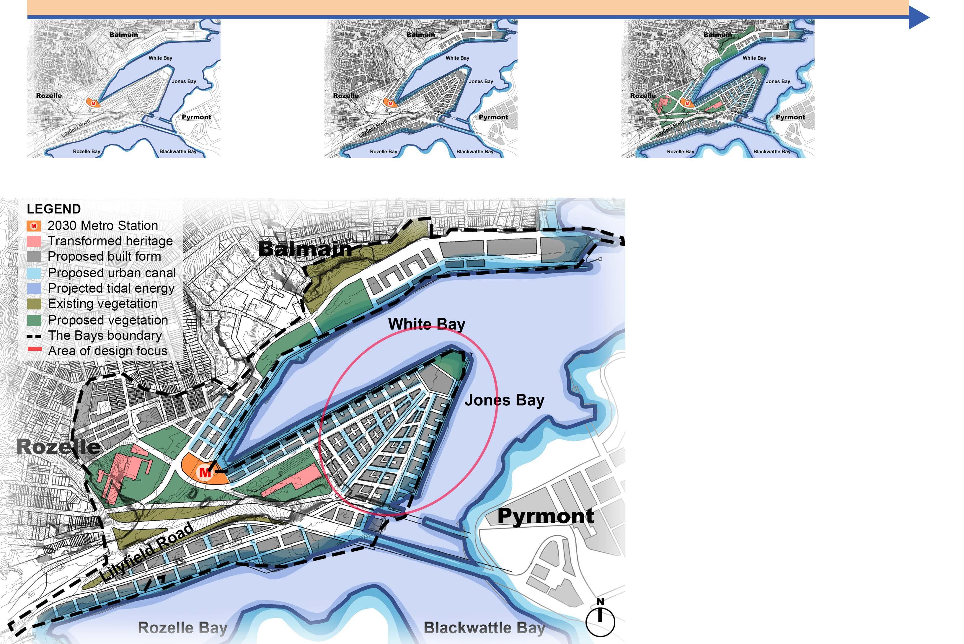
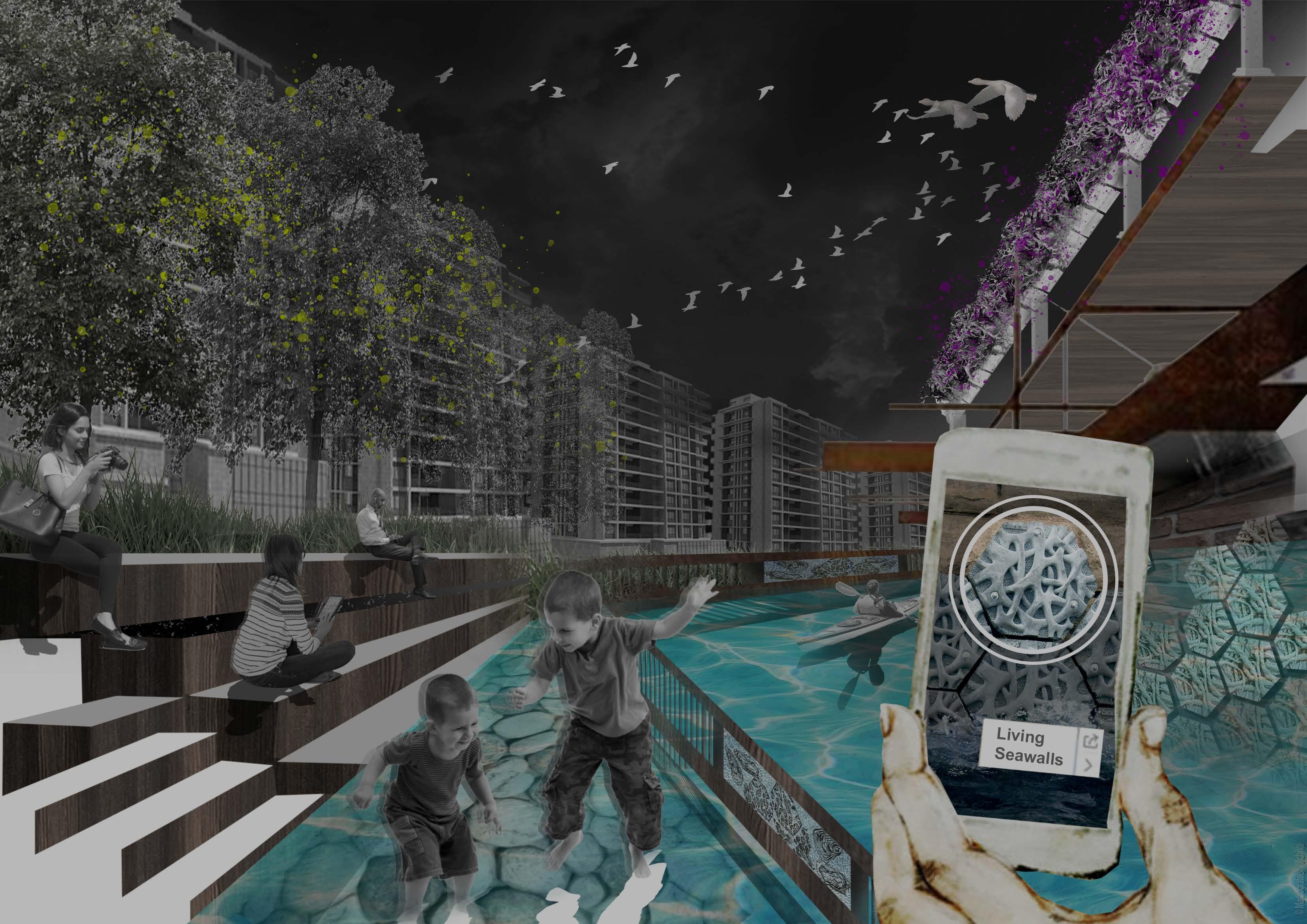
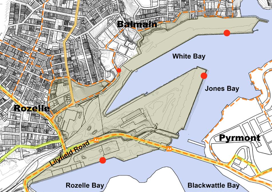
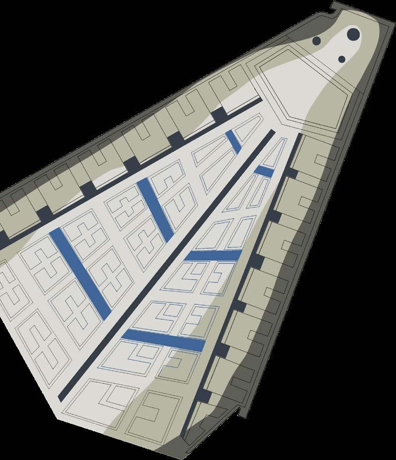
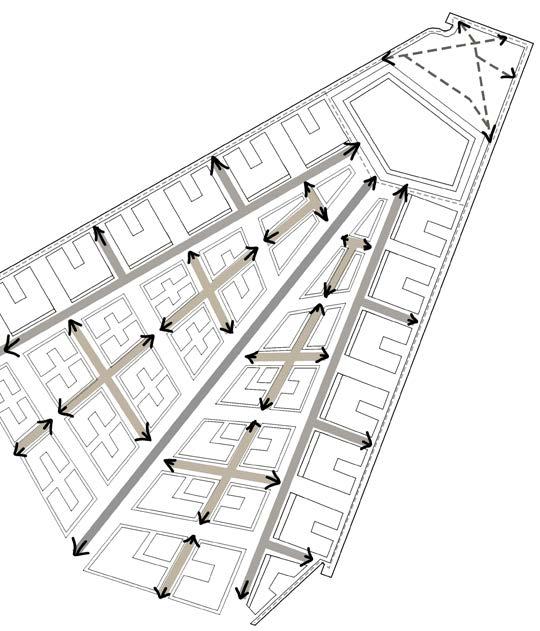
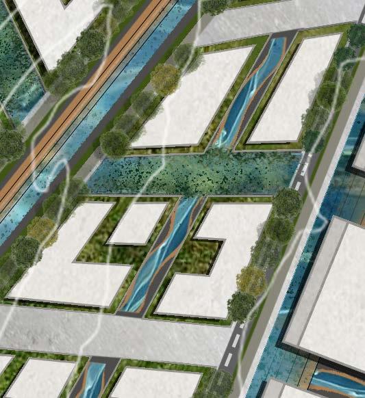
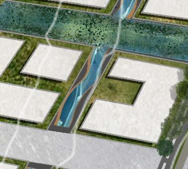
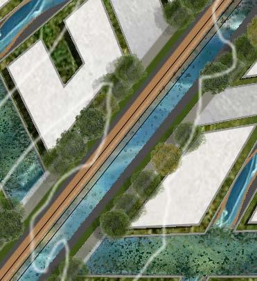
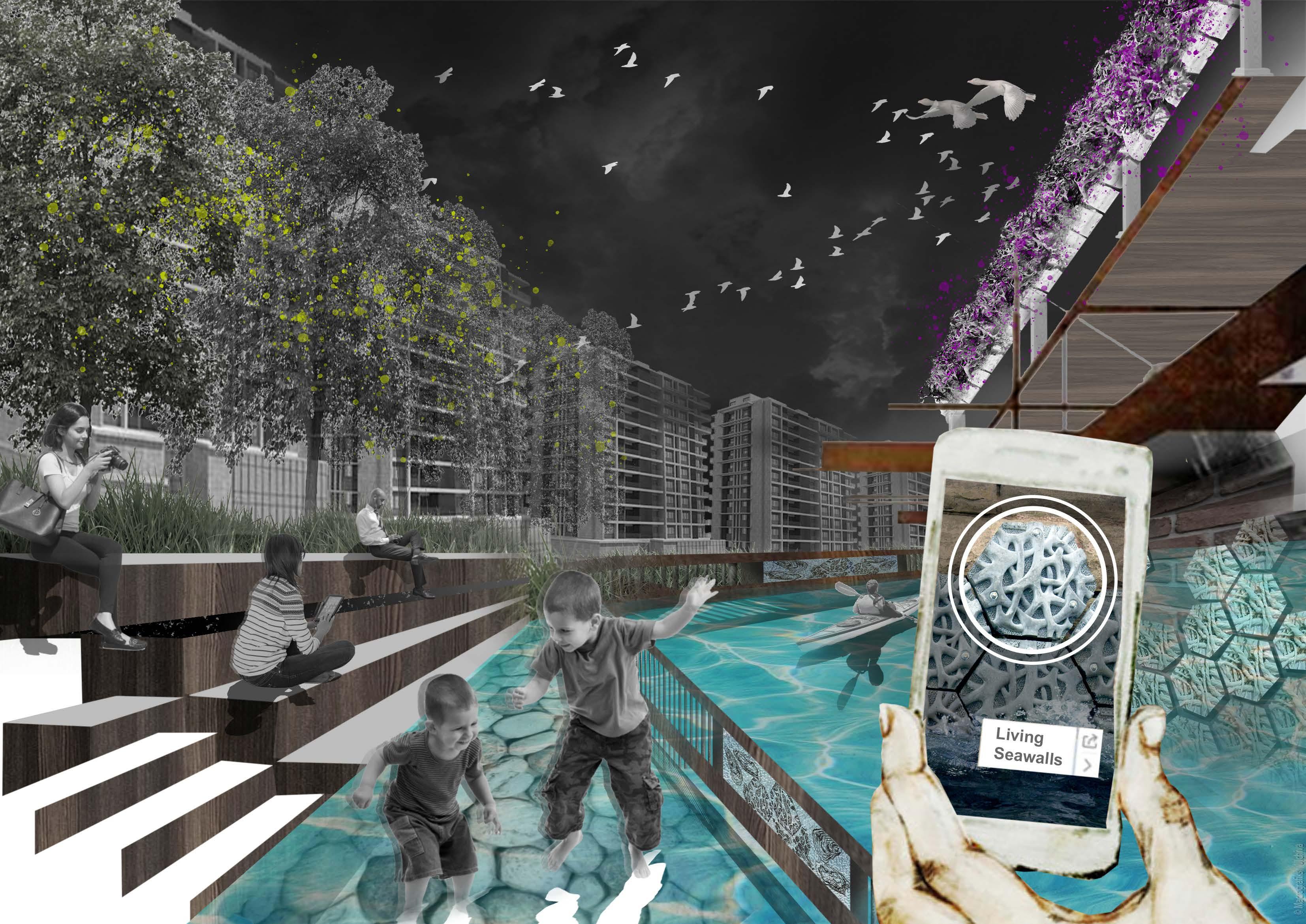
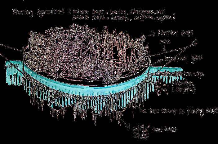
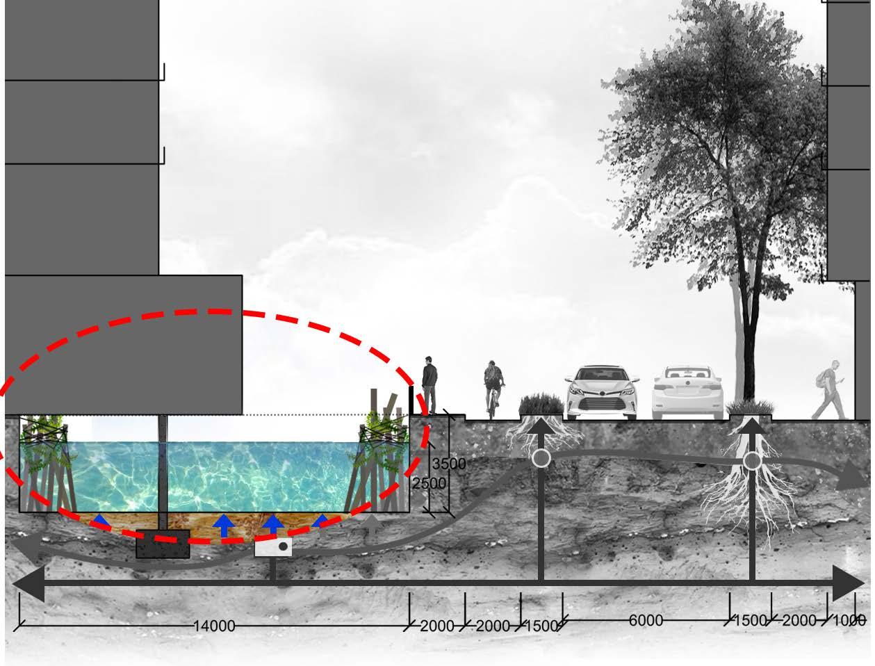
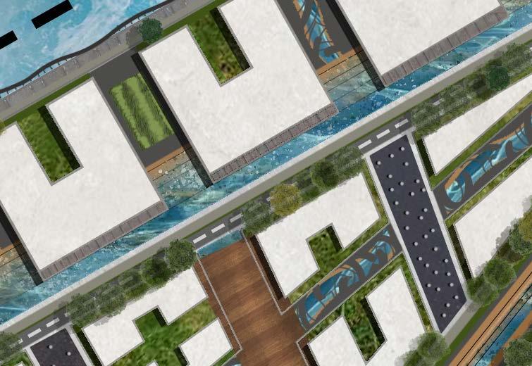
1 The urban canal program will be inserted and the harbour edge will be re-edited.
2 Population introduction, community construction, commercial development. Metro Station will open in 2030.
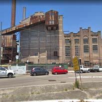
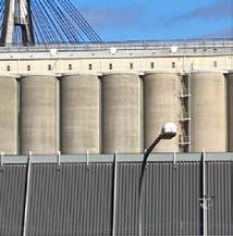
3 Protect White Bay Power Station and Silo.
4 Green coverage will increase, and production landscape will be developed.

YRS.
YRS.
YRS.
YRS.


Limit:
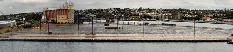
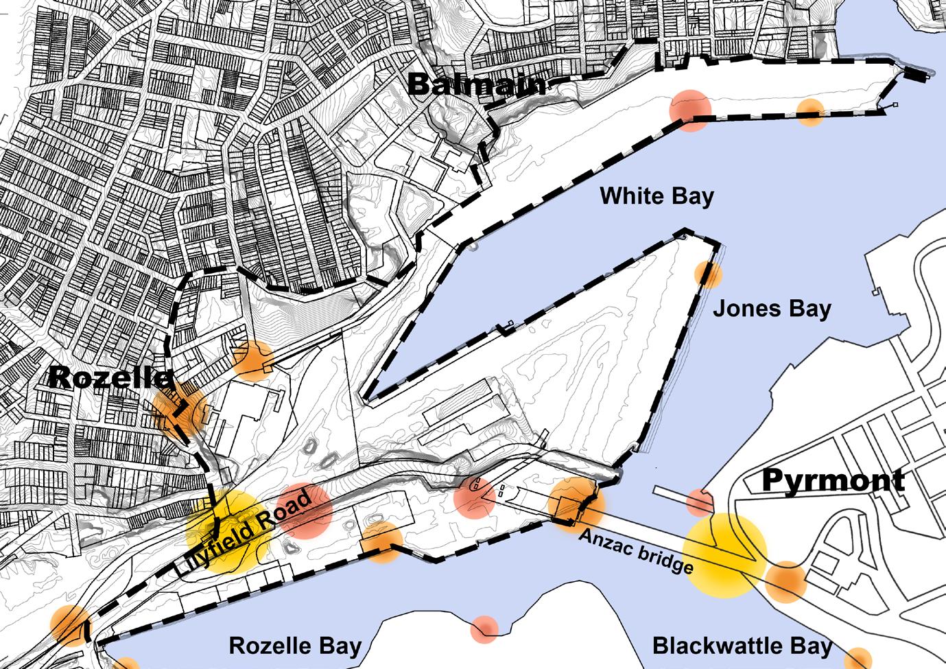
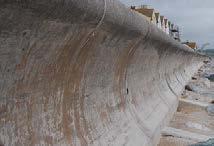
+ The existing concrete apron cuts off the connection
+ Hardly covered by any green space . Only some polluted vegetation grows along Lilyfield Road.
Opportunity:
+ Opportunities for developing high-rise building.
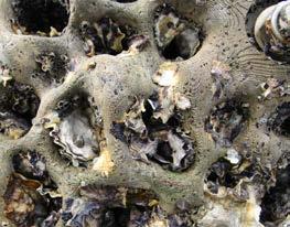
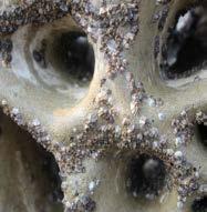
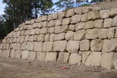
+ The harsh edge of port can be re-edited as a resilient habitat
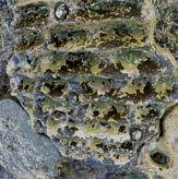
Existing seawalls & harbour edge
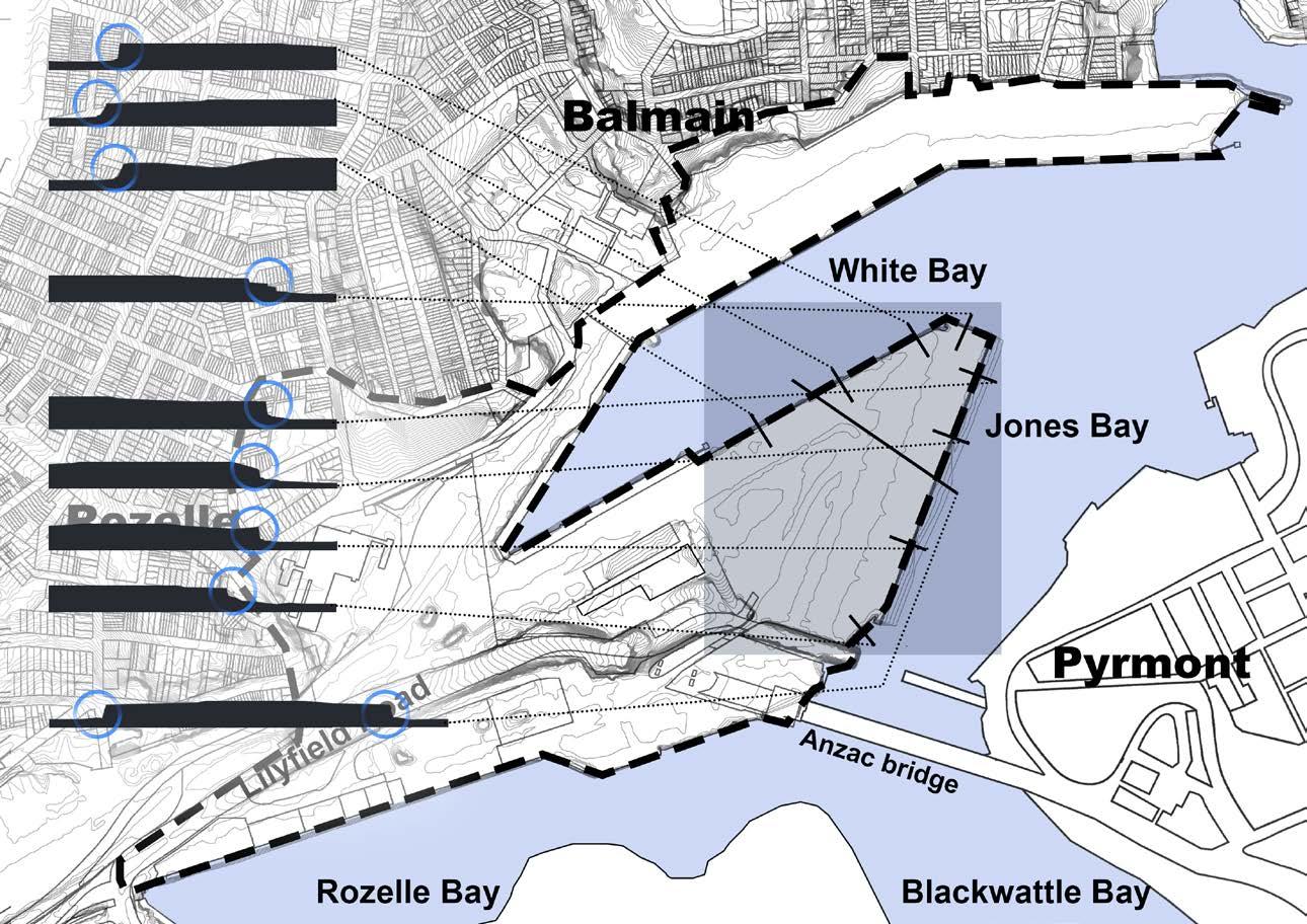
Existing bus route
Existing routes with wayfinding signage
Existing bike lane or low traffic street
Wharves The Bays boundary


Limit:
+ Single connection and chaotic traffic lead to the noise of the port.
+ Undeveloped land and abandoned historical heritage aggravate the urban heat island effect
Opportunity:
+ The public transportation around is good. The Metro Station will open in 2030, which will have the opportunity to increase the commercial value
+ Close to the City of Sydney and spectacular coastline, it is an opportunity to develop tourism.
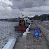
+ Abiding maritime services.
Limit:
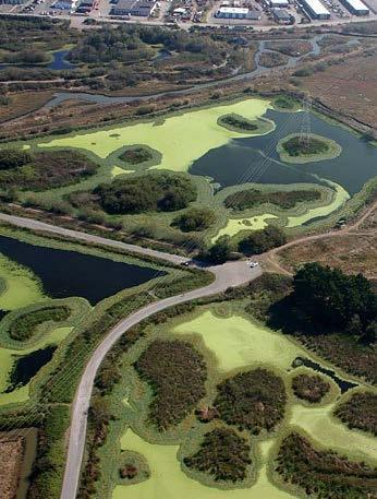
+Two important causes of site water pollution.
1 Pre-industrial land reclamation.
2 Tidal fluctuation.
Opportunity:
High intensity pollution
Medium intensity pollution
Low intensity pollution
+ Insert the dynamic waterfront landscape to break the material and harsh edge.
+ Transform the abandoned heritage as a sewage treatment plant
+ Weave the water back to the site. Opportunity is to purify the site.
Sediments & contaminants
Good water quality
The Bays boundary HARD DRAINAGE
Existing street water flow
Existing rainwater flow
Heritage
Maritime services
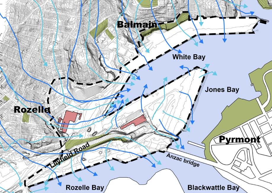
Existing vegetation The Bays boundary
Sea level change
Orginal shoreline
Potential sediments & contaminants


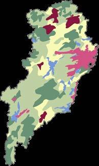
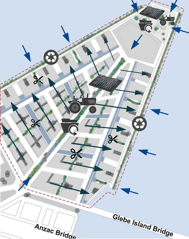
OPPORTUNITIES
ECOLOGICAL ENVIRONMENT ANALYSIS
1 Increase the coverage of open green space
3 Develop ecosystems with purification function Propose production landscapes 4 Solar energy design
ANALYSIS 5 Develop public transport connections
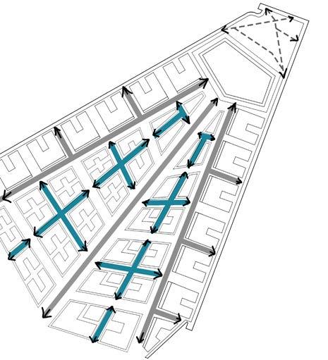
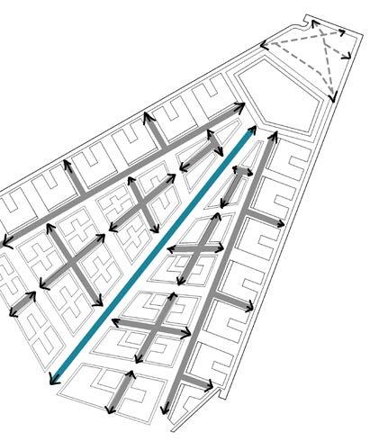
7 Make full use of undeveloped space Re edit the harbour edge and create more internal edge conditions
8 Maintain maritime services
QUALITY ANALYSIS 9 Insert the urban canal program
Re plan the water system
history and create landscape with cultural significance
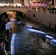
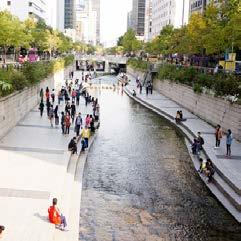
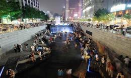
Precedent: ChonGae Canal Restoration, Central Seoul, Korea
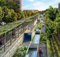
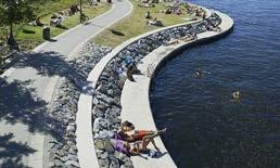
Precedent: San Pedro Creek, San Antonio, America
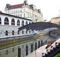
Precedent: Renovation of the river Ljubljanica Barcelona Spain
Green space coverage is scarce
3 The land is polluted by industrial heavy metals The heat island effect is serious
ANALYSIS 4 Few street types and loud noise
Concrete apron - lack of community connectivity and functionality
PRINCIPLE 1
Plan for long-term growth and renewal
OBJECTIVE 1
Flexible reclaimed land development policy changes over time and site needs. Design moves include returning farmland, demolish, recycling and cut and fill.
OBJECTIVE 2
Regularly update and maintain the drainage system to maintain the functions of water circulation and purification.
OBJECTIVE 3
Introduce vegetation with purification function to establish a new ecology centered on Central Avenue and carry out natural succession.
2
Embrace ecology and culture
OBJECTIVE 1
OBJECTIVE 2
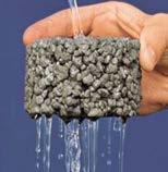
Increase green space coverage and use sustainable materials such as porous pavement, wood and stone to minimize design intervention. Recognize the history of the site, create recreational facilities that can simulate the reclamation process or Silo shape.
PRINCIPLE 3
Enhance social interaction
OBJECTIVE 1
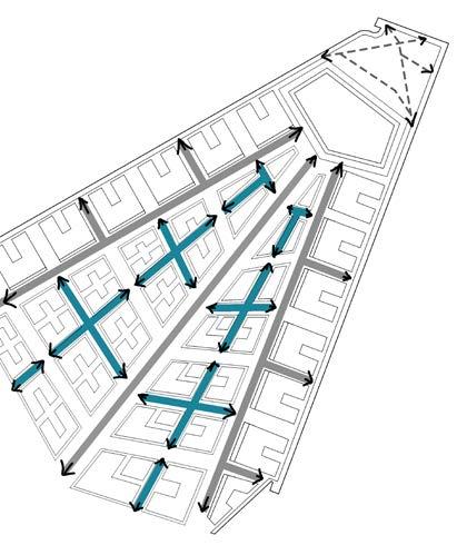
Give priority to green transportation, build walkable communities and bring people from different backgrounds and cultures together
OBJECTIVE 2
Use edge and surrounding building forms to re integrate undeveloped space and structure to activate various waterfront activities.
OBJECTIVE 3
OBJECTIVE 3
Design languages such as linkage, overlying and interspersed to deal with the edge of the canal and develop marine ecosystem.
Public waterfront areas provide various favorable edges, which not only provide access to water and learning opportunities for vulnerable groups, but also allow the participation of guardians


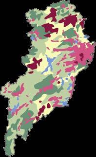
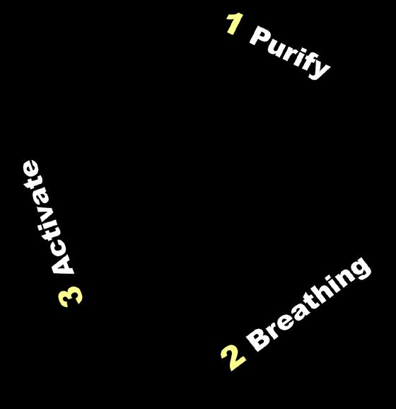
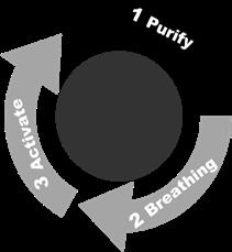
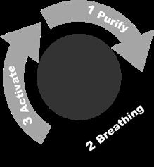
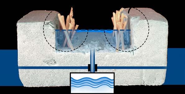
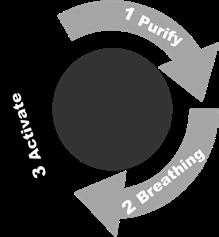
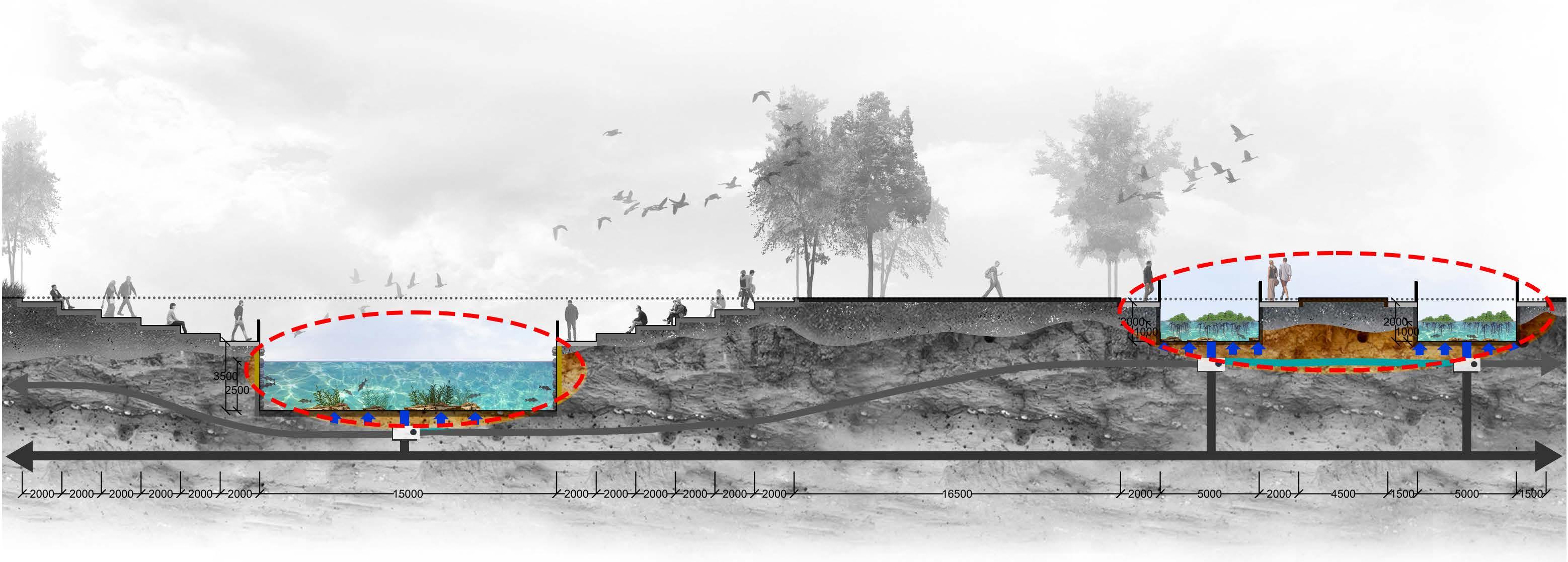
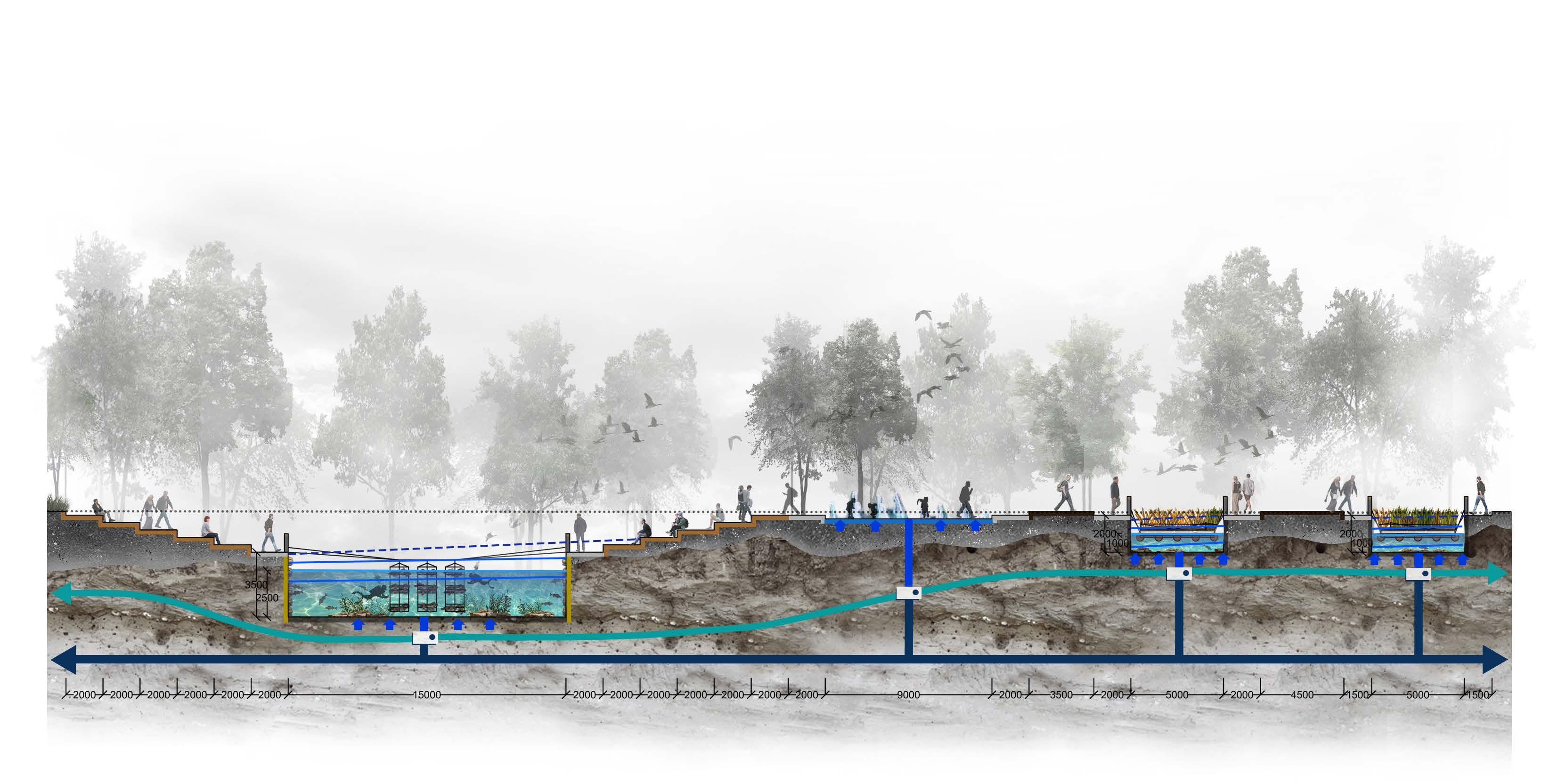
STAGE 1 - "PURIFY"

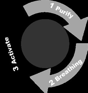
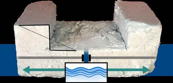
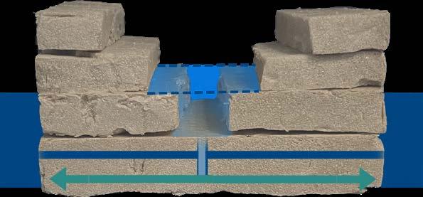
STAGE 2 - "BREATHING" STAGE 3 - "ACTIVATE"


Concrete
top of Glebe Island.
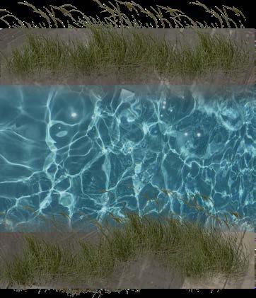
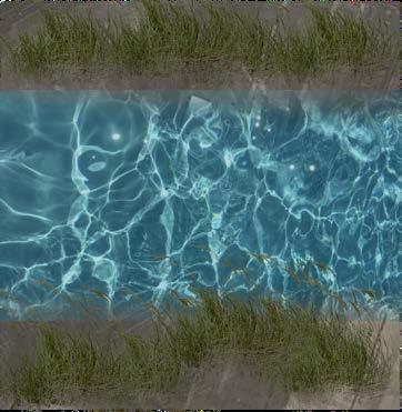
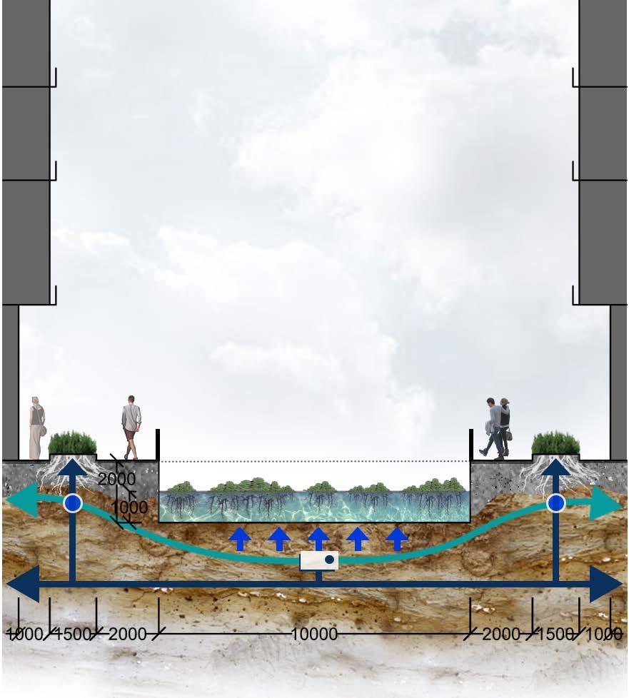
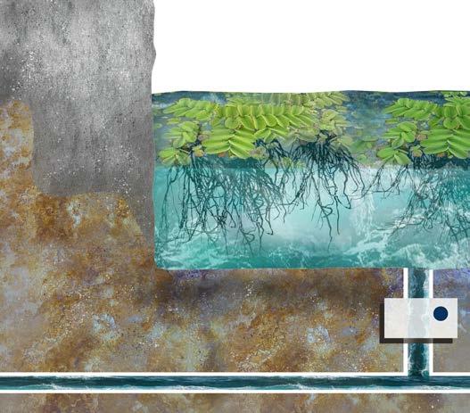
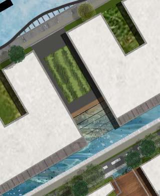
The sea water flows into the terrain change area to create urban canal in the inner space.
Cultivate aquatic vegetation with purification function in urban canal.
The top of Glebe Island is reserved for site water circulation.
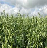
Plant salt tolerant vegetaion centered on Central Avenue.
Mostly concrete pedestrian street
Set bicycle lanes on Central Avenue and "Leisure" Street.
Set double lane on "Leisure" Street. Cars can turn around at Landmark Building.
The first floor of Landmark Building is used as car park.
1. Topographic change
Present:
Existing concrete apron
2022-2023: Concrete apron is being converted and demolished 2023-2024: Topography change: Cut and recycle


STREET TYPES SECTIONS
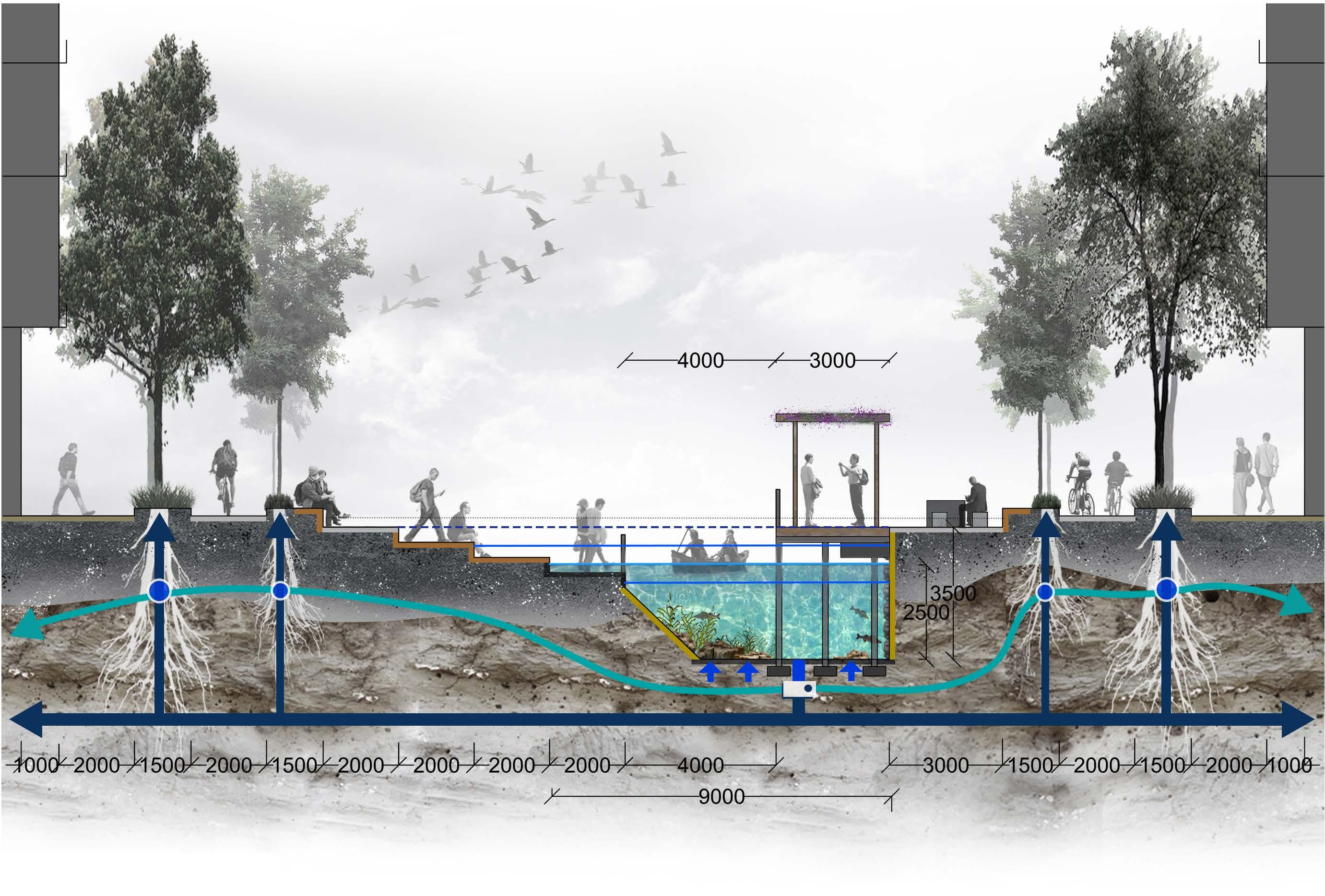
Scale: 1:200
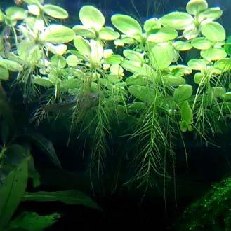
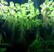
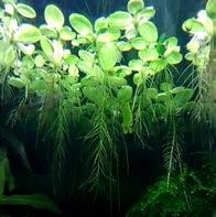
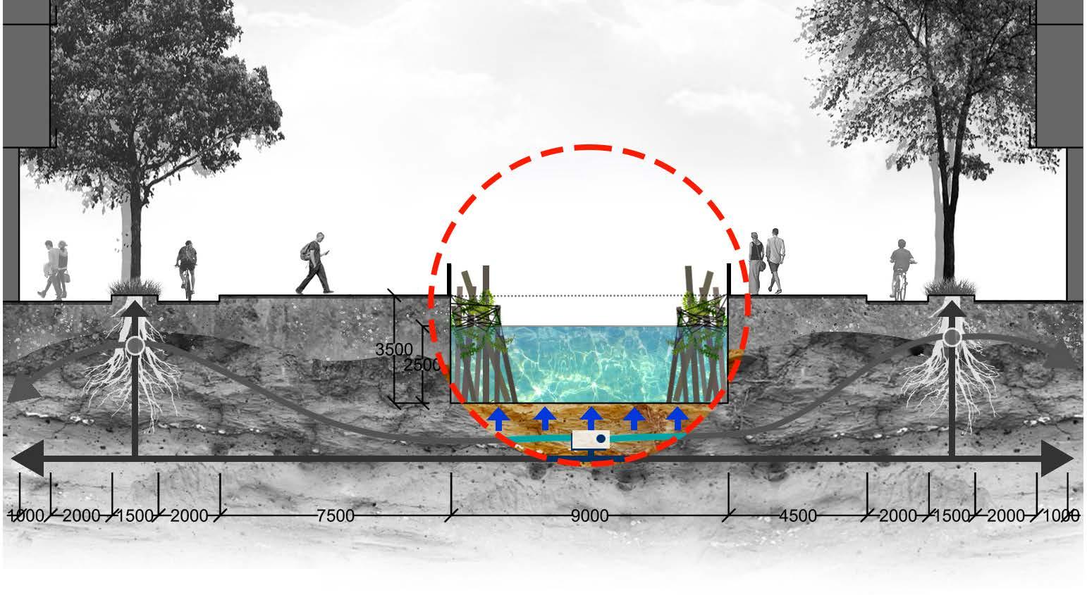
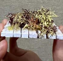
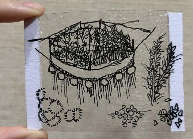
Purification function aquatic vegetation cultivation
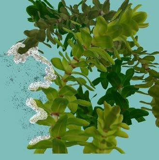
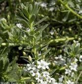
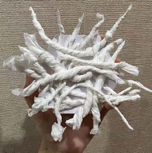
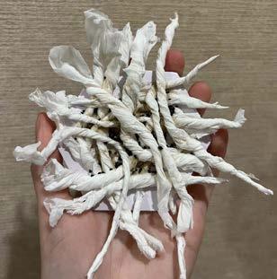
Elodea canadensis
Temperature: 0-28℃
Grwth rate: 0.1m per week 2.5m deep urban canal


Intercept silt and sediment

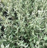
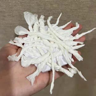
Salvinia natans
Temperature: 0-18℃
Grwth rate: Up


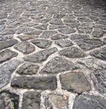
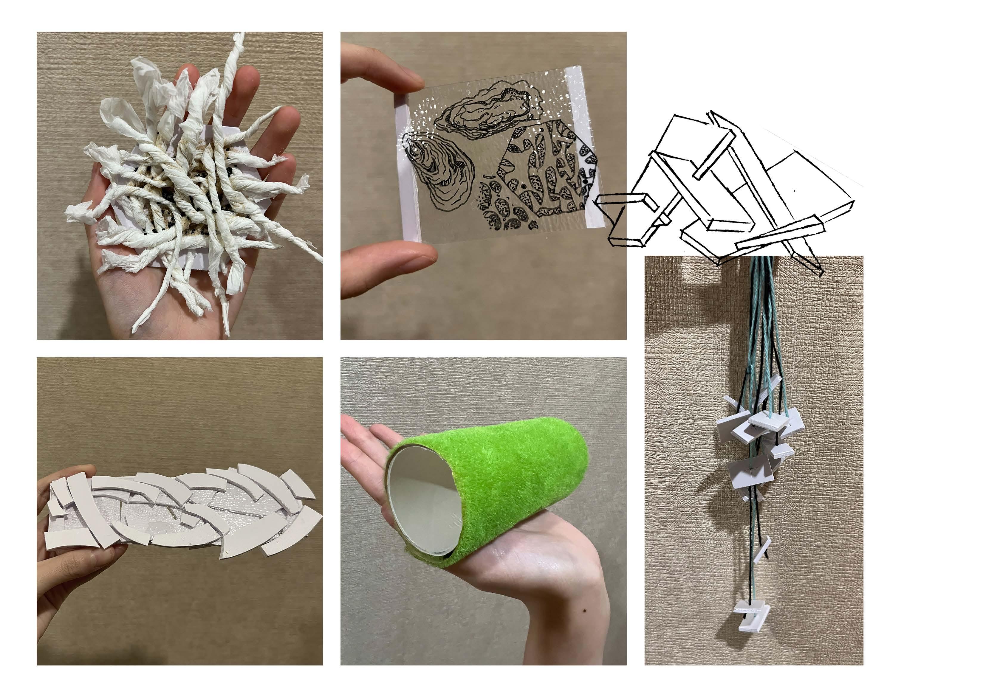
Material - Industrial palette
1-5
Aquatic vegetation with purification function
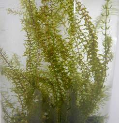
Elodea canadensis (Waterpest)
Temperature: 0-28℃
Grwth rate: 0.1m per week
Public open space, mainly pedestrian
SCALE: 1:150


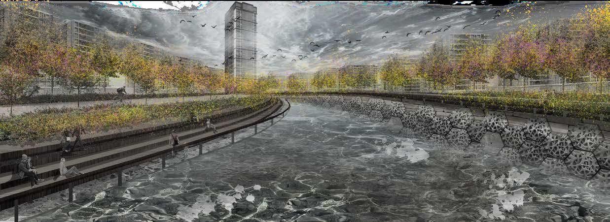
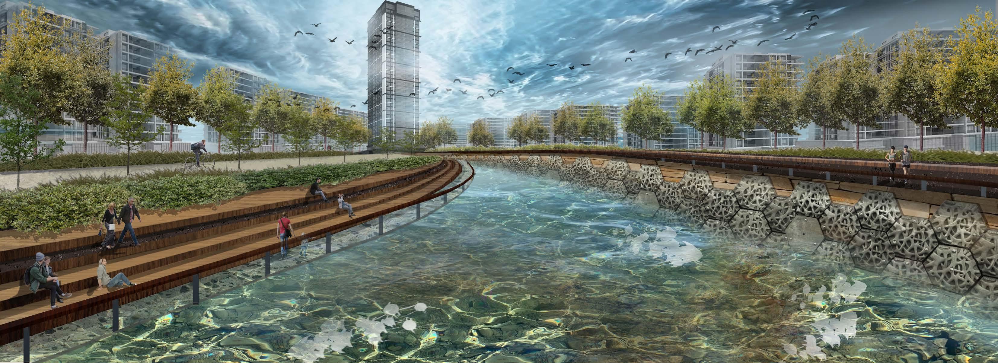
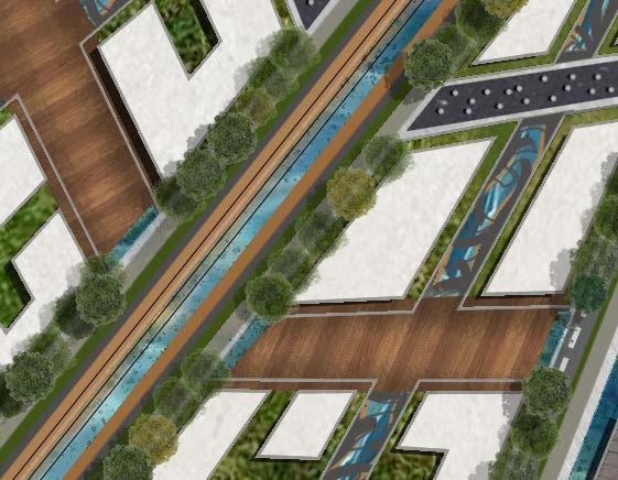
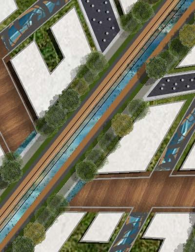
Cut and fill the terrain of Central Avenue Linear Waterfront, "Leisure" Street, "Floating" Walkable Laneway and Waterfront Wetland Park, and develop the terrace landscape.
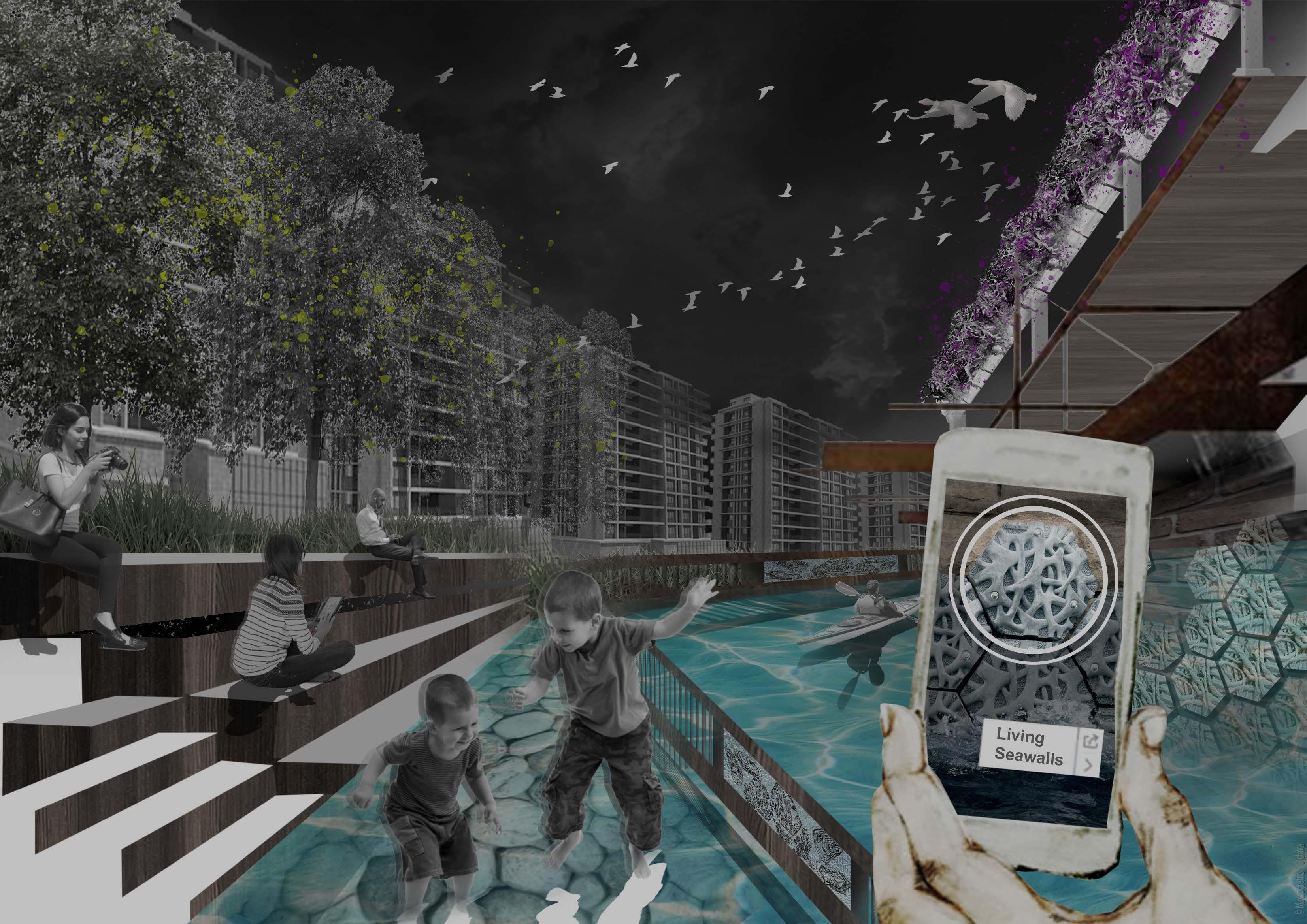
Add low depth canal to the pedestrian street around "Floating" Walkable Laneway and "Leisure" Street.
Increase the green space coverage and native vegetation planting and let it natural succession.
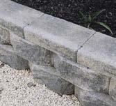
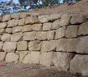
Use many sustainable materials.
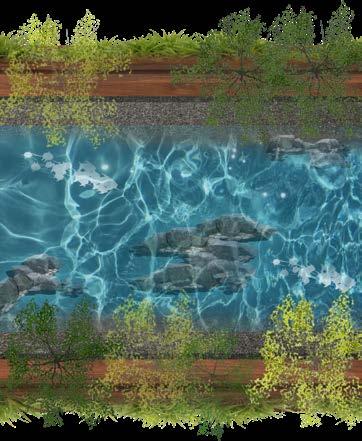
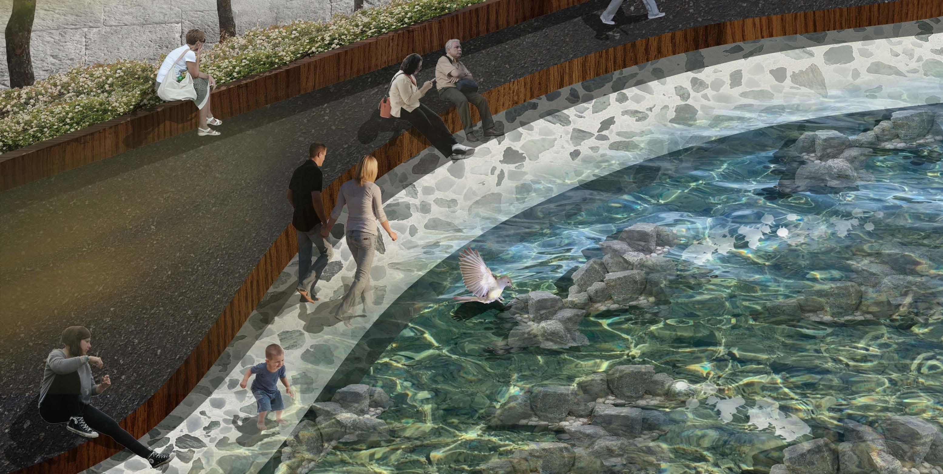
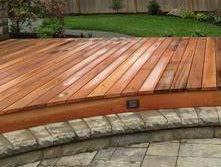
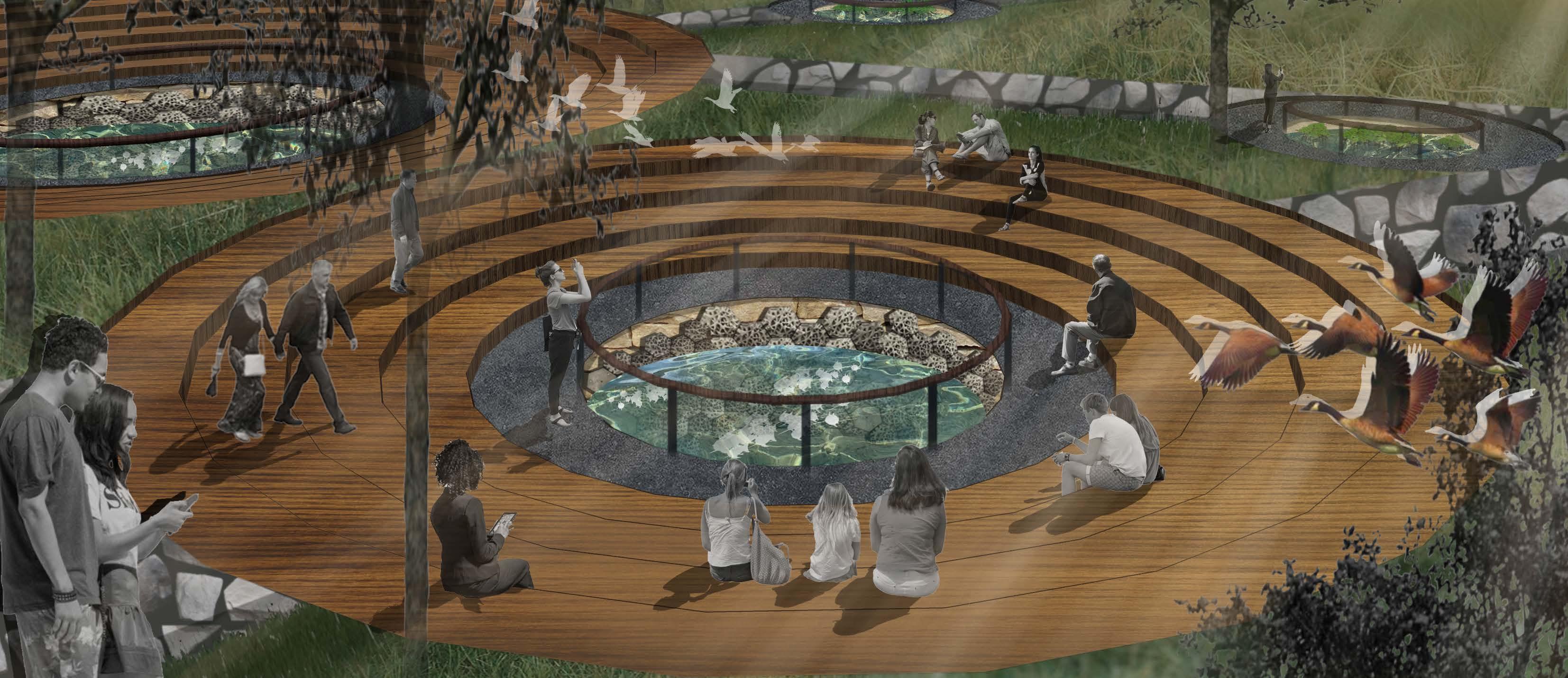
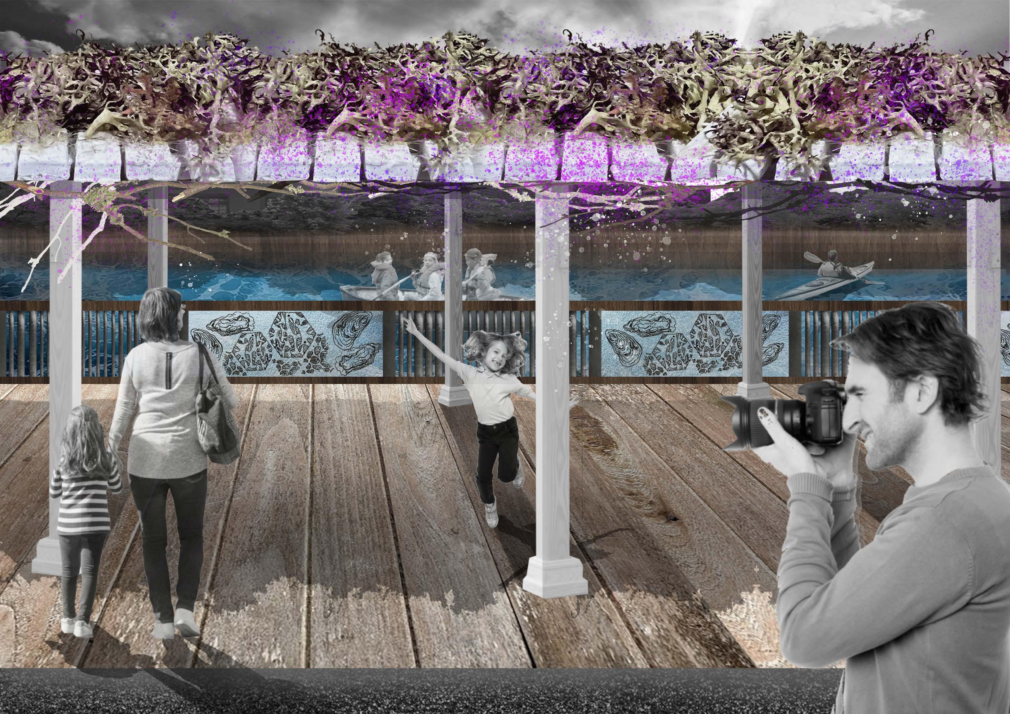
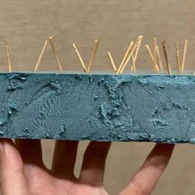
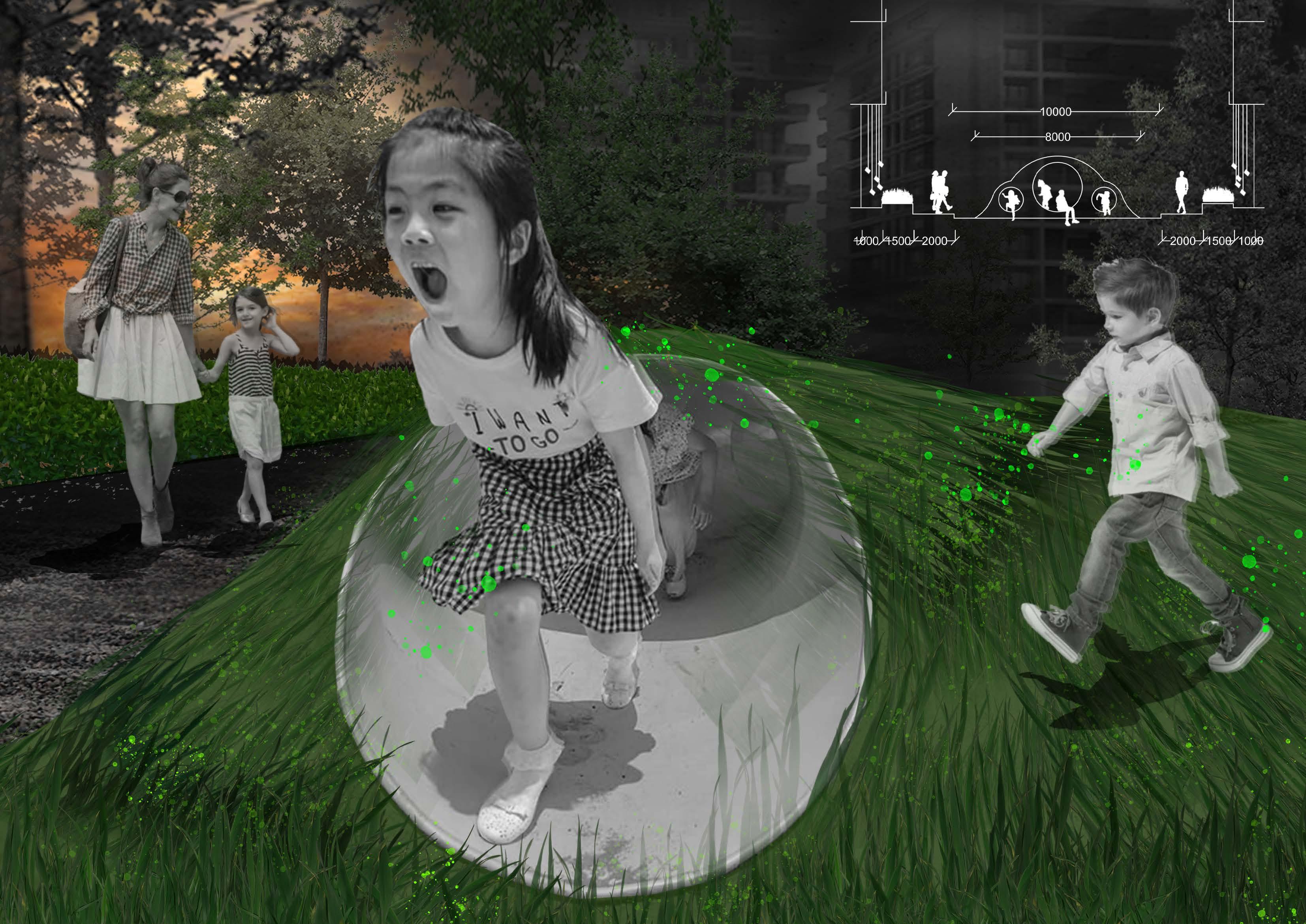
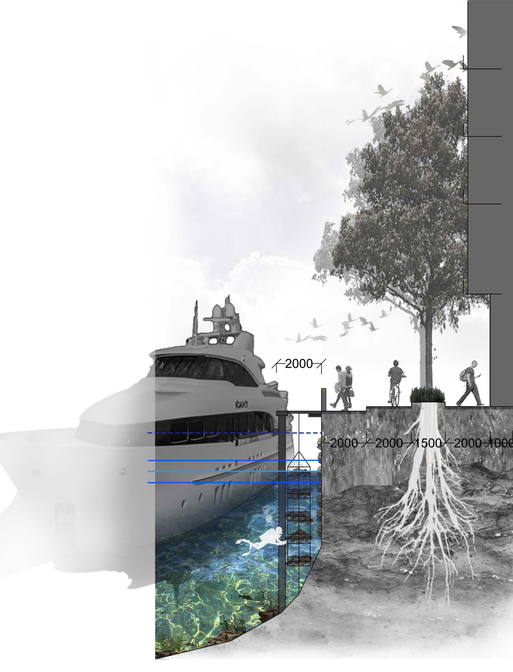
Set the seating platform, vegetation buffer, walkways, biological habitat and water contact opportunities according to different edge conditions.
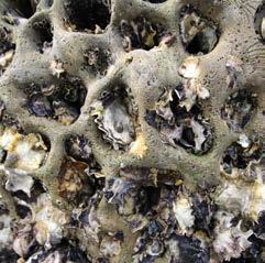
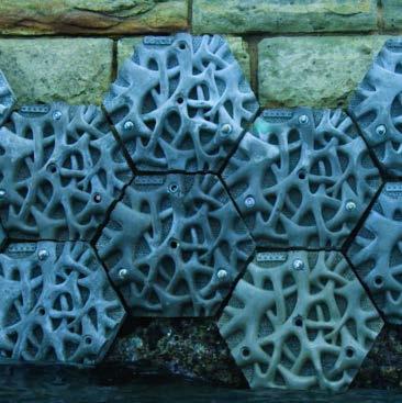
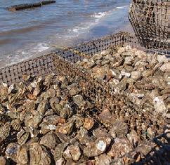
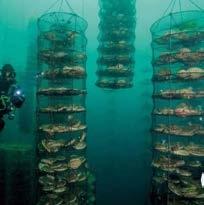
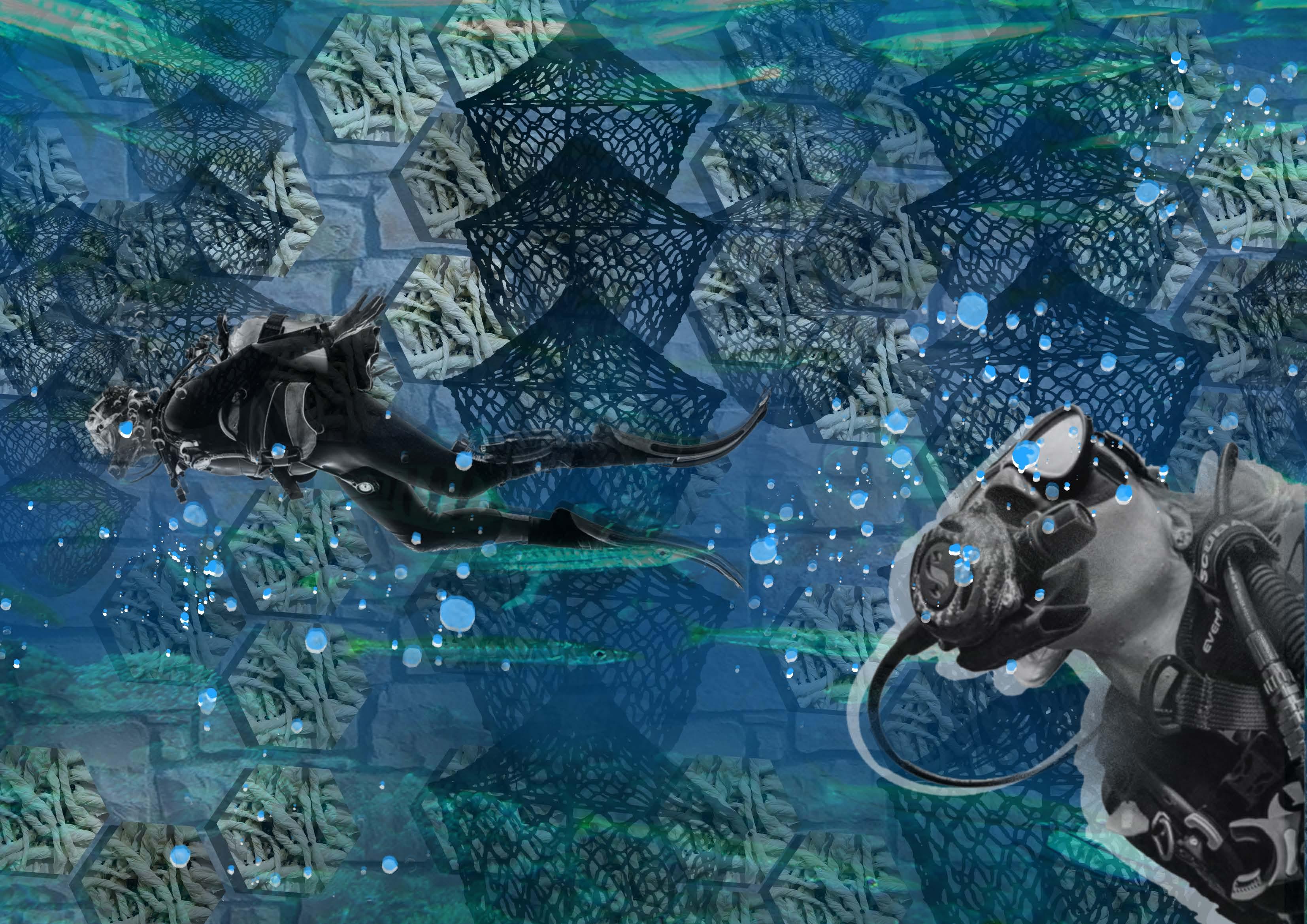
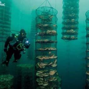
Develop marine biodiversity (“Living Seawall”).
Keep Salvinia natans.
Waterfront Wetland Park. Returning farmland, changing terrain and increasing waterfront landscape. Increase public trails.
1. Ecological recovery

5th Year:
Existing topography, groundwater system and aquatic vegetation
6-7th Year:
1. Removal of Elodea canadensis
2. Collect the purified water from stage1 for 1-5 years in the underground storage tank
3. Maintain the supply of fresh water on site while cutting and filling
8th Year-:
Terrace Landscape: seawater adaptation topography intervention
5th Year:
Existing concrete apron
6-7th Year:
1. Concrete apron is being converted and demolished
2. Topography change: Cut and recycle


5-15 YRS.


Proposed activities
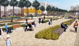

5-15 YRS.

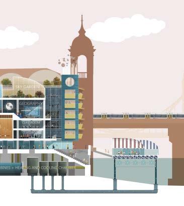
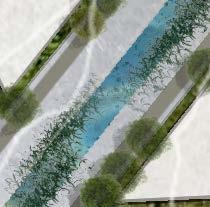
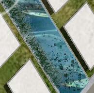
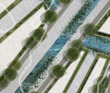
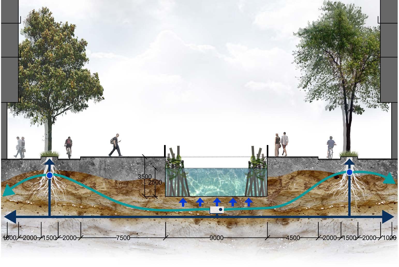
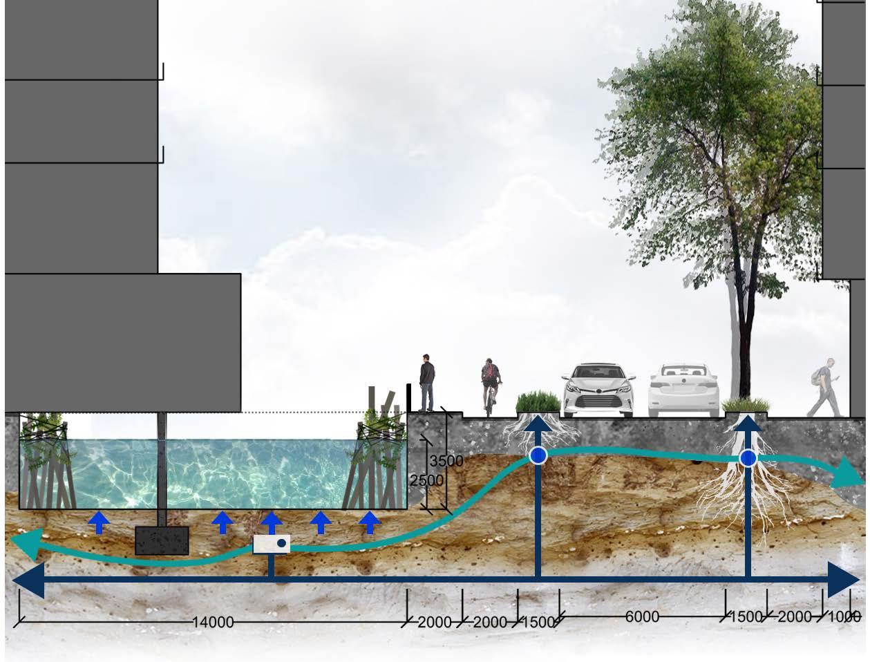
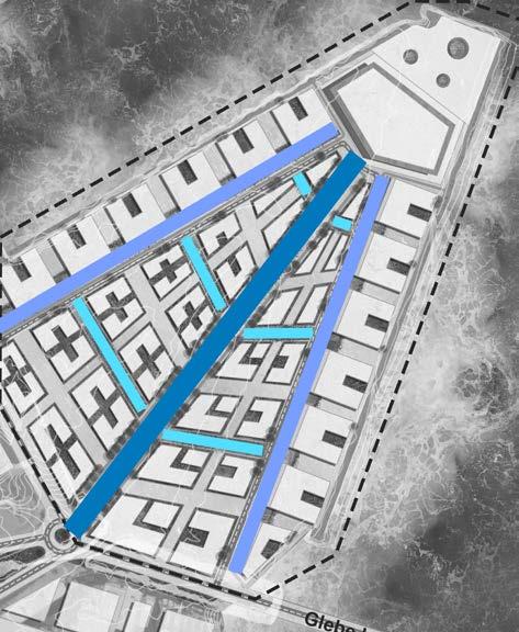
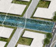
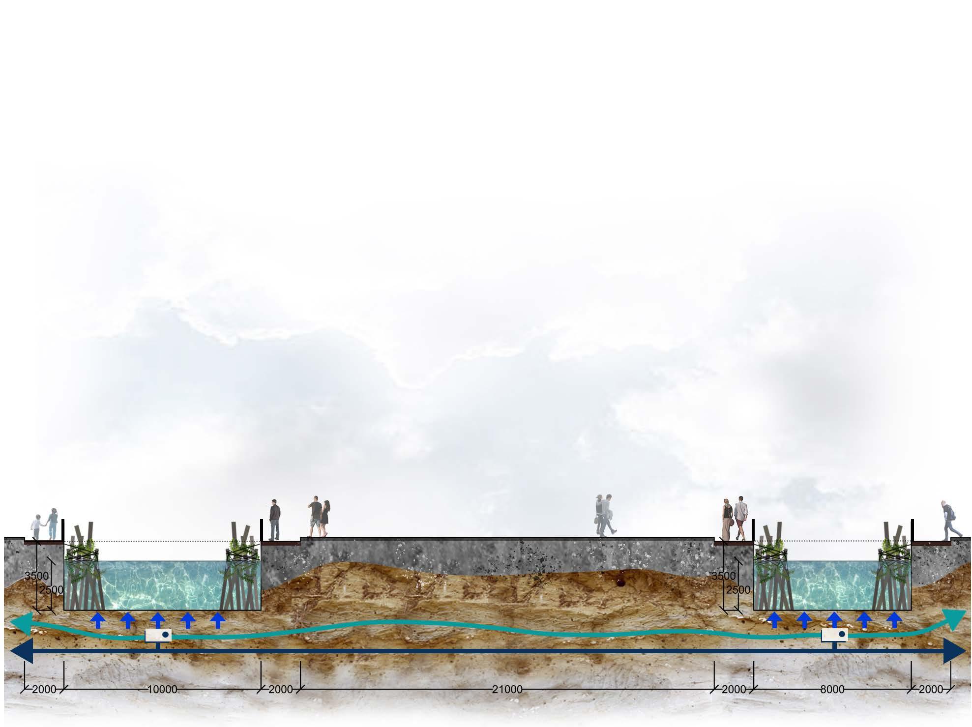
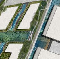
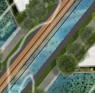
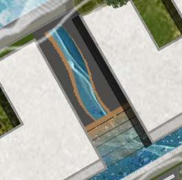
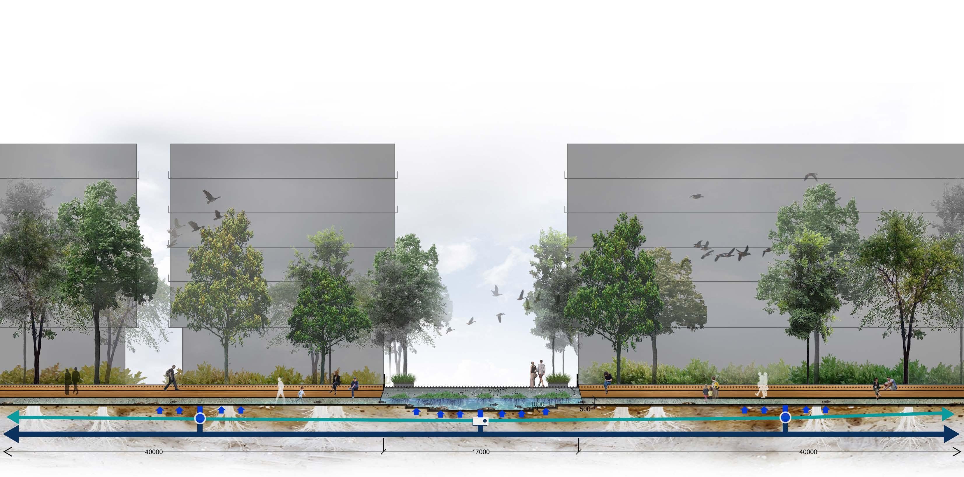
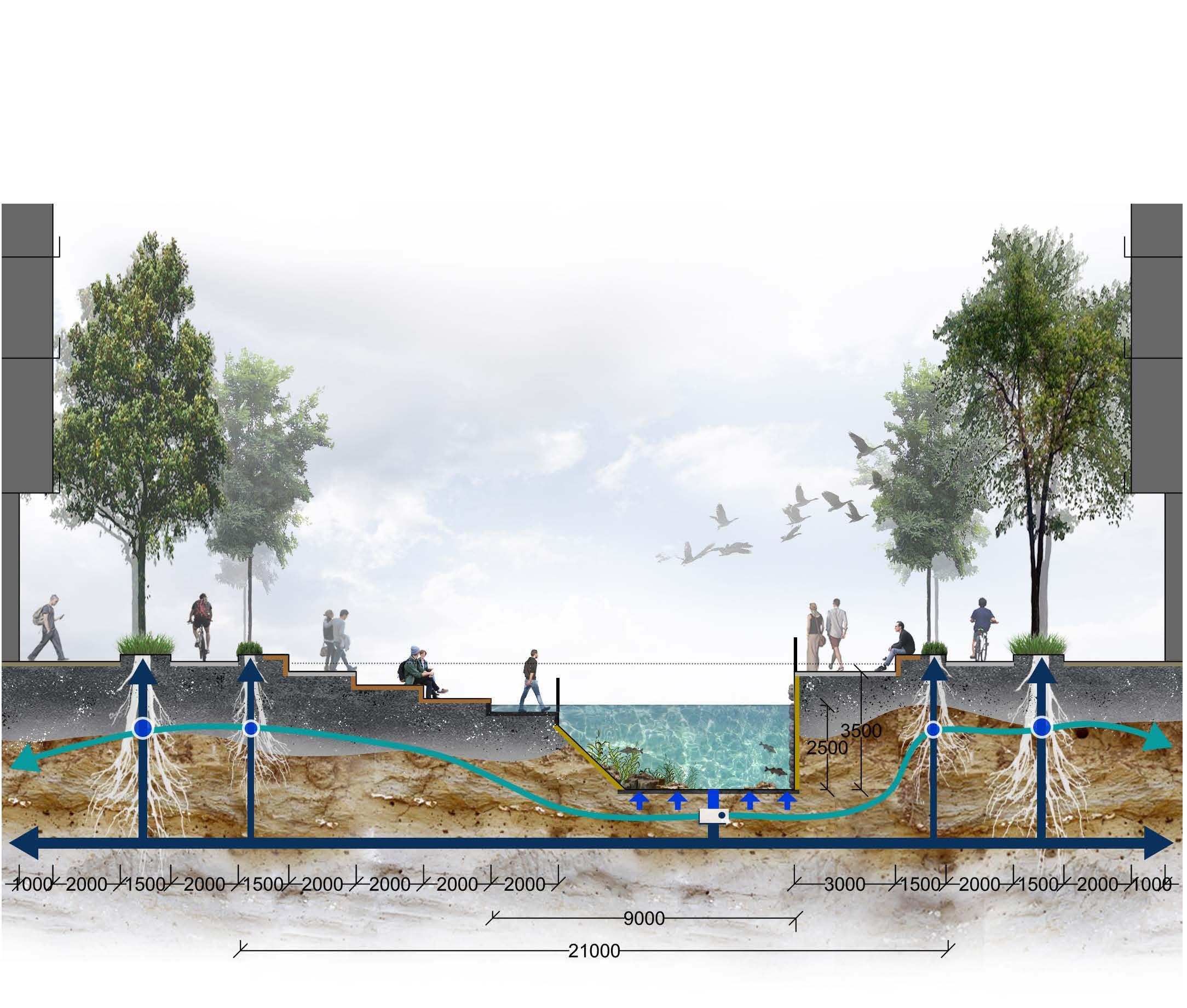
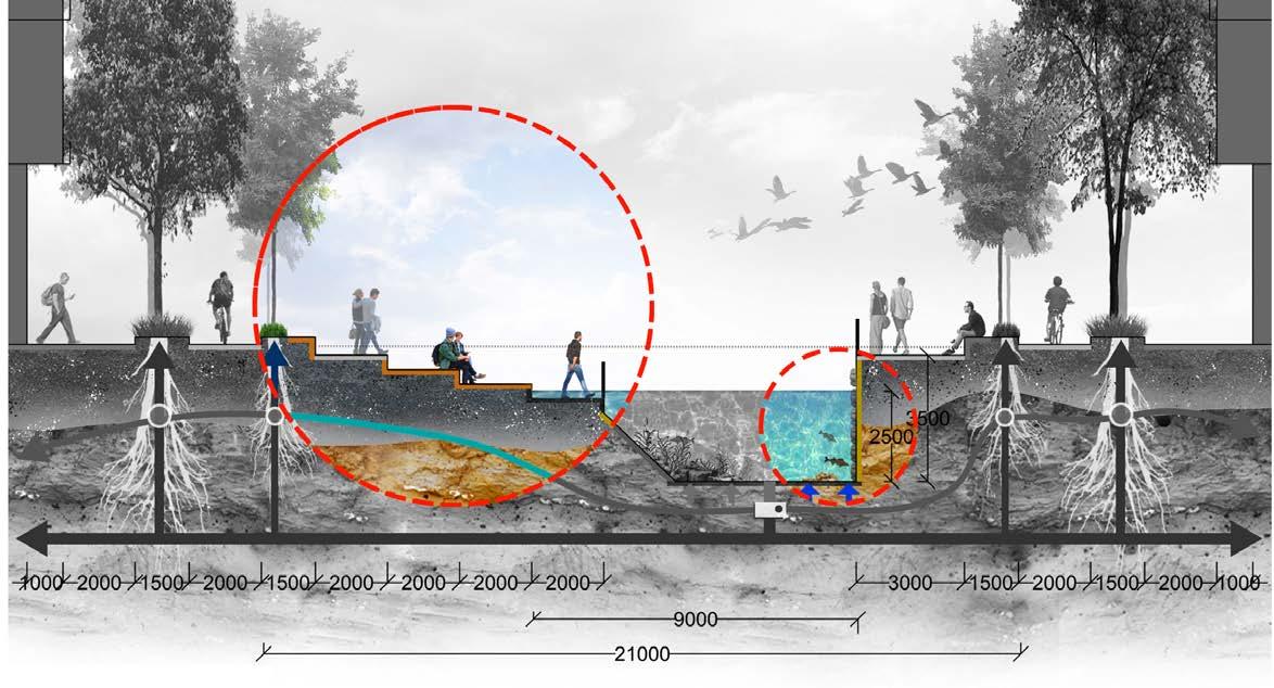
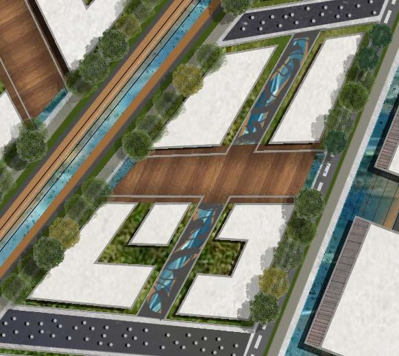
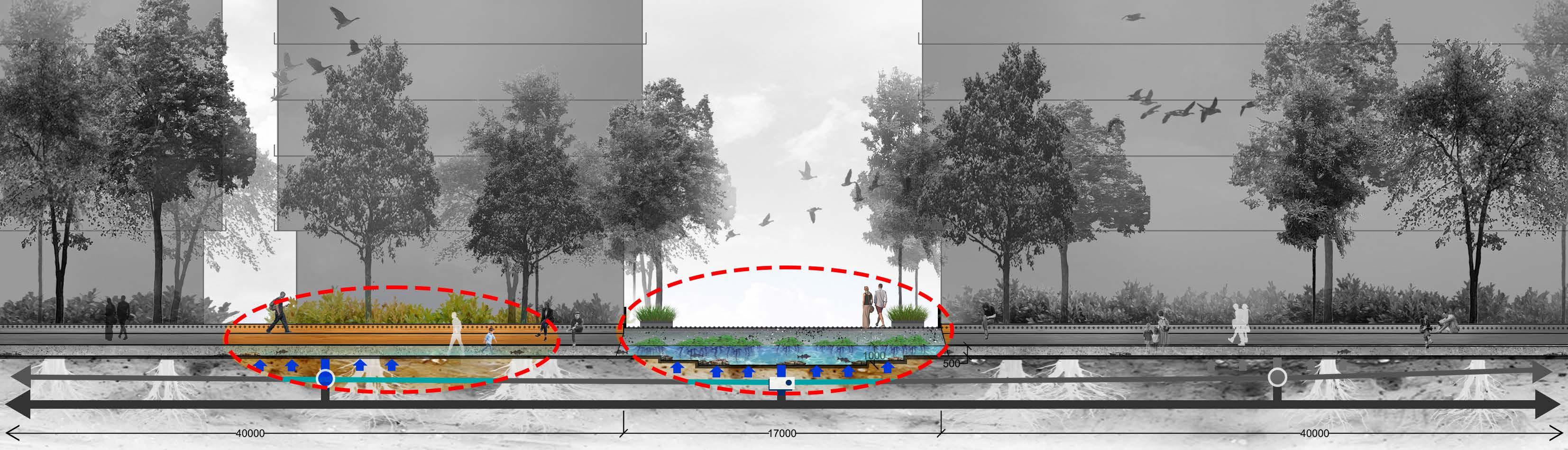
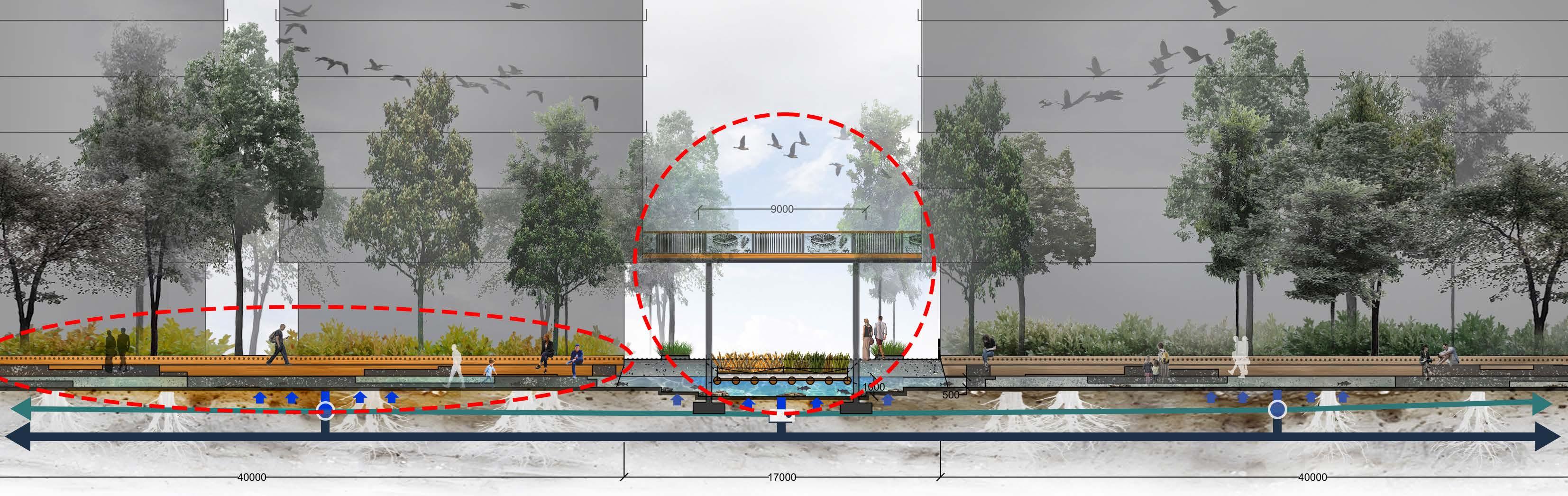
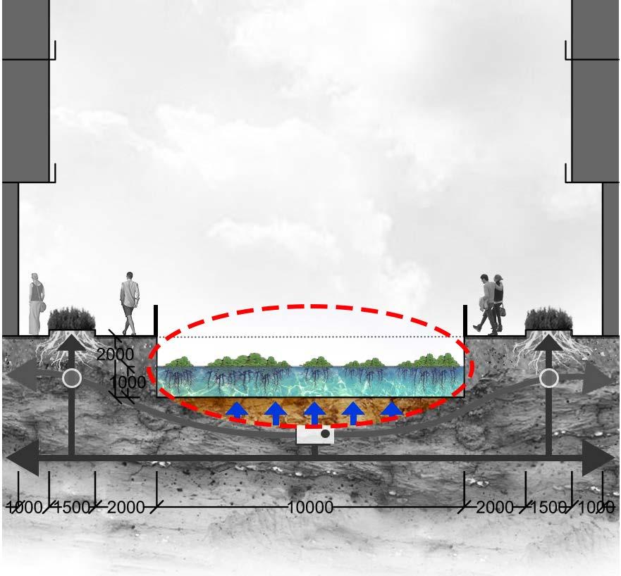
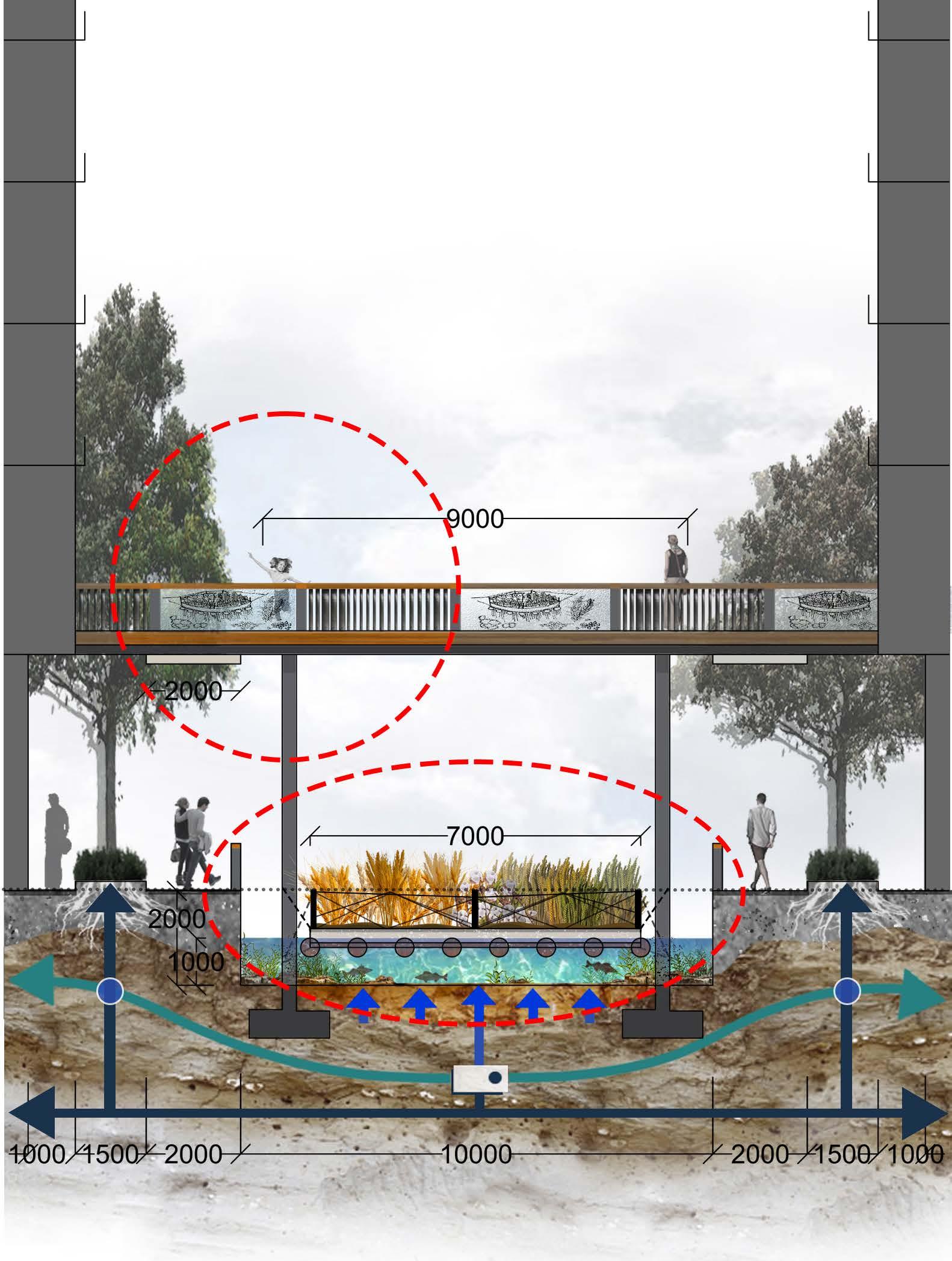
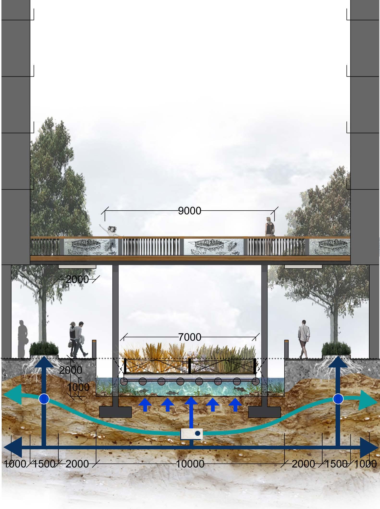
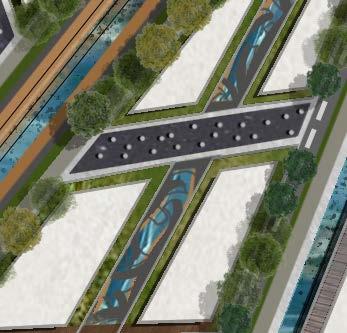
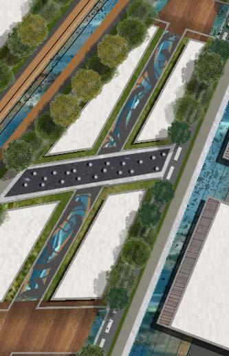
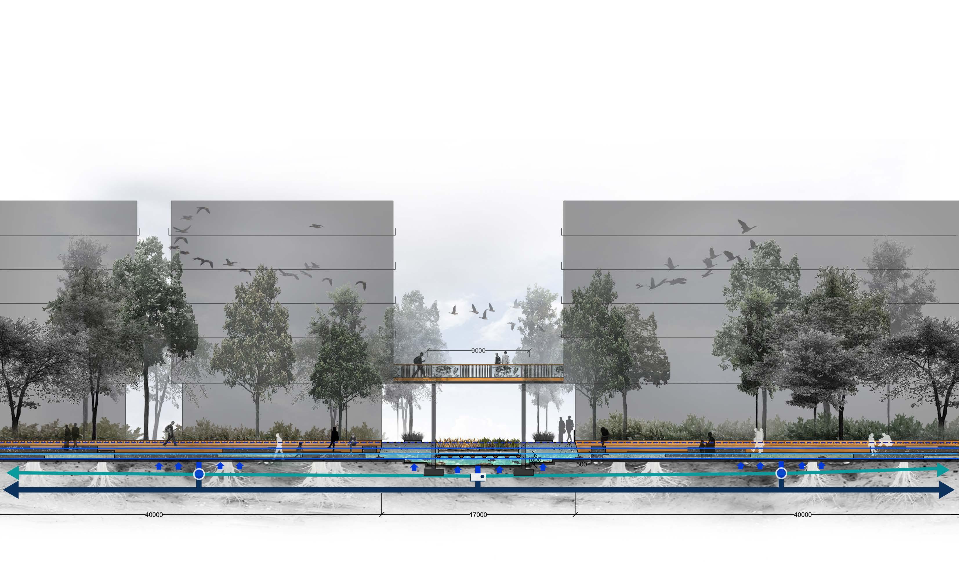
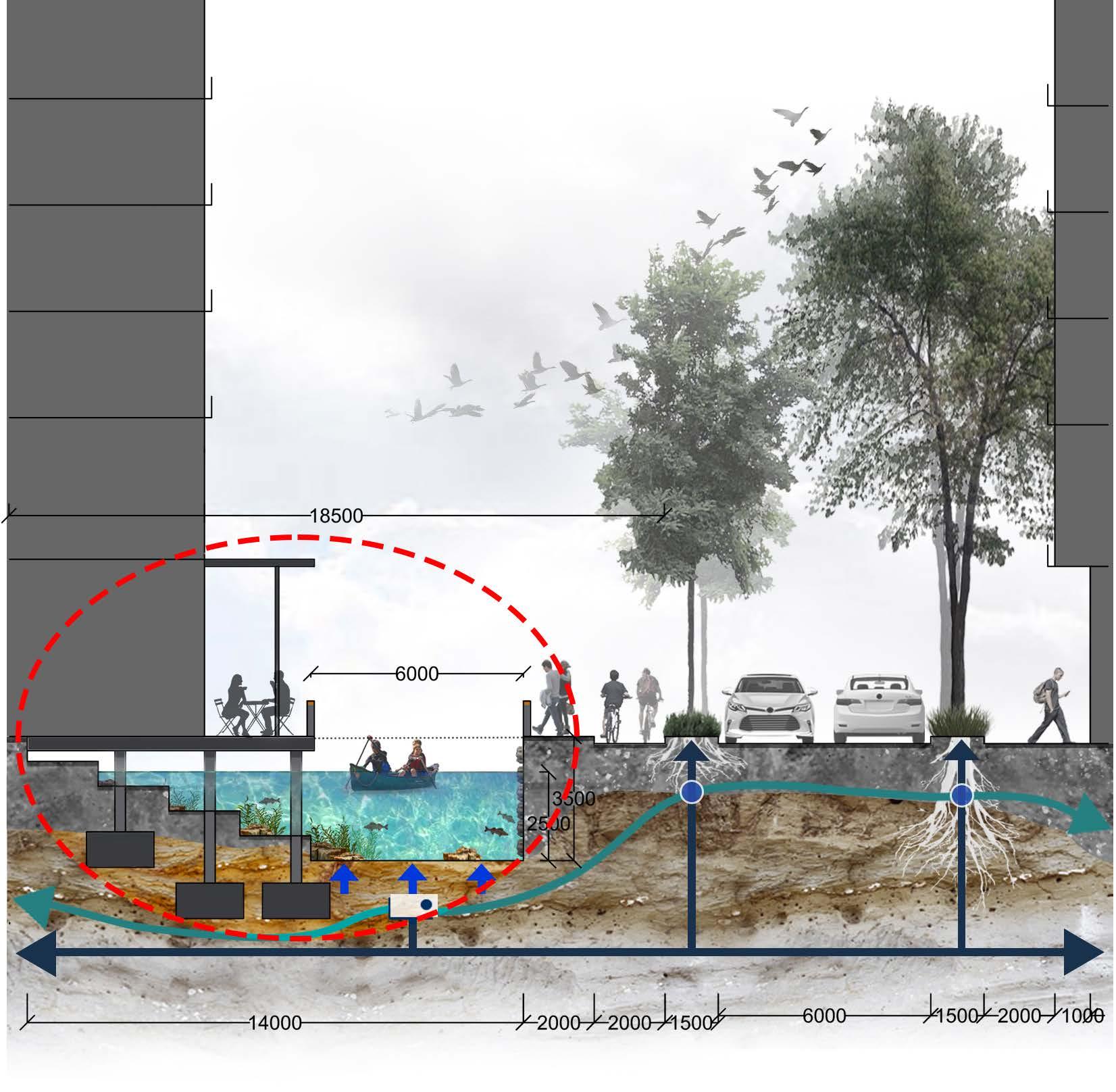
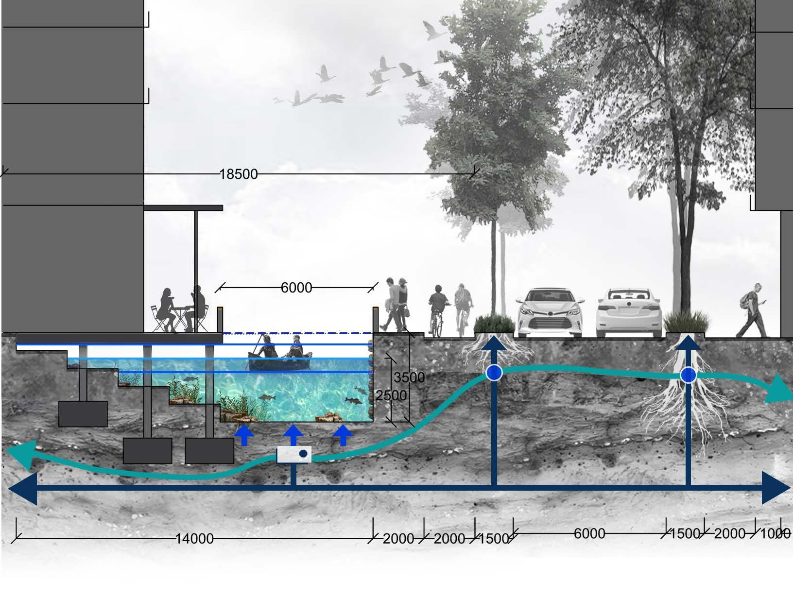
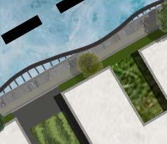
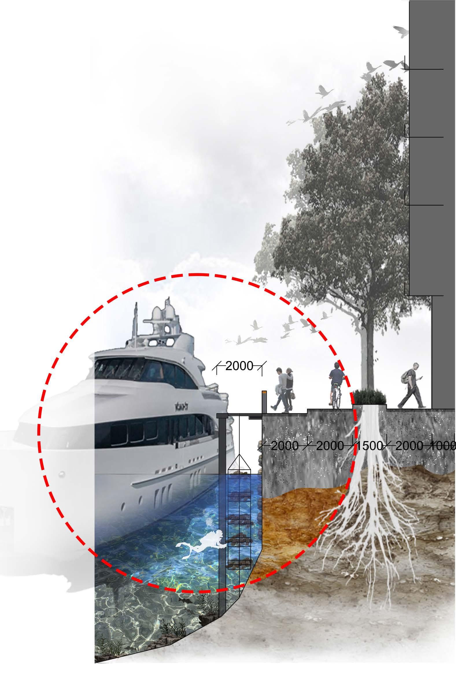
CENTRAL AVENUE LINEAR WATERFRONT 32m (PUBLIC OPEN SPACE)

5-15 YRS.
+ Car free street, mainly pedestrian + 2.5m deep urban canal
5-15 YRS.
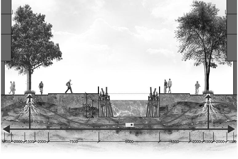
SCALE: 1:300
Salt tolerant vegetation
Groundcovers
Grasses
Shrubs/ small trees

Abstract effect

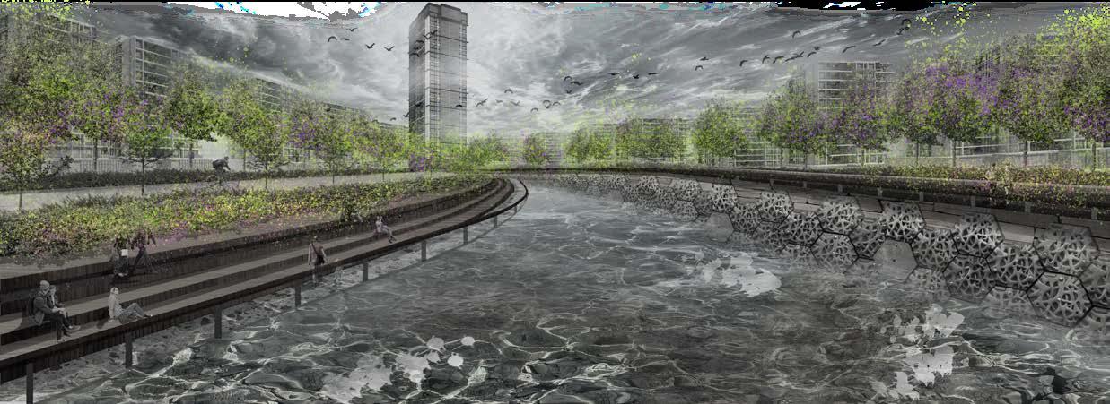

CENTRAL AVENUE LINEAR WATERFRONT 32m (PUBLIC OPEN SPACE)
Eco palette
5-15 YRS.
5-15 YRS. "LIVING

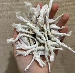
Strong reproductive ability and difficult to control Imitate Imitate
of oyster shell


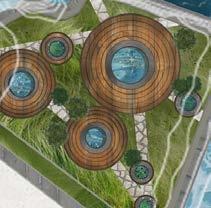
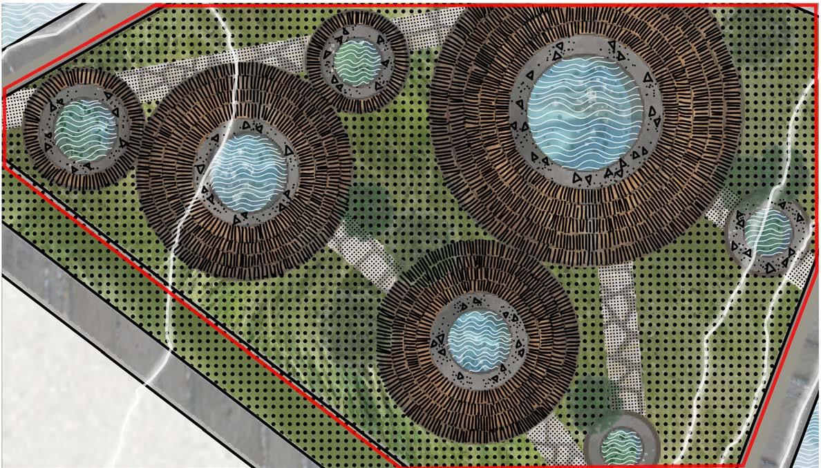
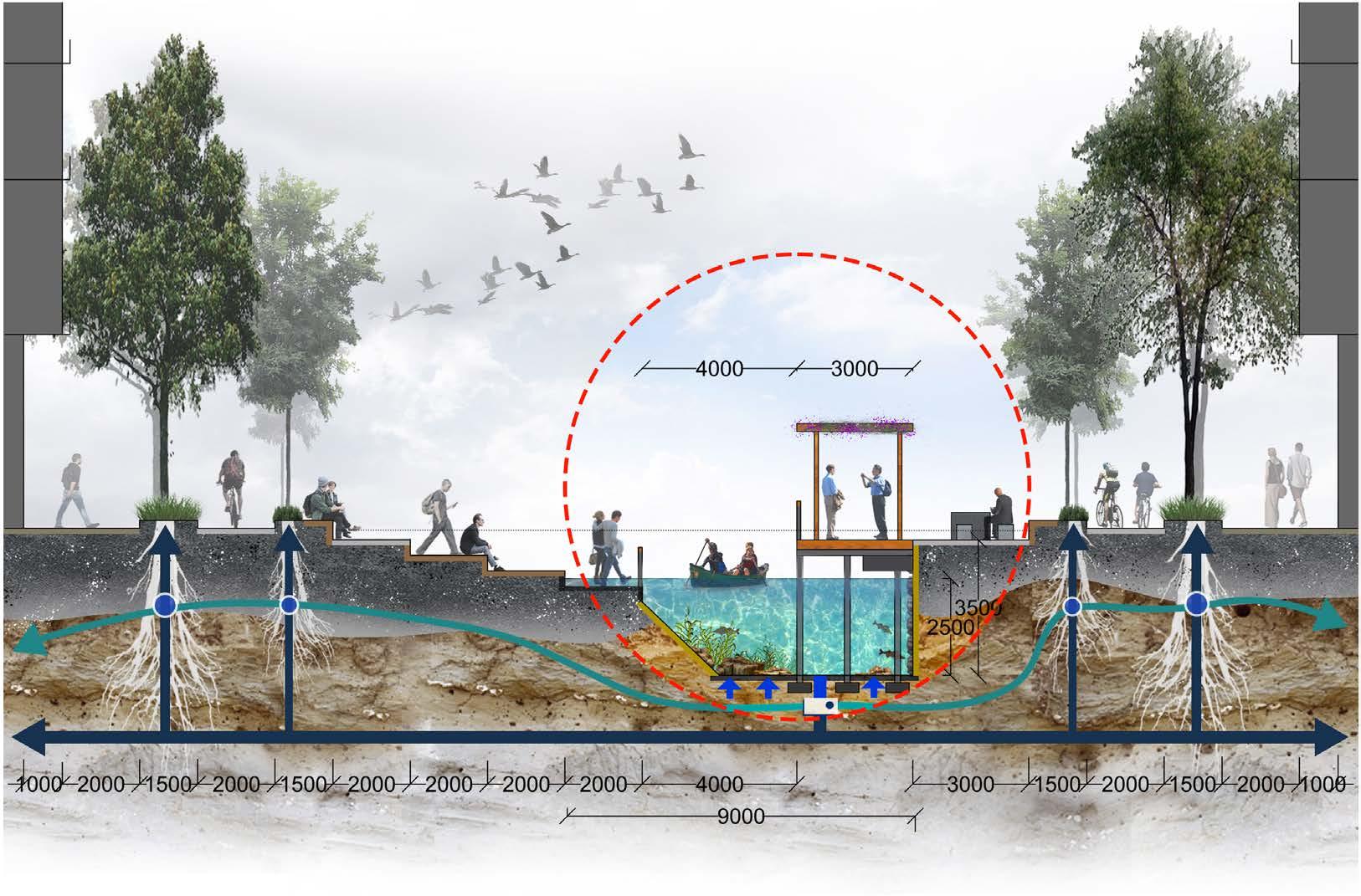
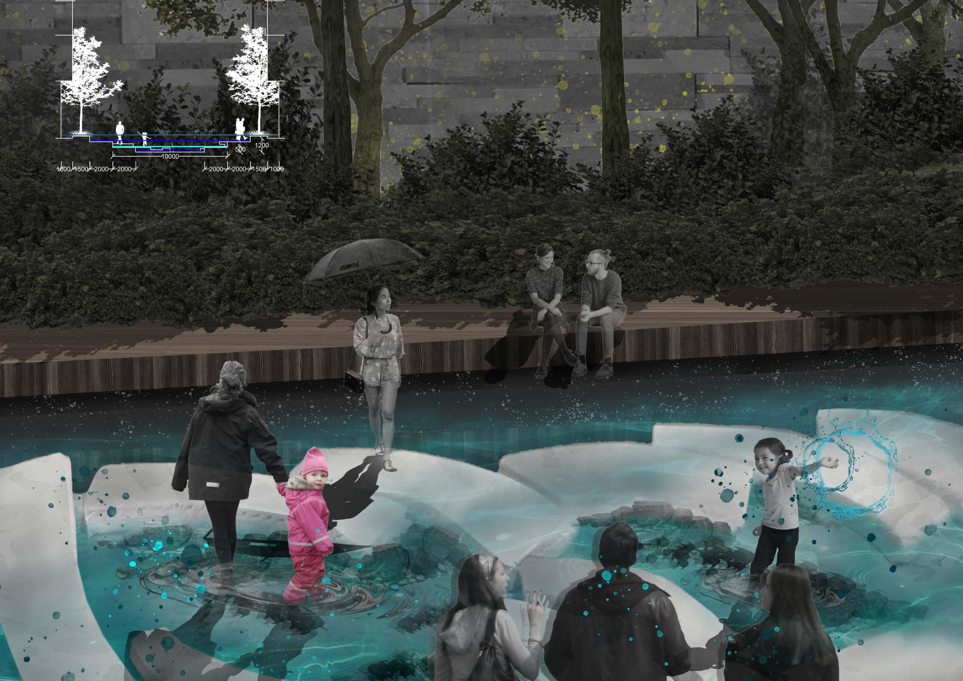
WATERFRONT WETLAND PARK SCALE: 1:200
Design Language "Overlying"
WATERFRONT WETLAND PARK (PUBLIC OPEN SPACE)
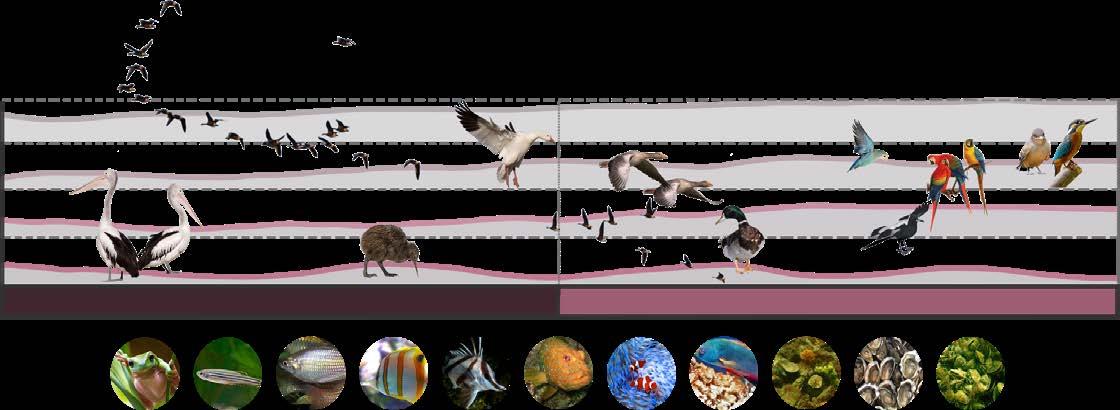
Proposed marine biological chain
LEVEL 3
ENERGY
LEVEL 2
ENERGY
LEVEL 1
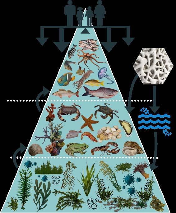
CARNIVORES
5-15 YRS.
HERBIVORES
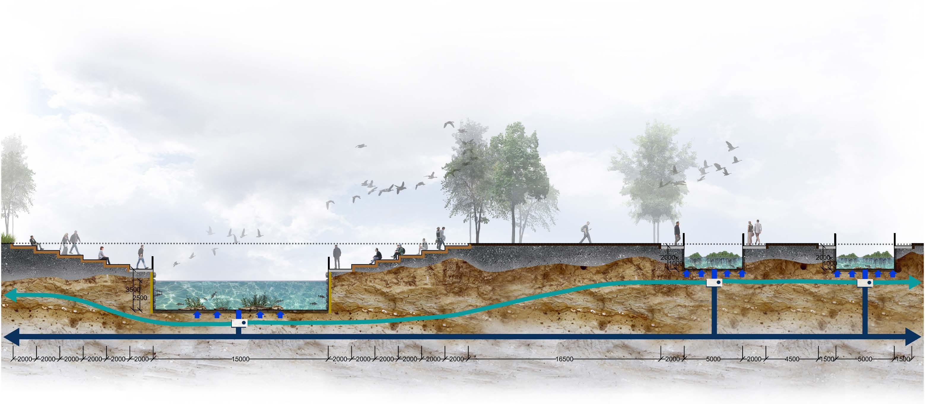
PHOTO-AUTOTROPHS (PLANTS)
Purification function aquatic vegetation cultivation (stage1 Elodea canadensis)
TEXTURE DETAIL PLAN

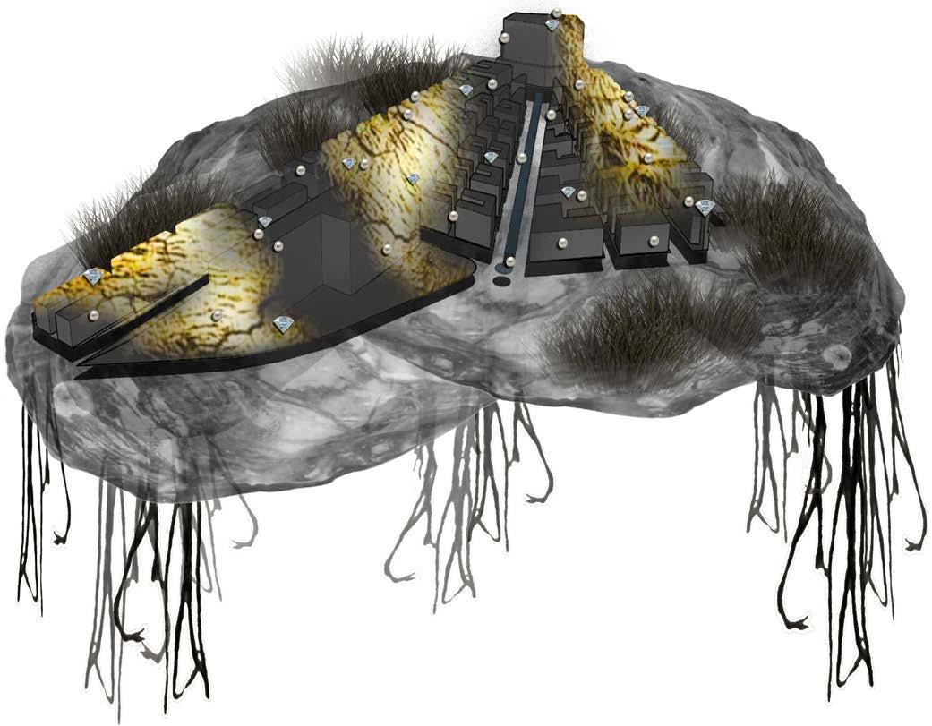
SCALE: 1:300 Historical significance
WATERFRONT WETLAND PARK (PUBLIC OPEN SPACE)
Sustainability - Material & Edge condition
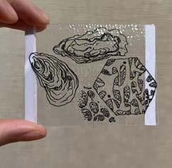
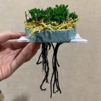
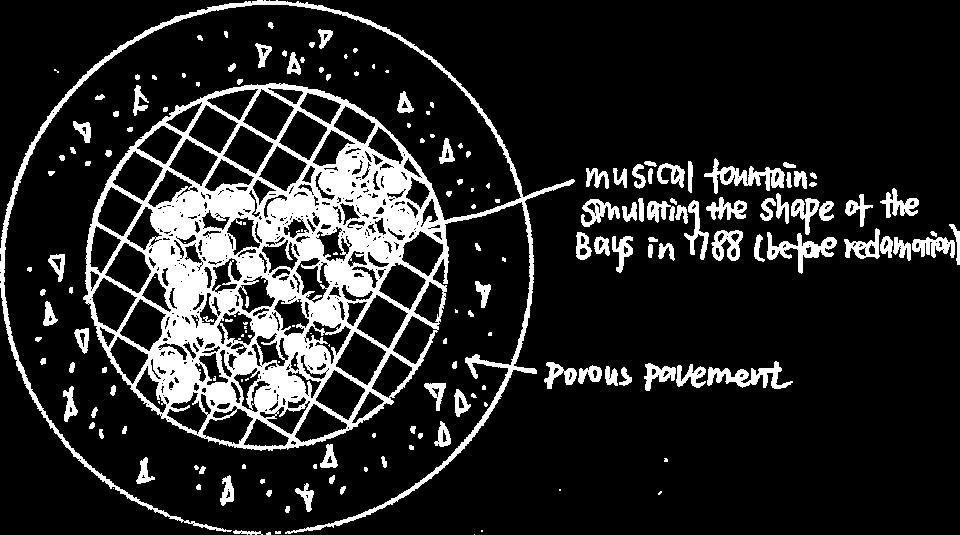
Imitate the shape of Silo
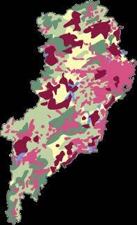
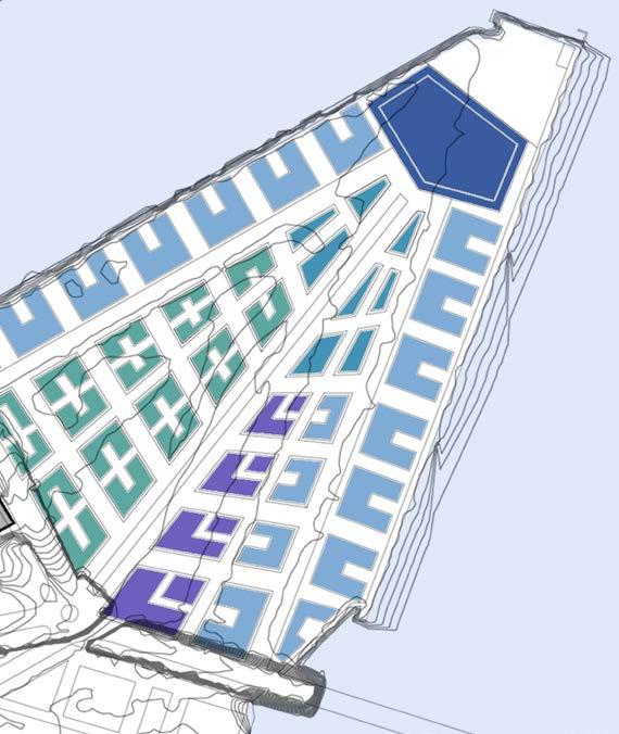
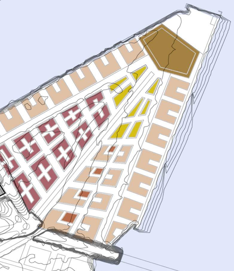
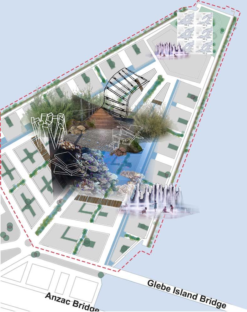
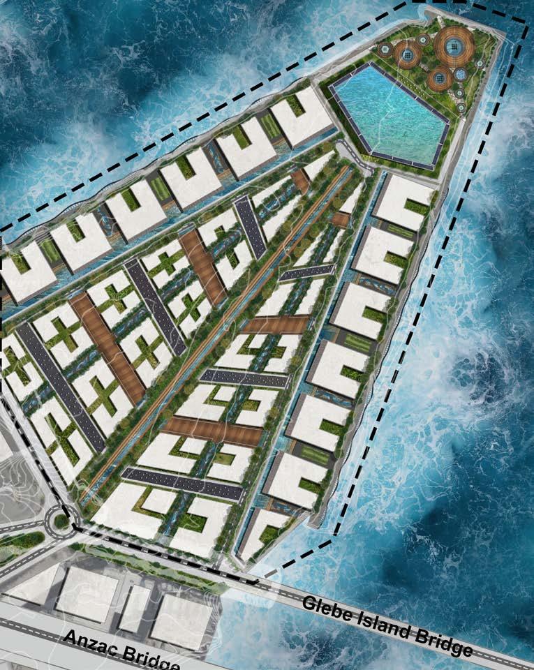
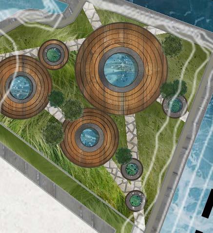
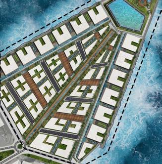
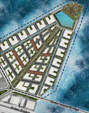
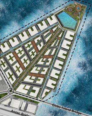
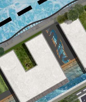
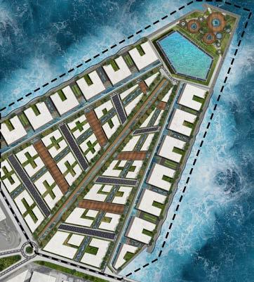
Stage 3 - "Activate" Plan
Scale: 1:2000
ABSTRACT DESIGN EFFECT

Exquisite urban interior space

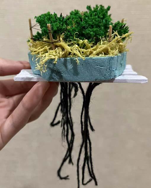
CONCEPT MODEL
Stage 3 - "Activate" Plan
Scale: 1:2000
ECONOMIC INNOVATION FUNCTION


ECOLOGICAL FUNCTION


CENTRAL AVENUE LINEAR WATERFRONT (exquisite urban interior space)
15-50 YRS.
Design language: "Interspersed"
1-5 YRS.
5-15 YRS.
Purification function aquatic vegetation cultivation (Elodea canadensis) Wooden terrace platform

Scale: 1:200
15-50 YRS.
Opportunities for direct contact with water

Scale: 1:150
15-50 YRS.
Scale: 1:200
CENTRAL AVENUE LINEAR WATERFRONT
+ Car free street, mainly pedestrian + 2.5m deep urban canal

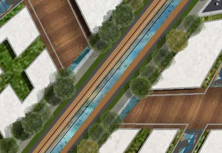

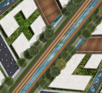

CENTRAL AVENUE LINEAR WATERFRONT (exquisite urban interior space)
15-50 YRS.
0.5m deep urban canal design
Recreational facilities simulating cultural heritage
"FLOATING" WALKABLE LANEWAY (exquisite urban interior space)
Design language: "Interspersed"


1-15 YRS.
15-50 YRS.

15-50 YRS.
Redesign of 0.5m
1-15 YRS.

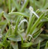
Salvinia natans: The purification function is strong, but the reproductive ability is strong and uncontrollable 15-50 YRS.
Scale: 1:200
Handrail design (Education)
Scale: 1:100
15-50 YRS.

Scale: 1:150
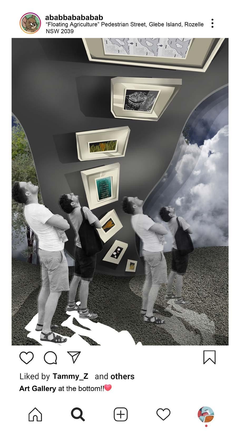
ART GALLERY IS ON THE EDGE OF THE
AREA (Cultural popular science)
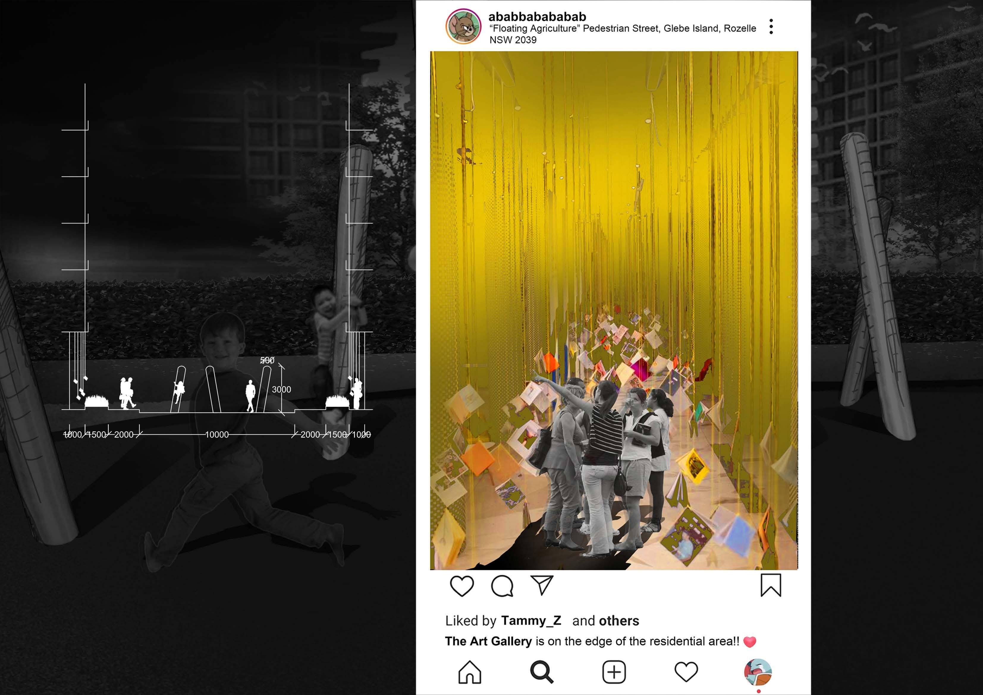

"FLOATING" WALKABLE LANEWAY (exquisite urban interior space)
15-50 YRS.
0.5m deep urban canal design
Recreational facilities simulating cultural heritage
(exquisite urban interior space)
Design language: "Interspersed"
1-15 YRS.
Purification function aquatic vegetation cultivation (Elodea canadensis)
(exquisite urban interior space)

15-50 YRS.

15-50 YRS.
Scale: 1:200

Scale: 1:150

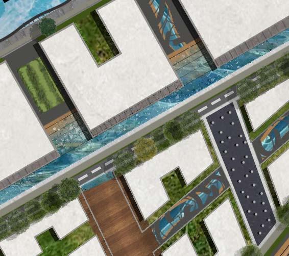
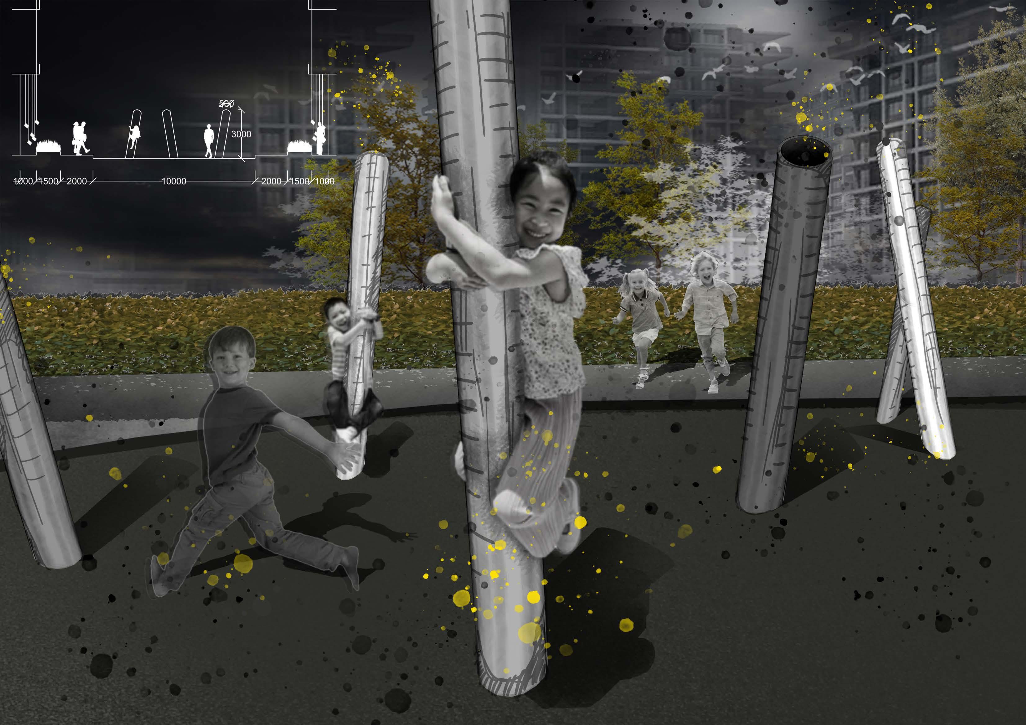
"LEISURE”
(exquisite urban interior space)
15-50 YRS.

Recreational facilities simulating Silos
(exquisite urban interior space)
15-50 YRS.
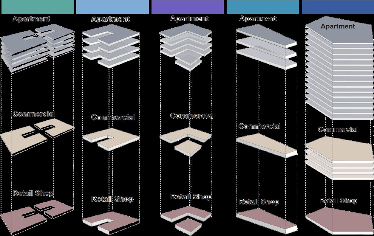
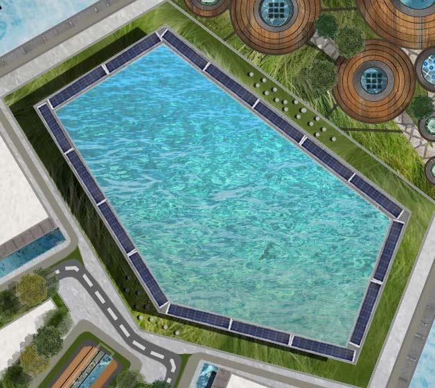
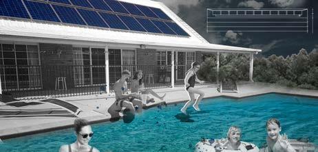
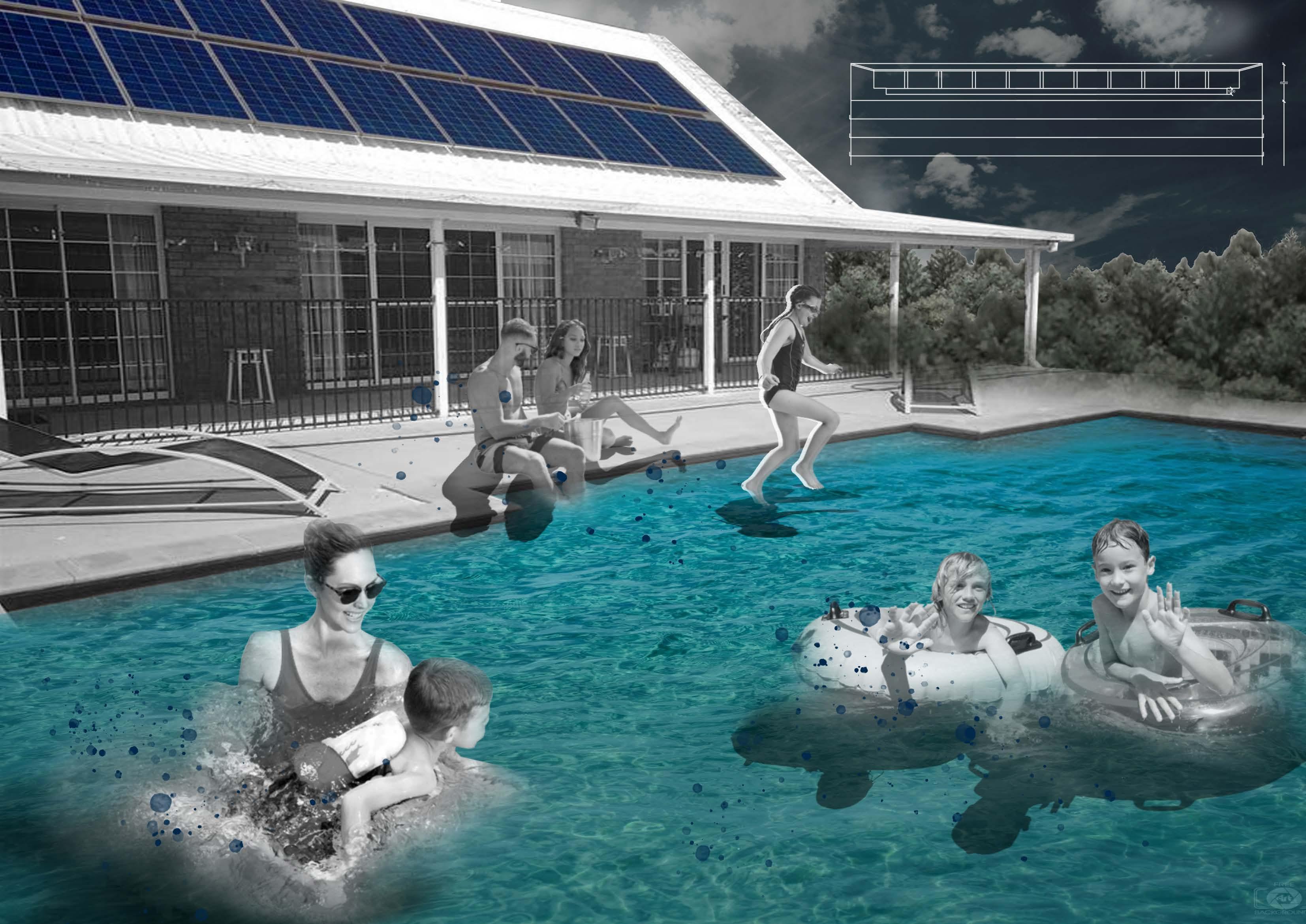
Top of the building: Solar swimming pool 2 floors ≈ 6m
Hotel 13 floors 39m
Mix use: Cooperate with the local government to explore how to update underground drainage system, develop new agricultural model and cultivate greenhouse vegetation. 4 floors 16m
Car park 1 floor 5m
Scale: 1:300


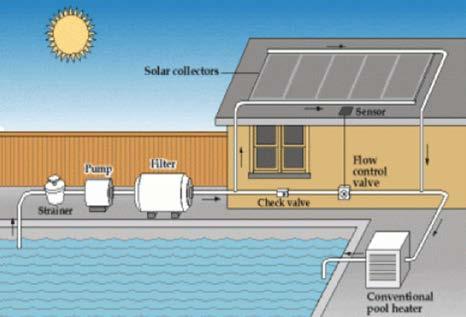
LANDMARK BUILDING - Solar swimming pool (top of the building)
Solar collector(heavy-duty rubber)
Collector tilt +\-15°
Concrete platform edge
Scale: 1:300

WATERFRONT WETLAND PARK (rough growing port edge)
5-15 YRS.

15-50 YRS.
Purification function aquatic vegetation cultivation (Salvinia natans)
WATERFRONT WETLAND PARK (rough growing port edge)
15-50 YRS.

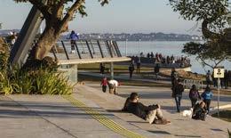
Through tidal fluctuation, it can arouse people's memory and stimulate daily sensory experience.


The extended iron support simulates the original coastline
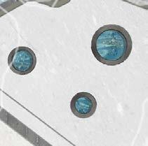
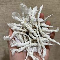
Oyster lantern net 1mx1mx0.4m
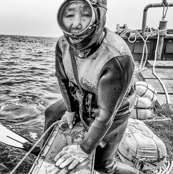
Maintain port operations
Precedent
BAYS
(rough growing port edge)
15-50 YRS.
When sea level rises...
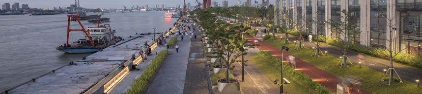
BAYS PROMENADE - offer job opportunities
STAGE 1 - "PURIFY"
STAGE 2 - "BREATHING" STAGE 3 - "ACTIVATE"