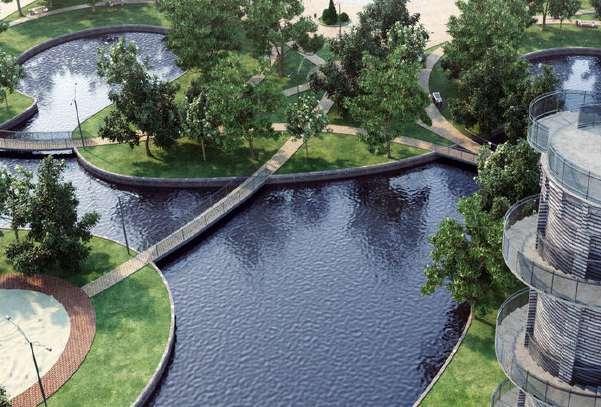
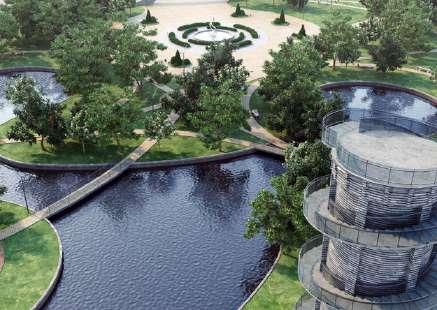
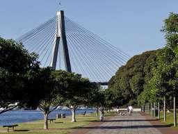
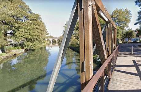
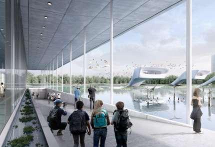
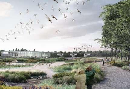
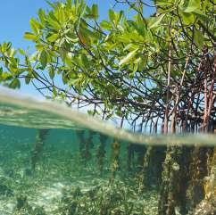
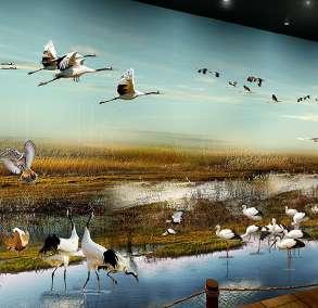
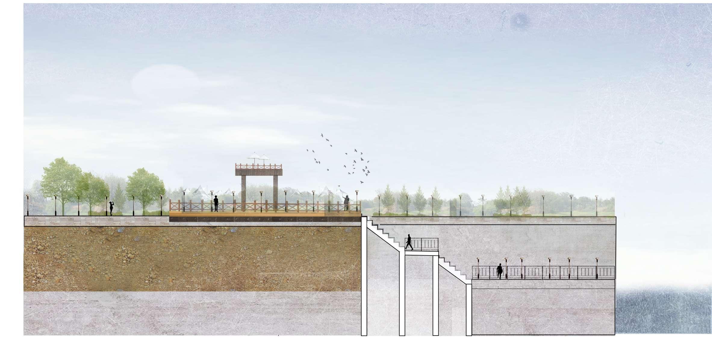
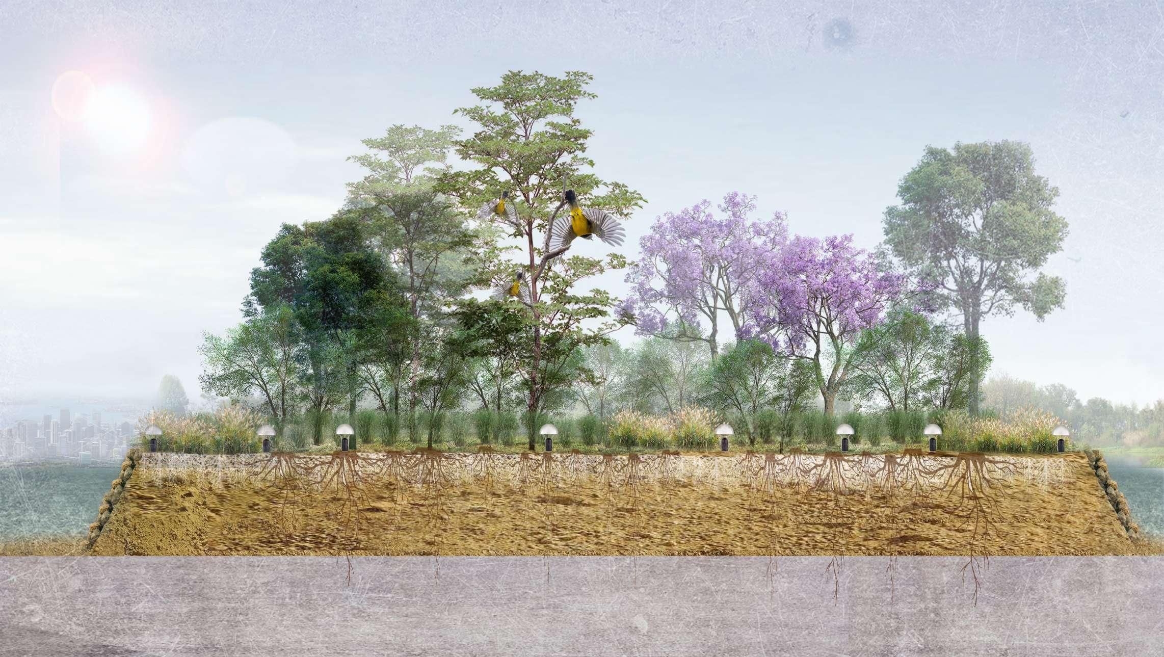
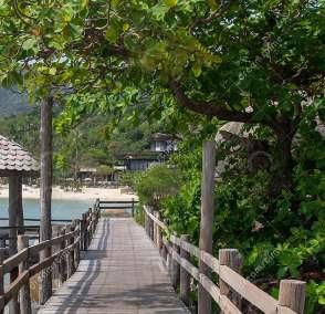
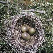
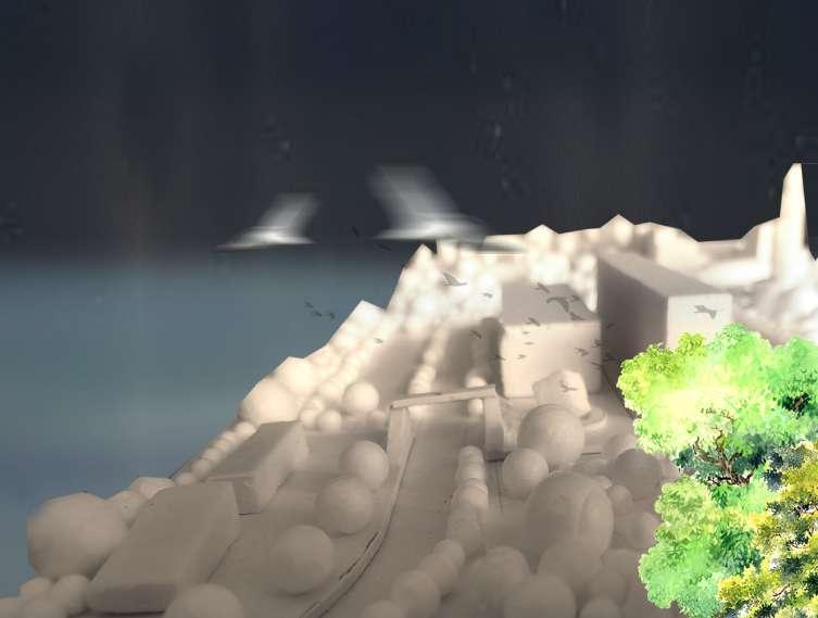
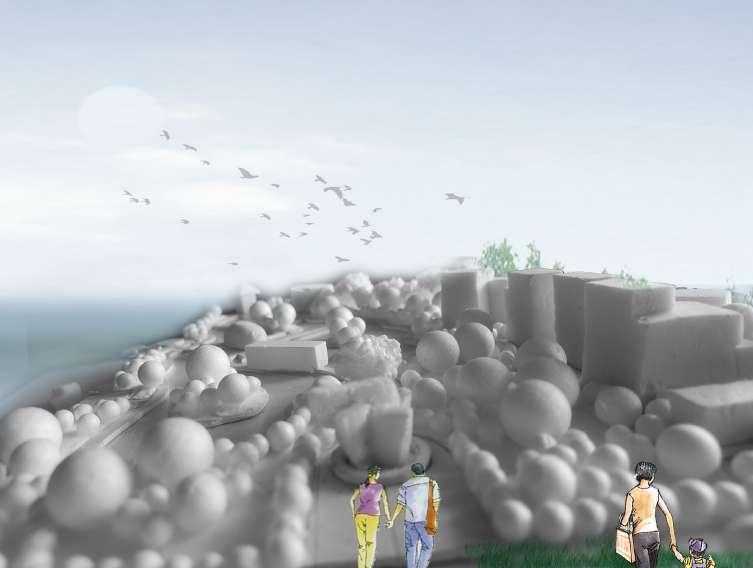
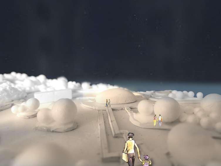
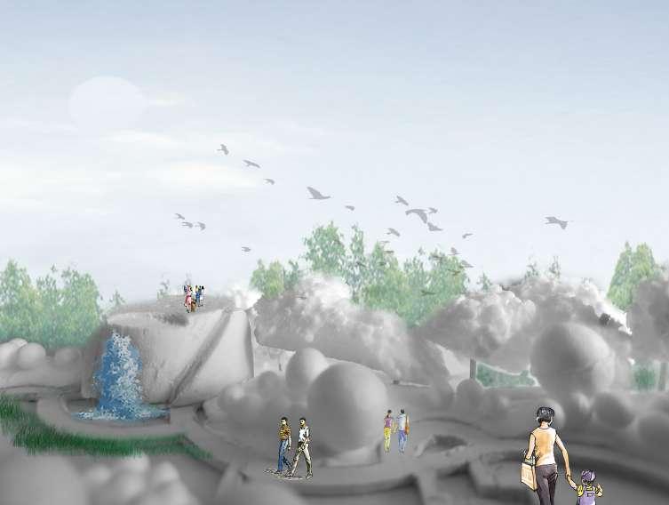
Urban coastal wetland landscape with human and bird coexistence
Process Log
Bichen Guo (Z5173512)
1.0 Framework
- What role does the intertidal zone play in a waterfront city?
- How can the intertidal zone at The Bays serve as a habitat for local birds while coexisting with human functions?
Explore the role of intertidal zones as local bird habitats in coastal urban public landscapes.
The Bird Position
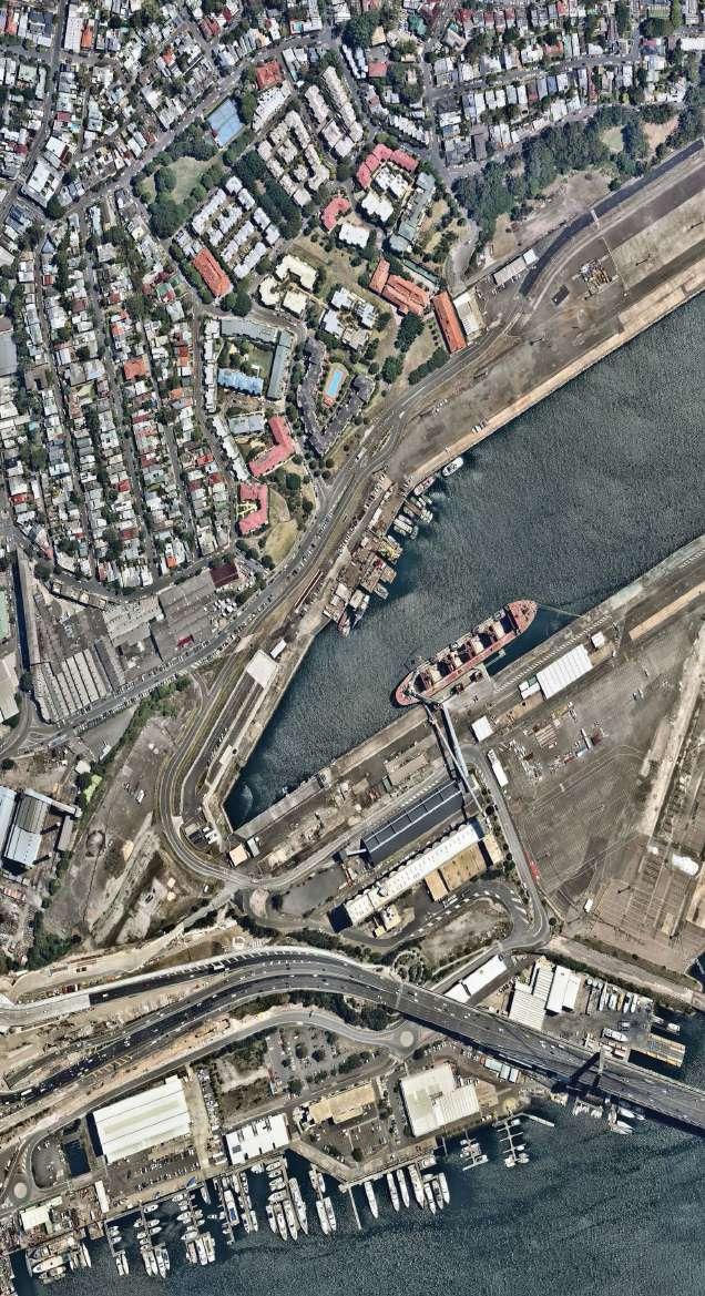
Our existing urban conditions
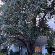
Where is the 'home' of other lives in today's highly developed human society?
what the topic is?
why it is important?
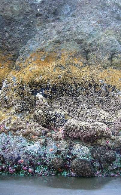
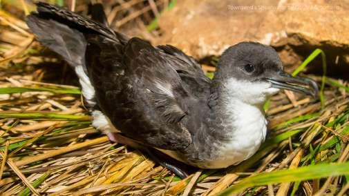
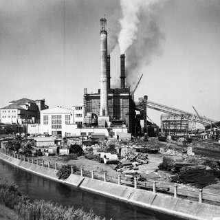
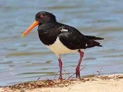
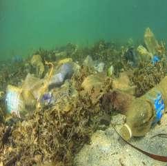
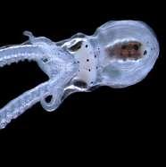
The destruction of intertidal ecology and the loss of habitat for local birds are problems that almost all coastal cities in the world have been facing in the last decade. The rapid development of coastal cities, especially the expansion of ports, has led to the neglect of intertidal ecological protection (Thompson, 2002). Today, the design and construction centered on human production and life place too much emphasis on positive economic development and convenience for its own single group. However, the immediate problem is the destruction of intertidal ecology through human intervention, which results in the loss of food sources and habitat for local birds (Mark,1997). In 2019, a large number of shearwater seabird carcasses were found on numerous beaches in Sydney. The direct cause of this problem is that a large number of birds are unable to find suitable living space at their destination and die in the endless search for habitat (Ming, 2019). The problem is not only for birds but also for many crab and shellfish species in the intertidal zone (the food source of seabirds), which are also facing the loss of living space due to excessive human modification of the intertidal zone, especially the harbor, resulting in a significant reduction in the number of organisms, which will directly lead to the destruction of the biological chain and negative changes in biodiversity (Jenkins, 1999). Therefore, it is important to actively restore intertidal ecology and create local bird habitats in the Bays urban public spaces.
In the essay on the ecological restoration of habitats in the intertidal zone, Peter proposes the use of high replication photographic sampling data in ecological sciences to analyze public spaces with opportunities for bird habitat creation, investigate and construct numerical models to simulate future habitat development to achieve bird habitat creation in intertidal areas (Peter, 2014). Such interdisciplinary collaboration and research open unlimited opportunities for future intertidal ecology. Landscape architects have the ability and responsibility to translate Peter's research ideas into reality so that intertidal ecological restoration and healthy development can be achieved through a series of integrated landscape and other disciplines, with reasonable human intervention and natural restoration, thus creating healthy and safe bird habitats for local birds in the Bays site and achieving biodiversity.
The Resident Position
Our existing urban conditions
Where is the ' health home' of residents in today's highly developed human society? what the topic is?
why it is important?
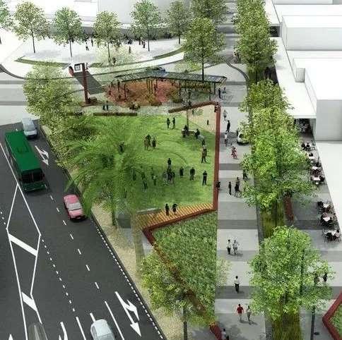
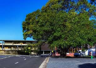
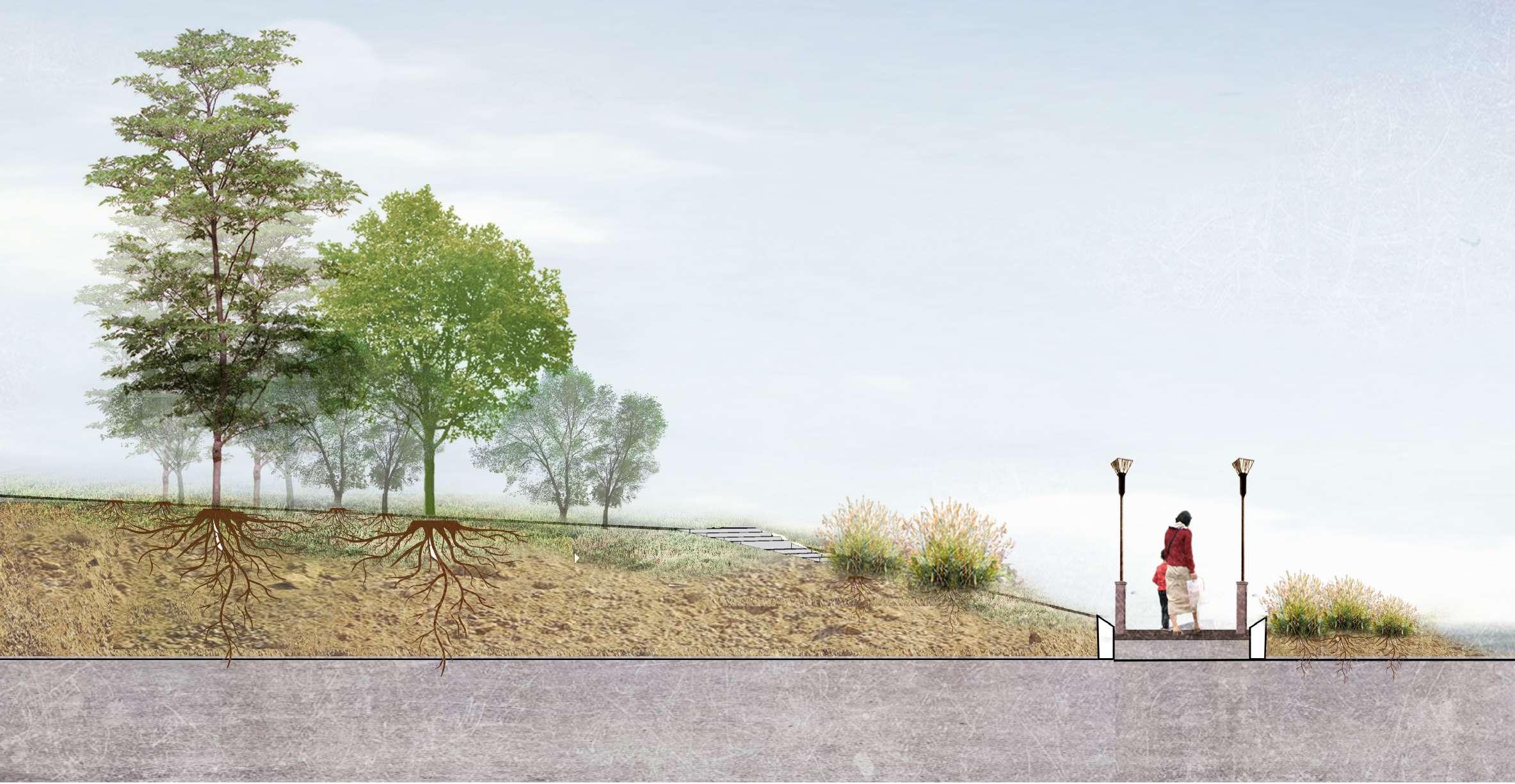
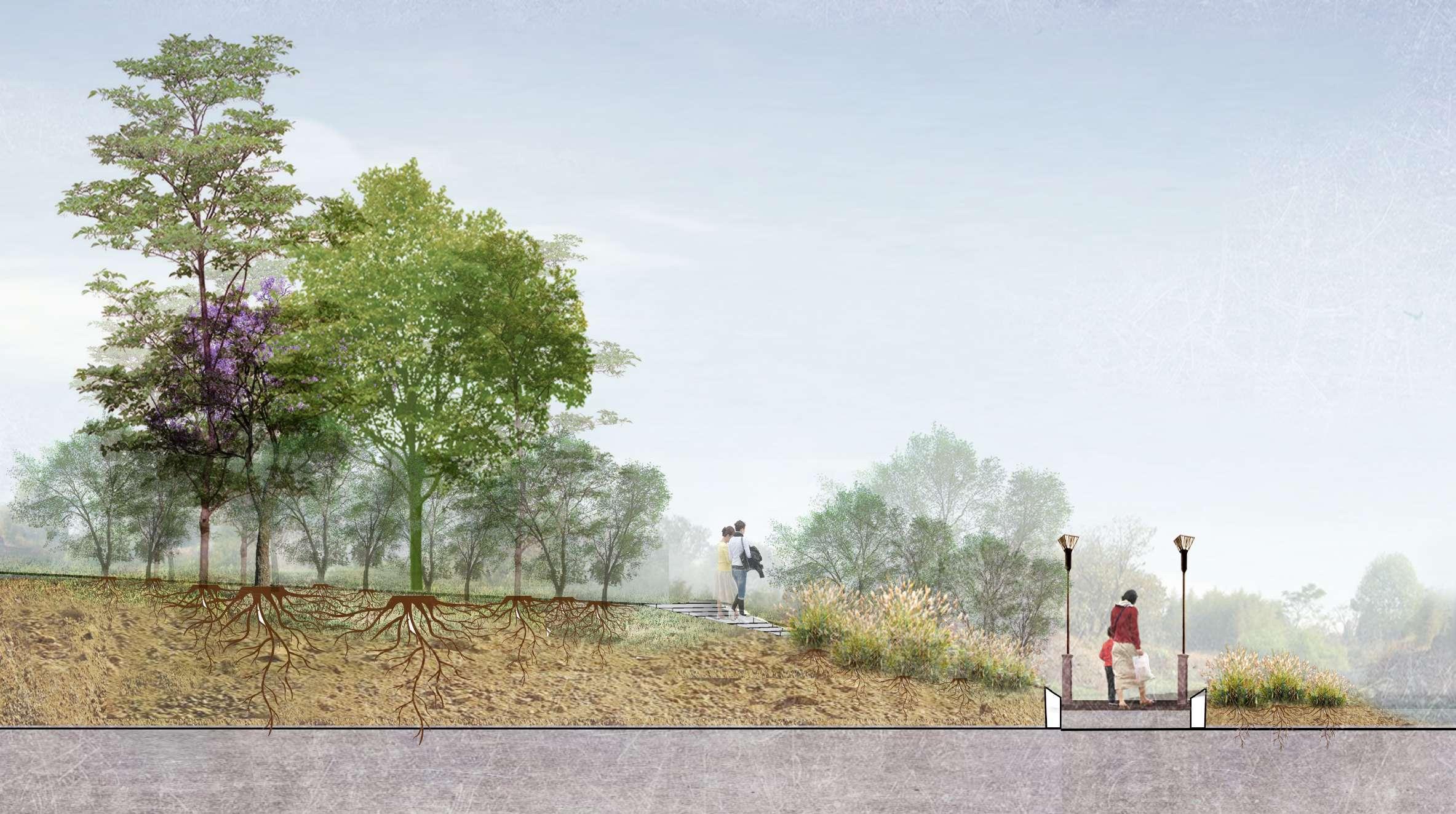
Urban greenway is dedicated to the construction of environmentally friendly urban green belts through the urban fabric and undeveloped natural areas within cities to address a range of urban flora and fauna ecological and social issues brought about by excessive urban development (Sustrans, 2019). In the last decade, rapid urban development has been reflected in the expansion of urban structures and populations and therapid development of central urban areas. This has led to the emergence of many gray high-rise buildings and a series of issues related to the lack of physical and mental experience of urban residents and the ecological destruction of flora and fauna (Dingding, 2019). For individuals, the urban greenway is highly resilient and extensive. It can be adapted to different urban contexts and cultures as well as being able to effectively and intuitively improve the acute problems faced by a city. Therefore, the urban greenway is a landscape element that is well worth exploring and experimenting with.
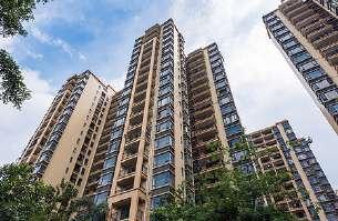
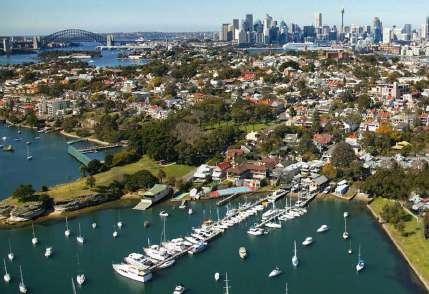
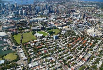
The Bays is in the heart of Sydney, so the high-density, the low-green residential area faces the problems of rapid urban development. At the same time, the site has a complex land use situation. With urban development, most of the industrial industries in the area have declined and abandoned, and residents, flora and fauna face a range of quality of life and survival issues (Dave, 2016). Therefore, the urban greenway concept and associated design are of ample value here. Through personal understanding and observation, the Bays has a large flora and fauna population and abundant public green spaces in the surrounding residential areas, creating an urban habitat greenway landscape can ensure better survival of its original flora and fauna, as well as enhance the physical and mental health of the residents, while alleviating the problems caused by rapid urban development.
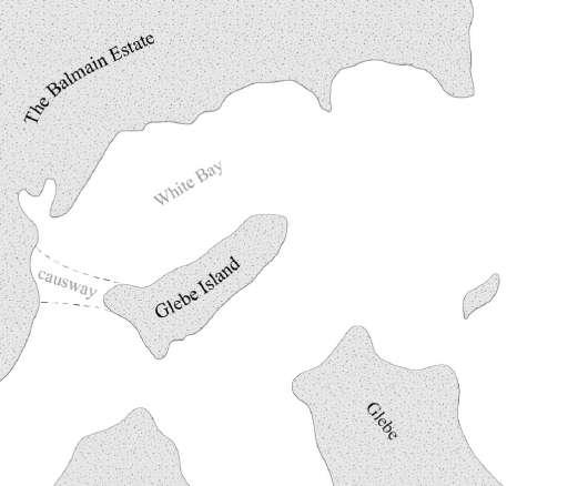
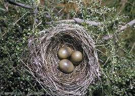
Site History Changes in birds
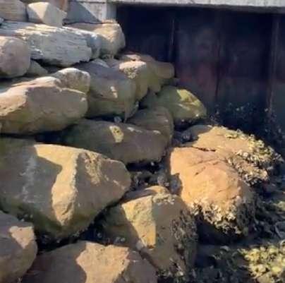
Glebe Island being a beach island, its only route is from the Balmain coastline at low tide. Therefore, it is also a natural habitat for birds (Urban Growth NSW, 2015).
Bird amount & species
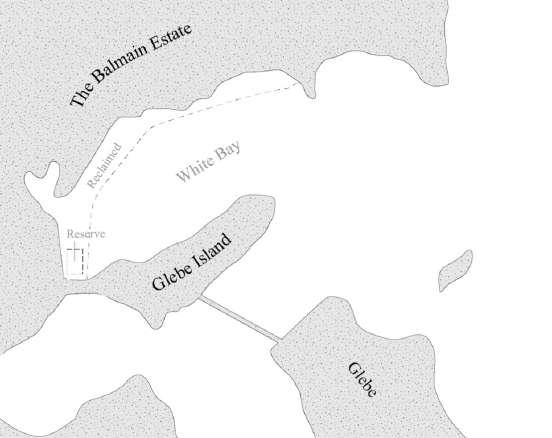
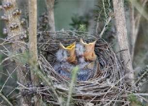
Glebe Island began to be connected to the Balmain area by artificial reclamation, and factories began to appear while the bird population declined significantly (Urban Growth NSW, 2015).
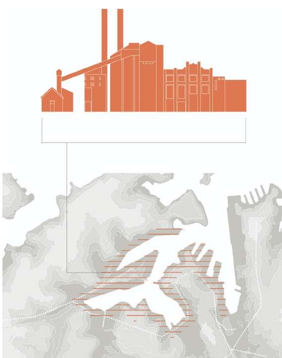
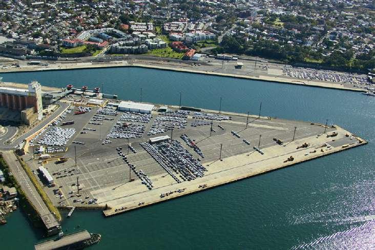
Glebe Island has become a heavy industrial area with a concrete platform. As a result bird habitats no longer exist and birds have almost disappeared (Urban Growth NSW, 2015).
- More than 300 species of local birds
- Thousands of birds stay here as well as hundreds of birds that reside here permanently (World animal protection AU, 2014)
- Less than 100 species of birds
- Only 40% of the original (World animal protection AU, 2014)
- Only 3-4 species of urban birds stay briefly
- Less than 3% of the original(World animal protection AU, 2014)
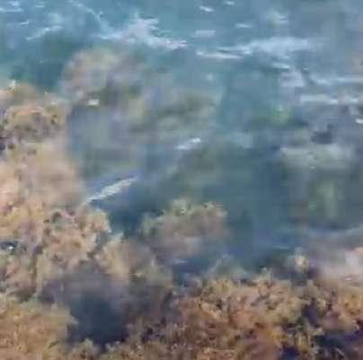
Glebe Island - mudflat bird habitat
Site History Changes in residents
Glebe Island - a space for residents to live
With the development of industry, the area around Glebe Island gradually appeared some supporting activity ares for workers. (Urban Growth NSW, 2015).
Number of residents
- Local workers mainly
- No more than 2,000 people live here (NSW Government, 2018)
Industry gradually declined and most of the land was converted into communities for the use of residents. (Urban Growth NSW, 2015).
The land around Glebe Island is basically transformed and the concrete platform of Glebe Island awaits transformation.(Urban Growth NSW, 2015).
- Increase in residents thanks to redevelopment of surrounding land
- The surrounding area has exceeded 40,000 residents (NSW Government, 2018)
- Future development of Glebe Island will help more people to settle here
- The number of residents reached about 50,000 (NSW Government, 2018)
2.0 The Birds and Residents
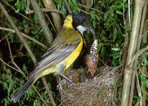
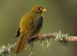
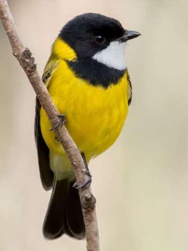
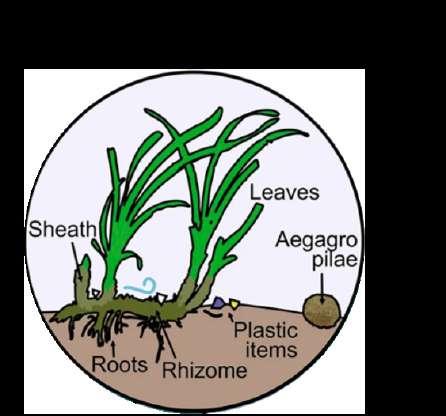
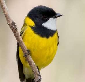
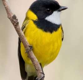
Golden Whistler Bird Analysis
Bird life and food webs
The life of a golden whistler bird
cycle is about 1 year
- September and January are egg laying times each year
- Incubation time is 15 days
- Each pair of birds lays about 2-3 eggs at a time
- The weight of each baby bird is about 6-7 grams
- Each baby bird can eat 2-3 times its body weight
- It takes about 3 months to grow into a young bird
- Body length is about 1011cm
- Each young bird needs approximately 30-50 of its own
- It takes 2-3 months to grow into an adult bird
- Adult bird size is 16-18cm
- Requires hundreds of times its own size to move around
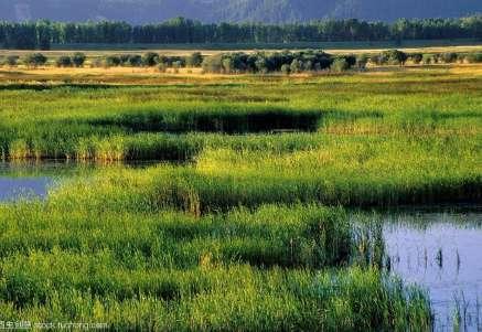
- Requires a certain wetland and intertidal environment for foraging and survival
- Breeding and mating take place every spring and fall
The golden whistler bird food web
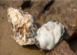
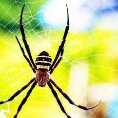
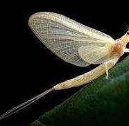
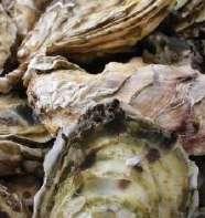
Each bird eats an average of thousands of oysters and tens of thousands of insects per year
Each insect needs about 10 times its own volume to survive
Needs 1-2 times its own space to move around
Baby birds
Young birds
Adult male birds
Adult female birds
Golden whistler
Insects
Seashell creatures
Small insects, shrubs and grass seeds
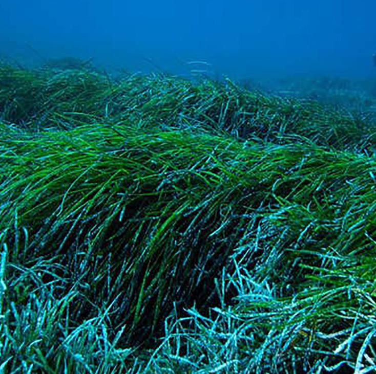
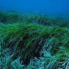
Seagrass
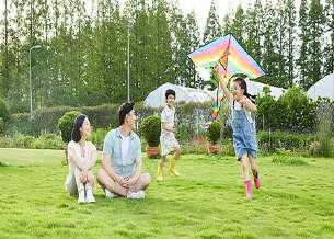
Local people Analysis
Local people daily life and activities
- Takes up the majority of the day
- About 10 hours a day
The person daily activities
Everyone's daily life space needs to combine urban and green
- Key facilities for everyone to travel
- A variety of formats
- A key space for living and socializing
- Takes up about 8 hours of the day
- The space necessary for people to live - Need at least 10 m2 space for its use
- May be used at any time of day
City life and private space take up half of the day person
Green spaces and public spaces take up the other half of the day
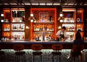
City Streetscape
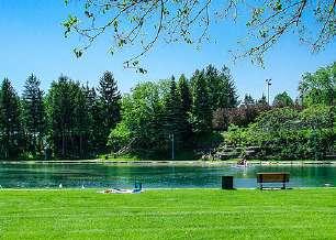
Park green space landscape
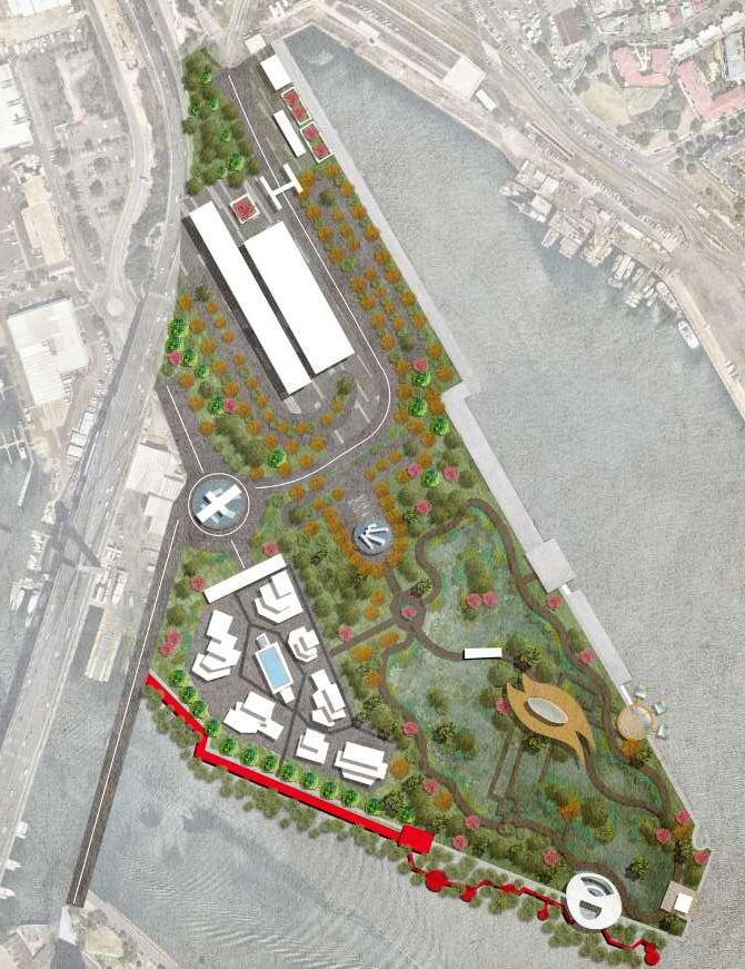
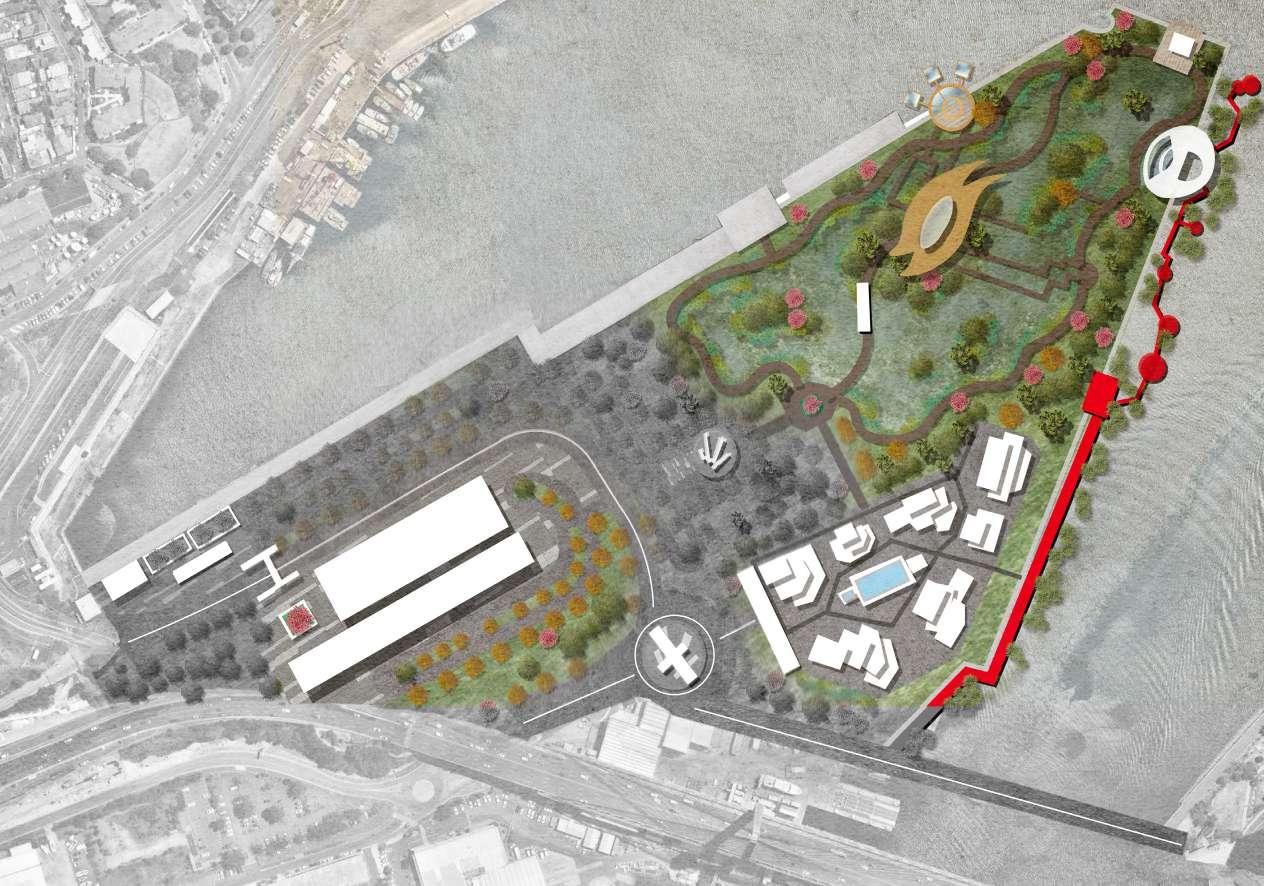
3.0 Responding to The Site
Bird Analysis
Today's birds
Map of today's local birds
Potential bird species
Legend
Existing bird stopping points
Potential habitat
Urban birds
Water birds
Beach nesting birds
Bush birds
Woodland birds
Bush birds
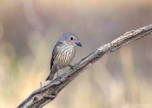
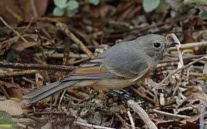
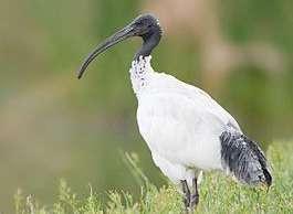
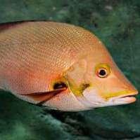
A compact songbird with a short pointed bill. The male is olive above and yellow below, with a white throat set on a black head. The female, overall, is grayish with a yellow wash underneath. Once inhabited the mudflat habitat of Glebe Island (Australia birdlife, 2020).
Golden Whistler
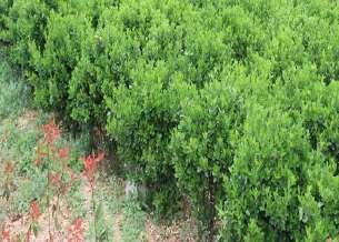
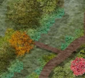
- Bushes
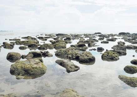
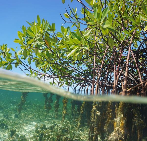
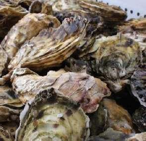
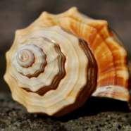
- Mangrove mudflat intertidal zone
- Oysters and other shellfish intertidal organisms as food (7-8 per meal)
- Insects in bushes (10-12 per meal)
- About 1 m2 of activity space each
- Requires a certain freshwater wetland environment
Urban birds Water birds
Beach nesting birds
Woodland birds
Resident Analysis
Today's resident communities
Map of today's residental areas
Potential residental areas
The rate of resident areas
Potential area
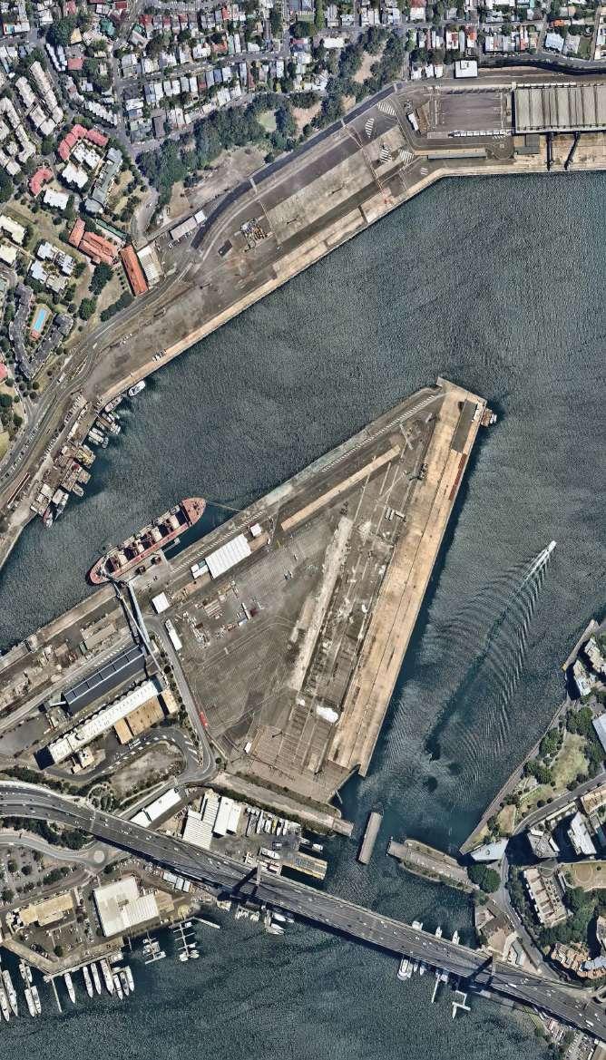
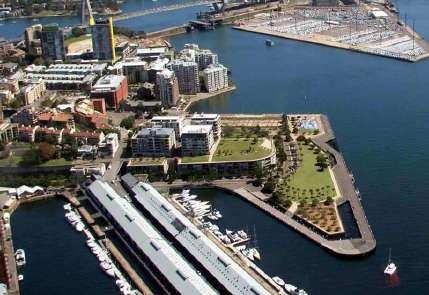
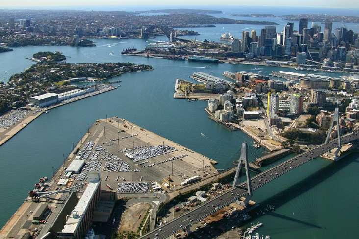
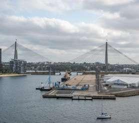
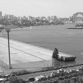
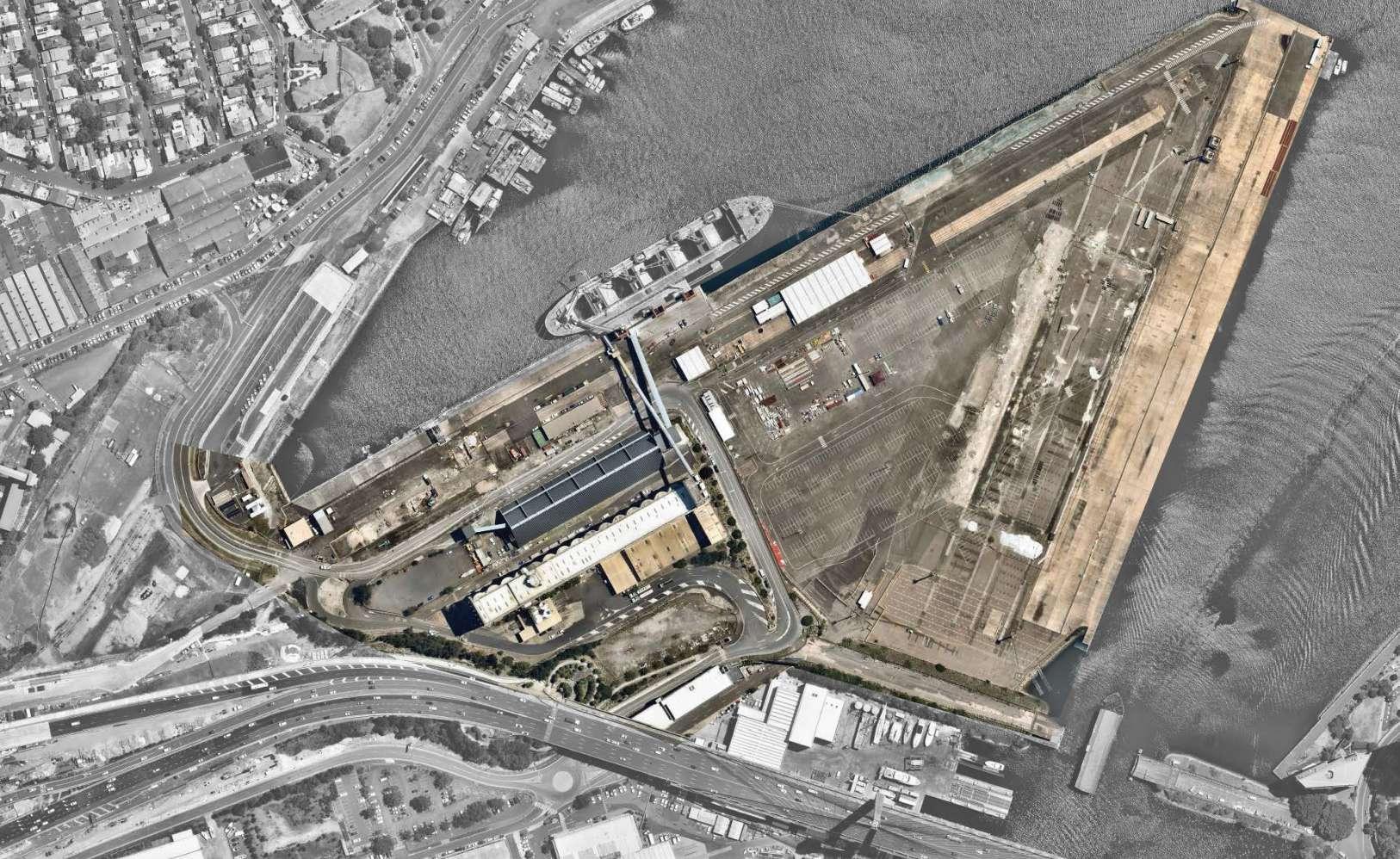
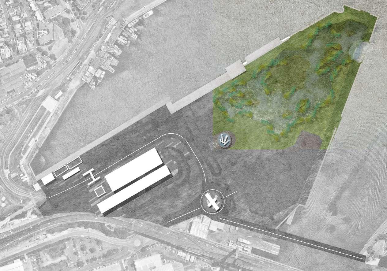
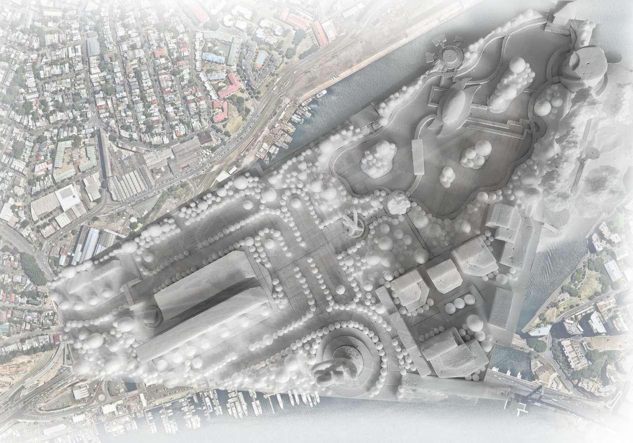
Today Glebe Island is a near-abandoned industrial terminal , but its special location makes it an important player in linking and radiating the surrounding community. Therefore, it is urgent to develop this site to integrate it into the city's development.
- Living space
- Entertainment zone
- Restaurants (1-3 times per day)
- About 10 m2 of activity space each person
- Requires a certain healthy and safty environment
Balmain Glebe
Pyrmont
Glebe Island
Vegetation Analysis
Today's surrounding green spaces
Map of today's green areas
Potential surrounding parks
Glebe Island is an artificially reclaimed concrete platform structure, and its former use as an industrial site has led to a significant increase in soil toxicity. Therefore, it is difficult for vegetation to grow naturally here.
- Cutting and Filling
- Water zone
- At least 30-40% of the entire site
- About 0.1 m2 of space each planting
- Requires a suitable microclimate
Glebe Glebe
Pyrmont
Jubilee Park Blackwattle Bay Park
Pirrama Park
Sydney Barangaroo reserve
Glebe Island
Water Analysis
Today's water flow and confluence
Map of today's water
Legend
Potential water forms
The underground water areas
The surface water areas
Creek confluence
Water flowing
Potential area
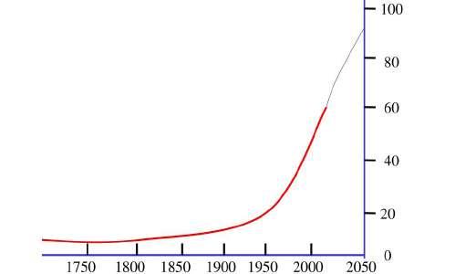
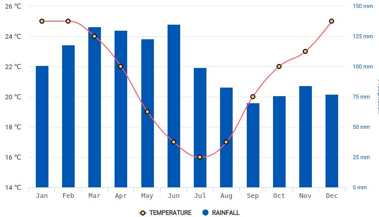
Precipitation in Sydney
Sydney has a humid subtropical climate with moderate average temperature changes throughout the year and no significant seasonal changes in precipitation, with slightly higher rainfall in the first half of the year due to easterly winds.
- The average annual precipitation is about 1214.3 mm
- Can meet the water needs of most vegetation
- About 60% of rainwater is collected
- Annual temperature between 8 - 28 degrees Celsius
- The temperature is also suitable for most vegetation
Rainwater pipes Creeks
4.0 Site Analysis
Opportunities & Constraints
Fundamental asset - Birds
Constraint
The concrete platform in the island becomes the biggest limitation for creating green space and water in the bird habitat.
Design principle
Landscape led, site-specific, constructing a bionic wetland habitat landscape suitable for the survival of the golden whistle
Opportunity
Glebe Island is surrounded by sea on three sides, and this special location provides the suitable conditions for the Golden Whistle to survive.
Opportunity
Glebe Island is richly edges and provides abundant water contact for golden whistles, which provide the basis for bird food and breeding.
Opportunities & Constraints
Fundamental asset - Access and circulation
Sydney Metro West
Opened: 2028
Opportunity
The entrance under the bridge provides opportunities for bicycle and pedestrian access to the island.
Design principle
Green access, safety and well-established circulaton, creating safe, comfortable and well-lit people living spaces
Constraint
The working port was the biggest limitation that was becoming a major barrier to accessing the island, so removing it became a key design move.
Opportunity
The connection of the broken bridge provides opportunities for more residents and tourists to enter the island.
Opportunities & Constraints
Fundamental asset - Vegetation & phytoremediation
Opportunity
A small amount of vegetation grows in the low contamination zone , which provides opportunities for subsequent phytoremediation and addition of new plants.
Design principle
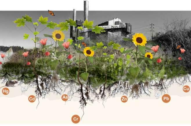
Phytoremediation is the direct use of live green plants to remove, degrade or contain contaminants in situ in soil , sludge, sediment, surface water and groundwater . By utilizing the natural capabilities of plants, contaminants can be removed, degraded, or stabilized (Sooprayen. V, 2017).
How does it work ?
Return to nature, combined with the concept of sustainable urban development, using the concept of phytoremediation to add plant communities, constructing an atmosphere of harmonious coexistence between people and birds.
To remove contaminants from soil, sediment and/or water , plants can break down or degrade organic contaminants , or control and stabilize metal contaminants by acting as filters or traps.
Opportunities & Constraints
Fundamental asset - Water and edge
Design principle
Opportunity
LP
Constraint
The original edges of the islands may not be able to cope with the rising sea levels year by year in the future, resulting in saltwater intrusion.
Water zone Legend
Water flowing Contour lines
The pipes that collect rainwater provide the opportunity to create a water element to the island's bionic wetland. Opportunity
The original marine vegetation provides opportunities for developing intertidal ecology.
Ecological priority and return to history. Create different forms of intertidal landscapes and construct a stable ecosystem to cope with sea level rise.
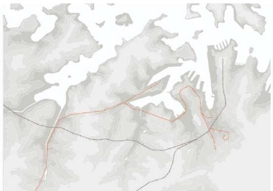
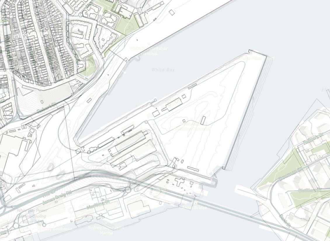
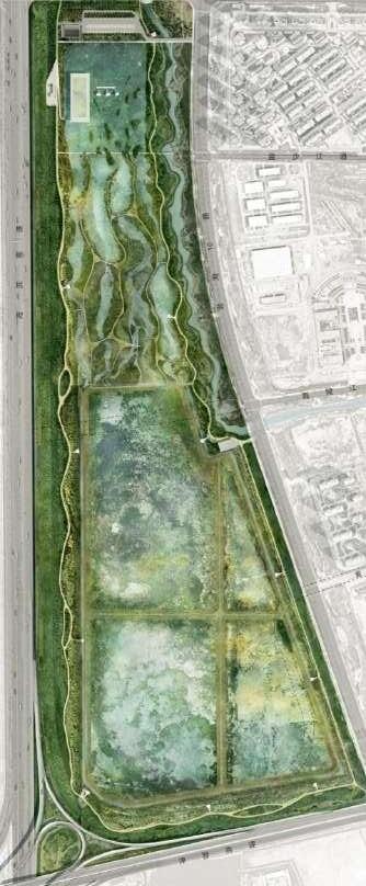
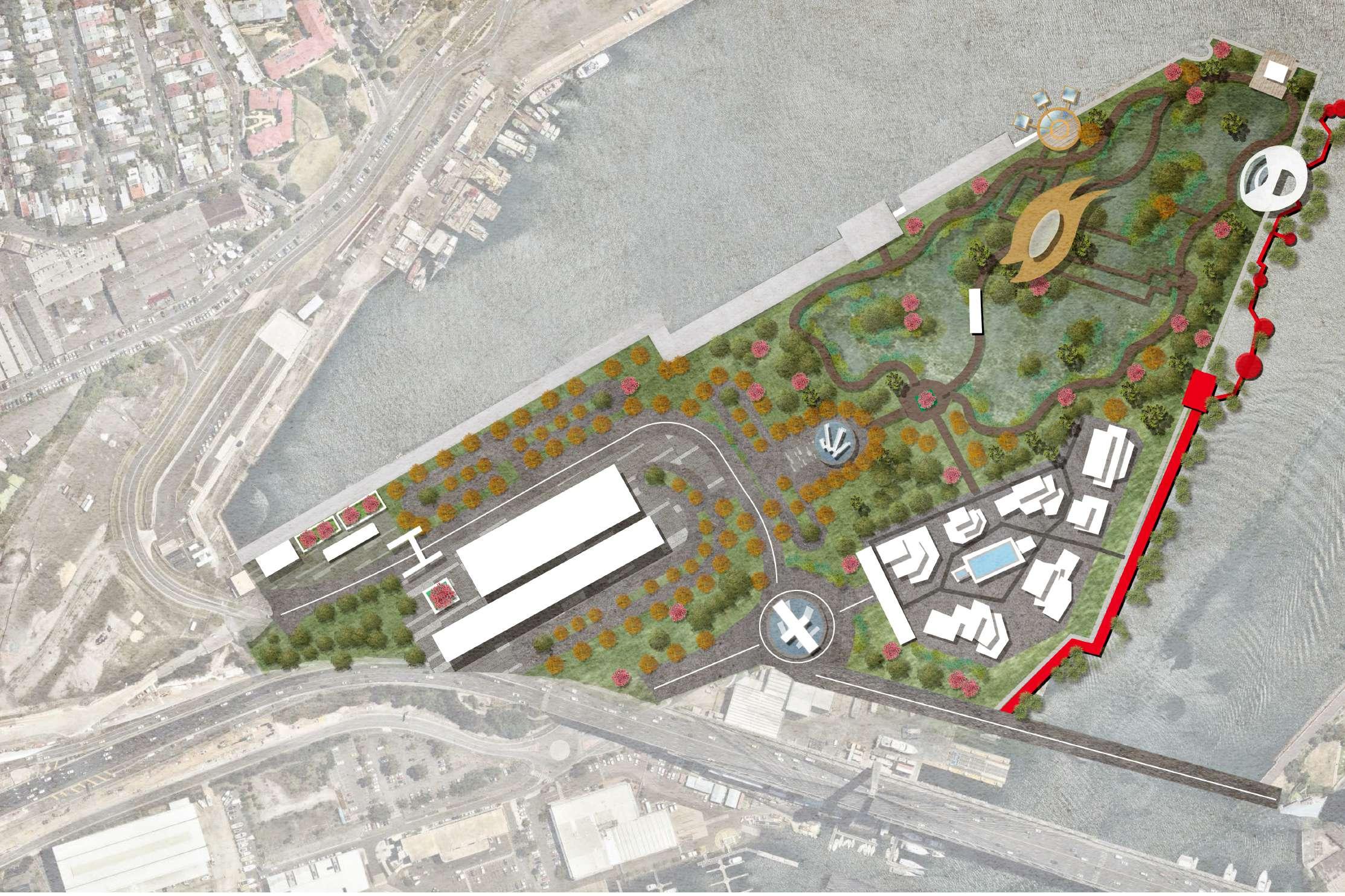
Site Selection
Precedent study - LINGANG BIRD AIRPORT
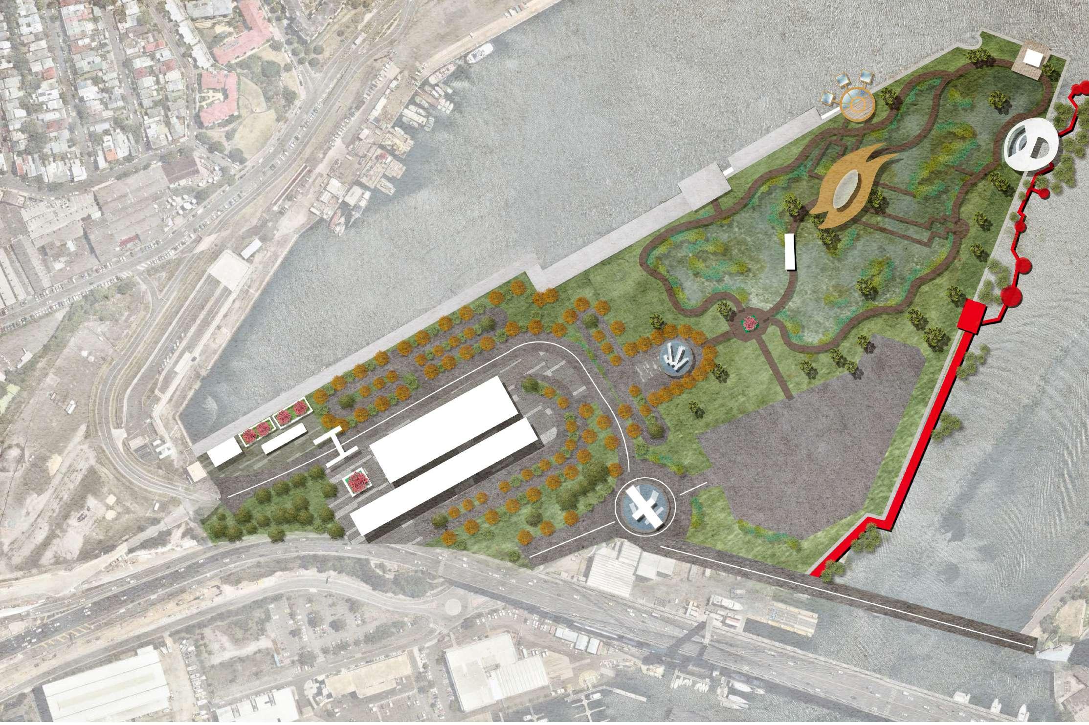
Map of purposed areas
Legend
Purposed areas
Purposed resident areas
Purposed social activities area
Purposed wetland areas
Potential area
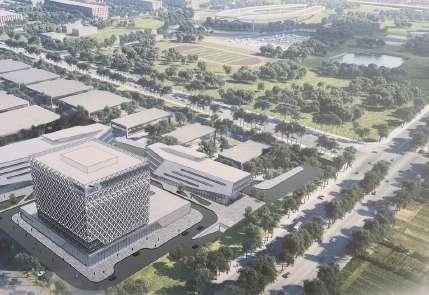
LINGANG BIRD AIRPORT
The project aims to create a flagship ecological wetland area while responding to targeted environmental conditions to attract and provide refuge for several endangered bird species. The 61 hectare landscape has been specifically designed to accommodate over 50 species of birds in 3 different water habitats.
- Green infrastructure such as artificial wetlands, green parks and urban forests
- Purified wastewater and collected rainwater are diverted to the entire wetland
- Meet the demand of the estimated 500,000 visitors per year
- 20 hectares of wooded surroundings to protect birds from surrounding urban development
Residential area - LINGANG BIRD
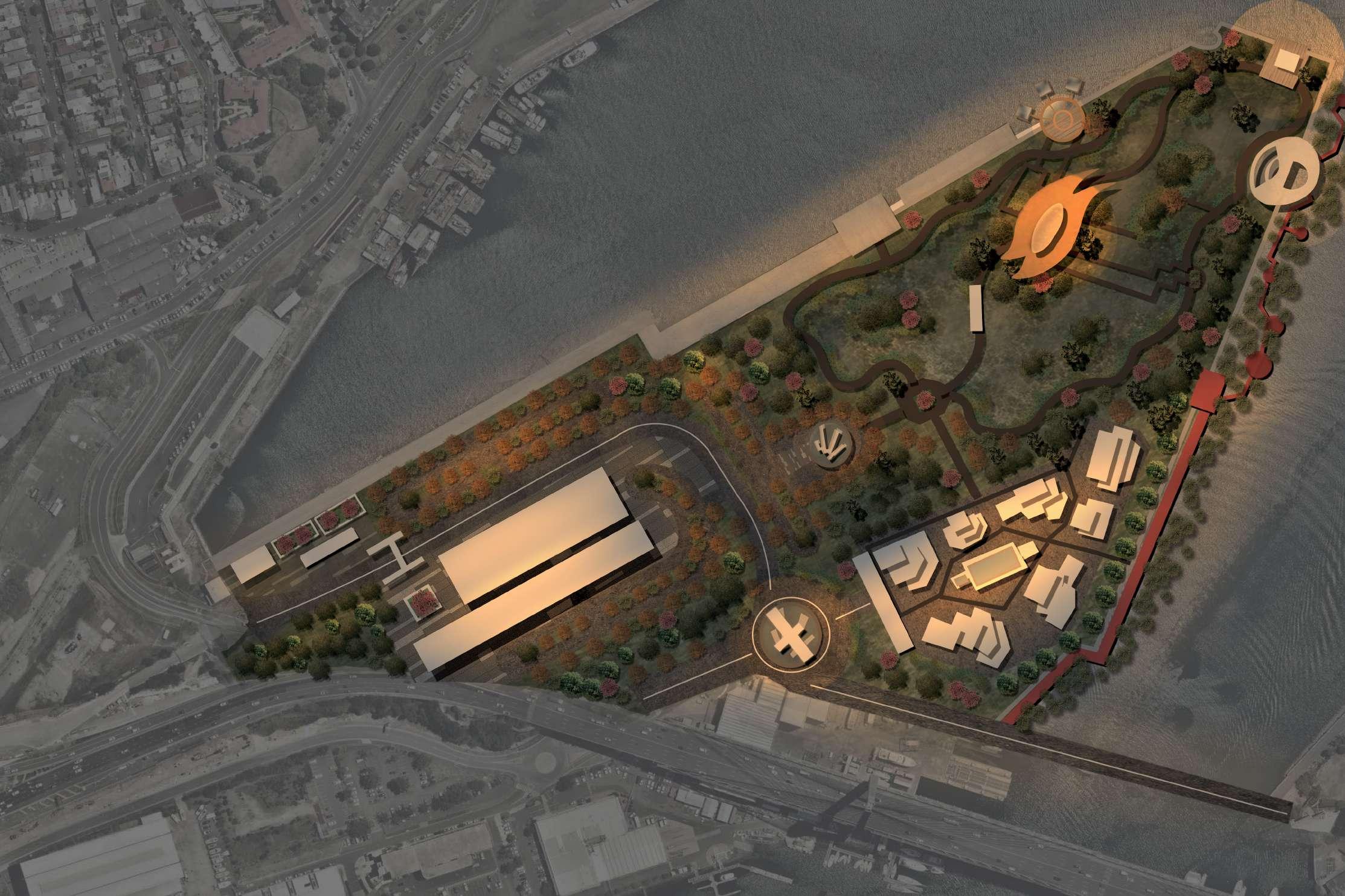
5.0 Design Process
Design Principles
Landscape led and urban development led to form a stable urban ecology
Design principle 1
Green access, safety corridors, creating safe, comfortable and well-lit people living spaces
Design principle 3
Return to nature, combined with the concept of sustainable urban development, using the concept of phytoremediation to add plant communities, constructing an atmosphere of harmonious coexistence between people and birds.
Design principle 4
Ecological priority and return to history. Create different forms of intertidal landscapes and construct a stable ecosystem to cope with sea level rise.
Design principle 2
Landscape led, site-specific, constructing a bionic wetland habitat landscape suitable for the survival of the golden whistle
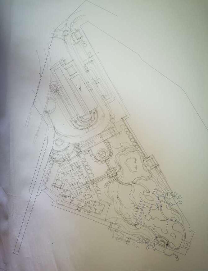
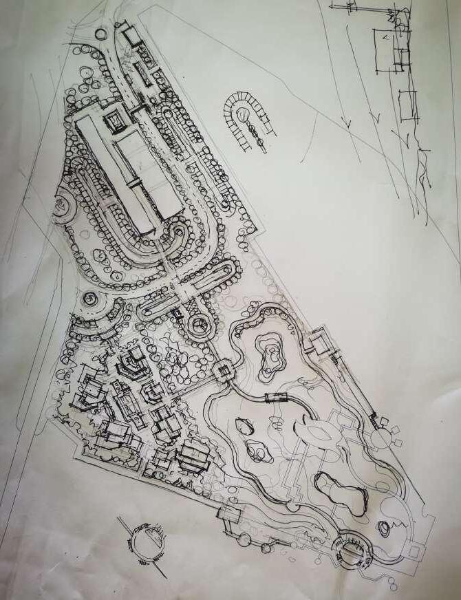
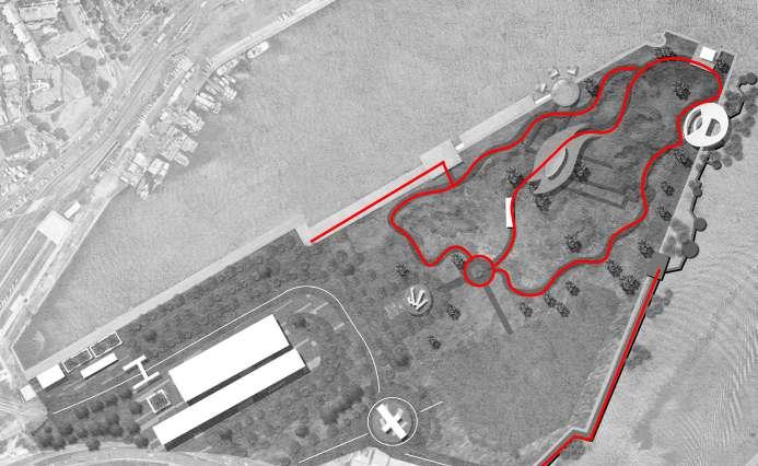
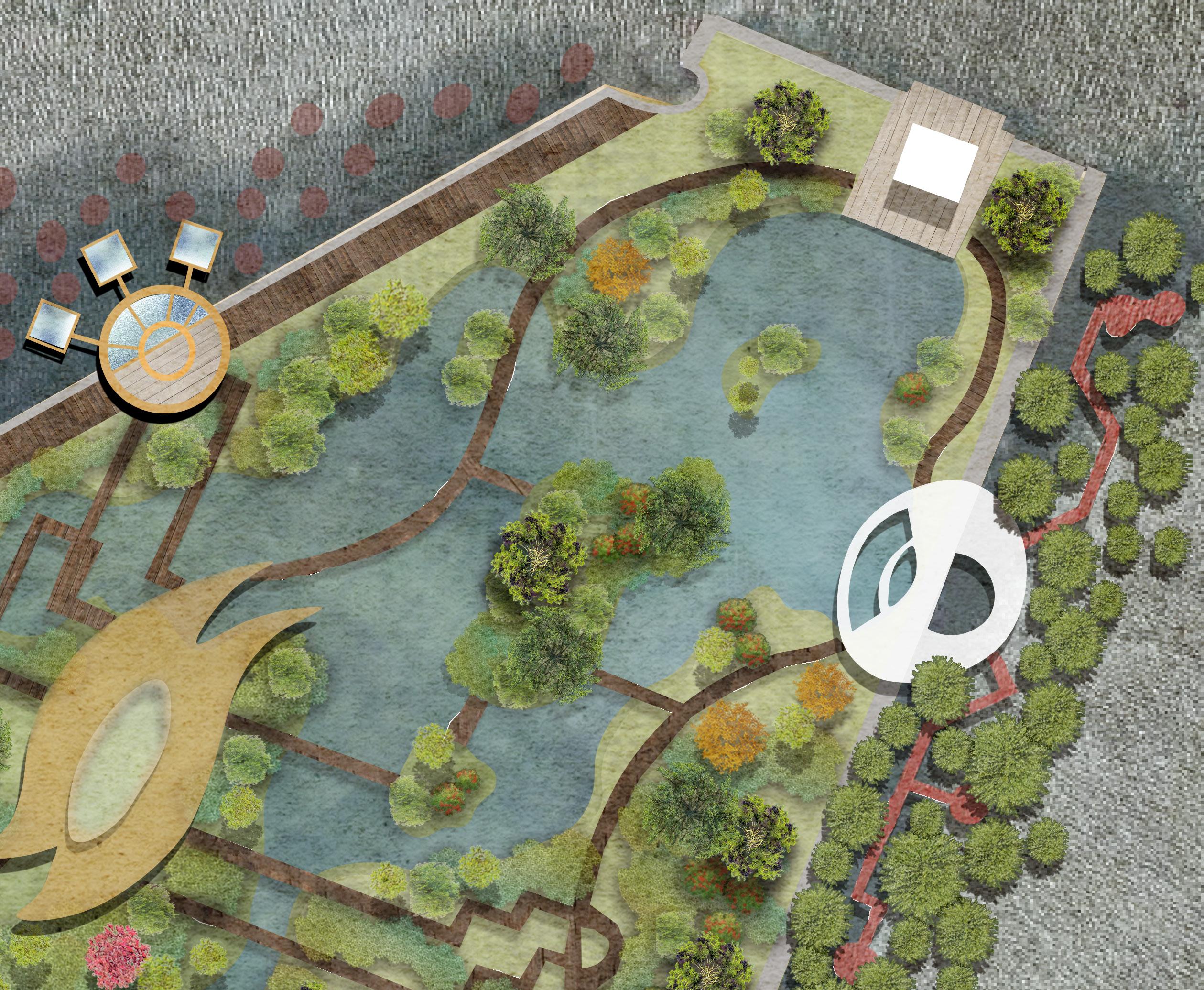
Design Process
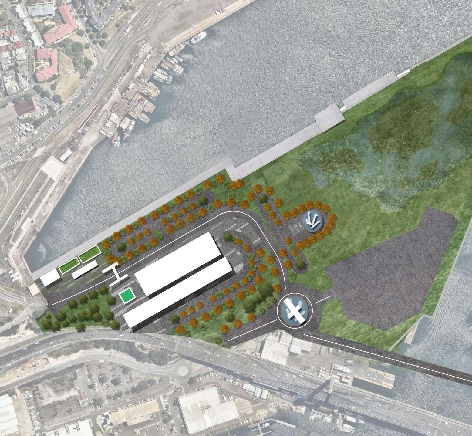
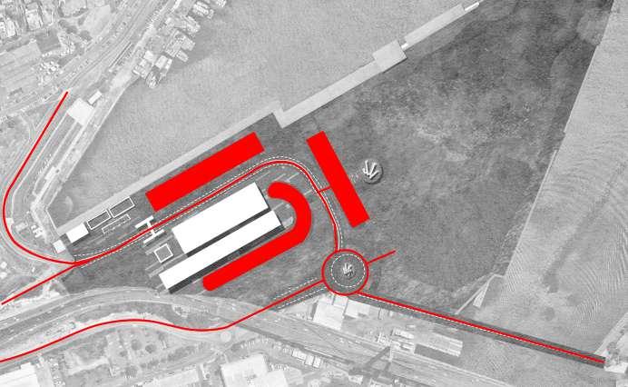
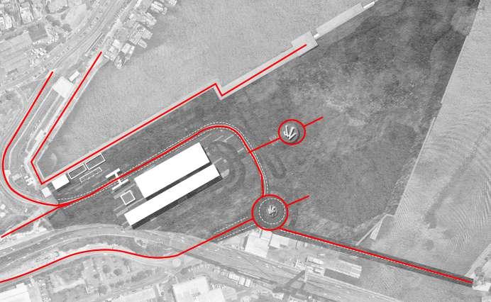
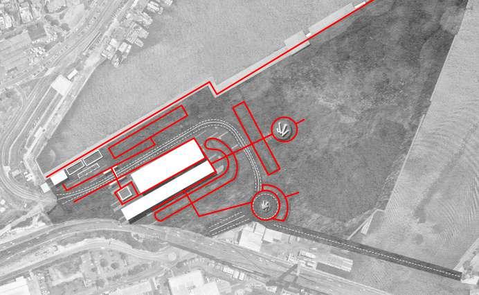
Masterplan process
The analysis was used to understand the site conditions, especially the functional division of the different areas. This process focuses on defining the structure and road connections throughout the project, and then using the site's specificities and fundamental assets to develop a targeted design. Clear boundaries between residential areas and habitats help to realize the concept of combining urban and ecological development.
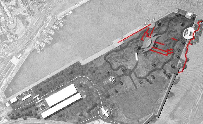
By defining the general structure of the project, a question about ecological restoration and rehabilitation is raised. This process of enriching and defining the details within the site realizes the idea of restoring the original ecology and at the same time realizing the idea of creating a green activity space for the residents.
Rethink the design of vegetation types and water treatment that contribute to ecological stability. By adding different vegetation (restoration plants, bird plants, and landscape plants) and water areas, the design achieves a sustainable ecological environment where people and birds can live together in harmony.
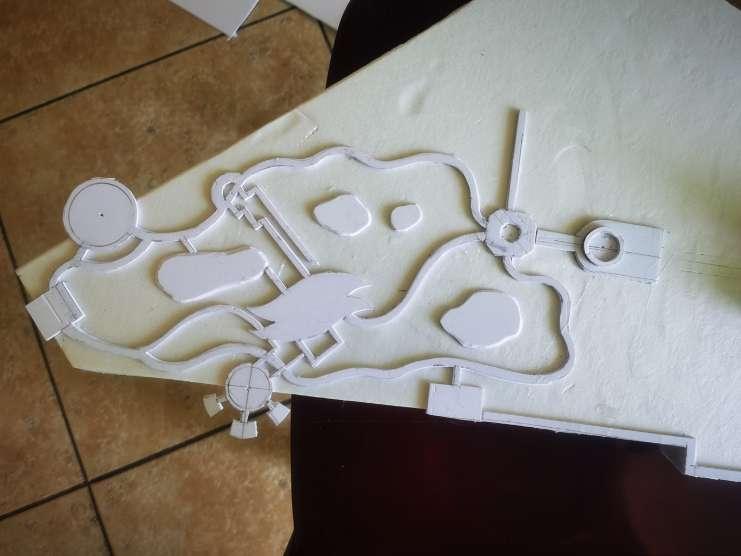
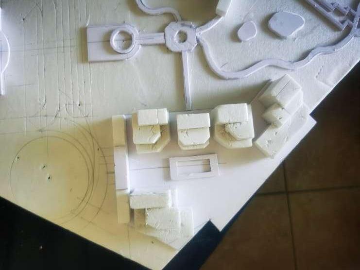
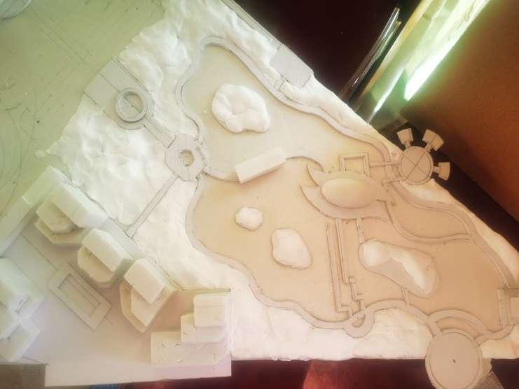
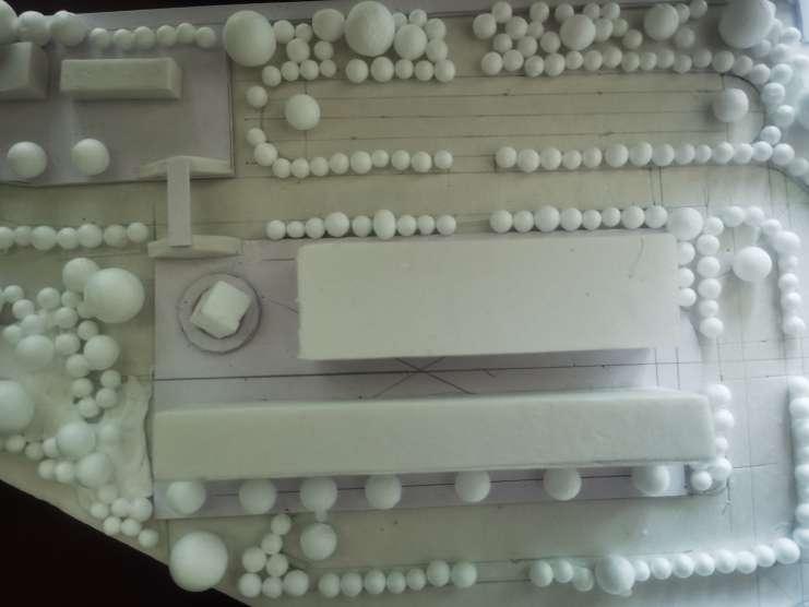
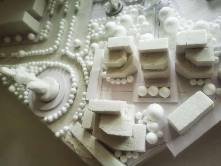
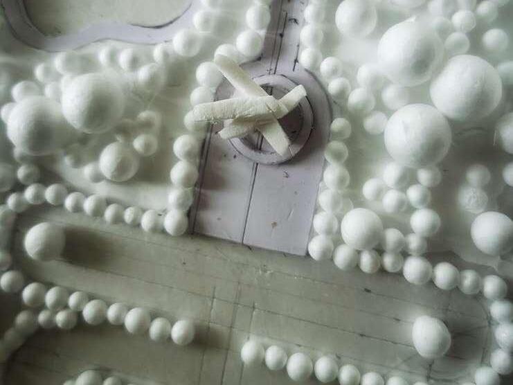
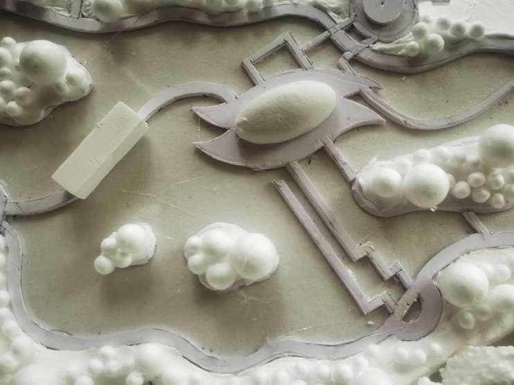
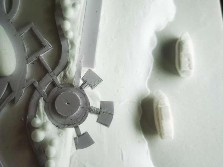
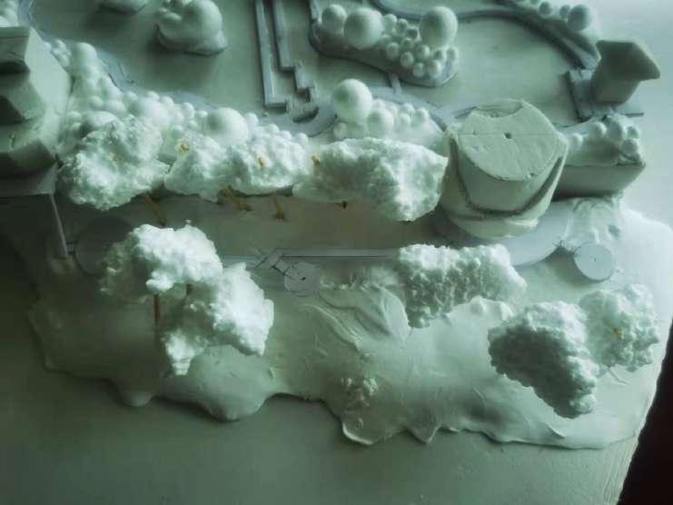
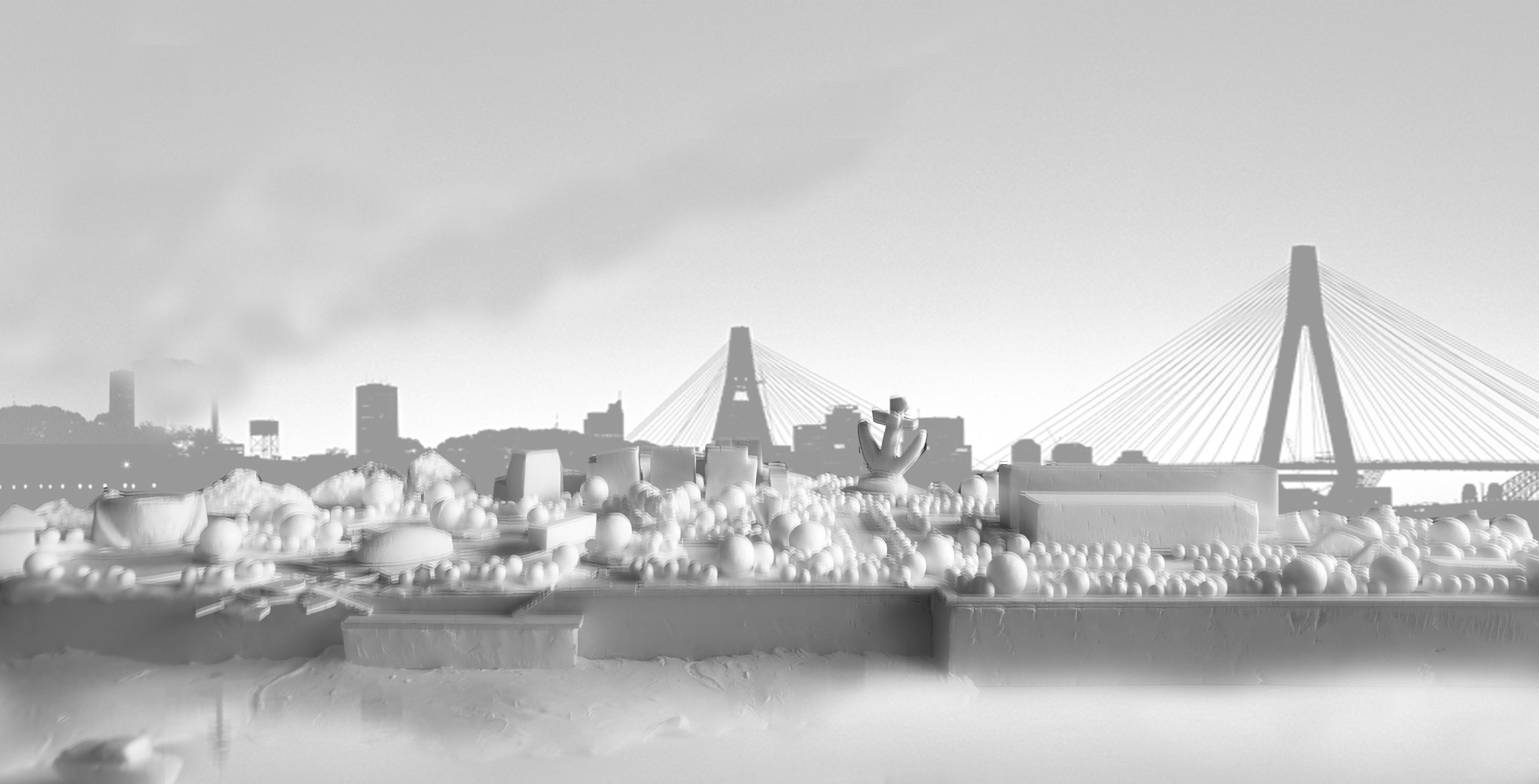
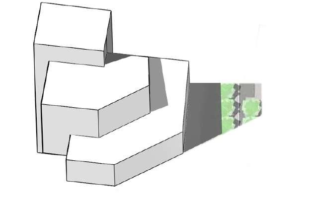
Design Process Model making process
The modeling process further verifies the rationality and accuracy of each design element and space by exploring design concepts and goals as well as key movements.
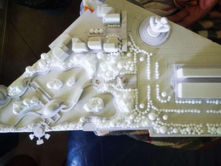
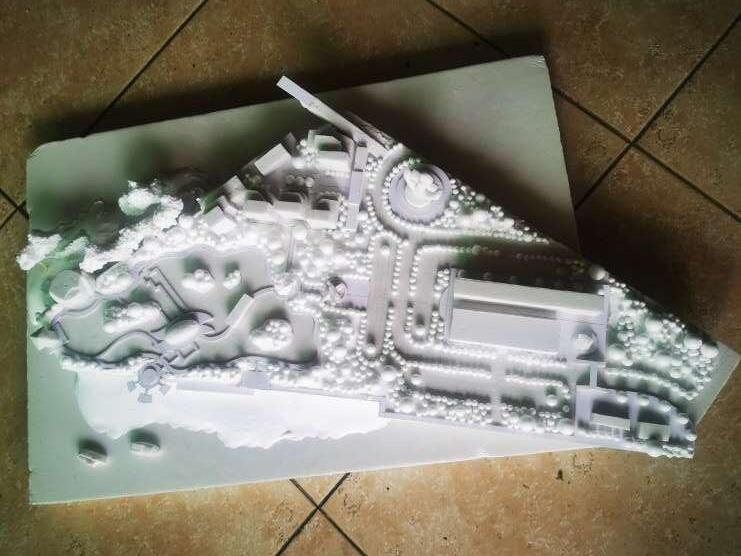
Design Process Model making process
Through the conceptual model, we further clarified the design of each area and how to achieve the sustainable development concept of human-bird coexistence and ecological stability through the design.
Measure of Time Timeline of goals and events
Sea-level rise
Deposition of mud flats
Percentage of tree canopy
Reduction of toxic soil
The appearance of the first bird
The life of a birds (bird numbers)
Bionic bush wetland & intertidal habitat Human interaction Stage
1
2
Degradation using phycological techniques (Ecologica Sinica,
Hybrid Question & Vision
Critical Events
Hybrid question
What if Glebe island became a local bird and resident ' habitat', enriching people's interactions with birds while rejuvenating the intertidal landscape on both sides?
Vision
This is an ecological restoration and urban development project using abandoned industrial land to create a bionic wetland; replace the original intertidal form with an environmentally friendly intertidal ecosystem; and create a series of facilities needed for residential and social activities. The formerly dilapidated Glebe Island will be revitalized.
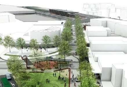
Event 1: Urban Connectivity and Site Renewal
Event 2: Habitat Establishment and Edge Renewal
Event 3: Community Establishment and Phytoremediation
Event 4: Realizing a stable ecology of human-bird symbiosis
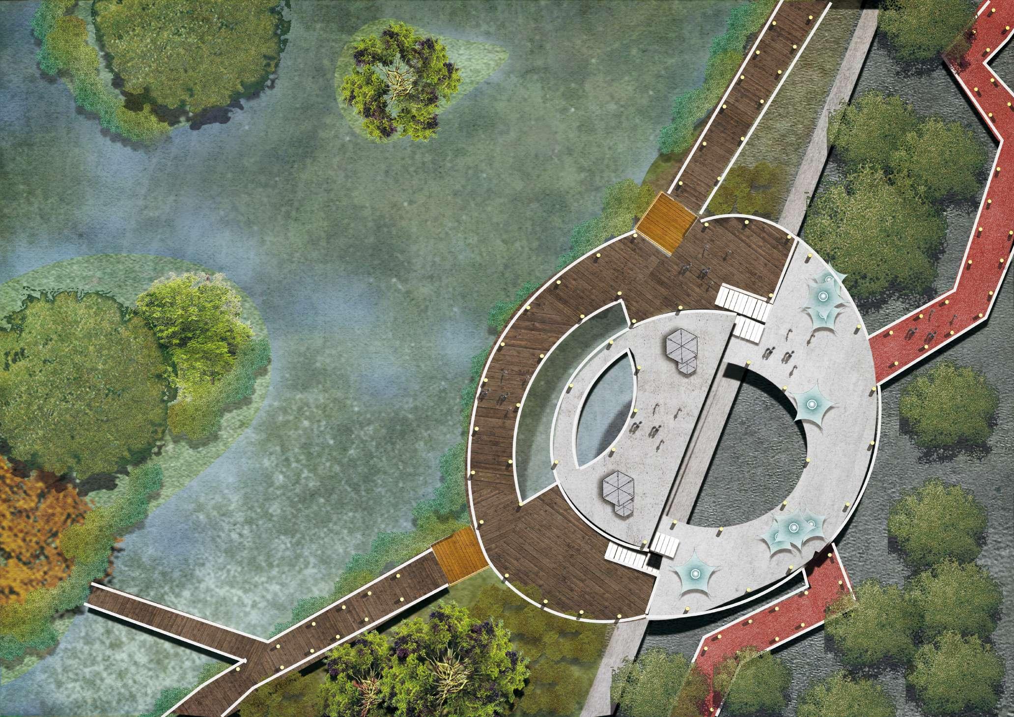
Stage Plan
Division of each stage
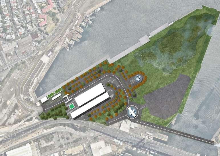
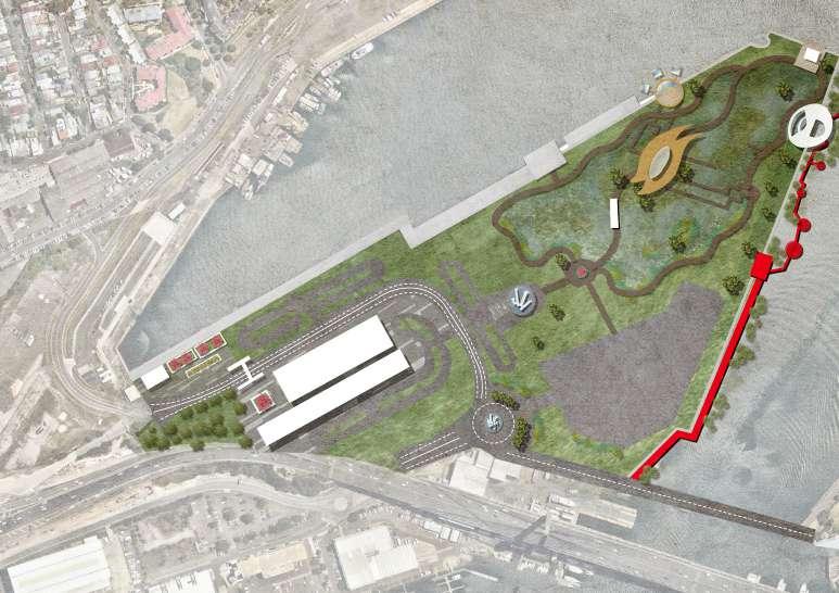
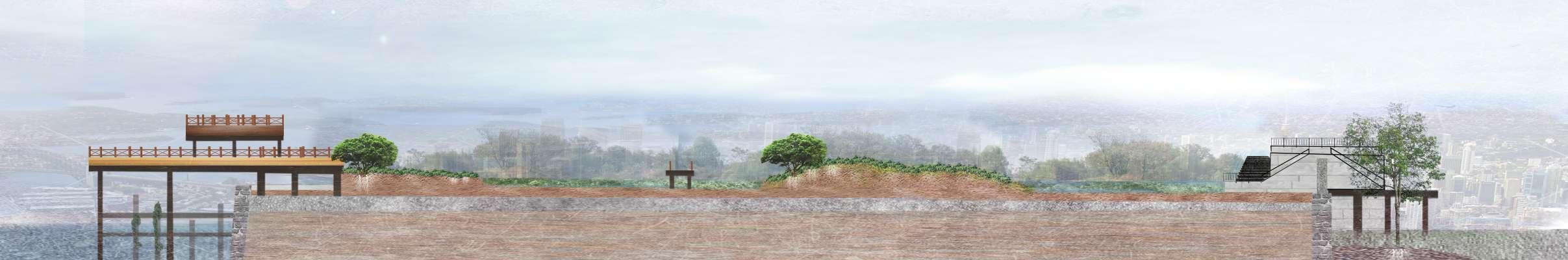
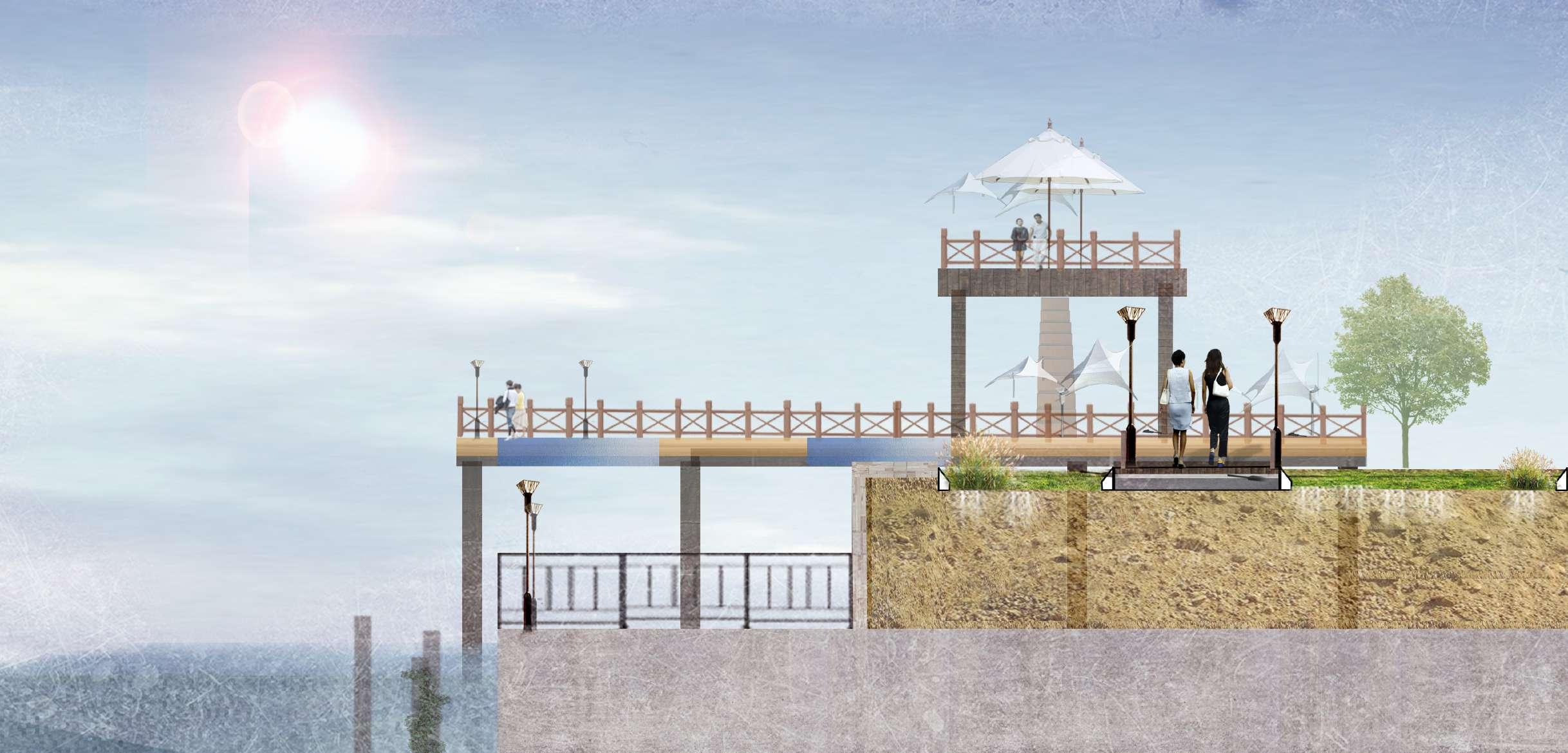
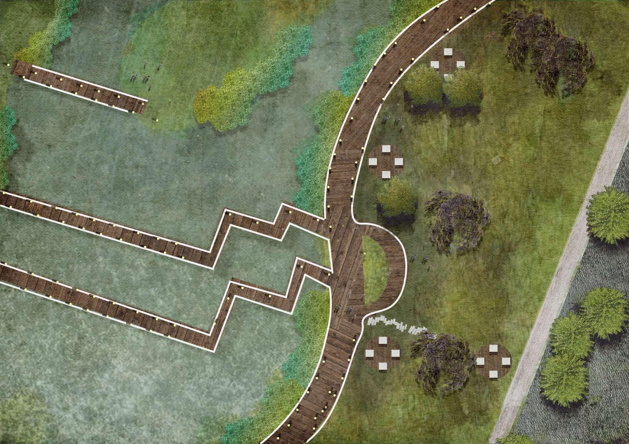
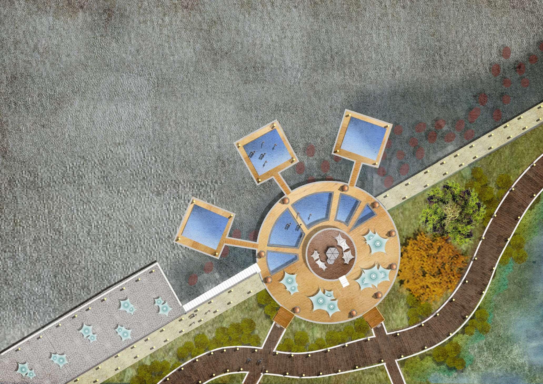
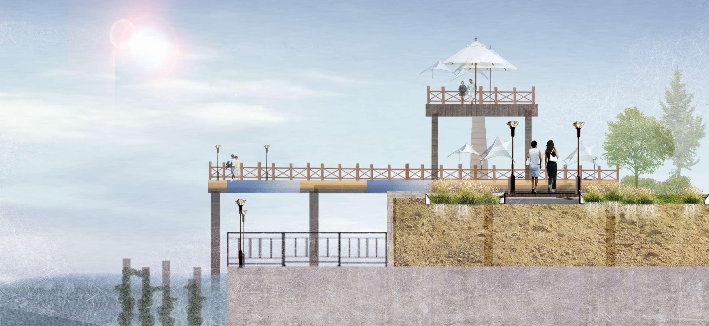
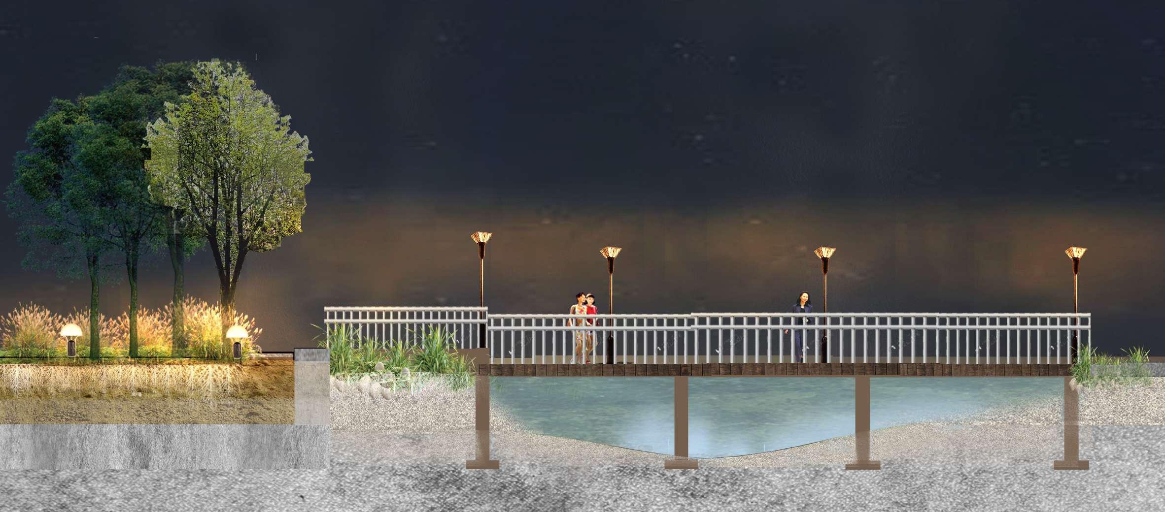
6.1 Detailed Design (Stage 1)
Stage 1: Urban Connectivity and Site Renewal
Stage 1 (2021-2025)
Urban connectivity and site renewal
Creation of the main entrance for pedestrian access to the island (metro)
Create motor vehicle entrance
Connecting broken bridges for greater urban connectivity
Creating a bionic wetland landscape
During this phase, some of the original buildings on the site were moved. Roads and entrances within the project were created, while the main framework of the habitat and the topography were established.
Stage 1:
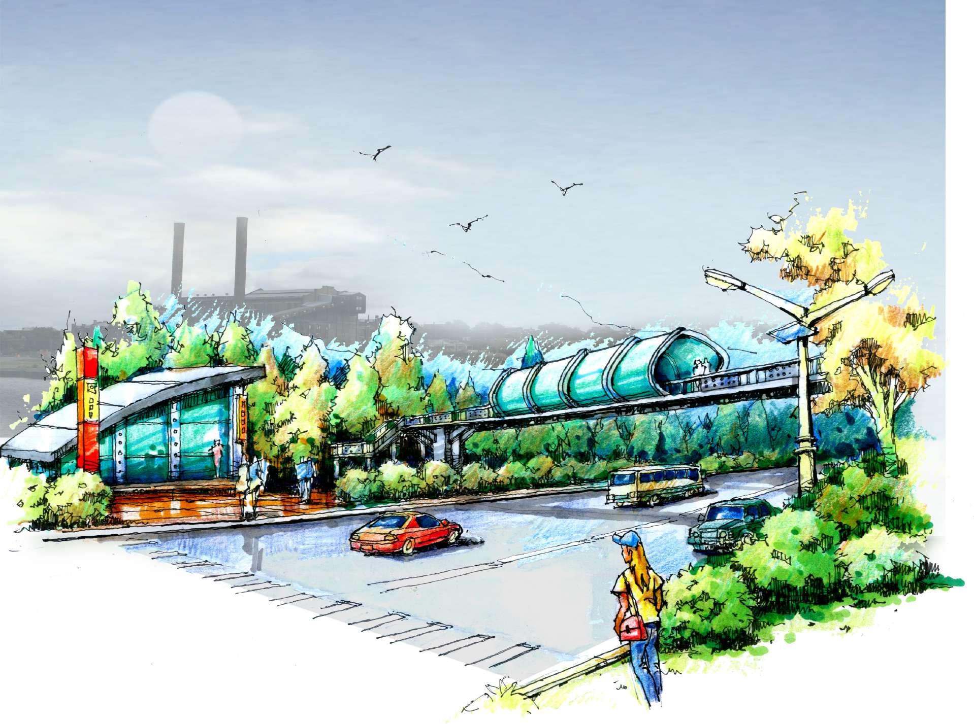
Urban Connectivity and Site Renewal Connection and entrance
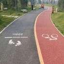
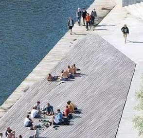
These images show the many types of road connections in the areas where people move around the project, ensuring that people can reach every space in the project through a well-developed system of connections.
Motor vehicle access road to the island Bicycle
Stage 1: Urban Connectivity and Site Renewal
North entrance
The entrance on the north side of the project is a key entrance. Not only does it allow for greater urban connectivity via the subway to bring more visitors to the area, but it also provides motorized access to the project for residents to the north.
1 The crossing bridge provides a safe environment for pedestrians
2 4-lane driving road and crosswalk design ensures easy access
3 Rich lighting provides a safe environment New metro station to open in 2028
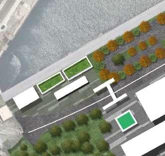
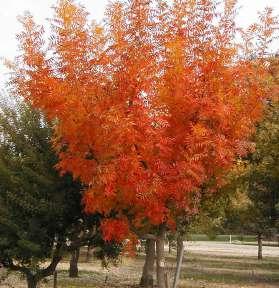
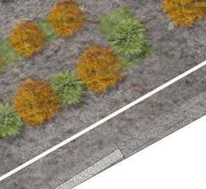
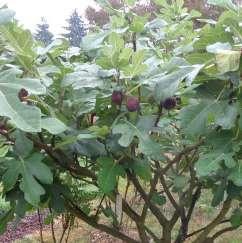
Chinese pistache
- Red and yellow leaves - Withstand harsh conditions and poor quality soil - Native tree species - Exfoliated bark enriches soil fertility
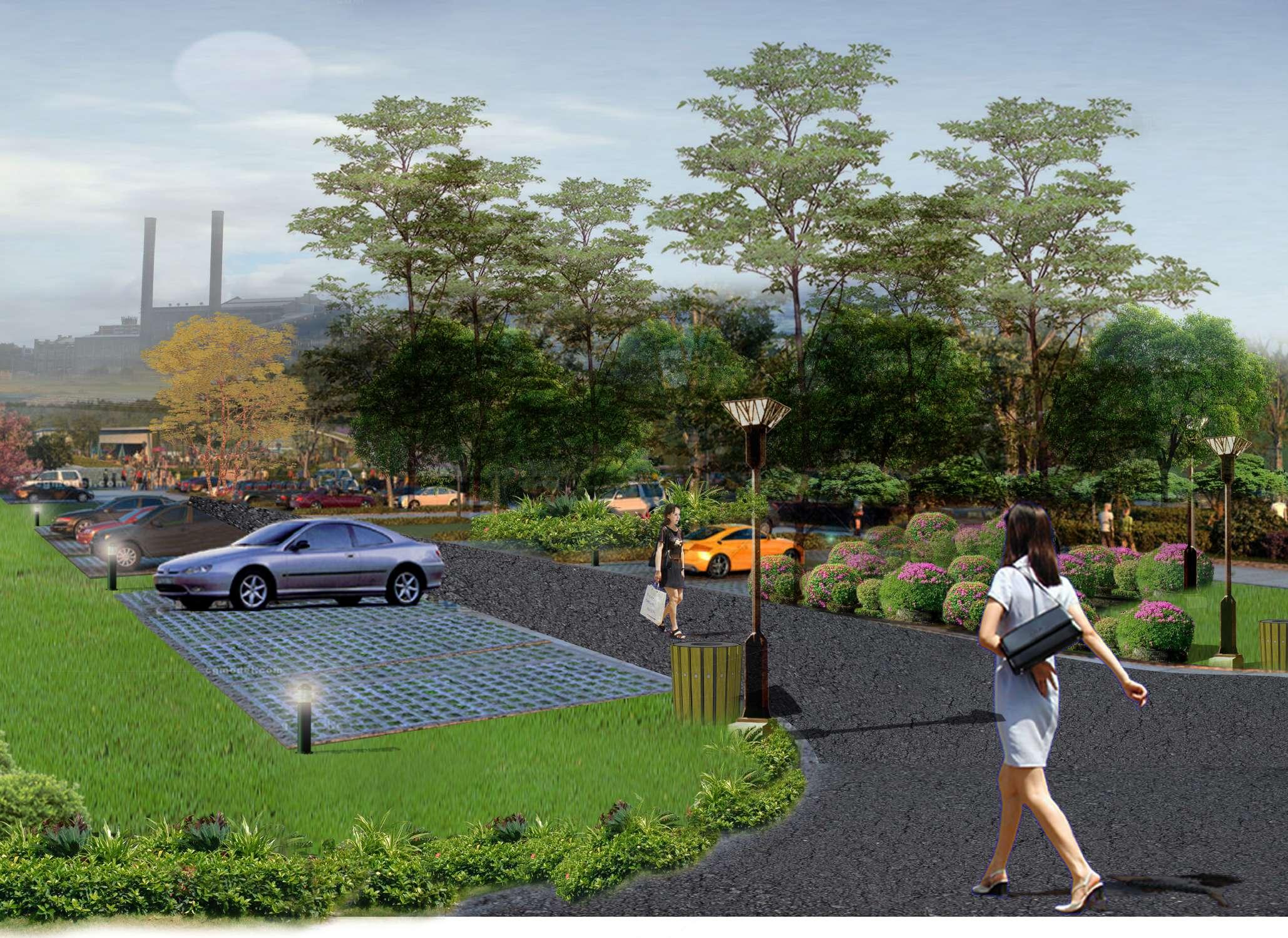
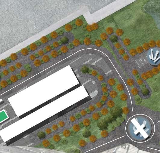
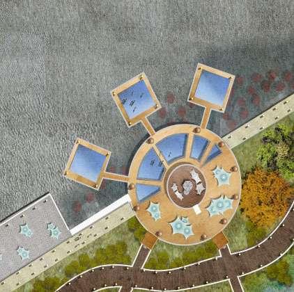
Stage 1: Urban Connectivity and Site Renewal Parking
There are three parking lots of different sizes throughout the project, providing convenience for people to get around and at the same time making adequate preparation for a certain amount of future traffic.
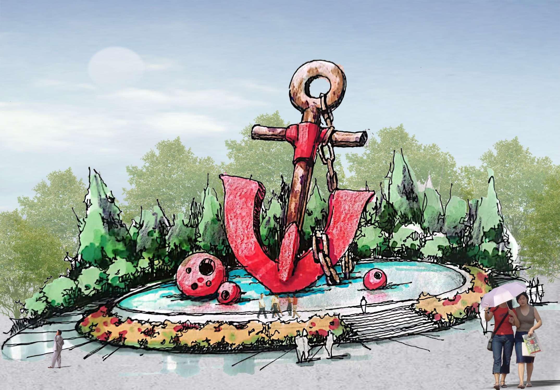
Stage 1: Urban Connectivity and Site Renewal South entrance
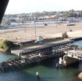
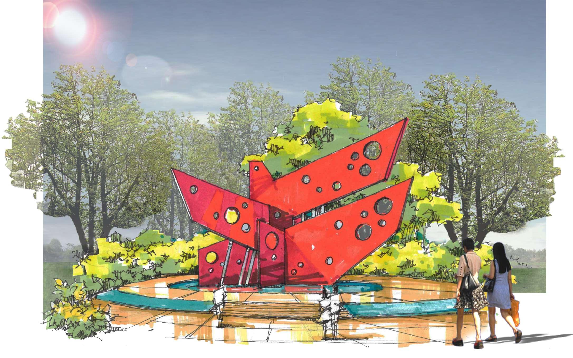
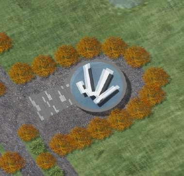
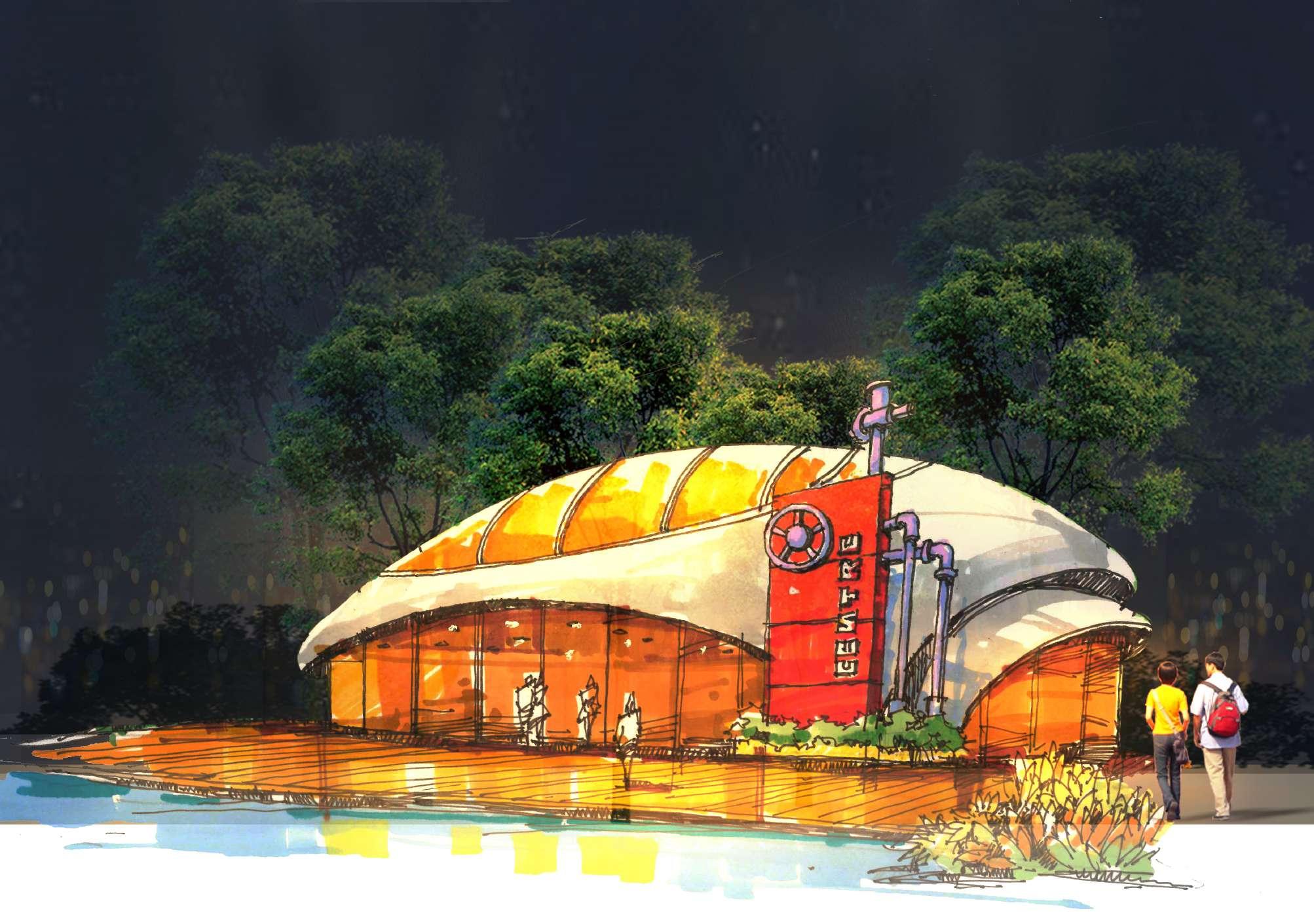
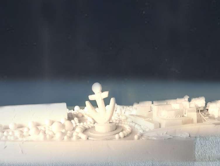
The southern entrance to the project is marked by a rusting anchor sculpture that reflects both the site's former industrial and marina history and the larger sculptural culture of Australia.
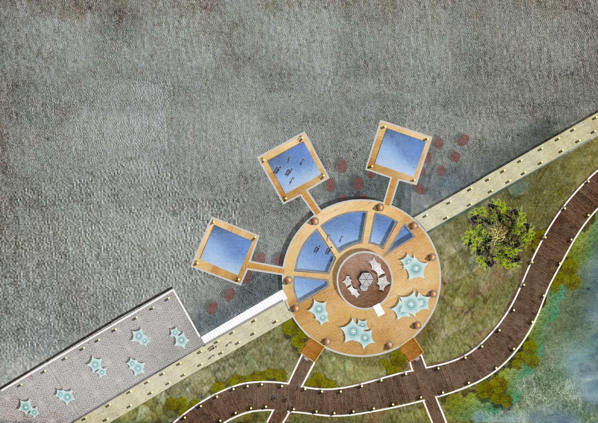
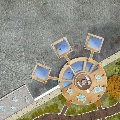
Stage 1: Urban Connectivity and Site Renewal
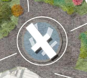
Bird habitat park entrance
The sculptures that combine industrial and bird elements reflect the former industrial history of the site, as well as the idea of a bird habitat. The sculpture also serves as a symbol of the entrance to the habitat park, which marks the inaccessibility of motor vehicles to the site for the safety of humans and birds, as well as ecological stability, and only accepts pedestrians and bicycles.
1 Combined bird and industrial style sculpture
Stage 1: Urban Connectivity and Site Renewal
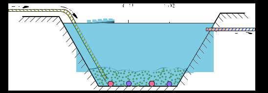
Creating a bionic wetland landscape
High-pressure pumps ensure that water covers the entire wetland system
Proposed intertidal landscape of oyster habitat intertidal area
These images reflect the topography within the habitat and the process of wetland water production.
Proposed bionic wetland
Booster pumps transfer water to the island
Proposed intertidal landscape of mangrove mudflats
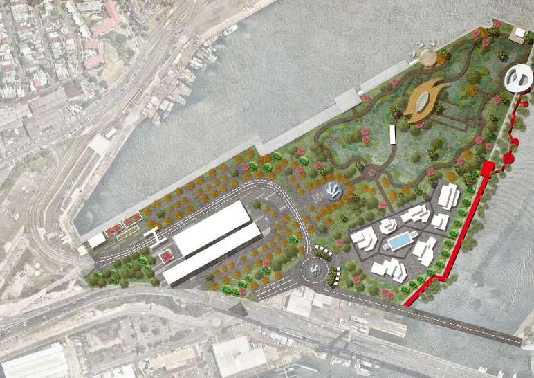
6.2 Detailed Design (Stage 2)
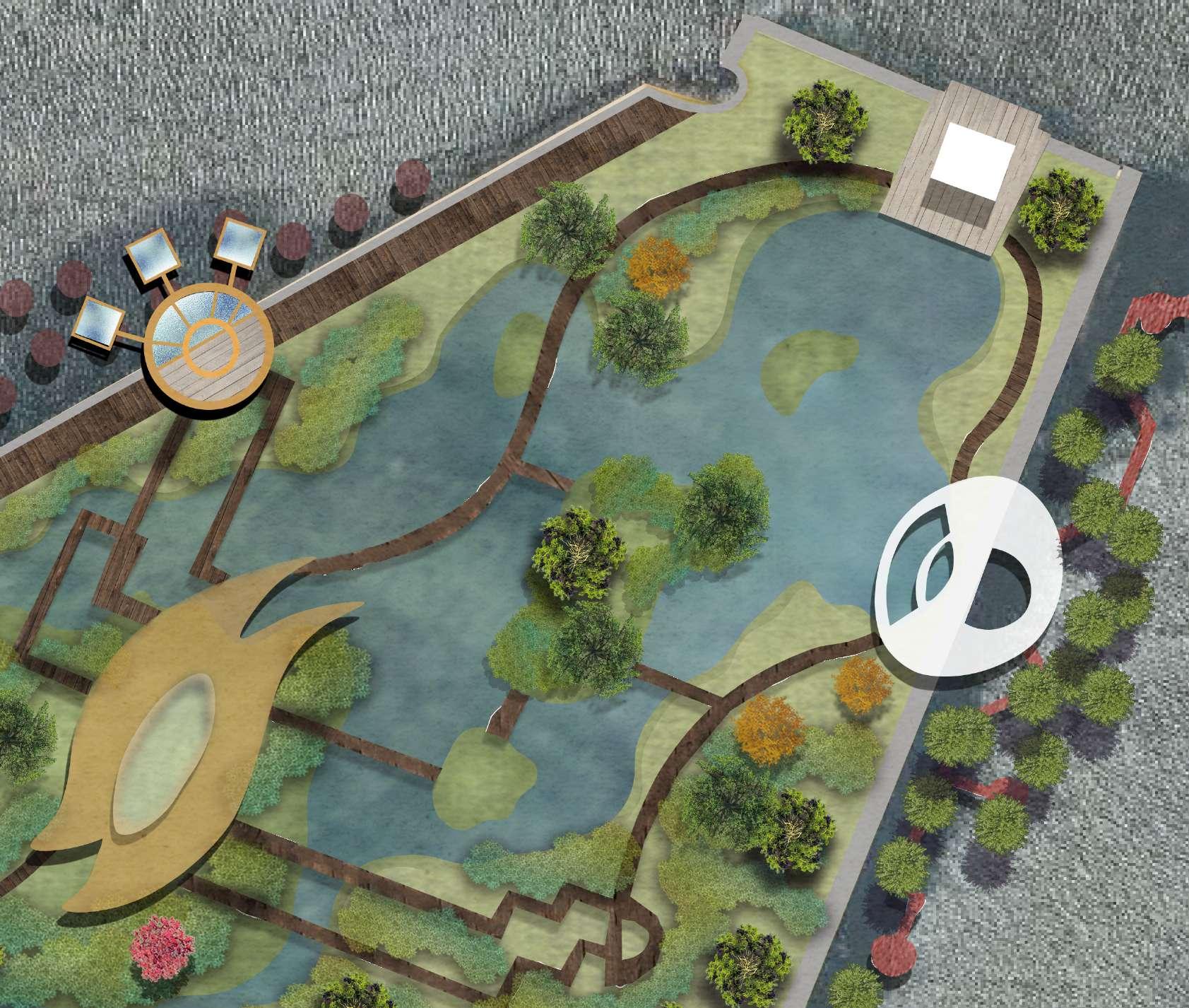
Stage 2: Habitat Establishment and Edge Renewal
Stage 2 (2025-2051) Habitat Establishment and Edge
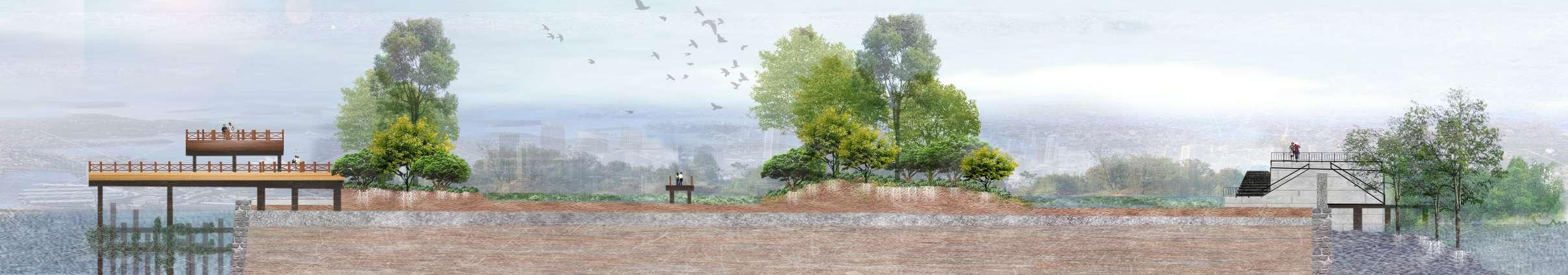
The establishment of the viewing platform Establishment of water treatment units Growth of dominant tree species Establishment of habitat service facilities
The creation of habitat pathways
At this stage, the habitat is fully established, with ample space for birds and a range of facilities for people to use. At the same time, the original edges of the site have been altered to address sea level rise and achieve intertidal ecological stability.
Stage 2: Habitat Establishment and Edge Renewal
Connection in the wetland habitat
Shared bike and walking trails in the habitat
Pedestrian-only trails in the habitat
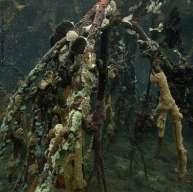
Reconstructed oyster habitat intertidal zone (north edge)
Reconstructed intertidal zone of mangrove mudflats (south edge)
These images show the road system in the park as well as views of the intertidal area.
Stage 2: Habitat Establishment and Edge Renewal
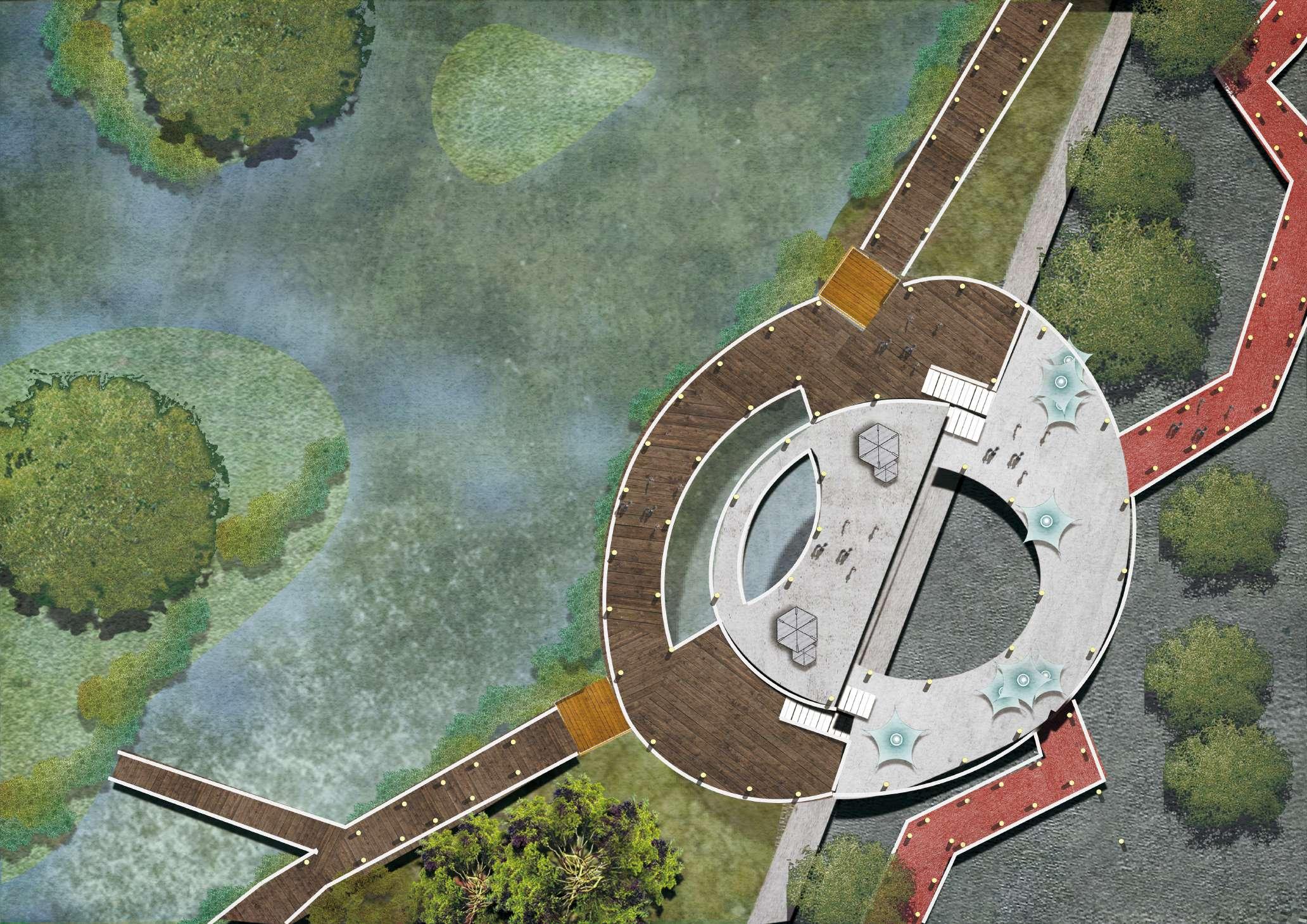
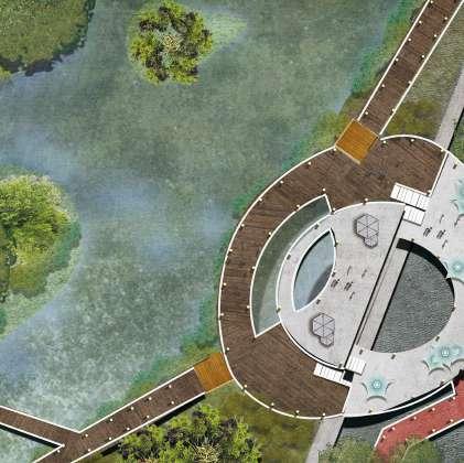
Golden whistle wetland habitat and intertidal zone establishment 1
Oyster habitat intertidal zone (north edge)
2
Intertidal zone of mangrove mudflats (south edge)
3 Bionic wetland (golden whistler habitat)
Stage 2: Habitat Establishment and Edge Renewal
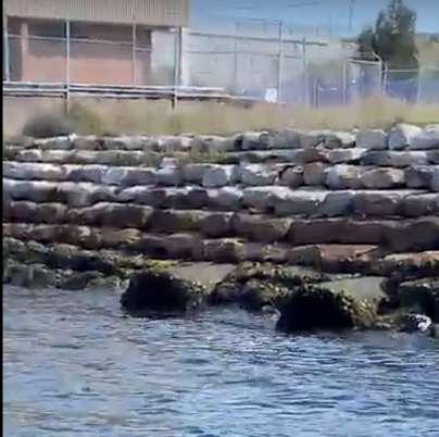
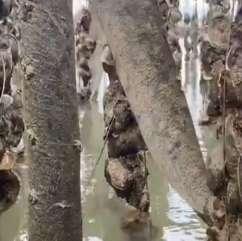
Oyster habitat intertidal zone (edge renewal)
The intertidal zone on the north side of the park is equipped with viewing and waterfront platforms of different heights for people to use, while different forms of oyster piles are established in the intertidal zone for the survival and development of oysters to achieve ecological restoration and stability of the intertidal zone.
People can observe the intertidal zone of oysters through the glass plane
Creation of oyster piles
- Providing a living environment for oysters
- Providing support for the edge
A small number of native dominant species grow at this stage
Stage 2: Habitat Establishment and Edge Renewal
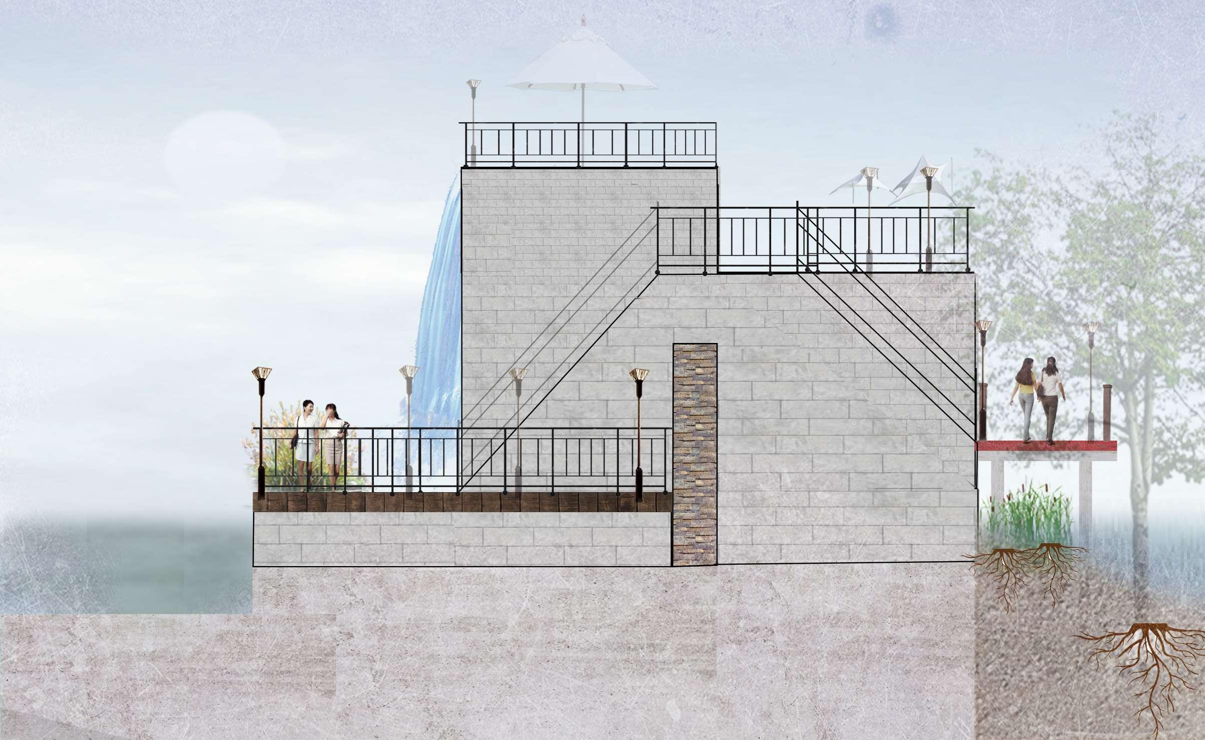
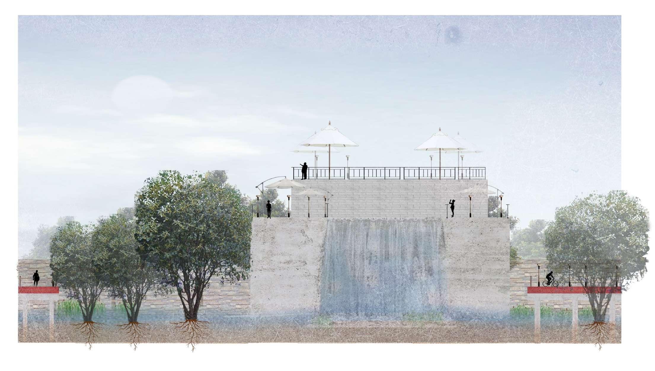
Mangrove mudflat intertidal zone (edge renewal)
The intertidal zone on the south side of the park is equipped with a water treatment plant room and a viewing platform, where mangroves are developed in the form of mudflats deposited by water to restore and stabilize the intertidal ecology.
Ground intertidal platform Second intertidal platform Third intertidal platform Waterfalls Mangrove coastal path Wetland trails
Stage 2: Habitat Establishment and Edge Renewal
Mangrove mudflat intertidal zone (edge renewal)
As the mudflats are initially formed at this stage, a small amount of mangroves appear
Stage 2: Habitat Establishment and Edge Renewal
Bionic wetland (golden whistler habitat)
The park's habitat is created with a 3m drop in terrain and resting areas for pedestrian use, while facilitating the planting of vegetation of different heights and levels to restore and stabilize the habitat ecology.
Bionic Wetland Wetland trails Wetland trails (pedestrian only) Rest area Bush lanes
- Provides shade and a suitable microclimate for people
- Some dominant native vegetation emerges
- A small amount of vegetation reduce surface soil toxicity
- Creation of wetland transition zones
- Ensure the safety of people
- Cope with the height of the wetland water surface in different seasons
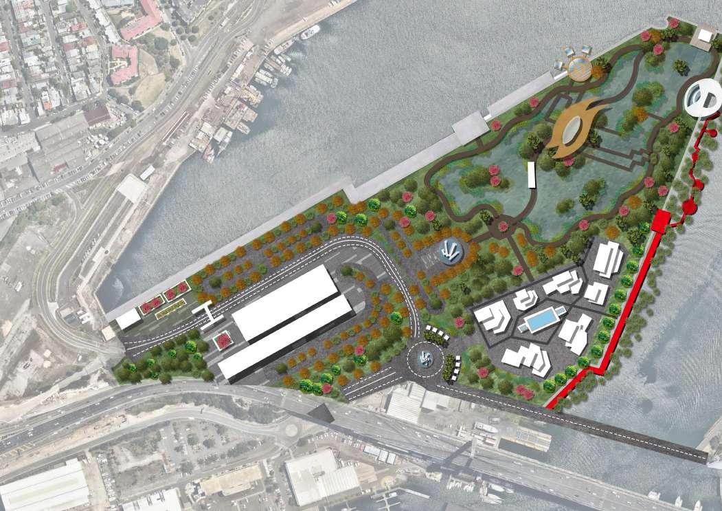
6.3 Detailed Design (Stage 3)
Stage
3: Community Establishment and Restoration Ecology
Stage 3 (2051-2071)
Community establishment and restoration ecology
Creating a green living area
Oyster habitat purifies seawater pollution
Mangroves reduce the toxicity of intertidal mudflats
Phytoremediation for soil purification
Redevelopment of the original factory into a new entertainment area
At this stage the human activity area has been established and the ecology within the habitat park is gradually stabilized with the joint restoration of a variety of vegetation and intertidal ecological endophytes.
Stage 3: Community Establishment and Restoration Ecology
Buildings in the community and restoration ecology
Building shading and ventilation
Bionic wetland (phytoremediation)
Intertidal zone of mangrove mudflats (clean intertidal soil and water)
Oyster habitat intertidal zone (clean ocean)
Stage 3: Community Establishment and Restoration Ecology
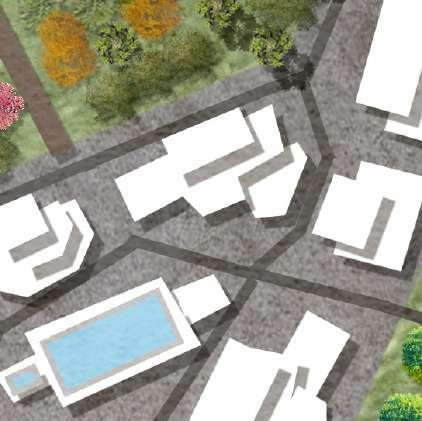
Green residential area
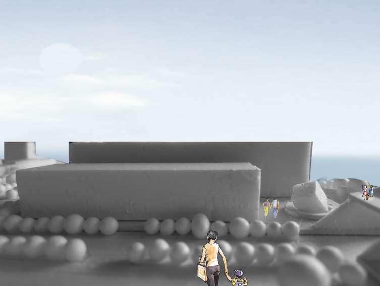
The neighborhood has abundant greenery and buildings of different heights and orientations to ensure that residents can enjoy safe, healthy living with views of the park and ocean from every angle. A series of amenities are provided at the entrance of the neighborhood for residents to use.
1
Convenient facilities
Residential buildings of different heights and orientations
Greenways in residential areas
Stage 3: Community Establishment and Restoration Ecology
Social activities area
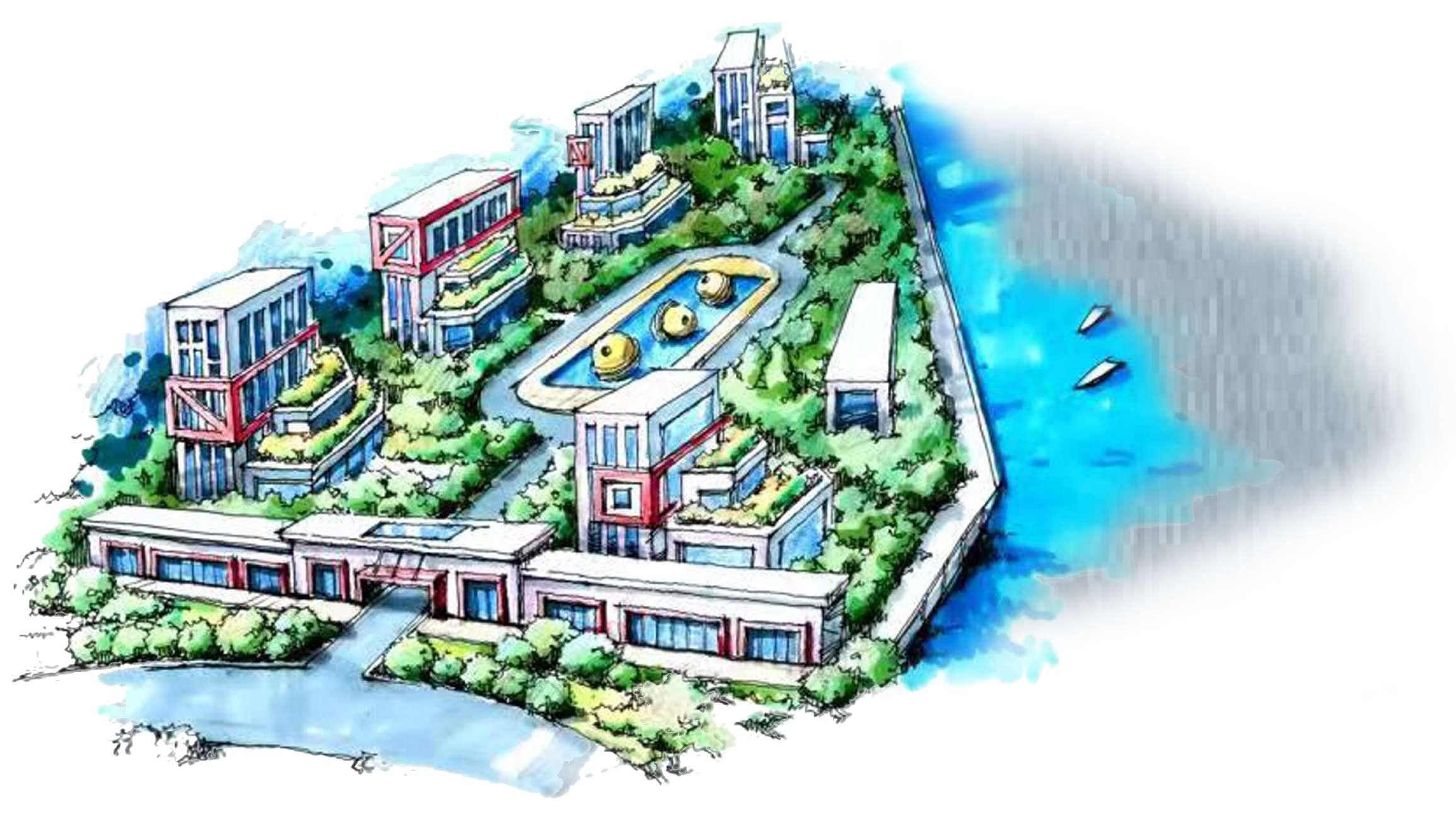
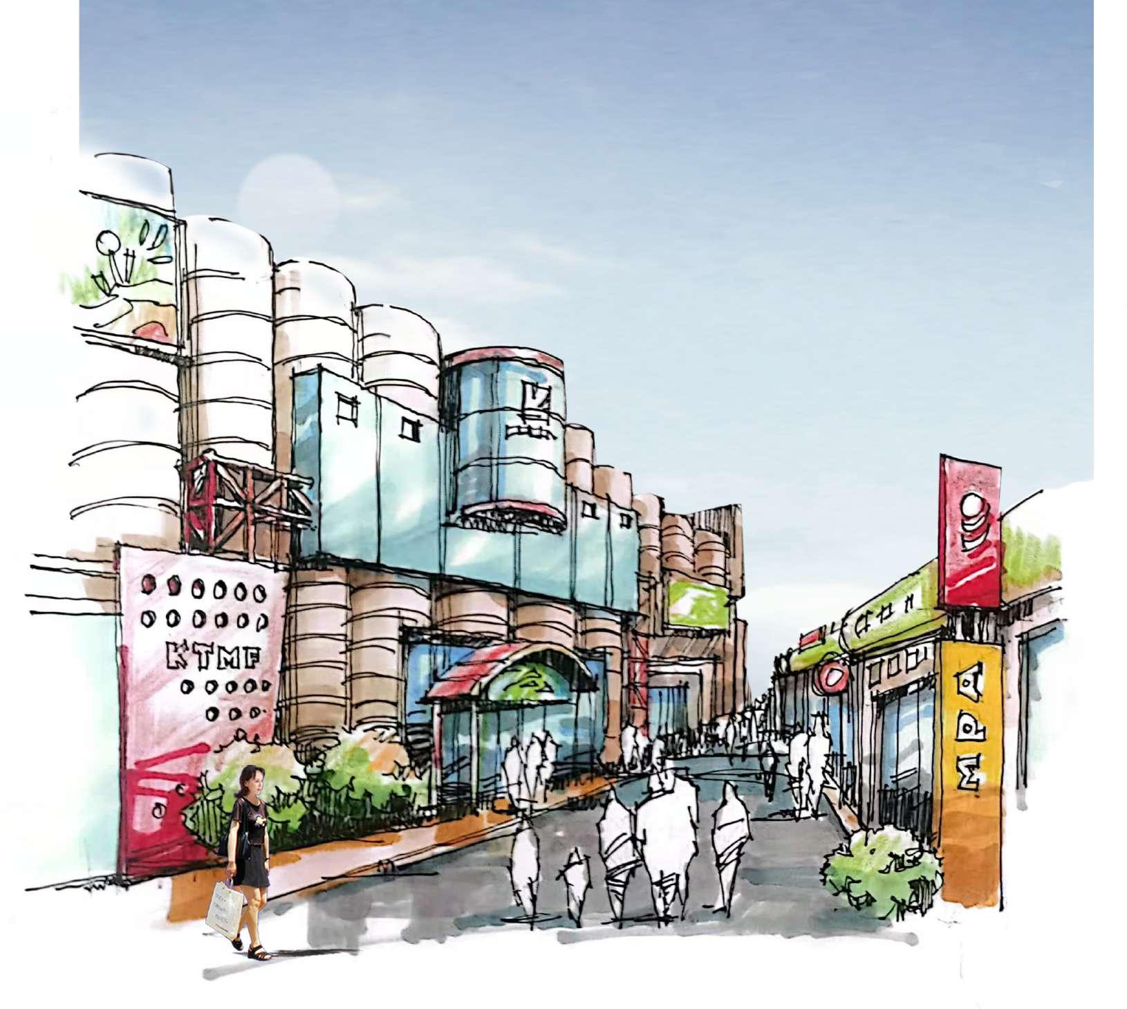
The abandoned factory was converted and developed into a new commercial center while retaining its original style, thus boosting the island's economy and attracting more people as well as facilitating the lives and entertainment of the surrounding residents.
1 2 Celebrated history and culture
Become a new social and entertainment area for the surrounding community and residents
Stage 3: Community Establishment and Restoration Ecology
Ecological restoration and phytoremediation
1 Oyster habitat intertidal zone (clean ocean)
2 Intertidal zone of mangrove mudflats (clean intertidal soil and water)
3 Bionic wetland (phytoremediation)
- Plant accumulation - Plant volatilization
- Plant Degradation
- Plant stabilization
- Inter-root degradation
Stage 3: Community Establishment and Restoration Ecology
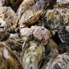
Oyster habitat intertidal ecology
1
The establishment of the oyster habitat has helped purify the seawater in the intertidal zone, leading to ecological restoration.
Stage 3: Community Establishment and Restoration Ecology
Oyster habitat intertidal ecology
Posidonia Oceanica
- Providing a food source for oysters
- Capture of anthropogenic waste such as plastic near the intertidal zone
- Reservoir of Co2 and sediment to provide a for oysters
+ High Tide
+ Low Tide
Each one needs 10cm2 of growing space
More people enter the site
Vegetation suitable for the golden whistle begins to appear
Each one purifies 50L of seawater
- Bacteria in seawater
- Heavy metal elements
- Sediment
- Impure substances such as seaweed
Creation of oyster piles suitable for oyster survival
Stage 3: Community Establishment and Restoration Ecology
Mangrove mudflat intertidal ecology
he establishment of mangrove mudflats helps to restore the ecology of the intertidal zone by helping to purify the water in the intertidal zone and by achieving a diversity of intertidal organisms.
Stage 3: Community Establishment and Restoration Ecology
Mangrove mudflat intertidal ecology
- Filtering of nitrates and phosphates
- Leaf litter provides nutrients for invertebrates and algae
- Traps beach sediments to stabilize intertidal areas
Mangroves
- Suppressing sea level rise
- Shoreline stabilization
- Provide living space for marine life
- Roots purify seawater
Wetland water
Soil + Organics Clean water
Nutrient water and mud flowing into the sea (waterfall)
Flow back to the wetland (waterfall)
+ Low Tide
+ High Tide
Stage 3: Community Establishment and Restoration Ecology
Bionic wetland ecology (phytoremediation)
Phytoremedi -ation shrubs
Multiple levels and types of vegetation are present in the park, and the ecological stability is achieved through the principle of phytoremediation to purify the soil in the site, adjust the pH level and improve the soil fertility.
Phytoremedi -ation grass Golden Whistle Plants Landscape vegetation
Stage 3: Community Establishment and Restoration Ecology
Bionic wetland ecology (phytoremediation)
Plant uptake and assimilation of pollutants
- Falling flowers provide fertility to the soil
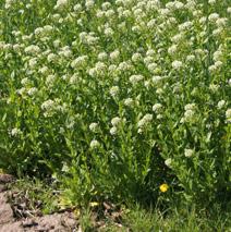
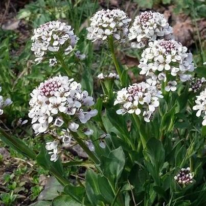
Thlaspi arvense (shrub)
Thlaspi caerulescens (shrub)
- Flowering has a certain appreciation value 1 1 2 2 3
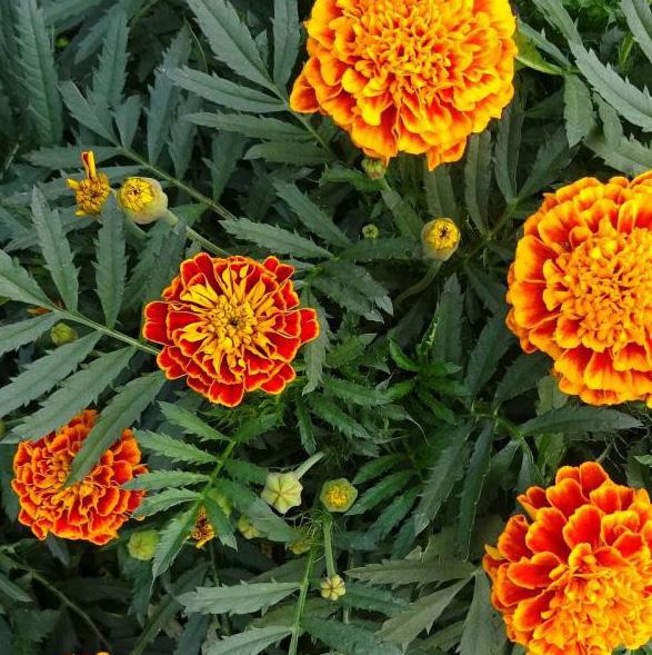
Tagetes (shrub)
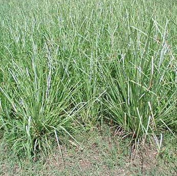
Chrysopogon zizanioides (grass)
- Degradation of heavy metal substances in soil
- Balance soil acidity and alkalinity
- Increase soil fertility
Plants use enzymes to degrade contaminants within plant tissues.
Plants can volatilize pollutants into the atmosphere
Biodegradation of environmental pollutants is achieved by plant secretions released by the roots of plants.
Plants absorb and precipitate large amounts of toxic metals from the soil and prevent them from entering the groundwater and food chain.
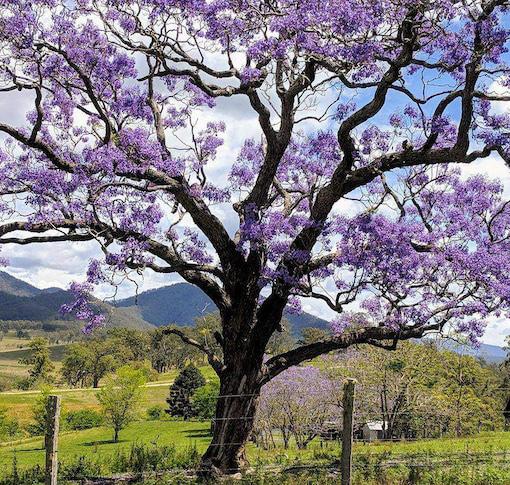
Jacaranda mimosifolia
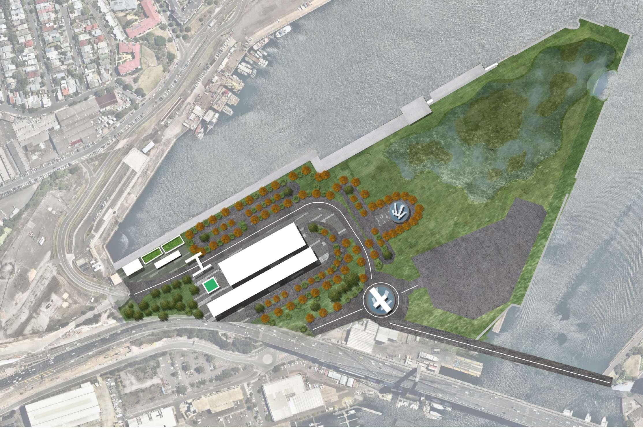
6.4 Detailed Design (Stage 4)
Stage 4: Realizing a stable ecology of human-bird symbiosis
At this stage the entire project achieves ecological stability for human-bird symbiosis, while ensuring people's activities at night and the safety of the space. The formation of a stable bird habitat and ecology within the habitat reflects the concept of sustainable development and a positive response to future climate issues.
Stage 4: Realizing a stable ecology of human-bird symbiosis
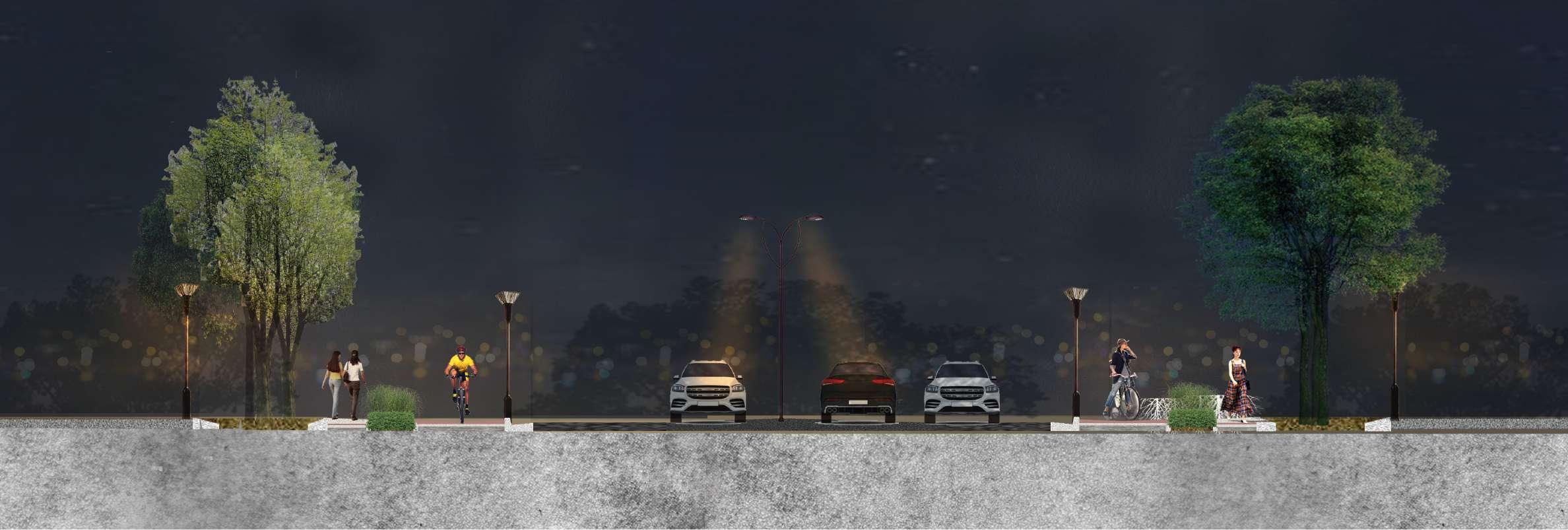
People safety and lighting (main roads)
Soil decontamination
- Root-protecting mulch material
- Reduce soil toxicity
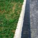
The rubber and highly permeable paving
- Ensures the safety of pedestrians and cyclists
- water collection function.
Multi-functional kerbs
- Functions of separating road structures and collecting rainwater
Stage 4: Realizing a stable ecology of human-bird symbiosis
People safety and lighting (wetland pathways)
Habitat green space Habitat hardening
Habitat marsh wetland
Habitat hardening
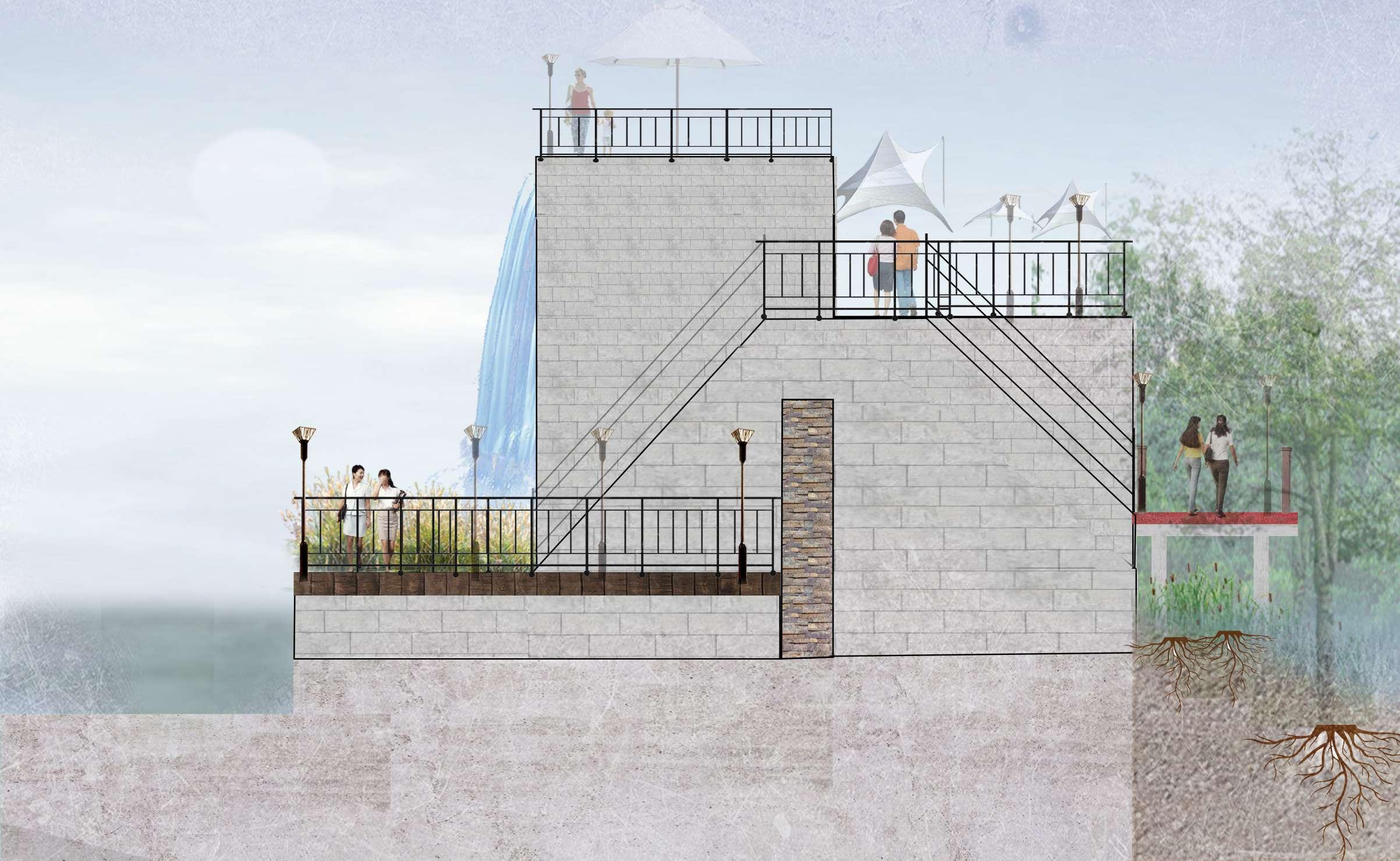
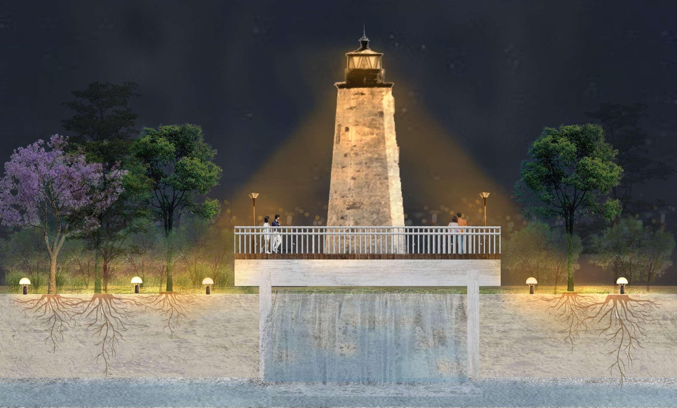
Stage 4: Realizing a stable ecology of human-bird symbiosis
People safety and lighting (lighthouse)
Convenient facilities such as public toilets
Viewing platform
Stage 4: Realizing a stable ecology of human-bird symbiosis
People safety and lighting (bird exhibition gallery)
The convention center (marina industrial style) in the Bird Habitat Park has both a series of convenient facilities and a bird exhibit that is integrated with the entire habitat park to help people, especially children, learn about birds on both a practical and theoretical basis, while also embodying the concept of education for sustainable development.
Educate visitors (children) about birds
- Combine practice and knowledge with the habitat park landscape
The industrial style dock-like buildings reflect the history of Glebe Island
A stable ecosystem of golden whistling habitats
1 Foraging area - Oysters - Marine microo -rganisms
1
2
2
3 Main activity area - Medium sized insects - Small insects
3
Breeding area - Intertidal fish - Shells and conch
Stage 4: Realizing a stable ecology of human-bird symbiosis
A stable ecosystem of golden whistling habitats (foraging area)
-Human interaction with the intertidal zone within the habitat
- Up close and personal with the sea for fun and education
- Food chains illustrates the establishment of a stable intertidal ecology
pathway light (3m H x 1m W)
High Tide
Low Tide
Whistle
Stage 4: Realizing a stable ecology of human-bird symbiosis
A stable ecosystem of golden whistling habitats (bird islands)
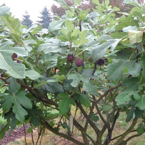
Ficus carica Linn.
- Loosening of the soil
- Provide fruit for birds
- Habitat space
The different sizes of the bird islands (sustainable development goals for climate change and biodiversity)
- Main space for the Golden Whistle
- Abundant greenery and insects providing food
- Creating a stable wetland ecosystem.
Golden Whistle
Medium sized insects Small insects
Stage 4: Realizing a stable ecology of human-bird symbiosis
A stable ecosystem of golden whistling habitats (bird islands)
-Increasing human interaction with the intertidal zone of the beach
- Provide green views of the seafront walkway
The intertidal waterfall discharges soil and fresh water into the intertidal zone, enriching the mudflats and thus providing conditions for mangrove growth
Intertidal fish Shells and conch
Organisms (fish and shells)
- Mangrove mudflats for reproduction and survival Golden Whistle (sustainable development goals for climate change and biodiversity)
- Annual reproduction, resulting in a stable and sustainable intertidal mudflat ecology
Stage 4: Realizing a stable ecology of human-bird
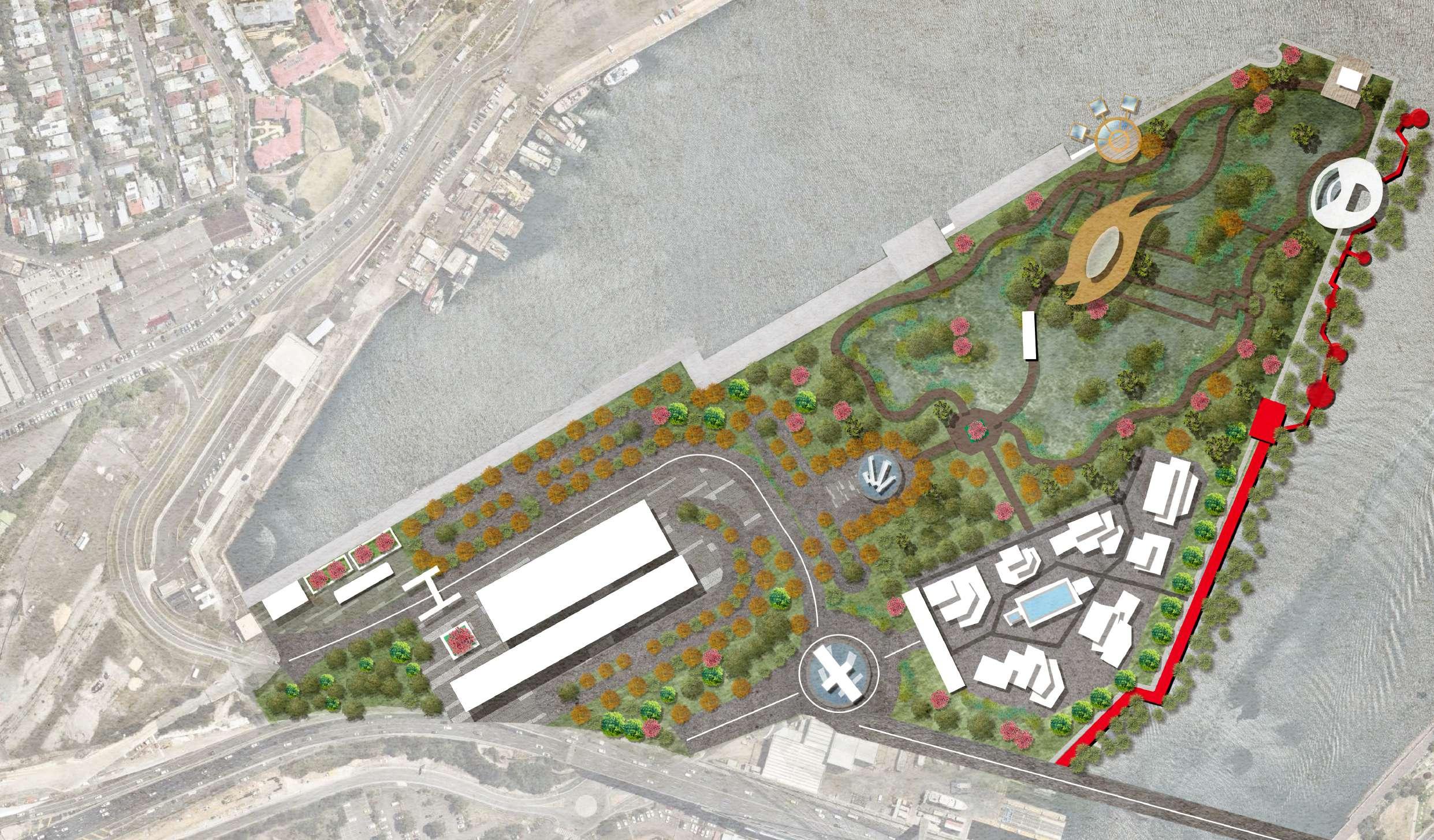
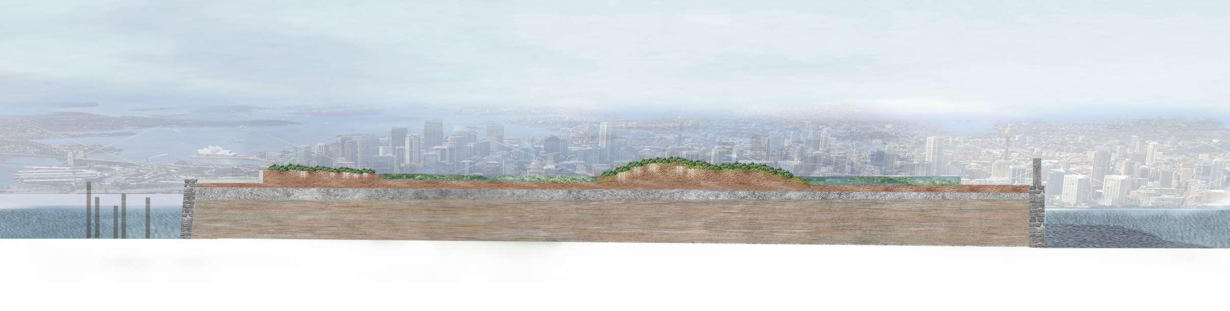
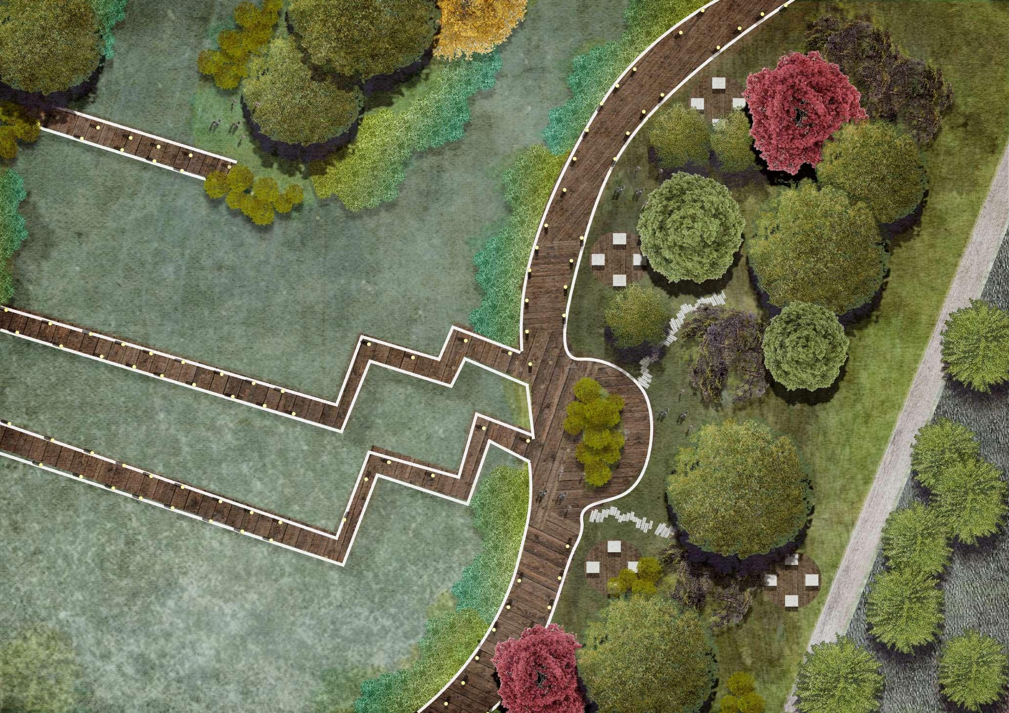
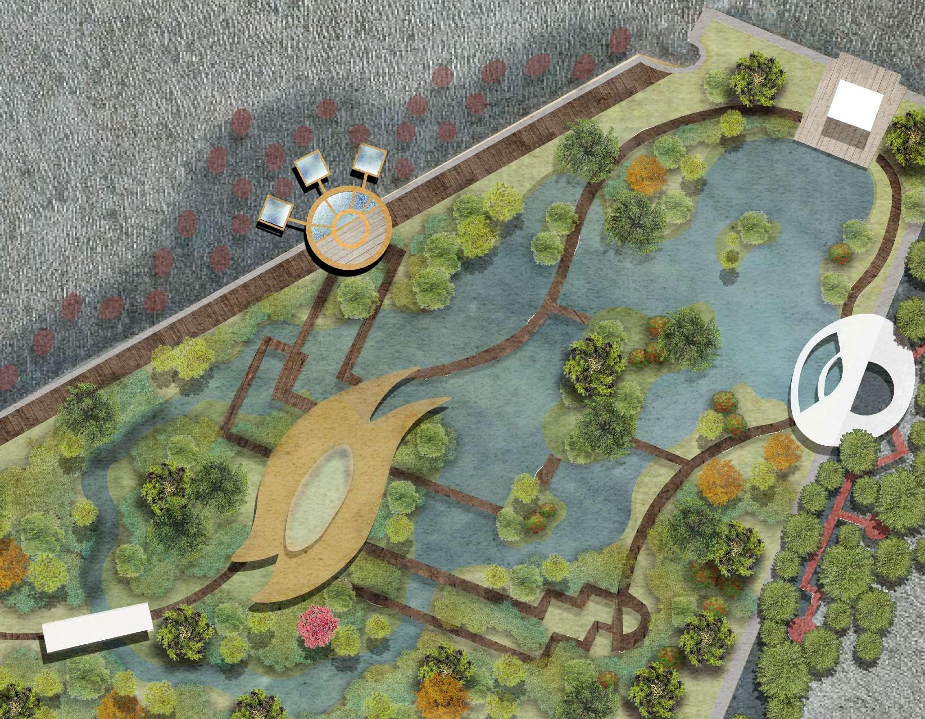
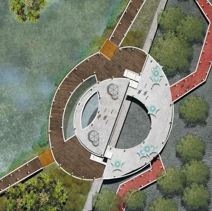
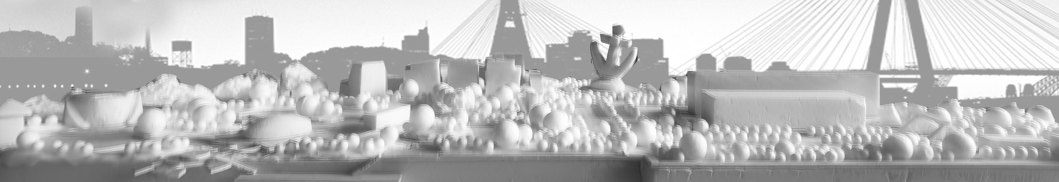
‘Eyes' in the space
Stage
Achieving sustainable urban and community ecology
Parking & commercial area
Main entrance
Entrance motor carousel
Wetland park entrance
Habitat centre
Wetland & intertidal areas
Reference list
Peter V. 2014, Predictable Habitat Associations of Four Crab Species Across the Low Intertidal Landscape of a Tropical Estuary over Time, Vol. 38(20), pp. 285-285. Doi: 1 10.1007/s12237-014-9799-0
Mark D. 1997, THE ROLE OF POSITIVE INTERACTIONS IN COMMUNITIES: LESSONS FROM INTERTIDAL HABITATS, Vol. 30(11), pp. 294-308. Doi: 10.1890/0012-9658
Thompson R. 2002, Rocky intertidal communities: past environmental changes, present status and predictions for the next 25 years, Vol. 29(2), pp. 168191. Doi: 10.1017/S0376892902000115
Jenkins S. 1999, Spatial and temporal variation in settlement and recruitment of the intertidal barnacle Semibalanus balanoides (L.), Vol. 243(2), pp. 209225. Doi: 10.1016/S0022-0981(99)00121-5
Ming Y. (2019). Hundreds of dead seabirds found on several famous beaches in Sydney, Australia, accessed 18 September 2021, < https://www. epochtimes.com/gb/19/11/20/n11668494.htm>.
Intertidal Zone, ' Wikiwand ', in Ocean Review. 2007, viewed on 22 September 2021, https://www.wikiwand.com/zh-sg.
Shearwater Bird, ' A.B.C.', in TOWNSEND'S SHEARWATER Review. 2021, viewed on 22 September 2021, https://abcbirds.org/bird/townsends shearwater/.
Christina H. 2006, The German way to greenways and habitat networks, Landscape and Urban Planning, Vol. 76(4), pp. 7-22. Doi: 10.1016/ 200409041
Dave S. (2016). 36 Hours in Sydney, Australia. Australia. accessed 22 September 2021, < https://ap01a.alma.exlibrisgroup.com/leganto/readinglist/citation/ 36302050200001731?auth=SAML>.
D i n g d i n g, H . (2 0 1 9 ) . L e t t h e "urban greenway" continue to extend, China, accessed 21 September 2021, < http://www.xinhuanet.com/ comments/2019-03/27/c_1124287579.htm>.
Harris B., Larson, L., & Ogletree S. 2018, Different Views from the 606: Examining the Impacts of an Urban Greenway on Crime in Chicago, Environment and behavior, Vol. 50(1), pp. 56-85. Doi: 10.1177/0013916517690197
Sustrans (2019). People, U.K. a c c e s s e d 1 8 A p r i l 2 0 2 1, < https://www.sustrans.org.uk/for professionals/infrastructure/sustrans traffic-free-routesand-greenways design-guide/sustrans-traffic-free routes-and-greenways-design-guide contents/2019-design-guidance/part 1-general-principles/3-people/>
Ebirds (n.d.). Gloden Whistler, Australia, accessed 21 September 2021, < https://ebird.org/species/golwhi1>. Australia museum (2021). Gloden Whistler, Australia, accessed 23 September 2021, < https://australian.museum/learn/animals/birds/golden-whistler/>.