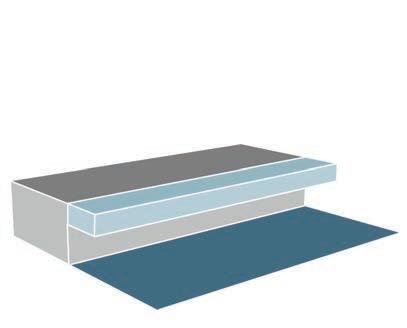
PROCESS LOG
PROCESS LOG
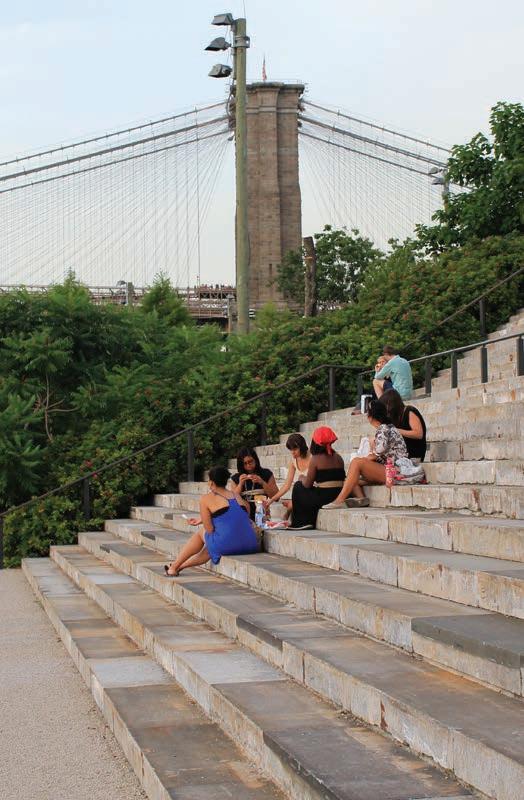
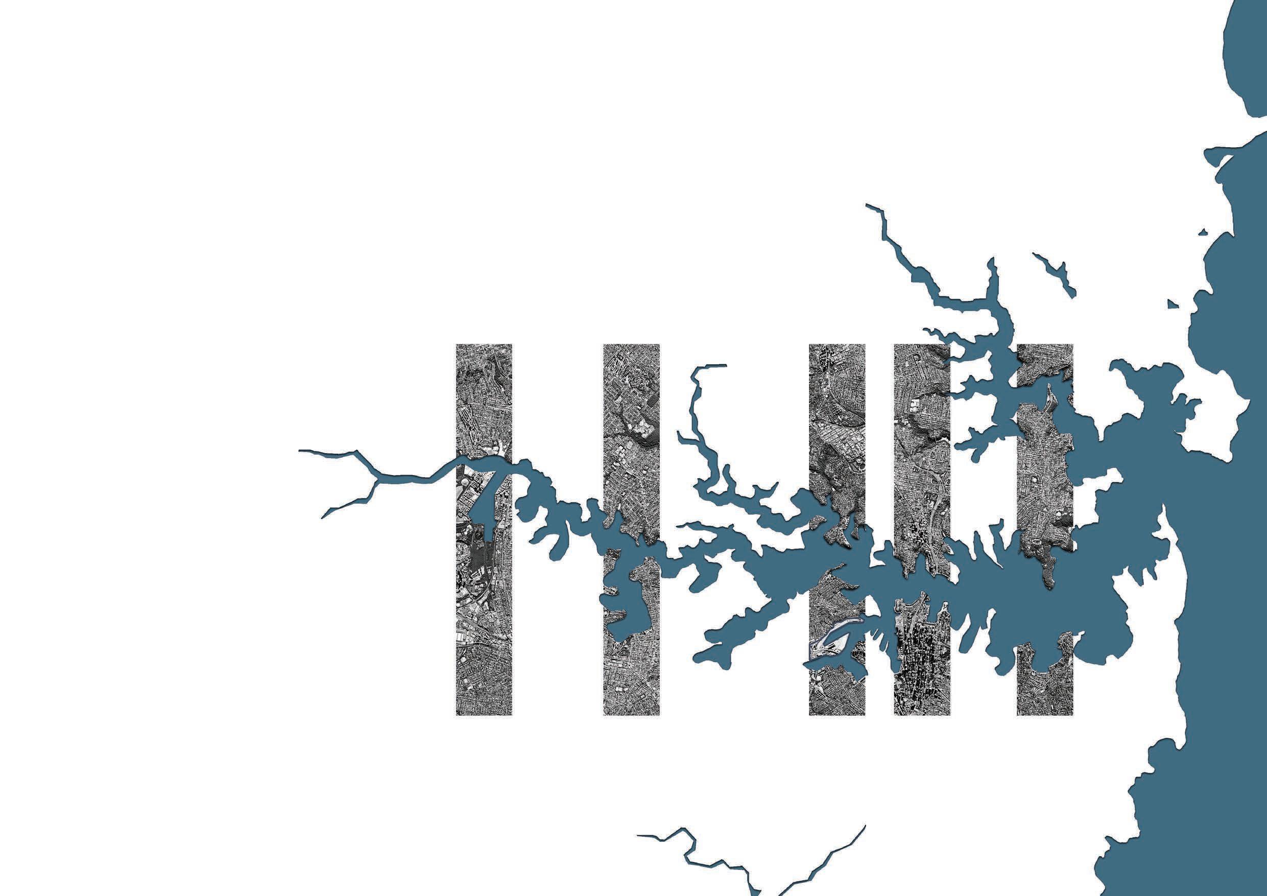
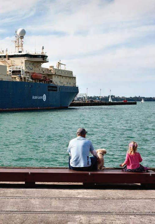
The time is now to sea change at ‘The Bays’.
INFLUX acknowledges the Traditional Owners and Custodians of the land that this project is situated on. This includes the D’harawal, Dharug, Eora, Gaimaragal, Gundangara and Guringai peoples, among others.
INFLUX pays its respect to Elders past and present and thanks them for sharing their knowledge and enduring connection to this landscape – the same landscape that is a central focus to our profession.
INFLUX would also like to acknowledge that Aboriginal Sovereignty has never been ceded, and that this land always was and always will be, Aboriginal land.
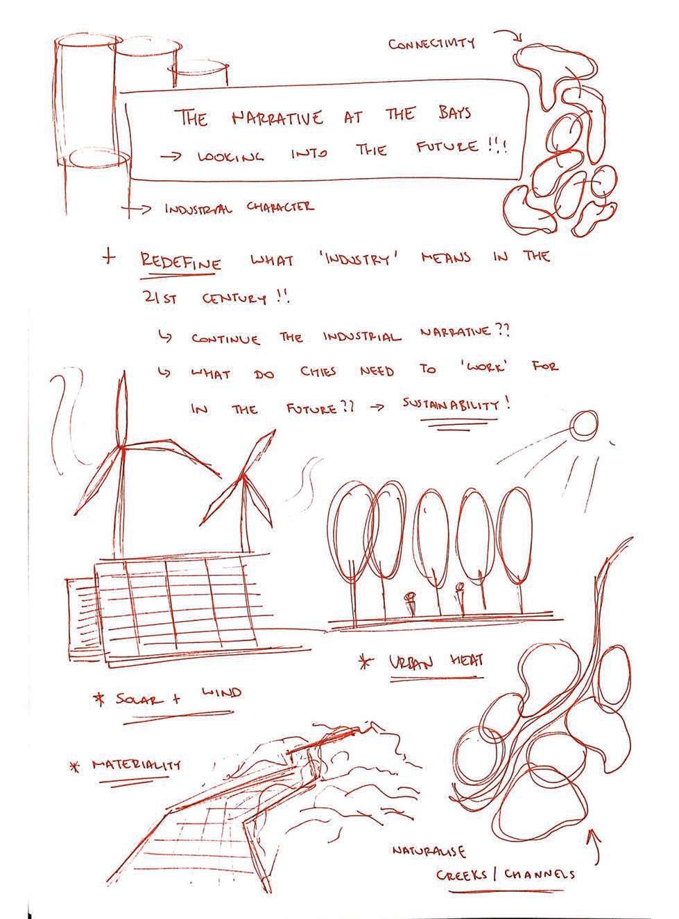
1.0 INTRODUCTION
2.0 PROJECT SCOPE
3.0 CASE STUDIES
4.0 SITE INTRODUCTION
5.0 DESIGN PROCESS
6.0 DETAILED DESIGN
7.0 CONCLUSION
8.0 REFERENCES
Chapter 1.0 provides a brief overview of INFLUX and the ‘Process Log’ at hand.
Climate Change is the defining issue of our time.
“the biggest threat to security that modern humans have ever faced”.
- David Attenborough, 2021.
Of its many impacts, Sea Level Rise is imminent. Global sea levels are rising at an unprecedented rate. This will have a devastating impact on cities and how they typically function, as it will threaten “to impact millions of people, destroy infrastructure, and damage the ecosystems in coastal communities” (Tang & Lukenda 2019).
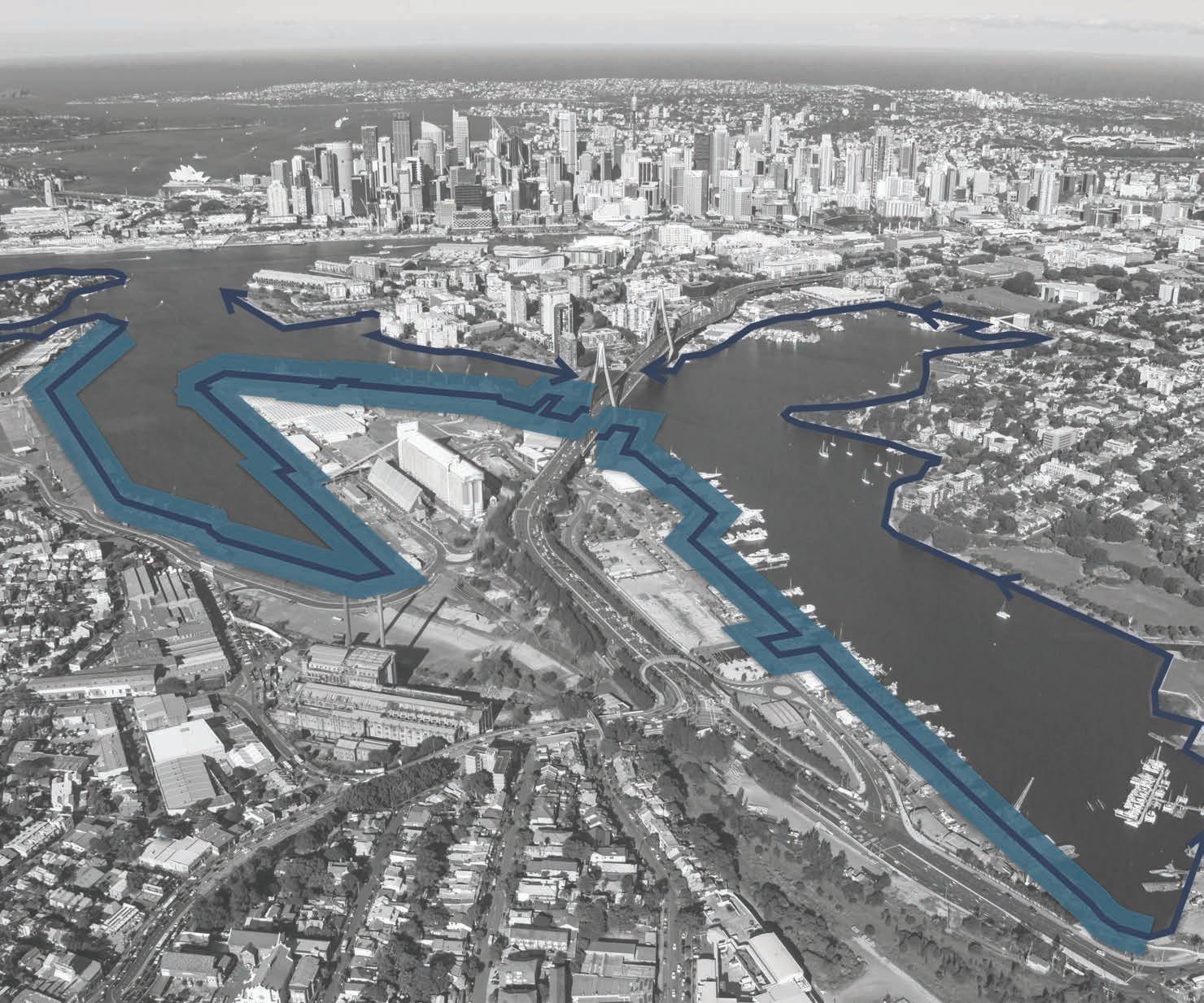
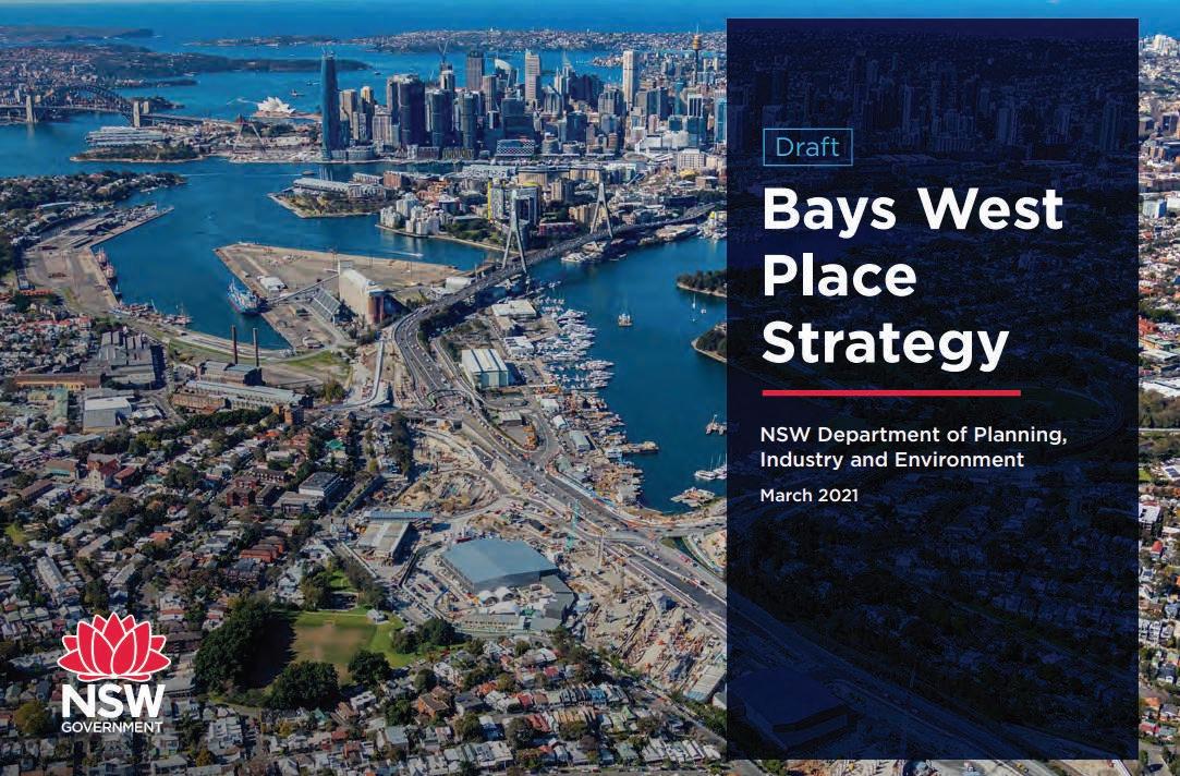
In the case of ‘The Bays West Precinct’ in Sydney Harbour, the impact of Sea Level Rise is profound. At this site, extensive land reclamation serves as an anthropogenic barrier to Sea Level Rise - only exacerbating its impacts. Therefore, there is a great need for bold new solutions and ways for our Harbour to adapt.
INFLUX aims to embed a new public realm that responds to Sea Level Rise at ‘The Bays’. It seeks to confront the schism between land and water by addressing the question;
How can a waterfront greenway embrace the conditions that Sea Level Rise will bring to ‘The Bays’ to, in turn, create thriving working waterfronts, resilient public spaces and foster emerging ecologies?
This process log will detail the extensive journey and process that had been undertaken for INFLUX to achieve this.
Chapter 2.0 aims to ‘set the scene’ and outline the intent and purpose for INFLUX at ‘The Bays’.
Australia’s coast is vast, diverse and unique.
The identity of most Australians is shaped by the relationship that we have with our coastal environment. To such an extent that more than 80 per cent of Australians live within 50 kilometres of the coast (Cechet et al. 2011). It is also estimated that approximately 6 per cent of Australian addresses are within three kilometres of the coast (Cechet et al. 2011).
Therefore, the coast has become one of Australia’s greatest assets - the location of most of Australia’s major cities, as well as being centres of trade, industry, arts, social activities, ecologies and cultural identity.
Sydney Harbour is universally acknowledged as a place of extraordinary natural beauty.
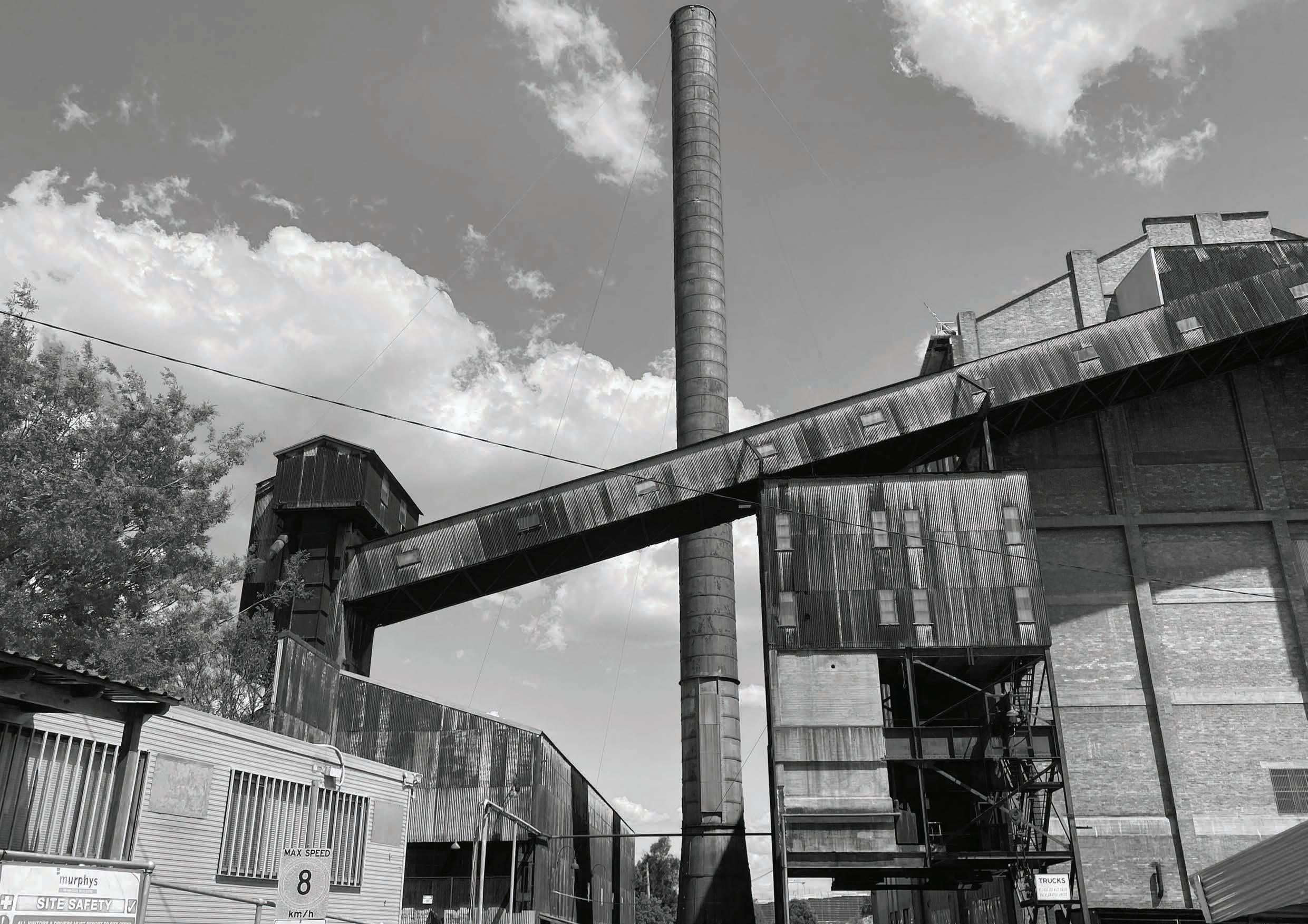
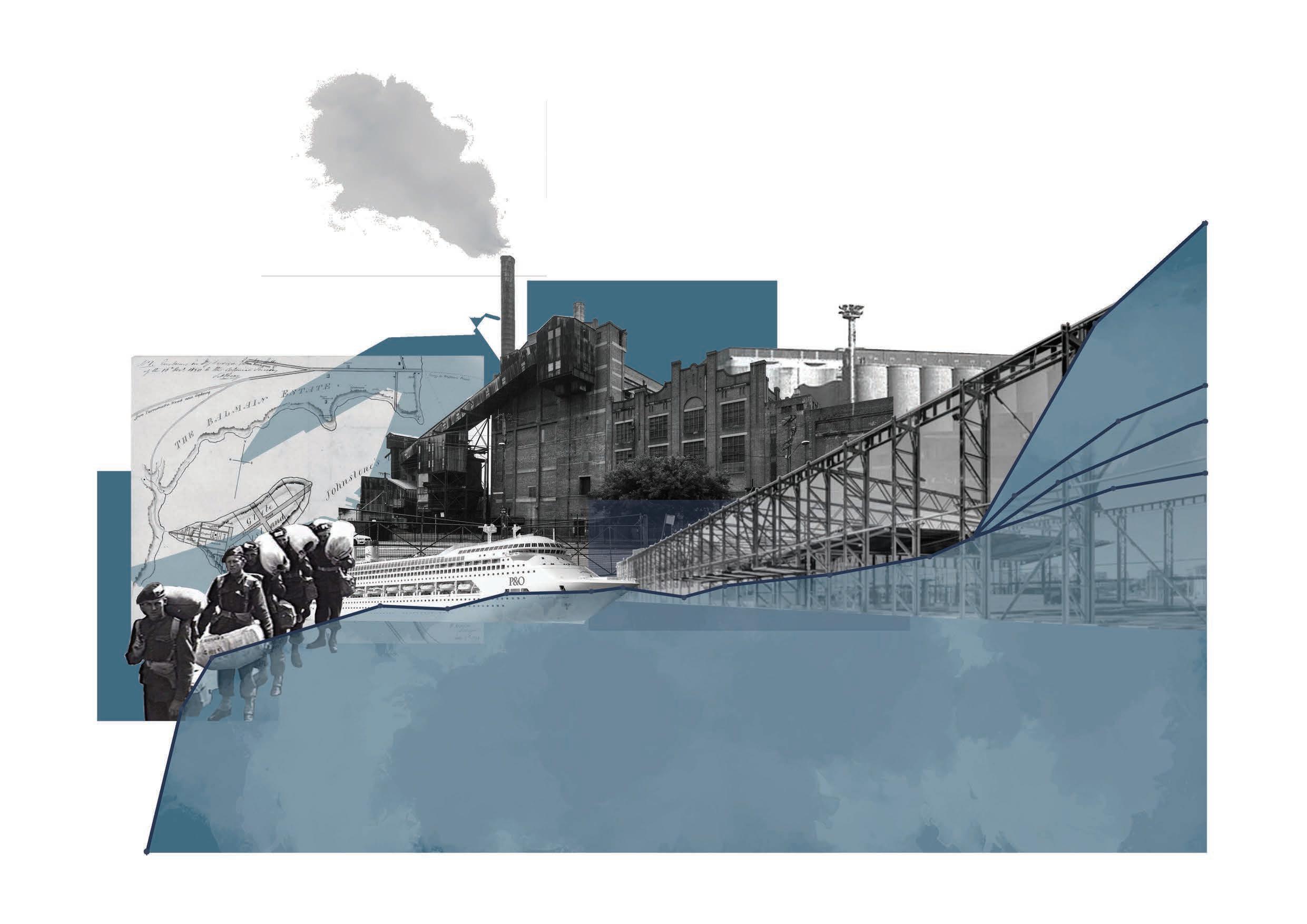
Historically, Sydney was the setting for a globally competitive city, located on the harbour “for ease of trade, access, transportation, and connectivity” (Martin 2016). ‘The Bays’ is a prime example of this. Since European Settlement, ‘The Bays’ has been subject to rapid industrialisation. Throughout the 19th and 20th Centuries, ‘The Bays’ acted as Sydney’s centre for heavy industry, with this continuing to a lesser extent today (NSW Department of Planning, Industry and Environment 2021).
However, this setting has now become vulnerable to the chronic issue of Sea Level Rise, and its related acute shocks.

/sea· level·rise/ noun
“sea level rise is an increase in the level of the world’s oceans due to the effects of global warming.” (National Geographic n.d.)
Despite the urgency to respond to Sea Level Rise in today’s age, it is a phenomenon that our planet has dealt with before.
Sydney Harbour is a drowned river valley that formed as a result of the interglacial melting that started approximately 21,000 thousand years ago. Throughout this time period, sea levels rose 120 metres - melting two-thirds of all the ice on earth (O’Dea 2021).
Global sea levels are rising at an unprecedented rate as a direct result of climate change. We are currently living in a critical window of time where we can act to lessen the impact of Sea Level Rise. The most recent COP26 (26th United Nations Climate Change Conference of the Parties) is evidence of this, with the conference highlighting the importance of responding to Sea Level Rise with representatives of nations across the world pledging to lessen the impacts of climate change.
However, Sea Level Rise is imminent. Although there is
uncertainty as to what extent sea levels will rise, it must be considered.
Figures vary, but the CSIRO (Commonwealth Scientific and Industrial Research Organisation) estimate in a ‘worst case scenario’ sea levels may rise to a global average of 1 metre by 2100 and up to 5 metres by 2300 (O’Dea 2021).
At an even larger time scale, if we stay on our current
emissions track, the earth would be on schedule to melt the remaining 30% of the ice on earth which would result in 60 to 70 metres of Sea Level Rise over the next 3 to 6000 years (O’Dea 2021).
With these staggering projections, it is clear that the time is now to act to lessen the impact of Sea Level Rise. This is especially the case for our cities, such as Sydney Harbour, which would be significantly affected by such a rise.
CSIRO SEA LEVEL RISE PROJECTIONS
2300 (5 metres)
*if we stay on our current emissions track 2200 (3 metres)


In wake of these global challenges, Landscape Architects play an essential role in curating and designing landscapes that can respond to the impacts of climate change, such as Sea Level Rise.
This quote from Nina-Marie Lister highlights this idea perfectly, drawing attention to the fact that Landscape Architects must come to embrace our necessary role as stewards of the Earth.
we can no longer follow McHarg’s ecological imperative, certain that ‘nature will show the way,’ there must be a new role for humans as creative agents in the process of unfolding, as interpreters of change, as designers once again.
- Nina-Marie Lister 2007, p. 48
Greenways are a seamless landscape planning tool used to re-integrate natural systems back into the urban fabric of cities.
The ‘greenway’ concept is widely defined as “linear open space corridors in the built or natural environment, which preserve biodiversity... and generally engage the community in recreational use” (Crawshaw 2009).
They typically follow existing urban corridors, such as canals, streets, and abandoned rail beds, and are very successful in balancing the needs of the natural environment with the built environment - providing opportunities for physical activity, recreation, habitat, and transportation (Akpinar 2016). More importantly, greenways play a critical role in ensuring “places for nature in the city” (Luymes & Tamminga 1995) - allowing all city dwellers, both human and non-human, to “achieve solitude and retreat without leaving the public realm” (Luymes & Tamminga 1995).
Even though the concept is still in its infancy in Australia, its popularity and success across Europe and North America make it exciting to see whether a concept like this could manifest at ‘The Bays’. This is especially since The Bays is currently devoid of any nature and would benefit tremendously from such an intervention. Not only this, but the addition of a greenway network at The Bays also presents the opportunity for a greater, interconnected network of greenways to extend across Sydney, linking with other
existing greenway networks, such as the GreenWay at neighbouring Iron Cove.
Furthermore, academics and scholars alike have praised the ‘Greenway’ model as a critical tool that may improve the resilience of cities in wake of challenges such as Sea Level Rise.
Its praise mainly stems from the idea that the “linear characteristics of the greenway present an opportunity to develop a continuous line of defence against both coastal and inland flood” (Tang & Lukenda 2019). These ‘soft’ coastal defence strategies best protect coastal communities as they absorb wave energy and respond best to their surrounding conditions. This is seen to be advantageous as many local ‘resilience strategies’ used by coastal communities today place focus on ‘hard’ coastal defences - such as flood walls, sea walls, and groynes, which are limited in their effectiveness to provide long-term protection of the coast.
This idea can apply to ‘The Bays’ - acting as the backbone to a larger, sustainable network of climate mitigation strategies across the Harbour.
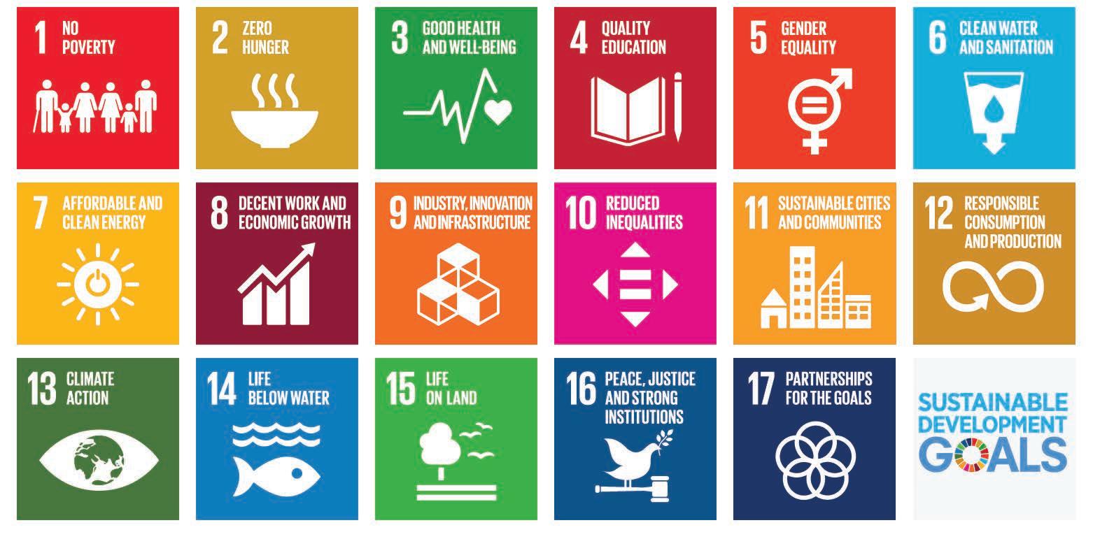
With regards to the impact which waterfront greenways have on reducing the impact of Sea Level Rise on coastal landscapes, this line of thinking is also able to be aligned with the strategic objectives and principles set out in many important government and international documents - such as ‘The Bays West Place Strategy (2021)’ and the UN’s ‘Sustainable Development Goals (2015)’.
The Bays West Place Strategy (2021)
» Direction 7 “Deliver a world class sustainable precinct which is carbon neutral and delivers efficient management of energy and water, and the elimination of waste”
» Direction 8 “Improve the precinct’s connectivity and integration into its locality and surrounding areas”
UN’s ‘Sustainable Development Goals (2015)’
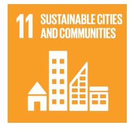
» Goal 11 “Mak e cities and human settlements inclusive, safe, resilient and sustainable”
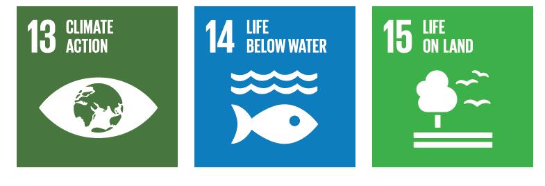
» Goal 13 “Take urgent action to combat climate change and its impacts”
» Goal 14 “ Conserve and sustainably use the oceans, seas and marine resources for sustainable development”
» Goal 15 “Protect, restore and promote sustainable use of terrestrial ecosystems, sustainably manage forests, combat desertification, and halt and reverse land degradation and halt biodiversity loss”
Chapter 3.0 details a variety of projects and waterfront greenways that have been successful in responding to water and the impacts associated with Sea Level Rise.
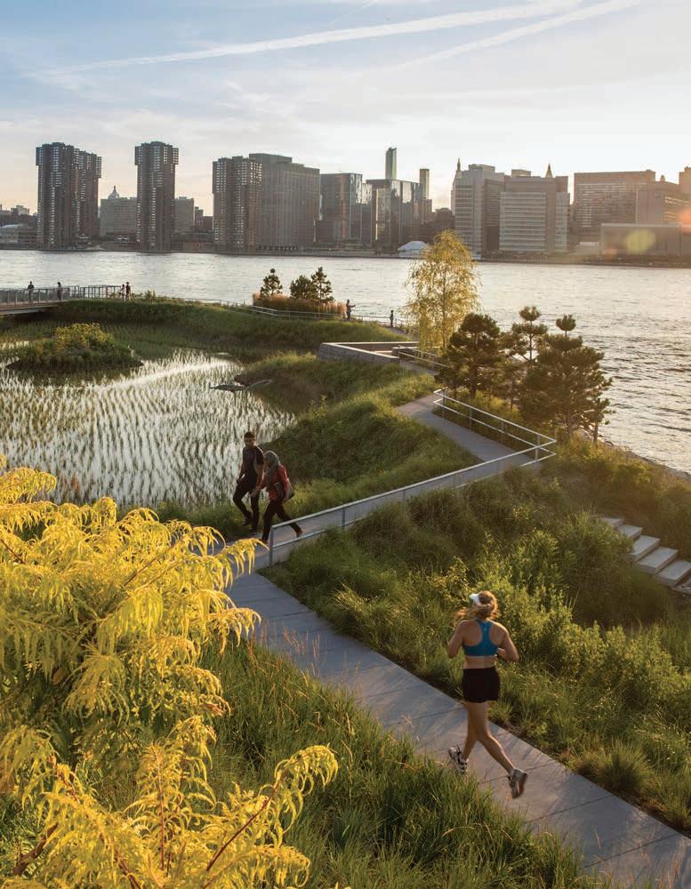
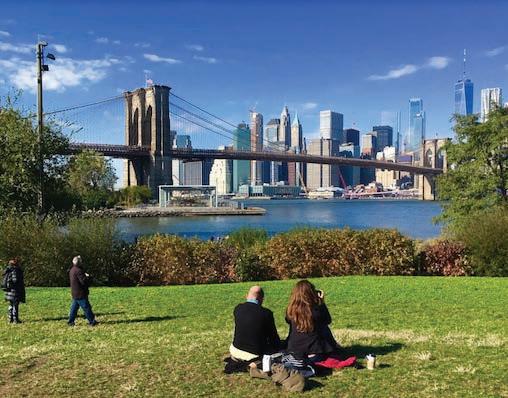
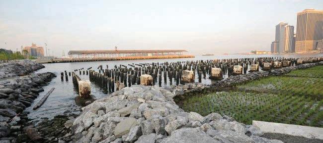
Designed by Landscape Architecture firm ‘Michael Van Valkenburgh Associates’, Brooklyn Bridge Park is an award-winning waterfront greenway located on the Brooklyn side of the East River in New York City.
A former port, the site has since been transformed into 34 hectares of open space, playgrounds, multipurpose courts, open plazas and more.
In addition to this, the design also considers the role which Sea Level Rise may have on the site, as well as its associated impacts (i.e. storm surge, hurricanes, flood). It does this through the introduction of sea walls, marshes and trees along the waterfront.
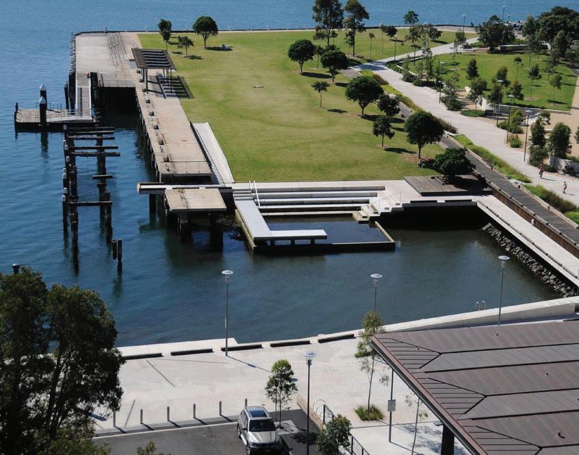
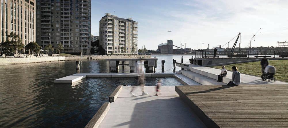
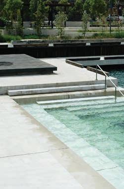
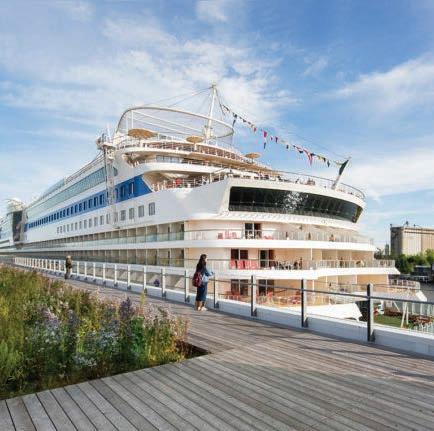
Centrally located in the inner-city suburb of Pyrmont, Pirrama Park is a dynamic park that responds to its local conditions.
A former industrial site, Pirrama Park provides a variety of spaces for harbourside enjoyment - taking people right down to the water’s edge.
Its various terraced and stormwater interventions create a dynamic park that responds to the site and its daily conditions, such as the tide.
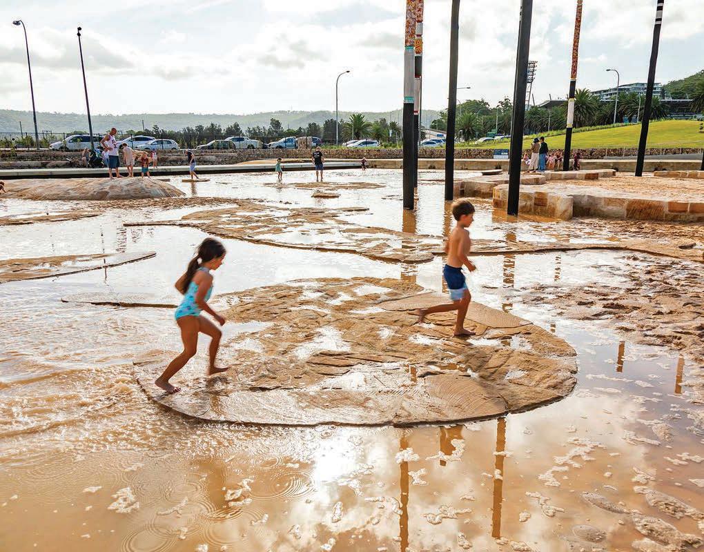
‘Tidal Encounters’ at Gosford Leagues Club in New South Wales is an immersive project and experience that responds to its surrounding landscape.
Designed by landscape architectural firm ‘Turf Design’,’Tidal Encounters’is a nature-inspired play space that includes an innovative ‘tidal terrace’ that transforms the play space into a water play zone when tides rise.
This innovative intervention showcases the transformative and ephemerality which water and tides can provide a landscape and space.
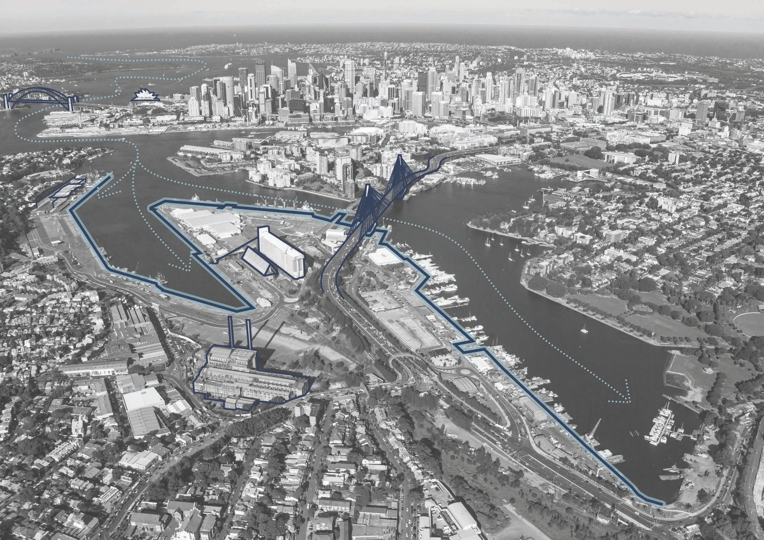
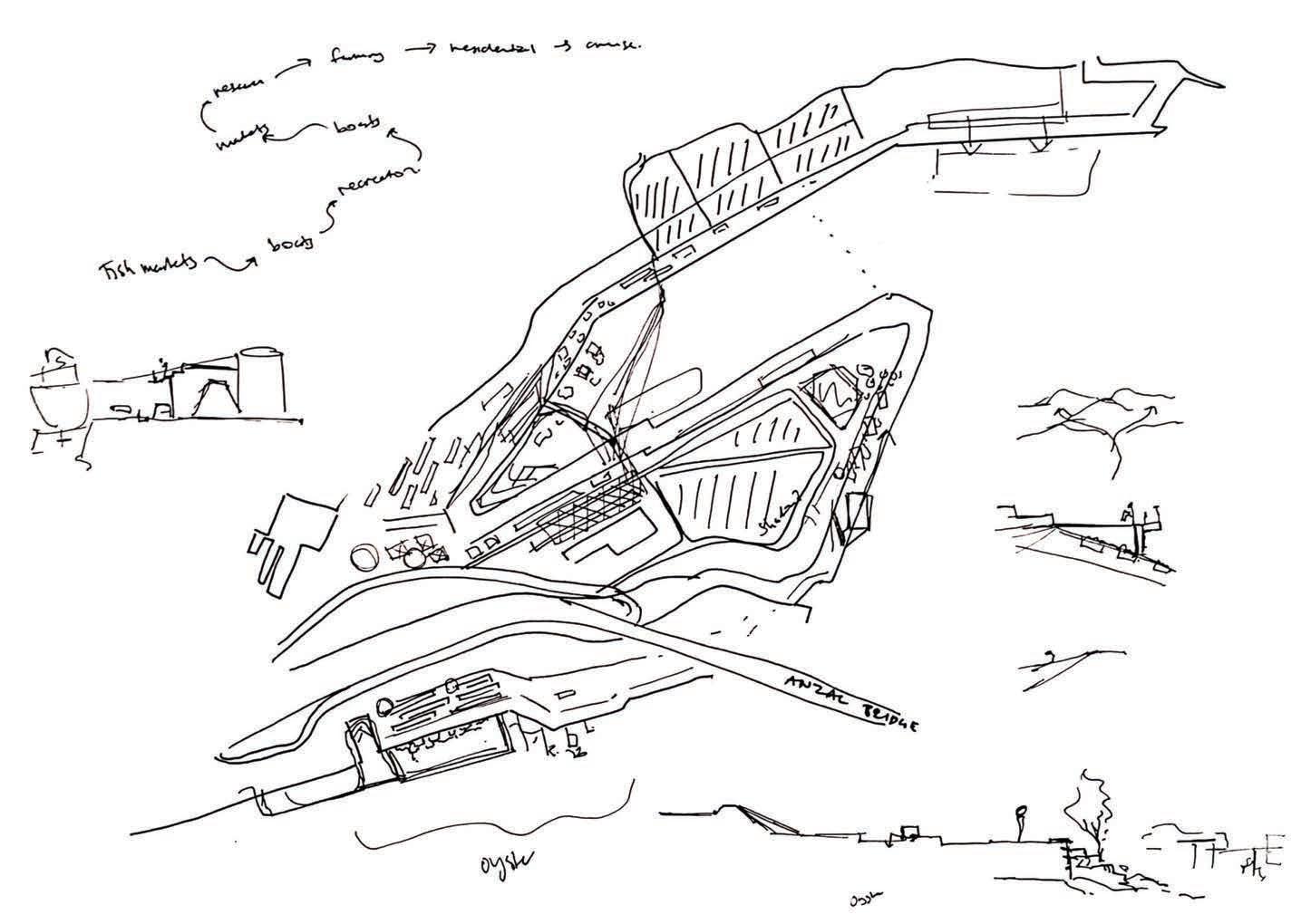
Chapter 4.0 introduces ‘The Bays’ as the perfect candidate for INFLUX - detailing nuances of the site, its context and many opportunities.
Waterfront locations across Sydney Harbour are highly sought-after. However, as economies and priorities shift, Sydney’s Harbour Foreshore has undergone a dramatic transformation. Habitats, industrial sites, and wastelands, which once lined the harbour foreshore have now been camouflaged over into new parklands, residences, and the like.
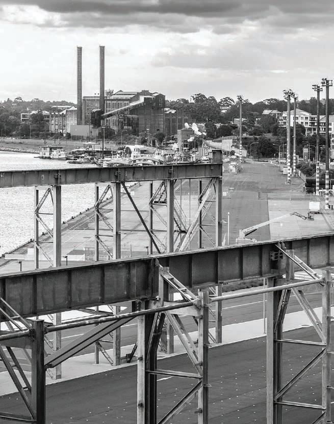
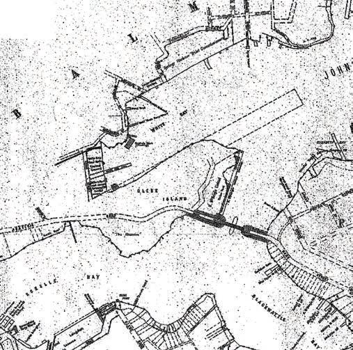
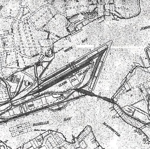
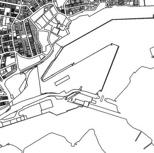
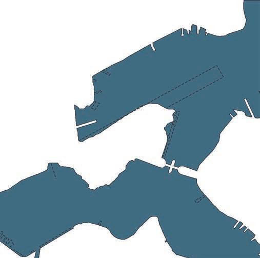
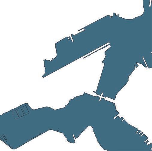
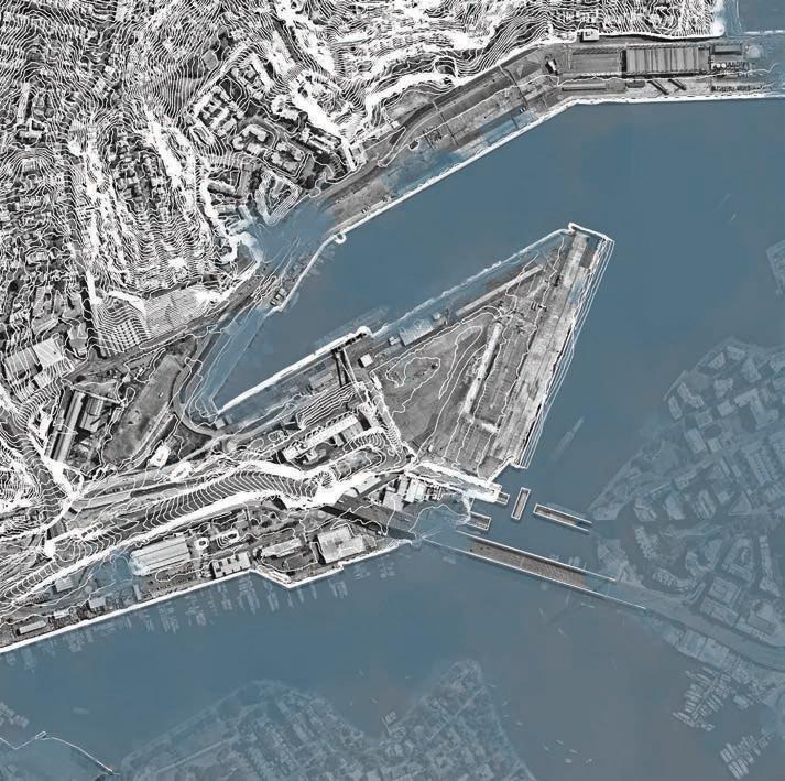
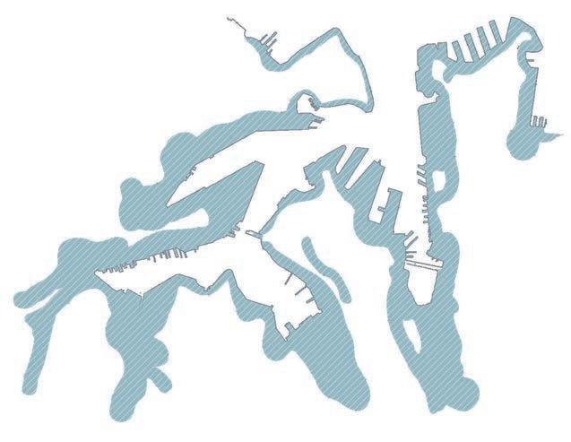
‘The Bays’ is the last flat surface yet to be built on in Sydney’s Harbour.


NSW Government 2017, The Bays Precinct South-West of Central Sydney, Digital Image, ArchitectureAU, Accessed 21 November 2021, <https://architectureau.com/articles/fjmt-appointed-to-masterplan-district-of-new-sydney-fish-market/>.
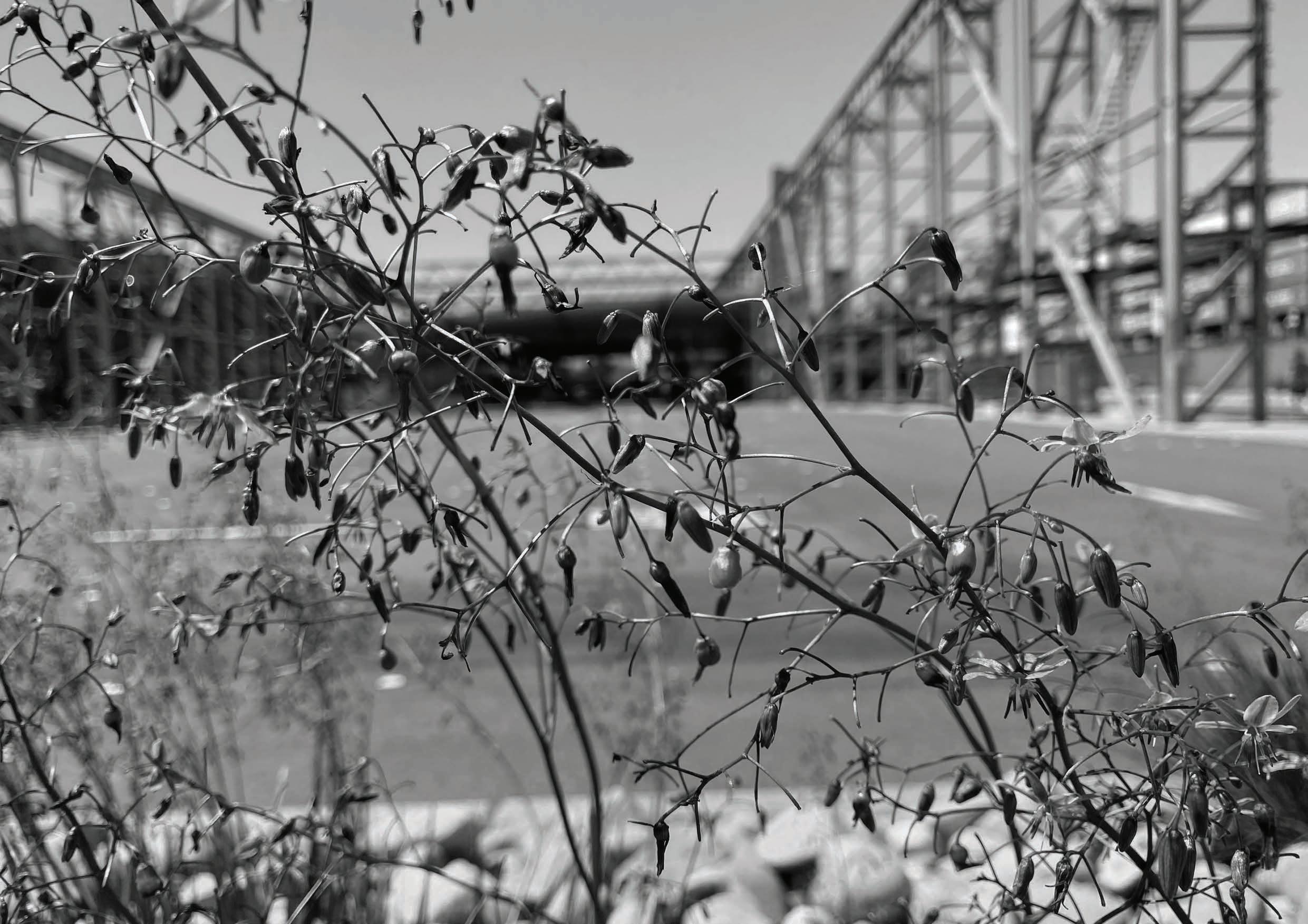
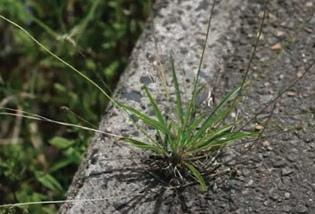
Today, ‘The Bays’ is characterised by its reinforced concrete, built edges, steel, and grandeur scale. However, when looking at ‘The Bays’ at a smaller scale, there are evident signs of life and ecology ‘within the cracks’ of the old cement.
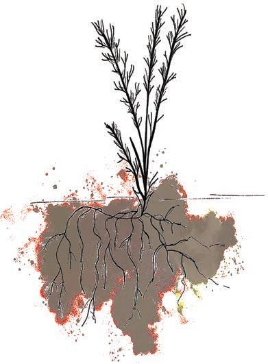


Bottom row of images sourced from: <https://powerplantsphytoremediation.com/performance_nl >.


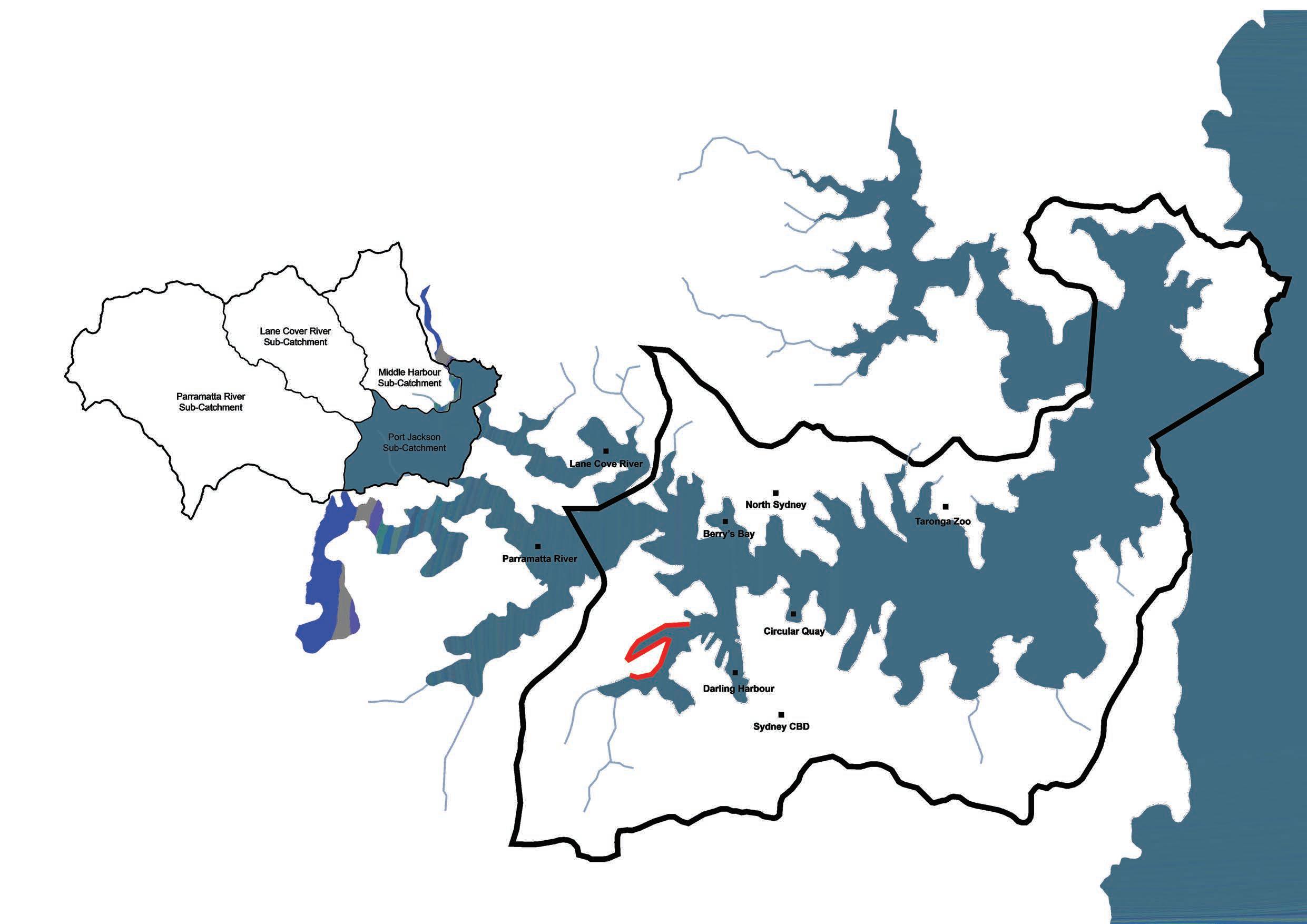
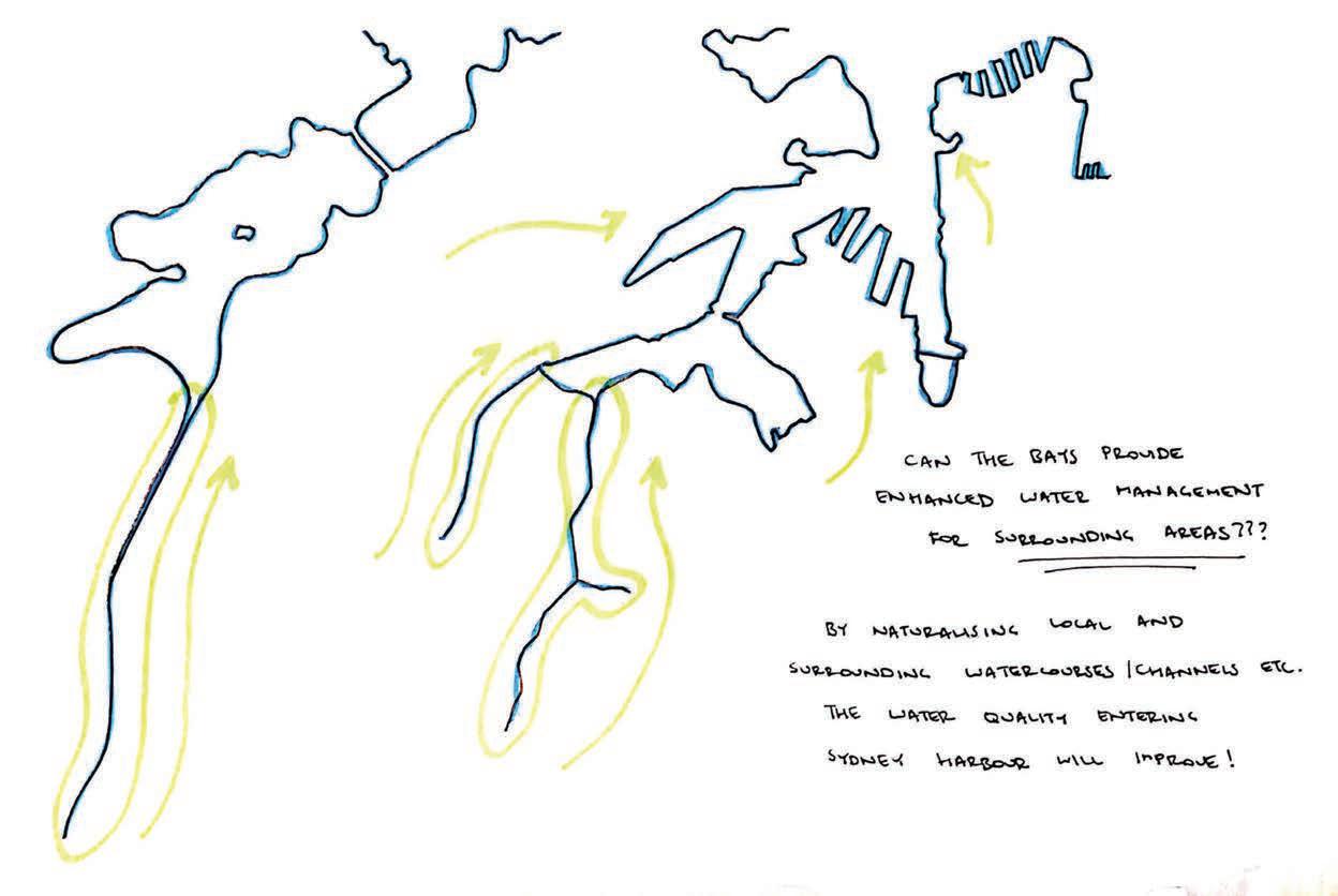
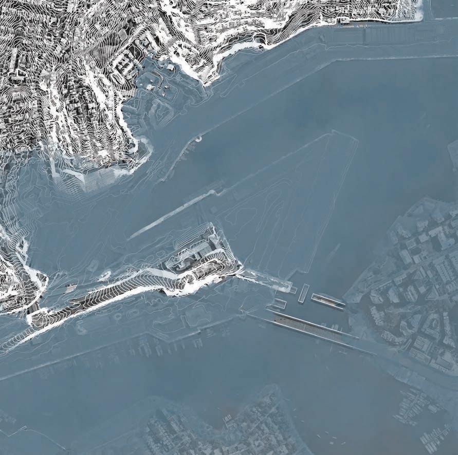
Sydney Harbour and Its Sub-Catchments
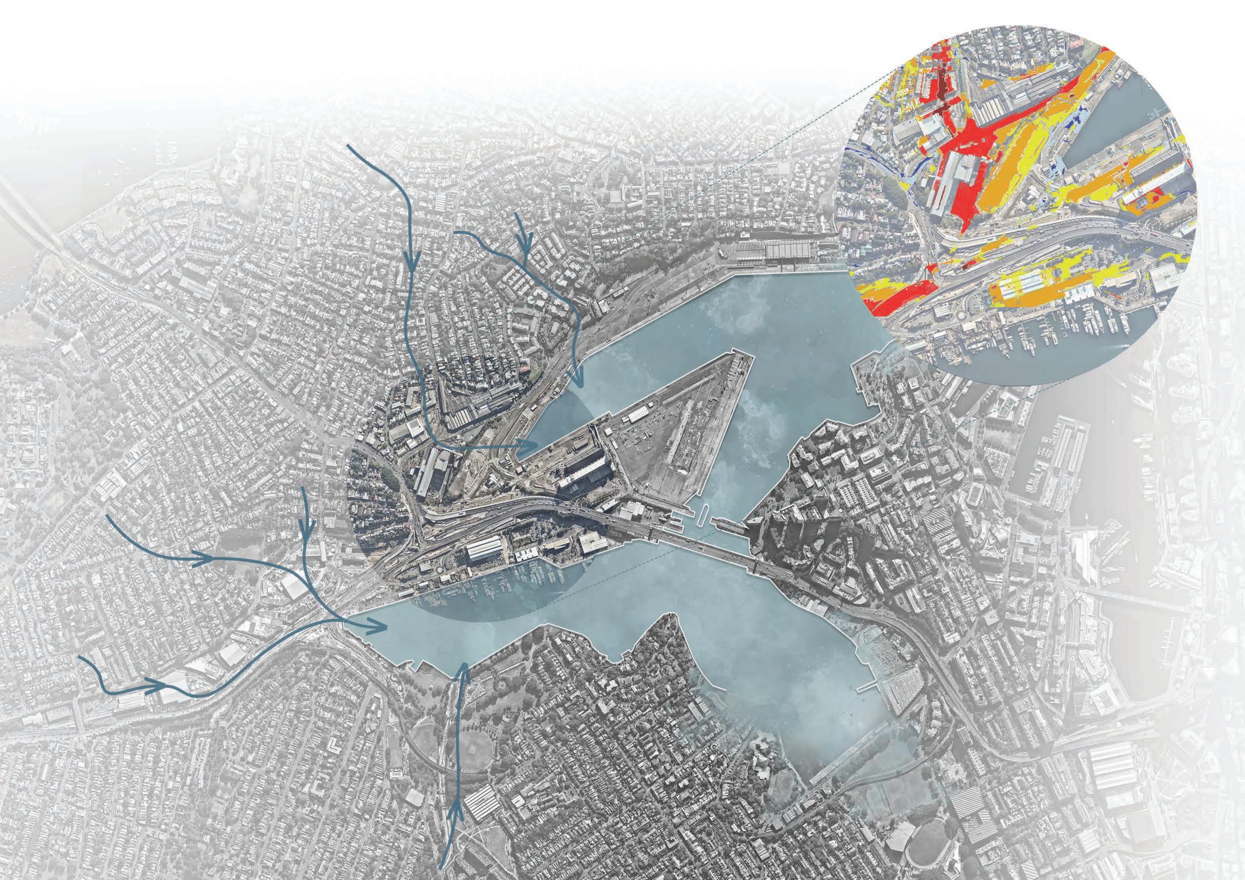
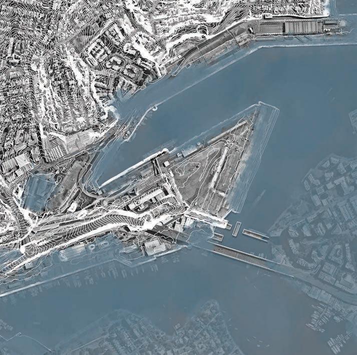
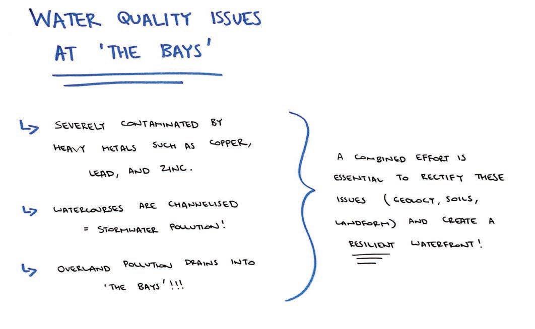
‘The Bays’ flat topography makes the site highly susceptible to flooding, with water draining into the site from higher areas, such as Balmain, Rozelle and Glebe.
Overland Flow Paths (Direction of Flow)
Since ‘The Bays’ is highly susceptible to flooding, the site is also a major risk of storm surge. The map detailed on this page highlight the areas suggested being evacuated in the event of a land-threat tsunami.
Evacuation areas in the event of a land-threat tsunami.
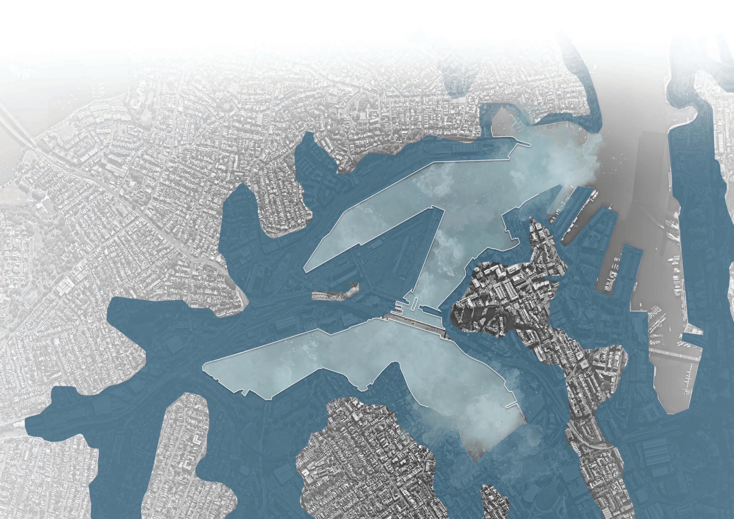
*Note. Information on this map is sourced from <https://www.ses.nsw.gov.au/resources-folder/tsunami-evacuation-map/>.
If we follow a pathway with high emissions...by 2050 , it is projected that sea levels will rise by 0.5 metres
That is approximately 5 hectares of ‘The Bays’ to be affected by Sea Level Rise.
Base image sourced from Nearmaps <https://www.nearmap.com/au/en>.
If we follow a pathway with high emissions...by 2100 , it is projected that sea levels will rise by 1 metre
That is approximately 17 hectares of ‘The Bays’ to be affected by Sea Level Rise.
If we follow a pathway with high emissions...by 2300 , it is projected that sea levels will rise by 3 metres
That is approximately 51 hectares of ‘The Bays’ to be affected by Sea Level Rise.

Following the analysis completed on the previous pages, it is clear that ‘The Bays’ is on the cusp of major change. With the threat of sea level rise ever so prevalent, the time is now to act and respond to Sea Level Rise.
years ago.
In response to the research and analysis that I have conducted thus far, I decided that INFLUX will aim to address the question below;
Water is constantly in motion. It changes states, crosses borders, nourishes life, destroys life.
How can a waterfront greenway embrace the conditions that Sea Level Rise will bring to ‘The Bays’ to, in turn, create thriving working waterfronts, resilient public spaces and foster emerging ecologies?
In essence, the research (hybrid) question ensures that INFLUX will respond to and achieve the following.
at ‘The Bays’... sea levels will rise create new tidal opportunities

INFLUX will project ways humans and nonhumans will interact with this new ‘tidal zone’
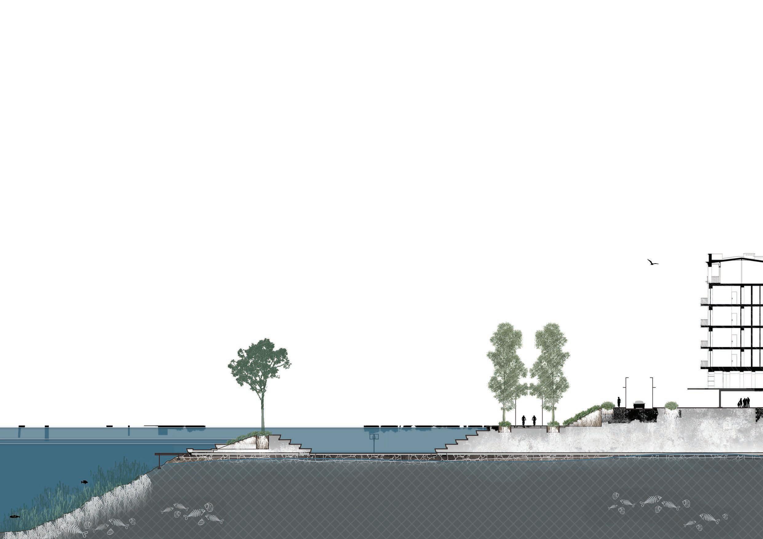
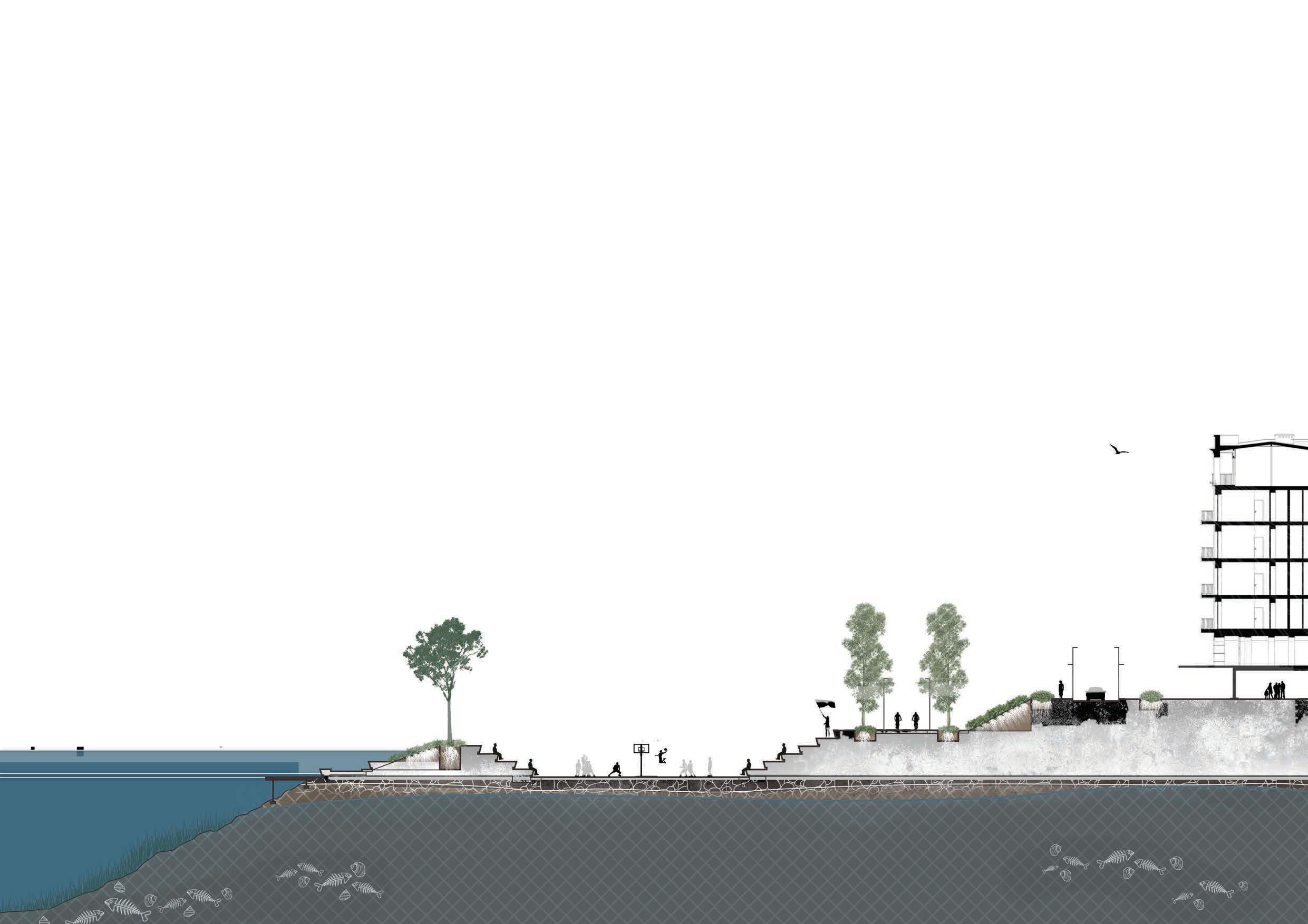
Length of Corridor: 4.5km
Width of Corridor: 60m
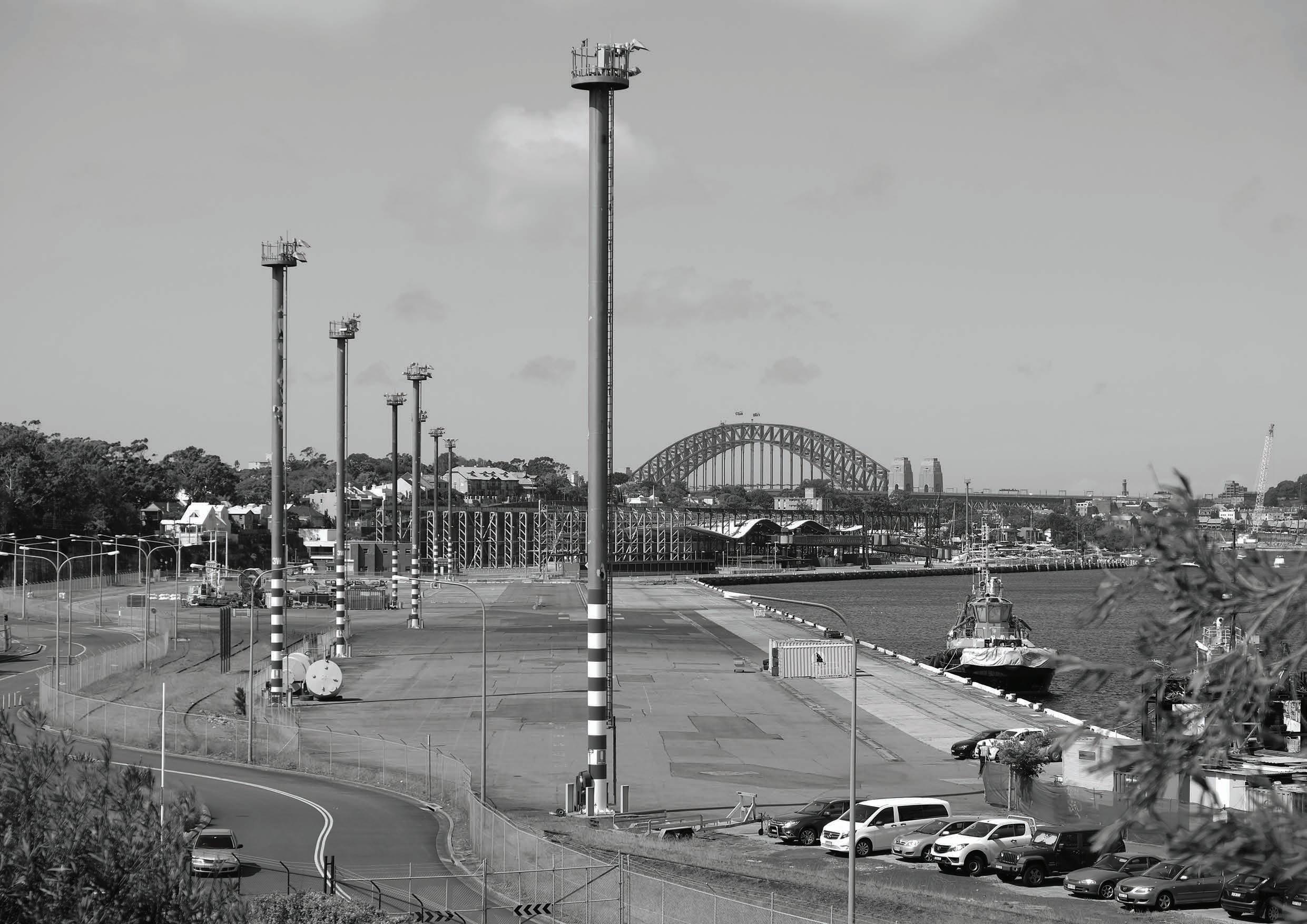
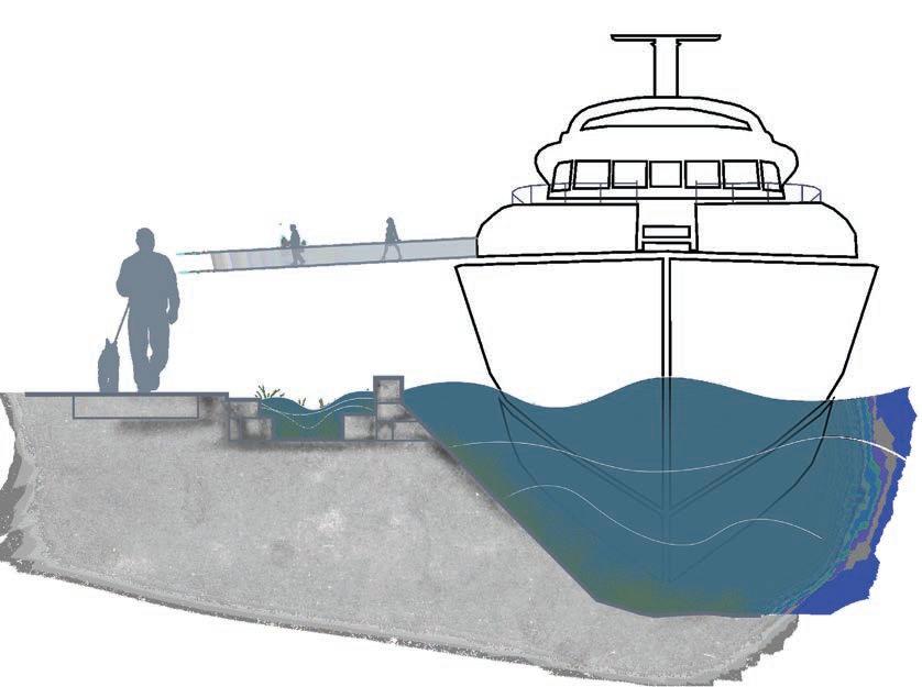
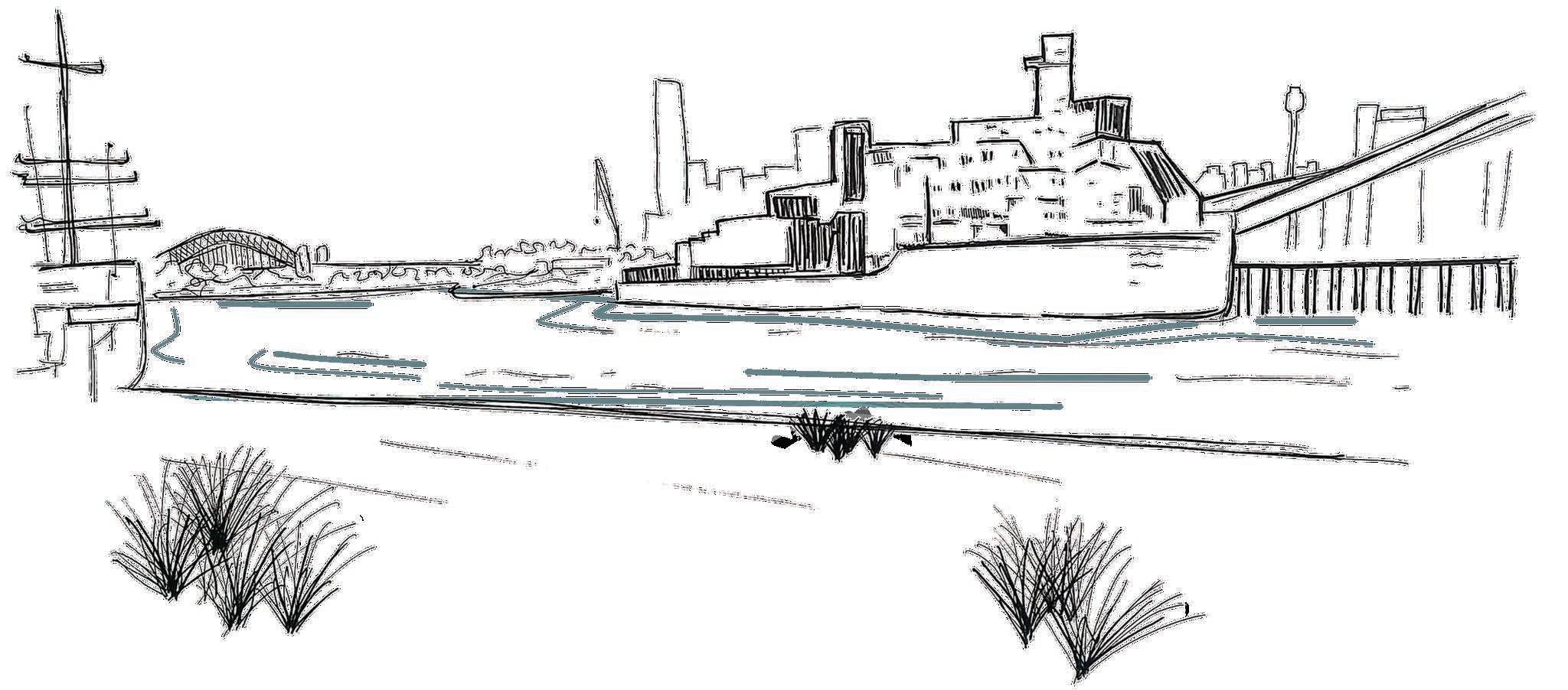
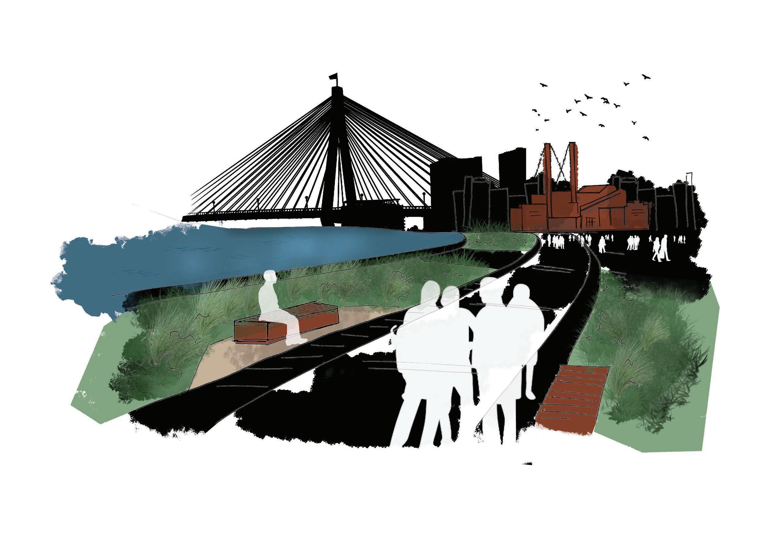
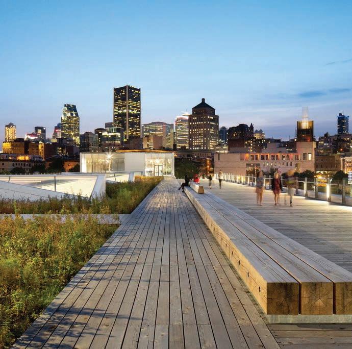
‘The Bays’ foreshore commands one of the most spectacular and unique views of Sydney - with it being one of the few remaining areas of working waterfront in Sydney’s Harbour.
However, despite its setting, ‘The Bays’ foreshore feels like an odd piece in an otherwise impressive Sydney Harbour foreshore. Its high level of development largely consisting of waterside industry has removed itself from its surrounding context - being the missing link and next chapter to be explored in the Harbour story.
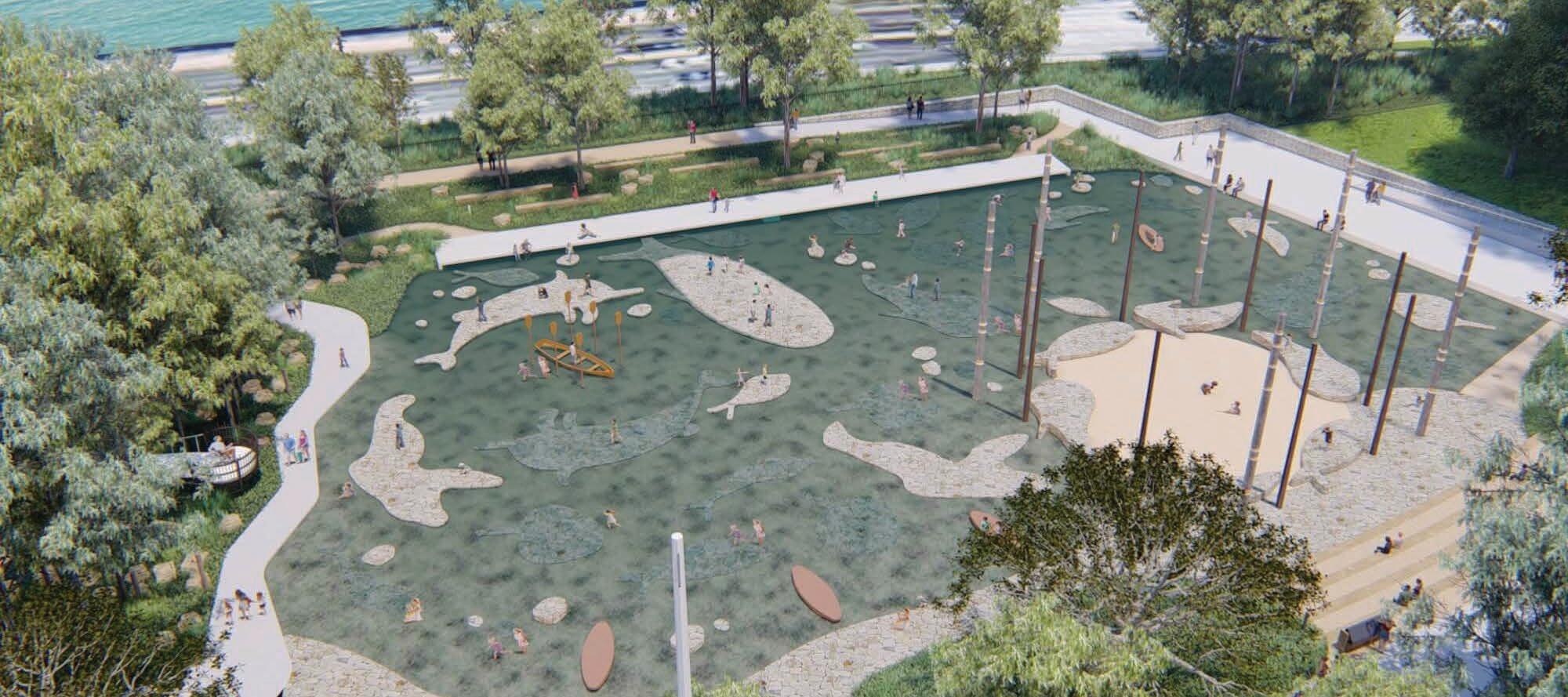
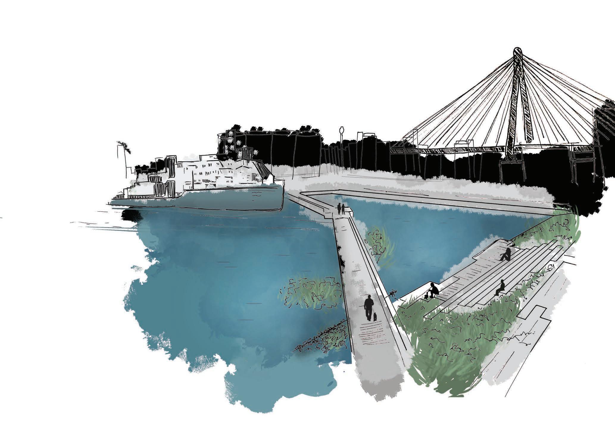
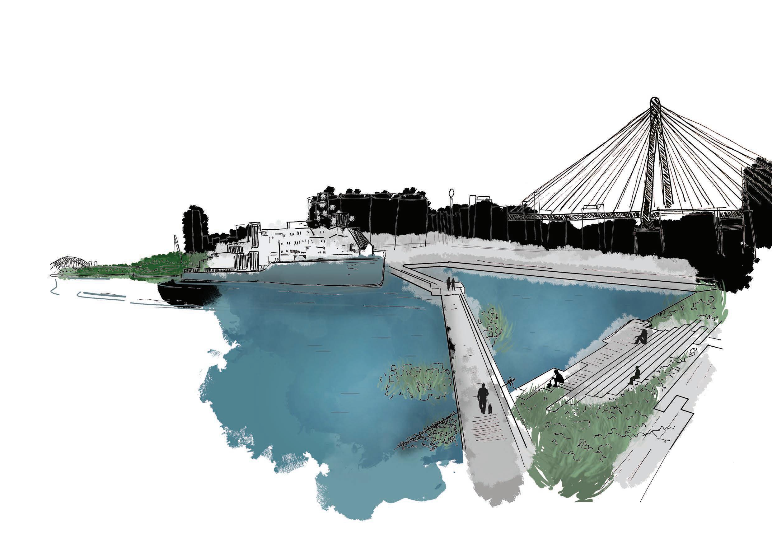
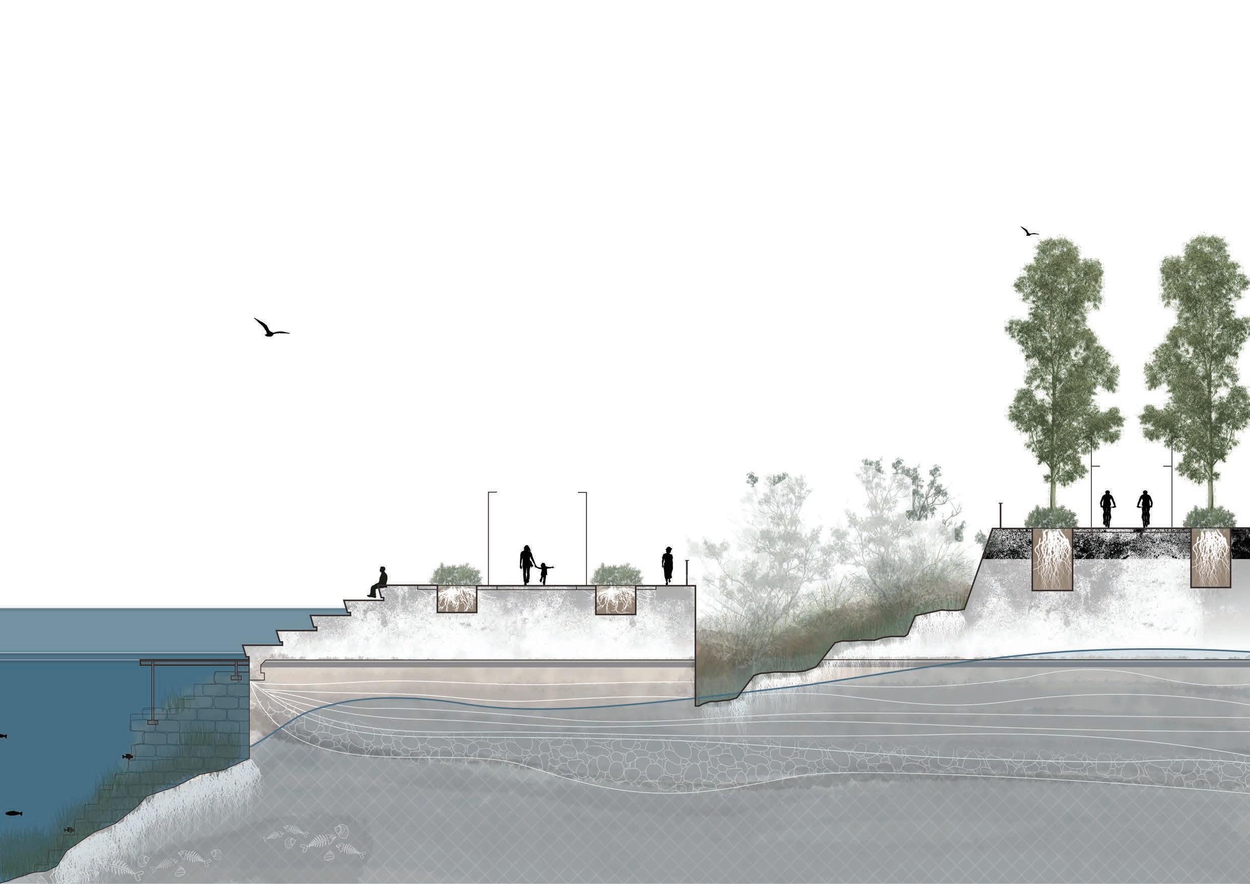
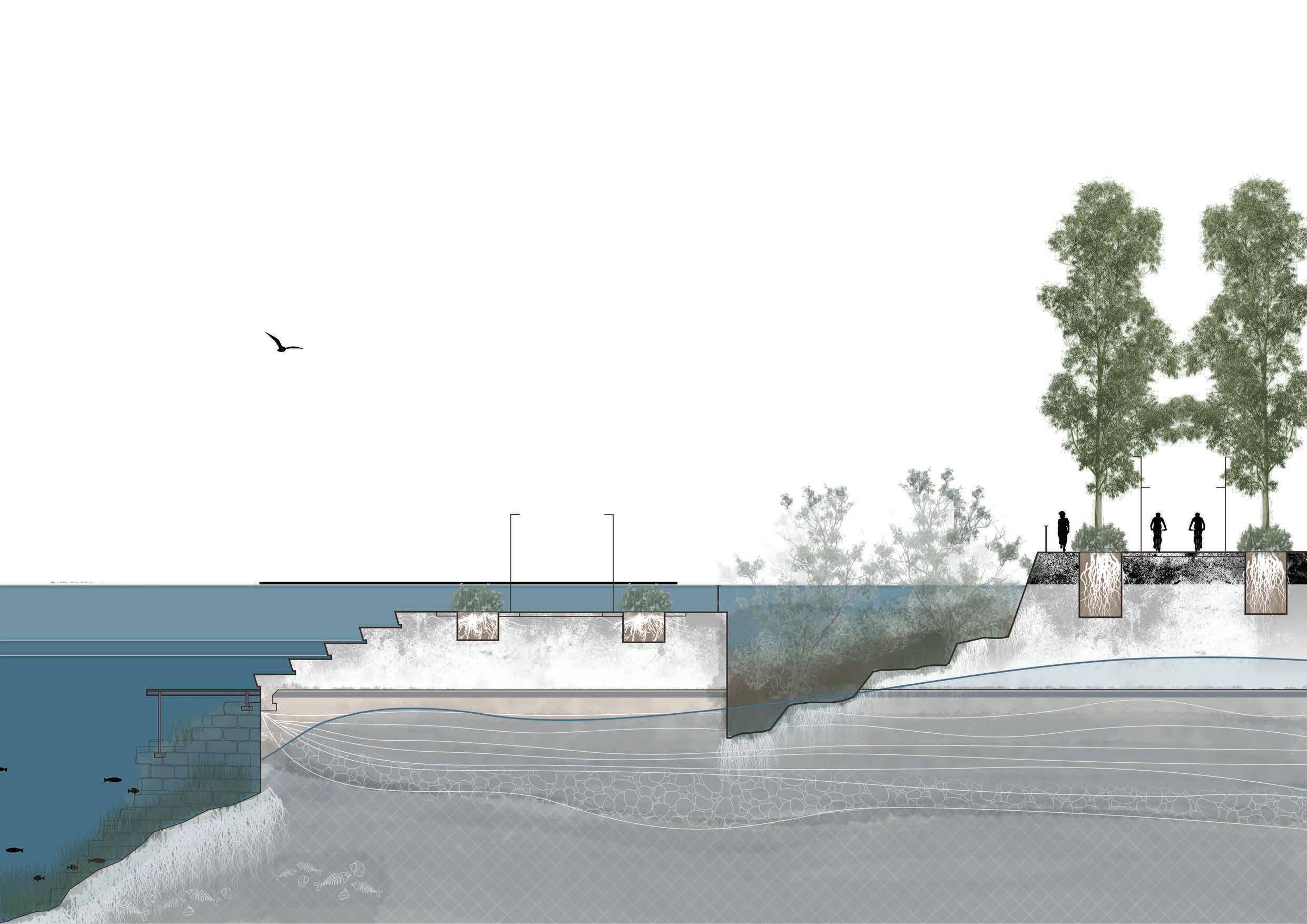
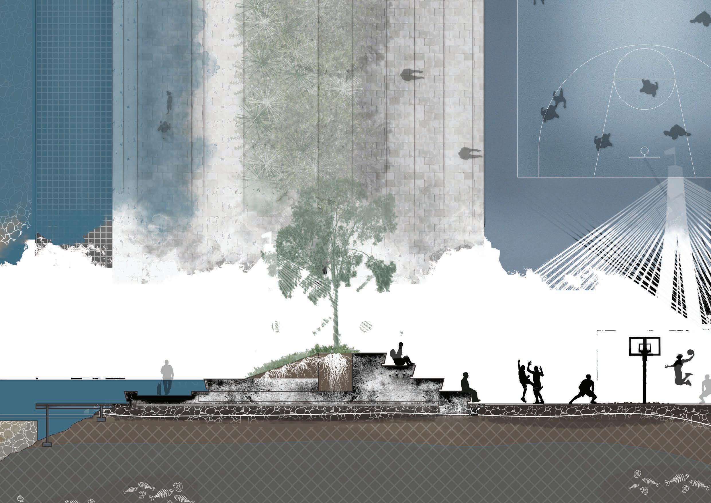
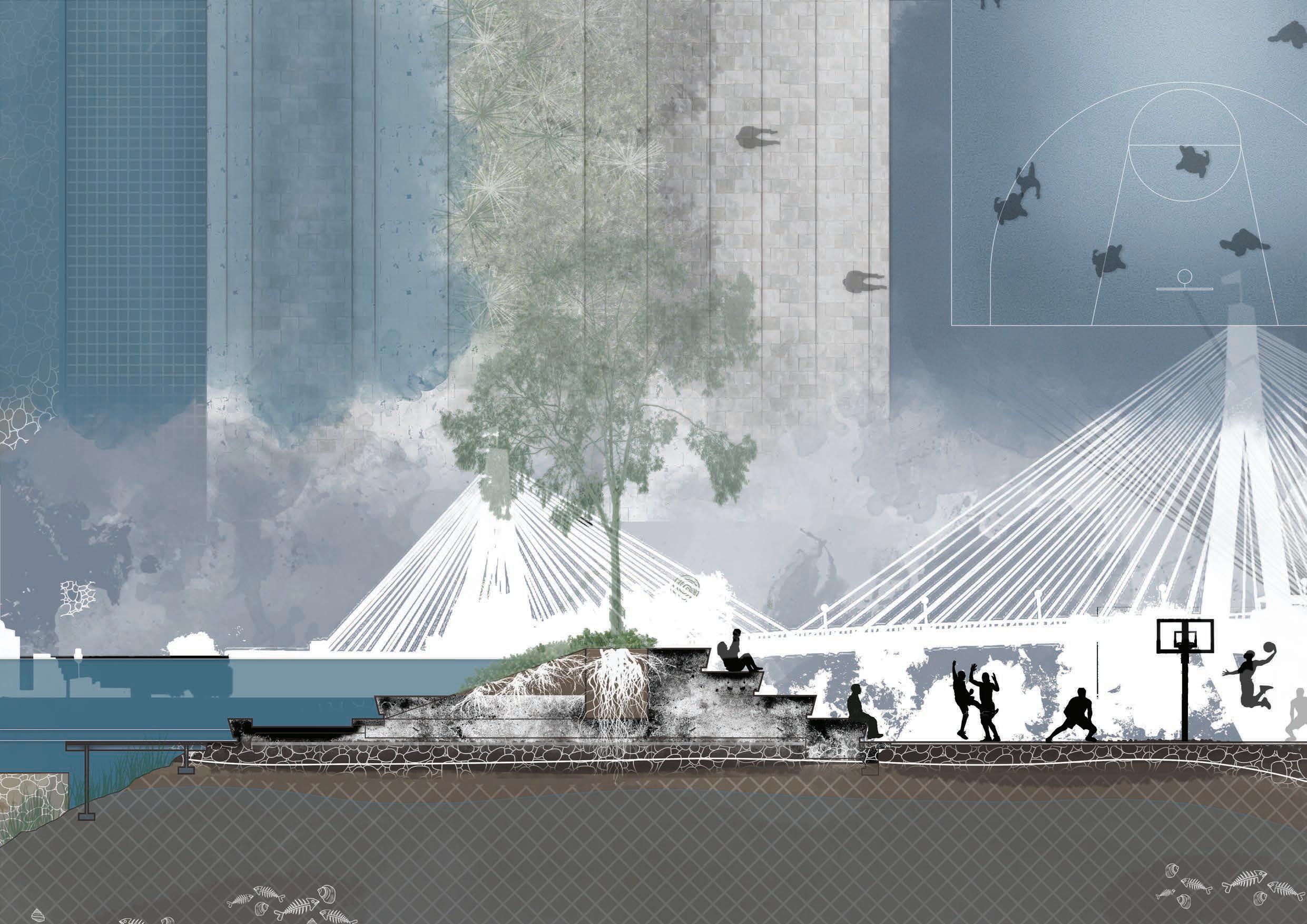
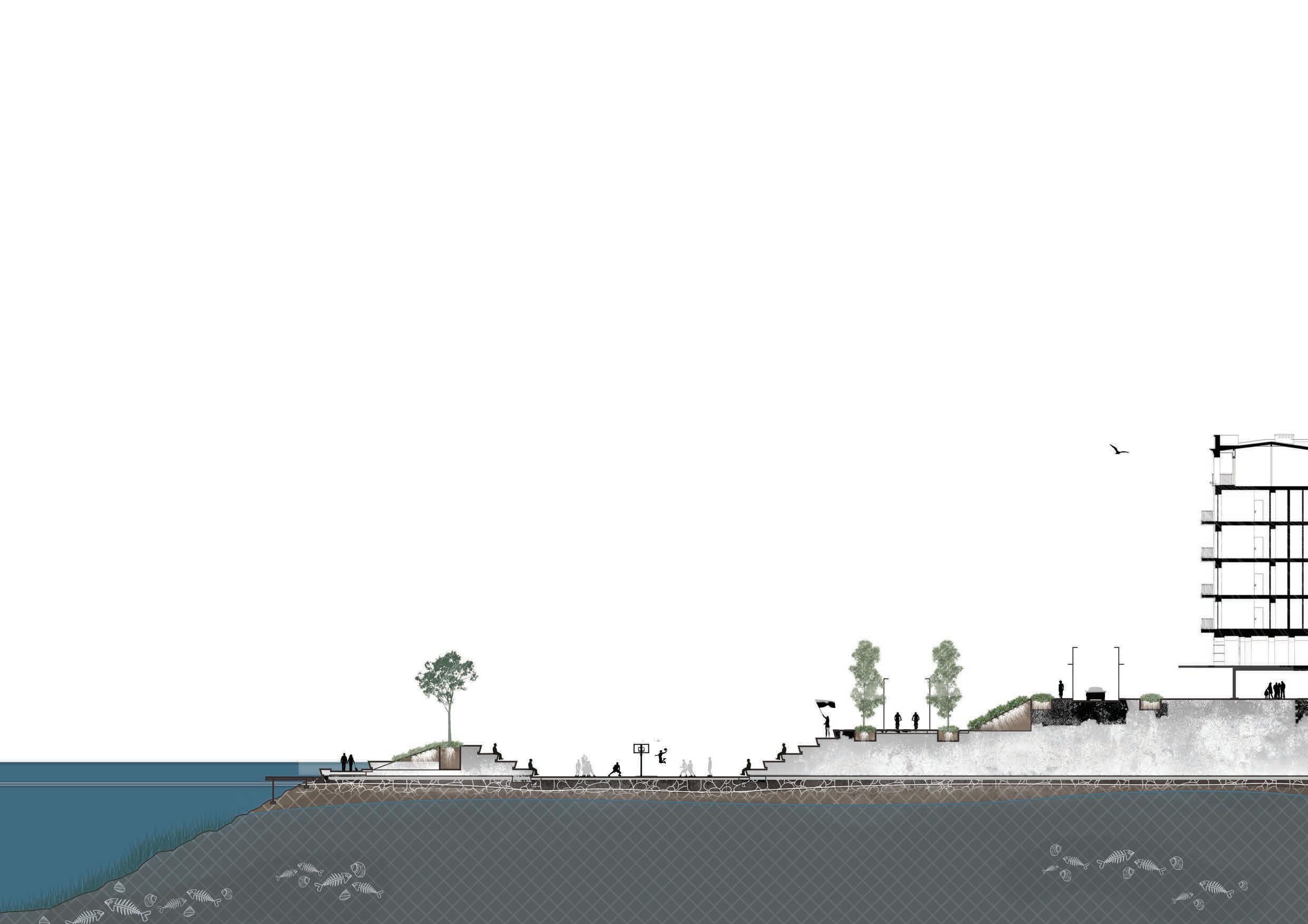
At its core, the primary purpose of a greenway is ‘to connect’, connecting people, ecological communities, or lost systems back together. Therefore, the overall proposal for INFLUX is to provide a continuous waterfront greenway that links Jubilee Park to the south with Ewenton Park to the north, that also aims to address the challenges associated with Sea Level Rise.

Chapter 5.0 recounts the design process and thinking that I had undergone to create INFLUX.
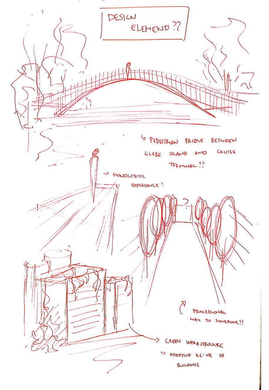


Chapter 6.0 details the specific design moves and interventions that INFLUX will entail.
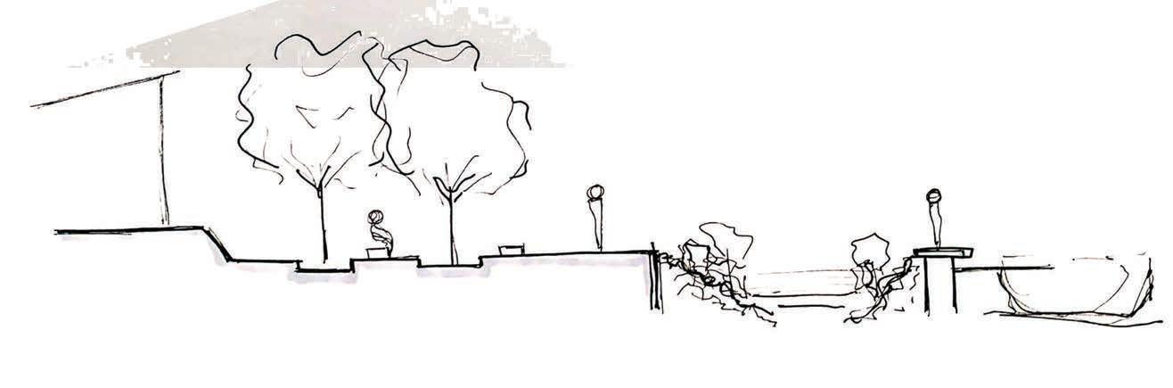
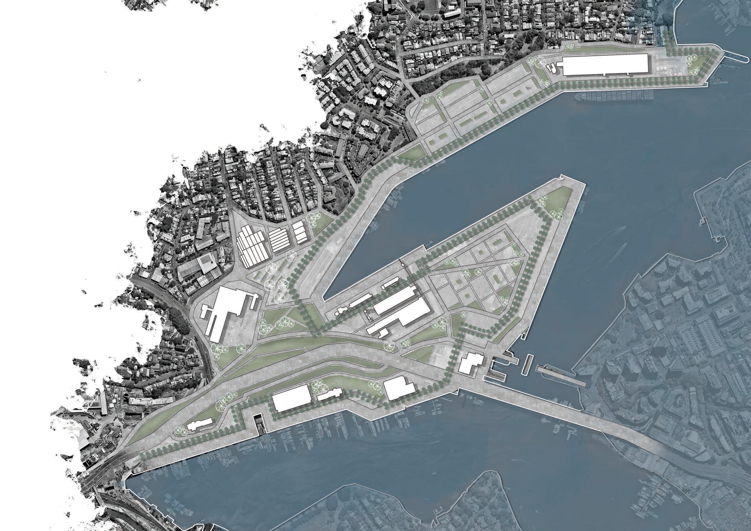
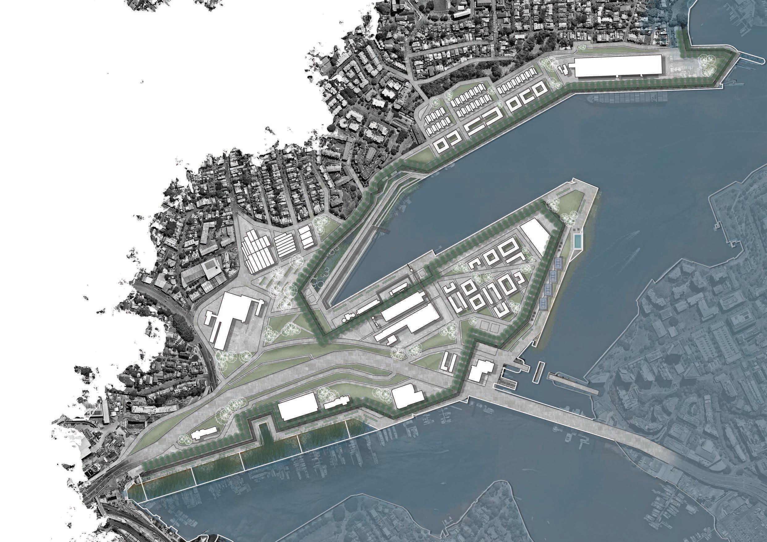
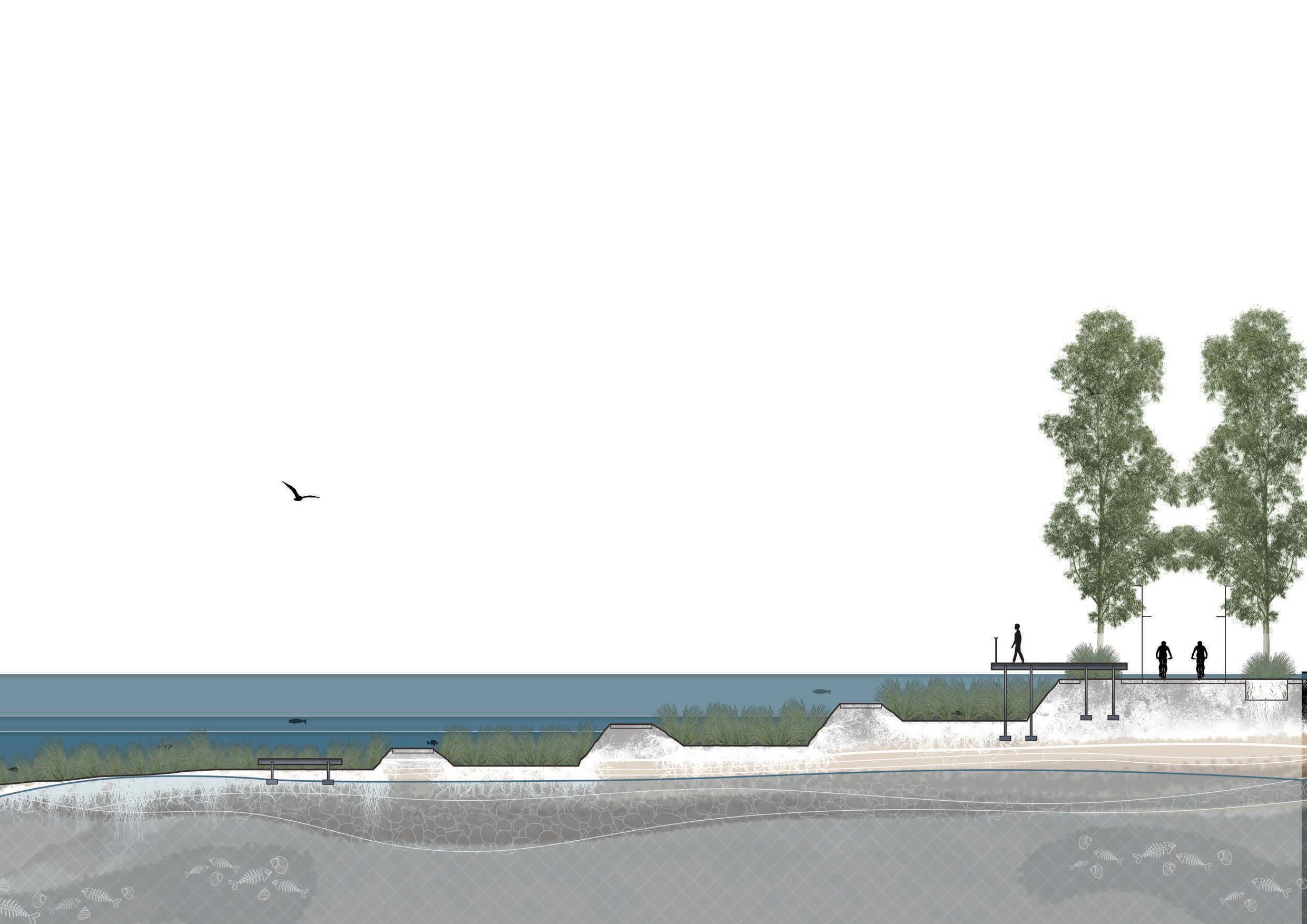
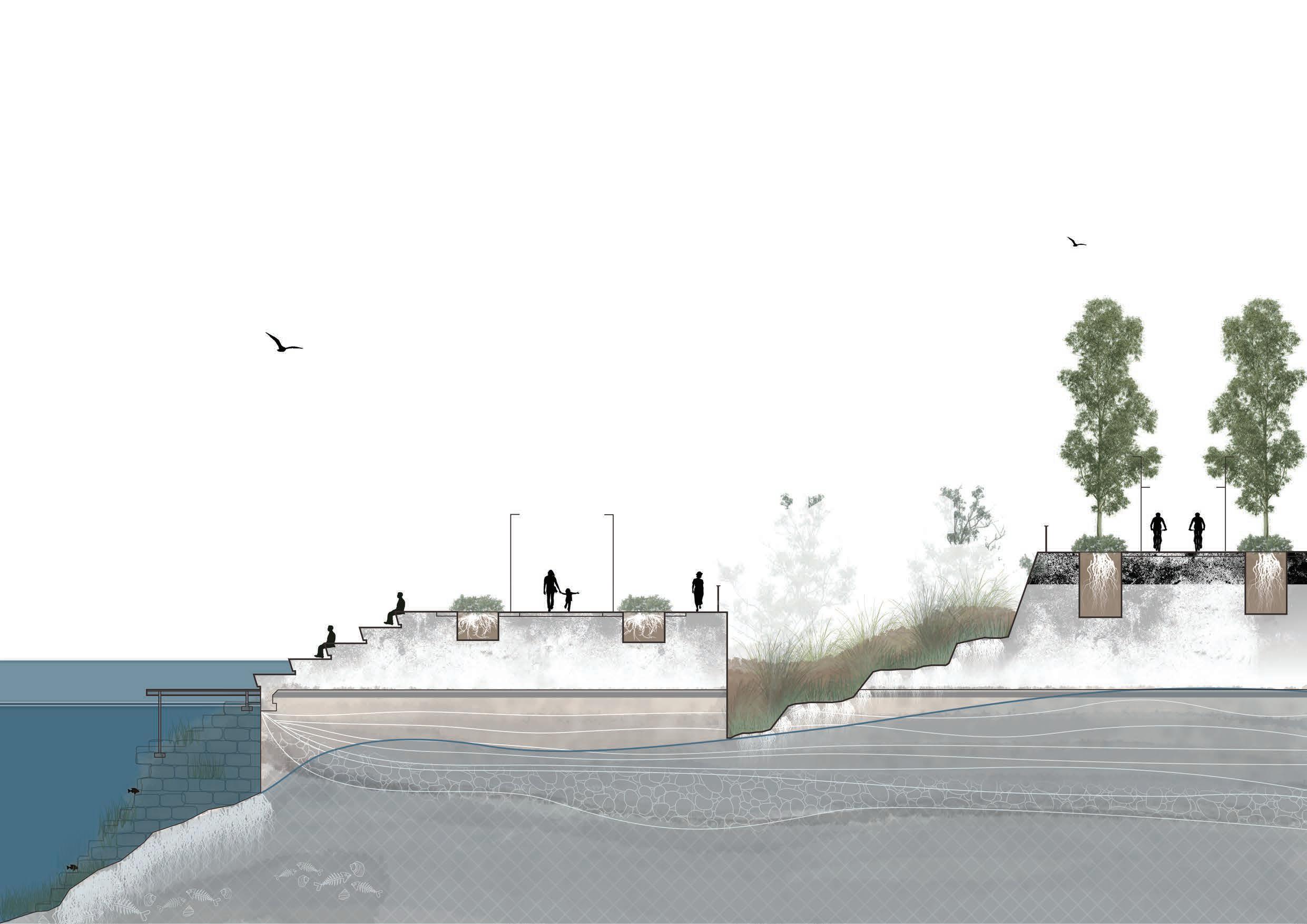
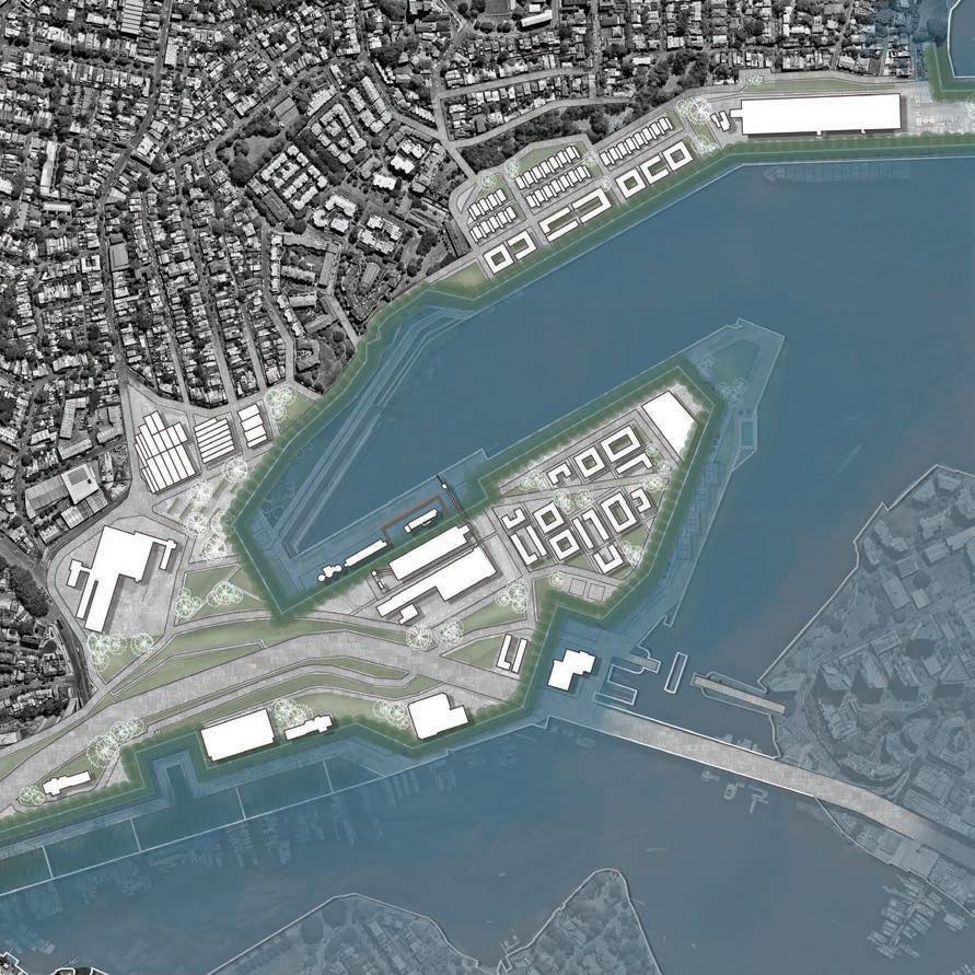
Set out overleaf is INFLUX! More specifically, the following pages will showcase the design details and interventions that INFLUX proposes for ‘The Bays’ Precinct.
This chapter of the process log provides a summary of INFLUX, looking at its;
» The 3 S taged Timeline
» The 3 S taged Masterplans
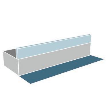
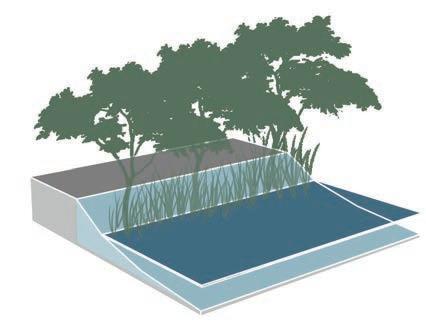
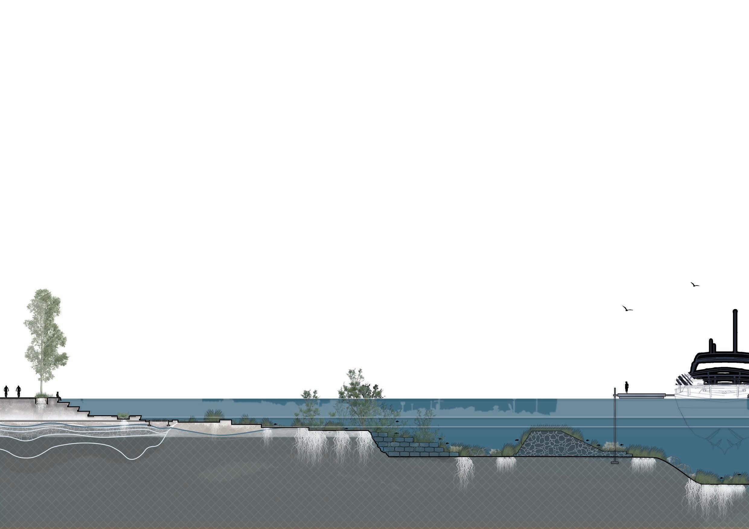
» Edge Conditions
» 6 Anchors
» An Overview of Each 6 Anchors
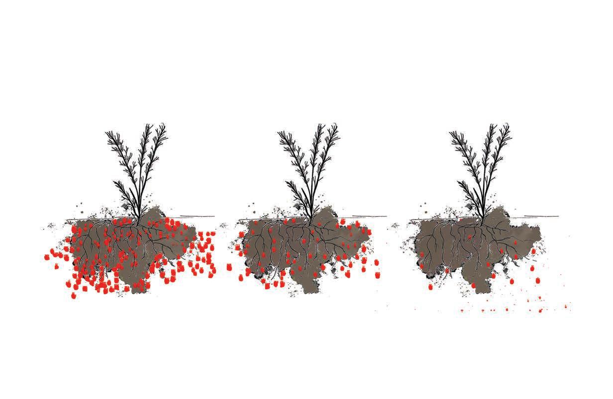
ABIDING EVENT #1: PHYTOREMEDIATION BEGINS (5-50 YEARS)
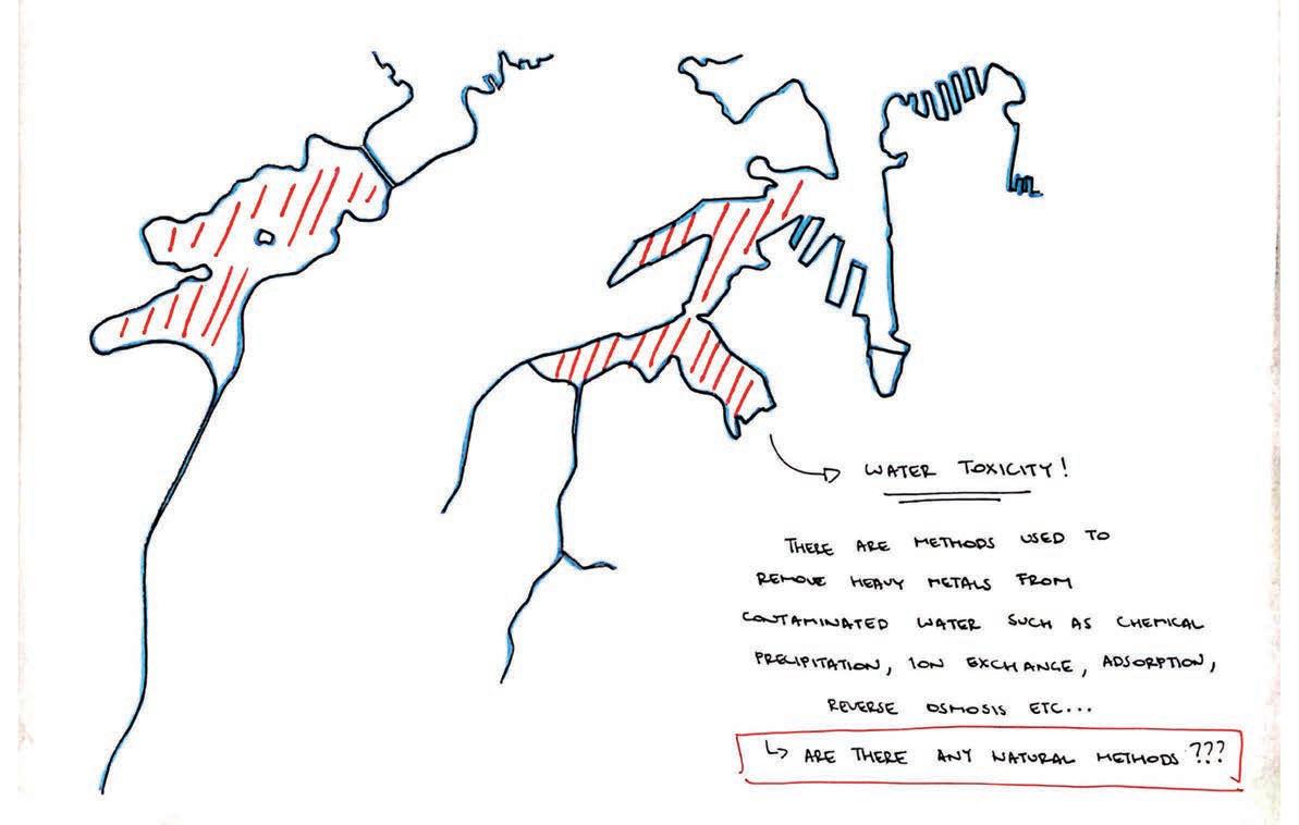
Sydney’s Metro will present a significant opportunity for people to visit, work, and play at ‘The Bays’. For this to be safe, there is a need to treat the highly toxic landscape.
ABIDING EVENT #2: THE NEXT GENERATION (2025-2039)
The birth of ‘Generation Beta’ presents the opportunity to introduce interventions at ‘The Bays’ that can allow this next generation to learn through experience the changing behaviour of our environment from an early age.
ABIDING EVENT #3: OPENING OF SYDNEY METRO WEST ‘THE BAYS STATION’ (2030)
After the opening of Sydney’s Metro West line, people can be introduced to the site as toxicity levels at ‘The Bays’ should be reduced significantly from processes of Phytoremediation.
ABIDING EVENT #4: SEA LEVEL RISE 0.4 METRES (2050)
Sea levels rising by 0.4 metres presents the opportunity to create intertidal ecologies around edges that will be most affected by Sea Level Rise.
ABIDING EVENT #5: SEA LEVEL RISE 1 METRE (2100)
Sea levels rising by 1 metre highlights the need for strategies and interventions that are climate adaptive and resilient for both humans (incoming visitors and residential communities) and non-humans (habitats).
ABIDING EVENT #6: THE BAYS METRO STATION WILL FLOOD (2200)
Sea level rise will claim and flood the ‘The Bays’ Metro Station.
ABIDING EVENT #7: SEA LEVEL RISE 5 METRES (2300)
Sea levels rising by 5 metres will draw attention to the wide impact which humans have had on the environment and the need to adapt to the new ‘normal’.
/re· vive/ verb
“to give or assume new vitality ; flourish again or cause to flourish again”
(Collins Dictionary 2021)
/a· ccomm· o· date/ verb
“to adapt oneself; to take into consideration or make adjustments for ; allow for:” (The Free Dictionary 2021)
stage 3
/em· brace/ verb
“to accept ; to take up; to adopt” (Collins Dictionary 2021)

Base image sourced from Nearmaps <https://www.nearmap.com/au/en>.
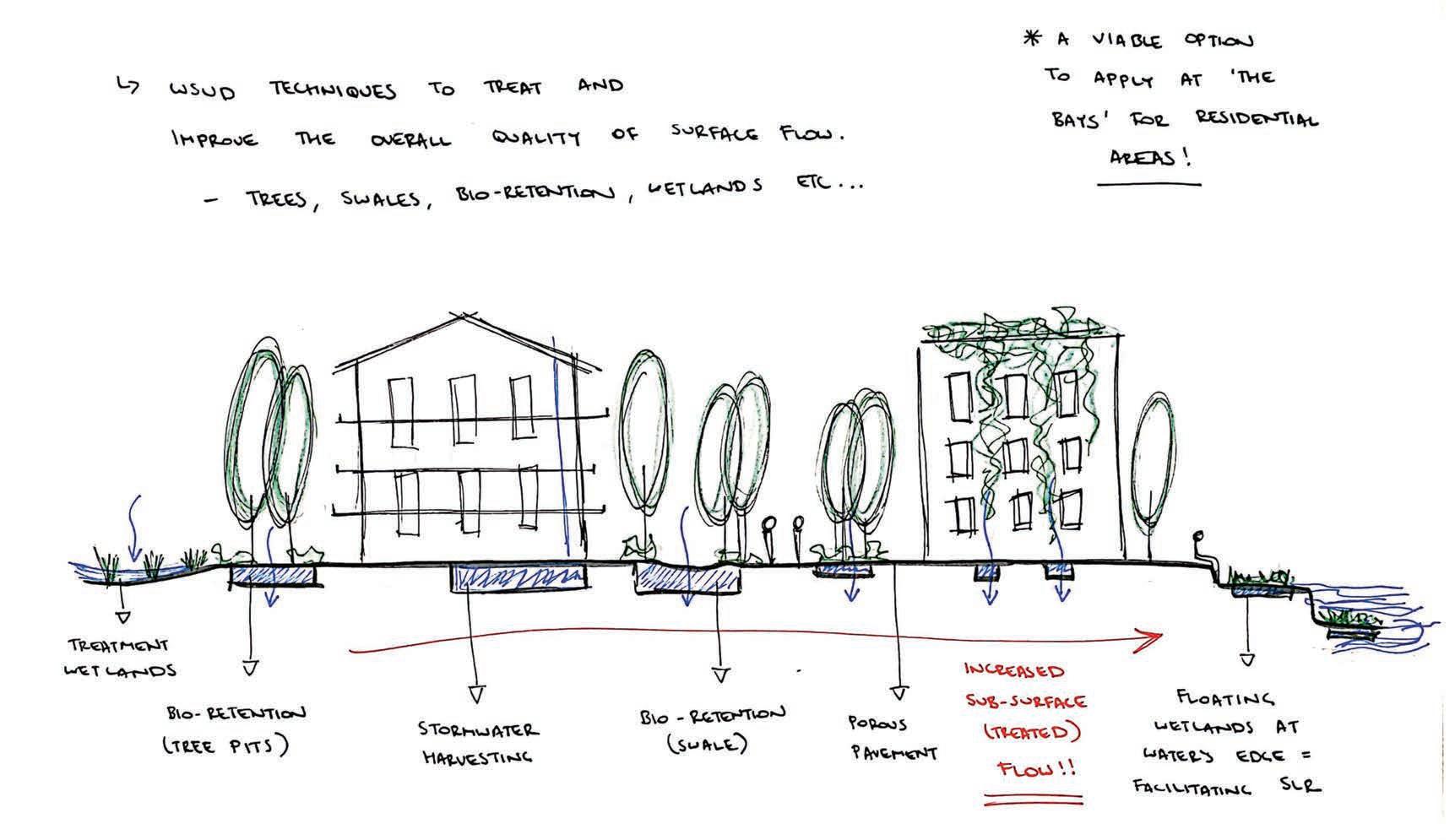
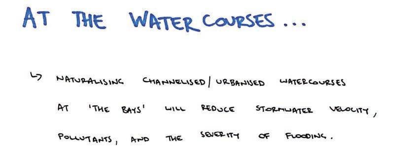
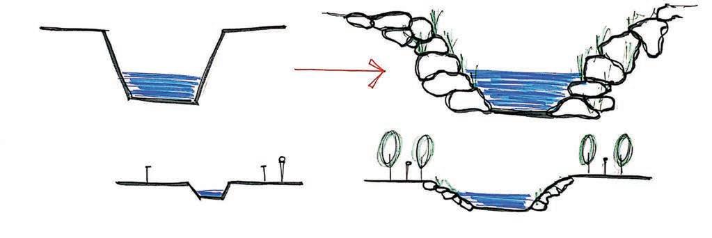
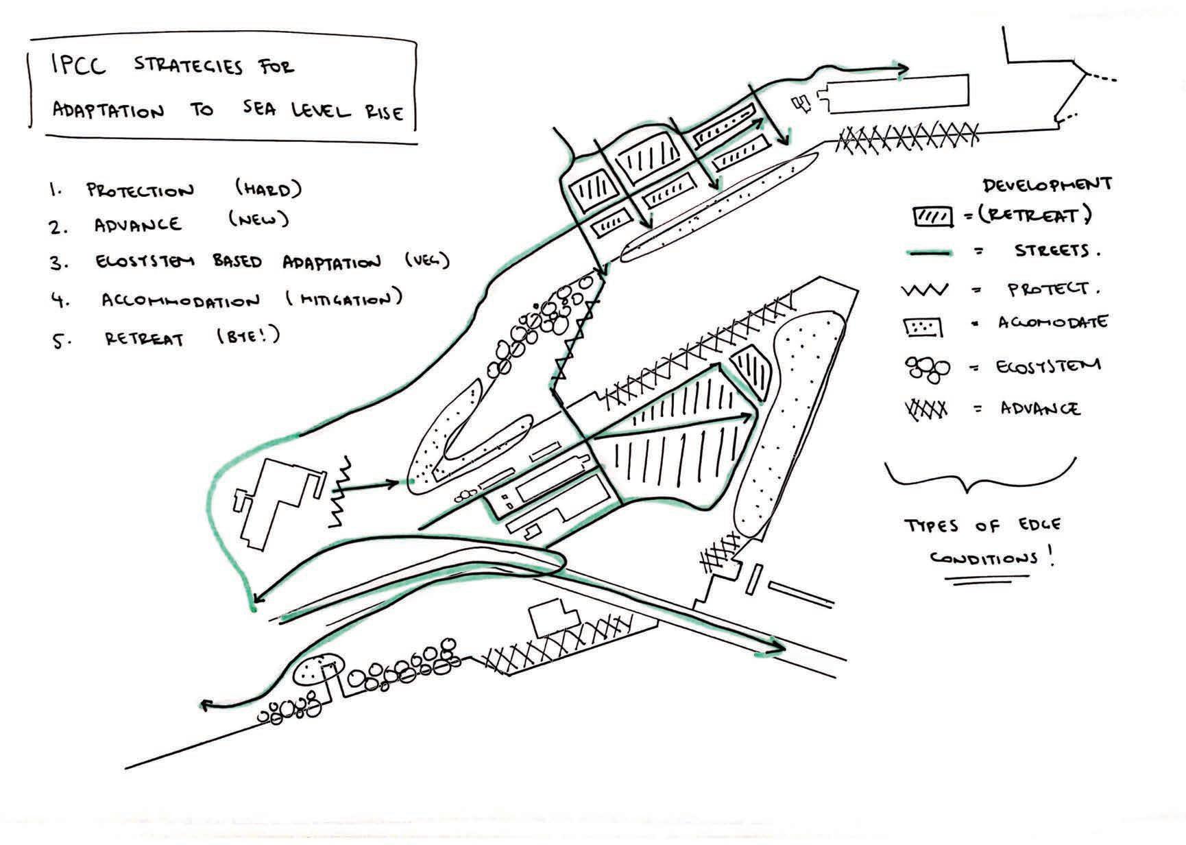
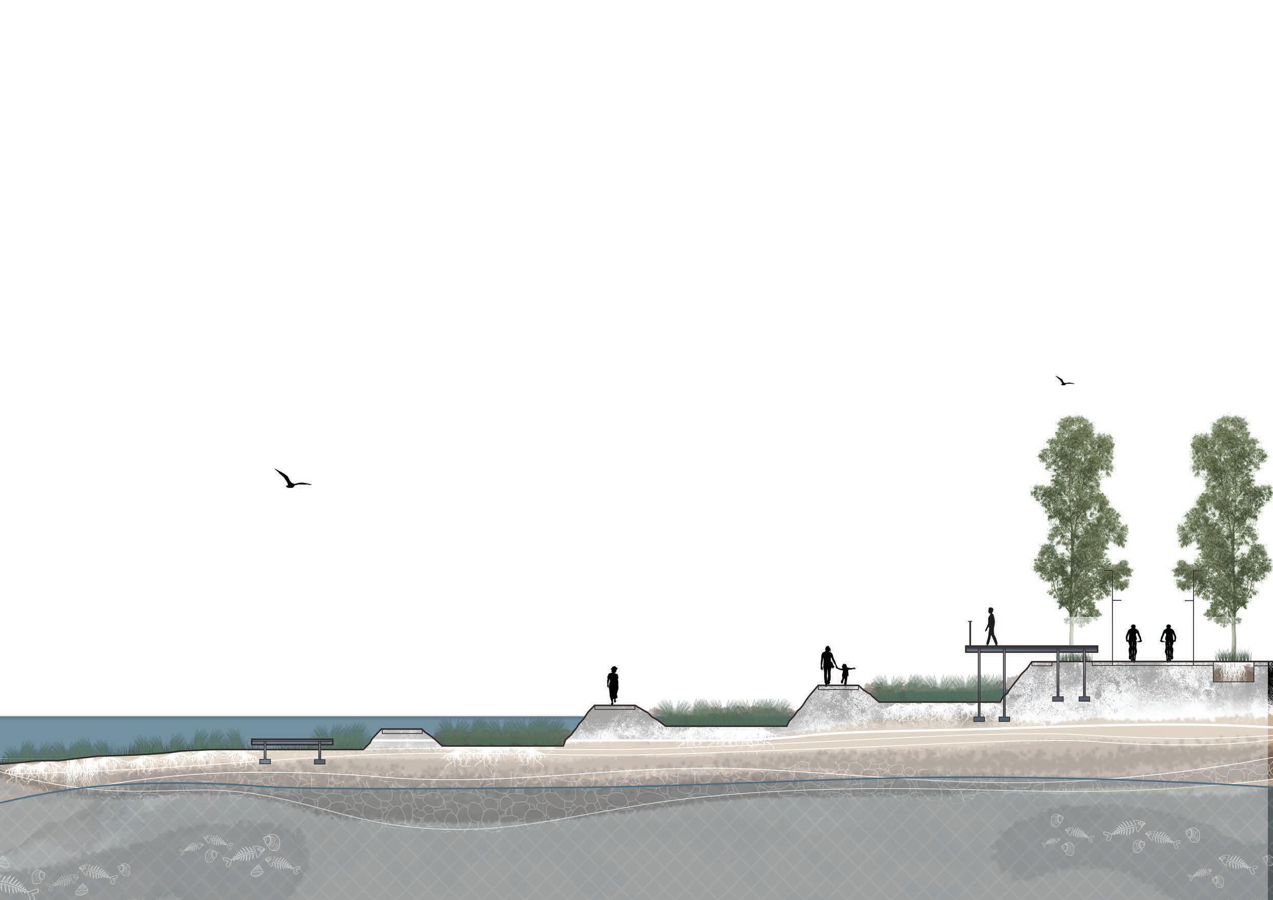
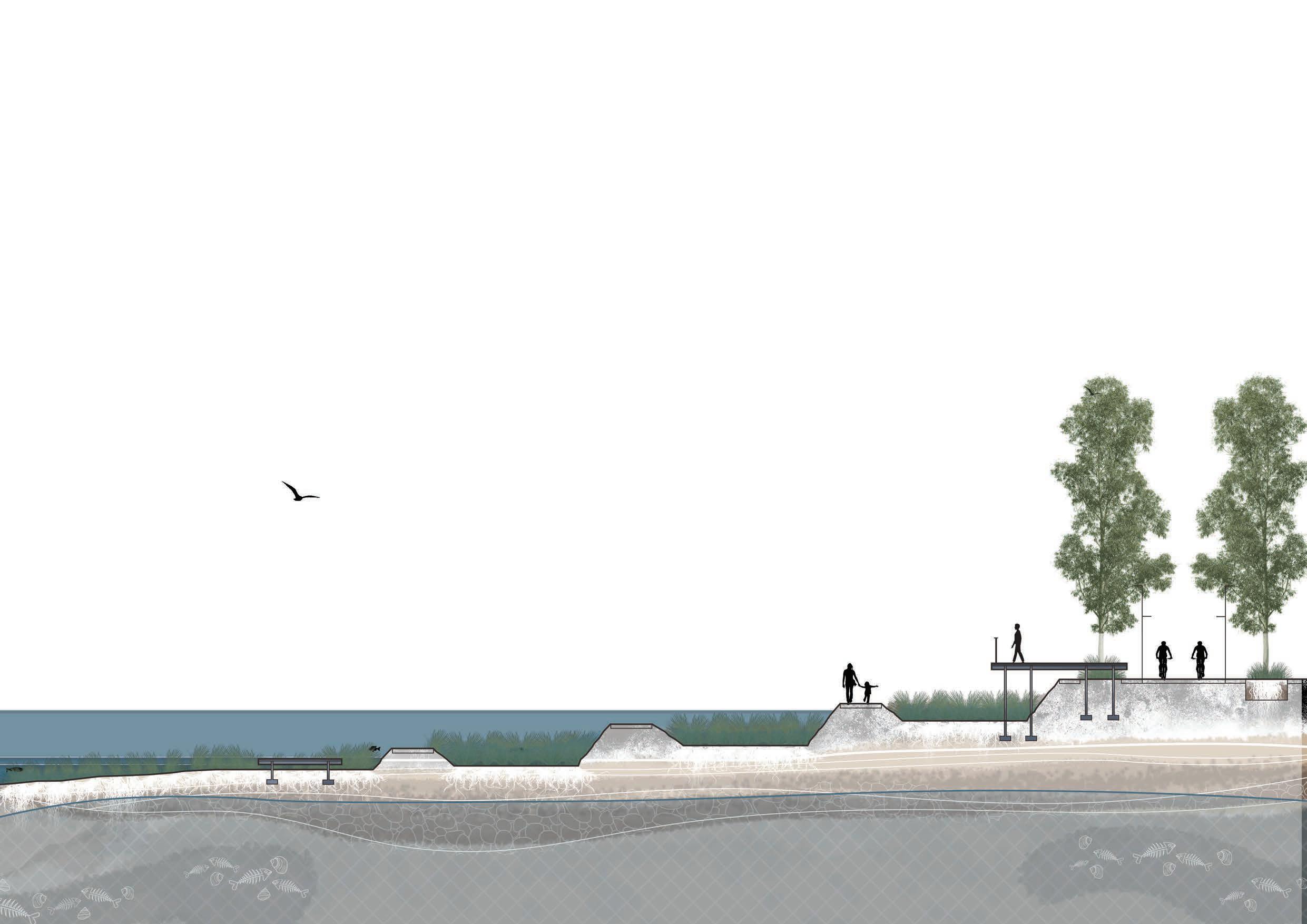
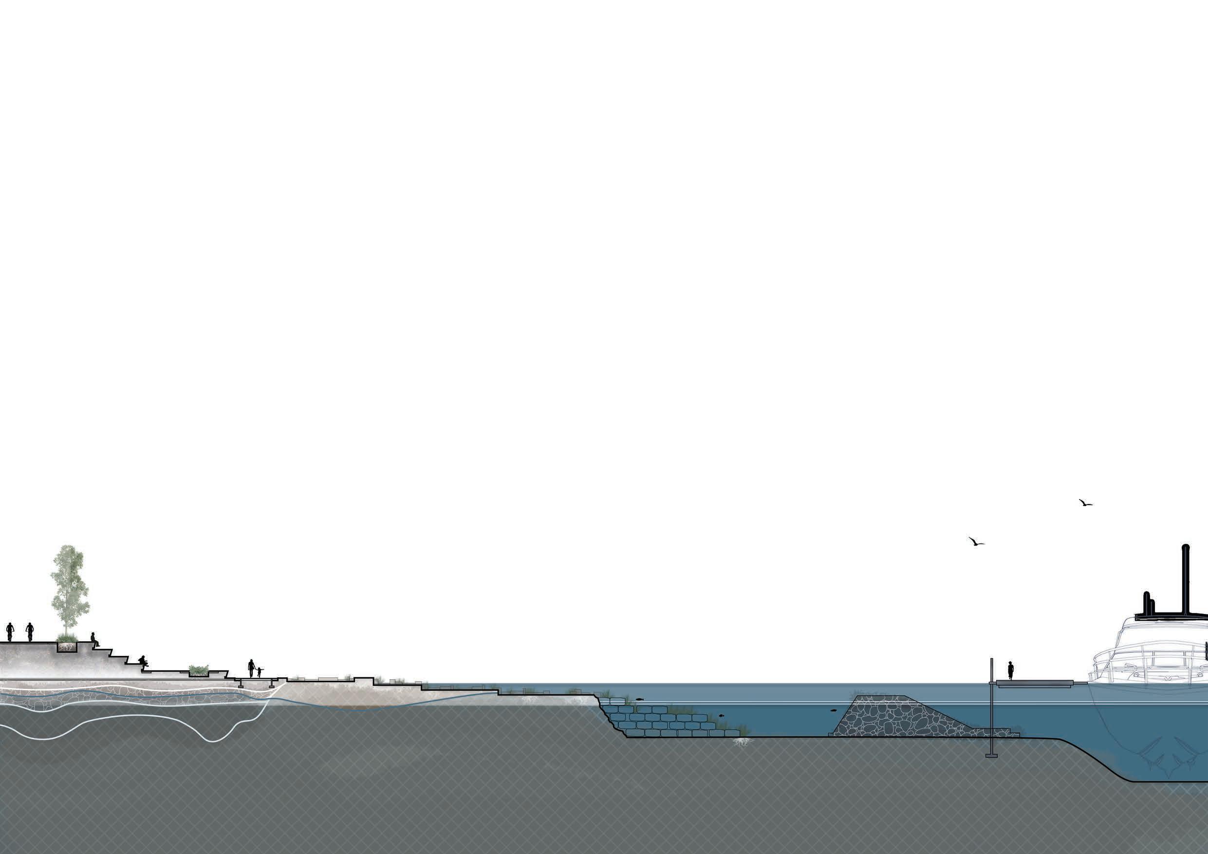
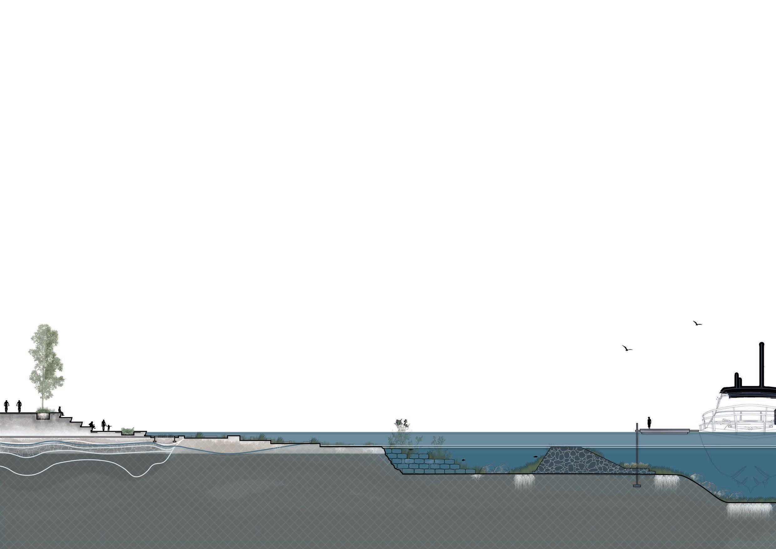
Throughout all three of its stages, INFLUX has been designed according to the following 5 different responses which the IPCC (Intergovernmental Panel on Climate Change) has outlined when responding to Sea Level Rise.
protection ecosystem based adaptation advance accommodation retreat
blocking extreme sea level hazards through hard coastal protection measures the conservation and restoration of ecosystems creation of new land by building into the sea a diverse set of biophysical and institutional responses to reduce vulnerability of coastal areas reduces exposure to coastal hazards by moving people, assets and human activities
The diagram on this page displays how INFLUX will spatially apply the IPCC’s 5 different responses when dealing with Sea Level Rise.
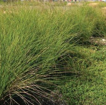
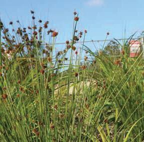
Ecosystem Based
Retreat
at a systems scale...
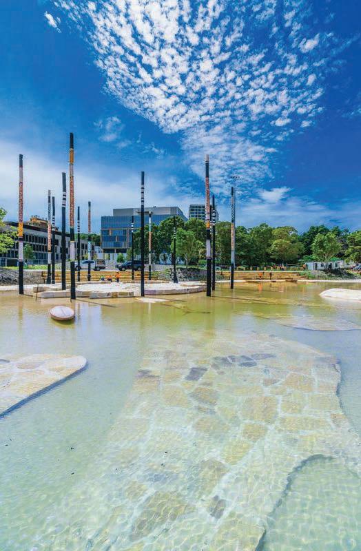
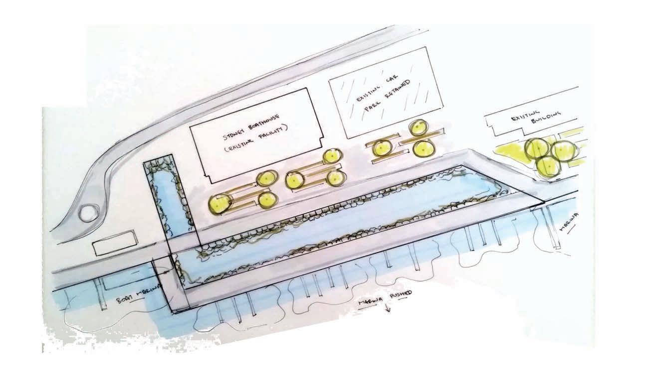
INFLUX is a journey that primarily consists of six unique anchors along ‘The Bays’ foreshore.
Anchor 1. That Ship Has Sailed
Anchor 2. Just Add Water
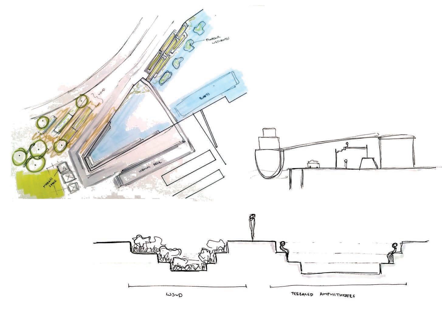
Anchor 3. Testing The Waters
Anchor 4. All Hands on Deck
Anchor 5. To Flood or Not To Flood
Anchor 6. Smooth Sailing
Anchor 1

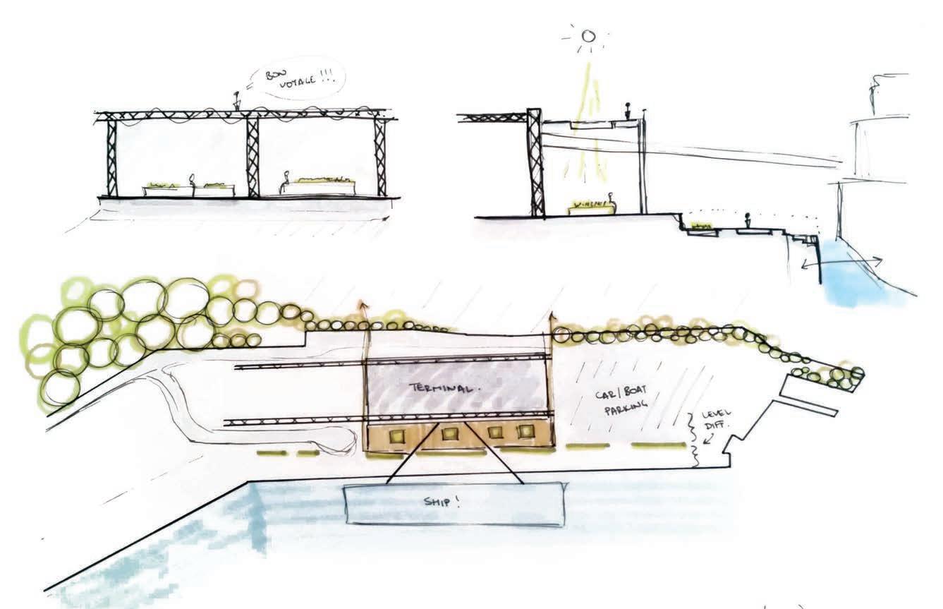
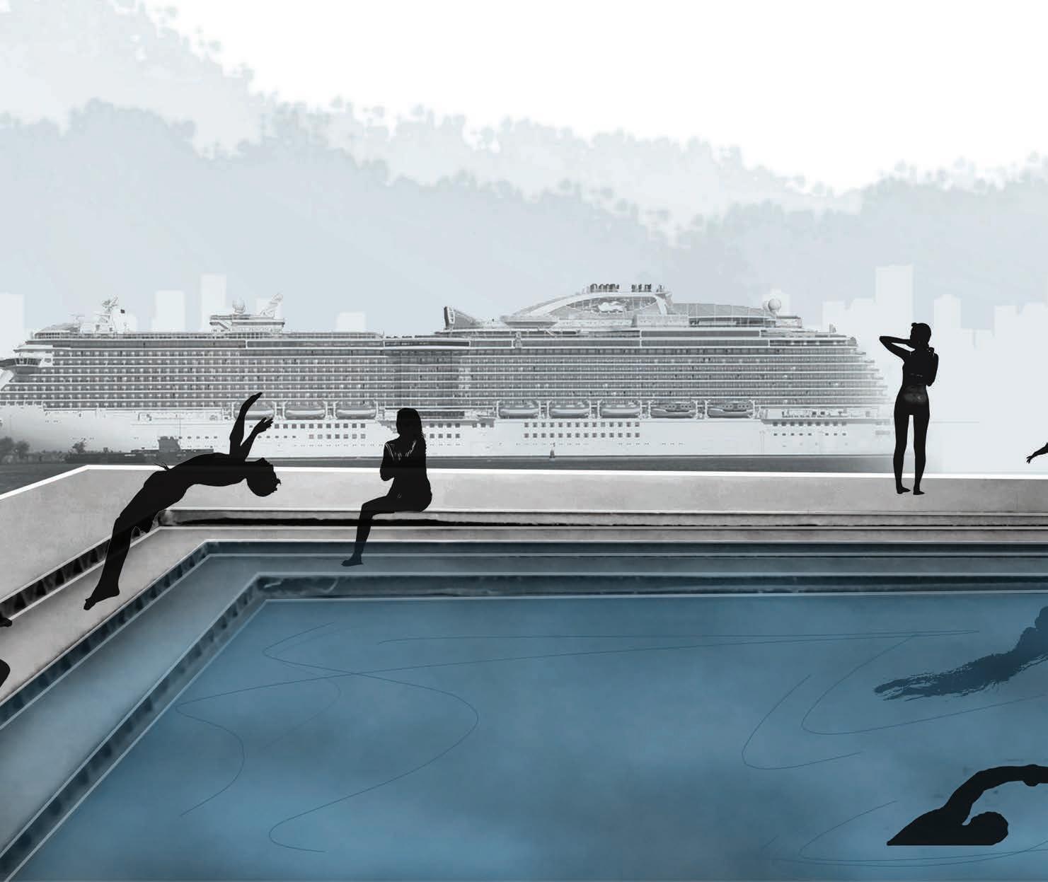
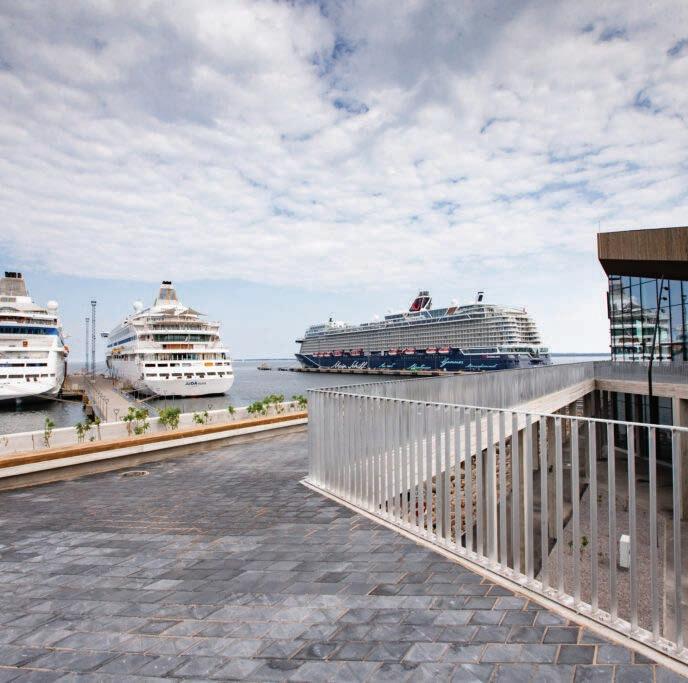
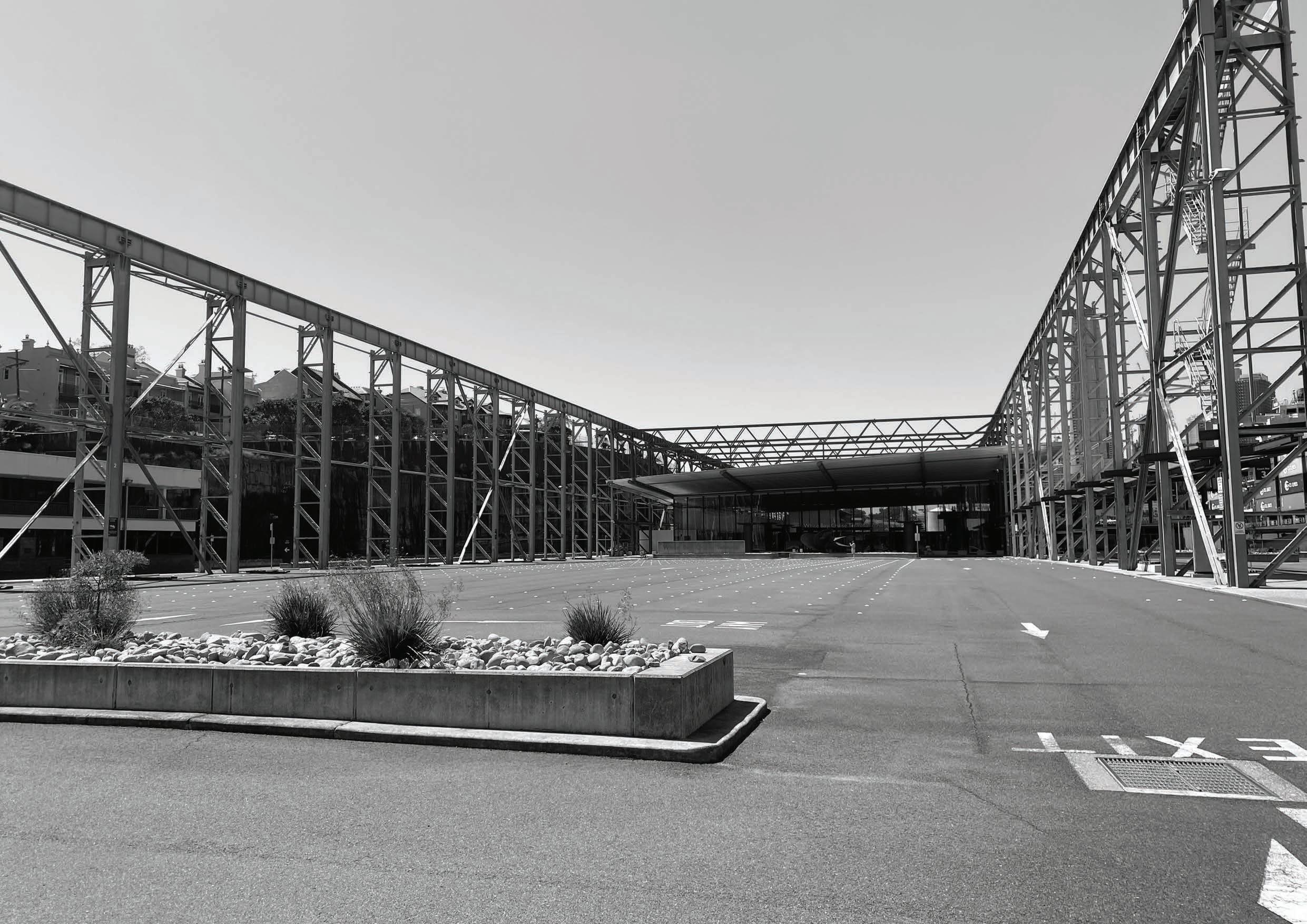
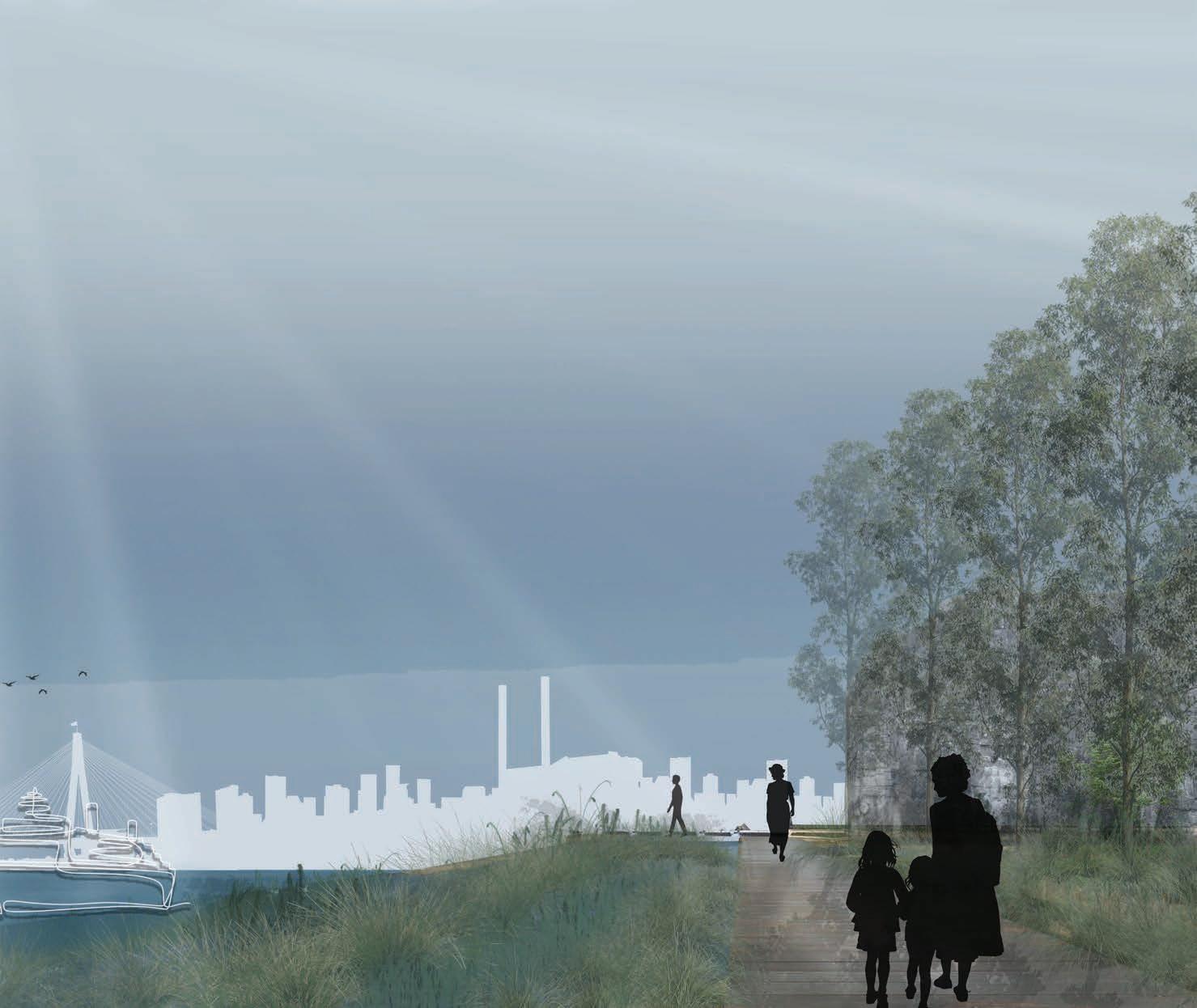
‘That Ship has Sailed’ focusses on the opportunities presented at the White Bay Cruise Terminal to be a place for the visitors and residents of ‘The Bays’ to view the incoming cruise ships, and when not in cruise season, be a spectacular place to view the city skyline. The following precedent images provide a snap shot as to how this would look like.
The Yearly Cruise Season at White Bay
SEPTEMBER APRIL
The Daily Cruise Activities at White Bay
5am
Cruise Ship Docks 6am-10am
Guests Disembark the Cruise Ship 8pm Cruise Ship Departs 11am-6pm Guests Embark the Cruise Ship
2


Anchor 3
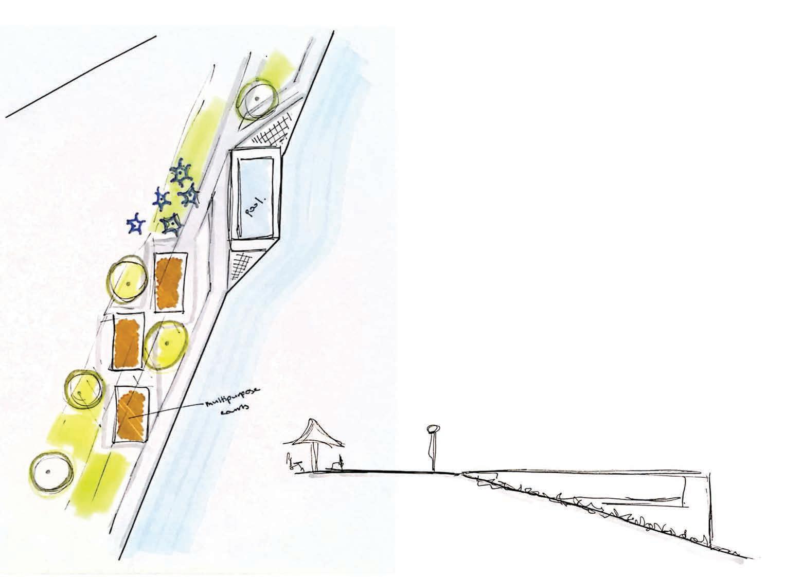
Anchor 4
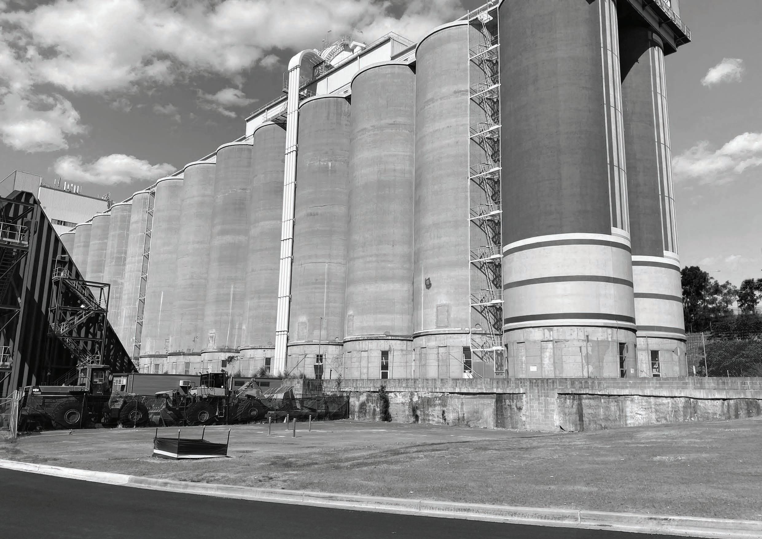
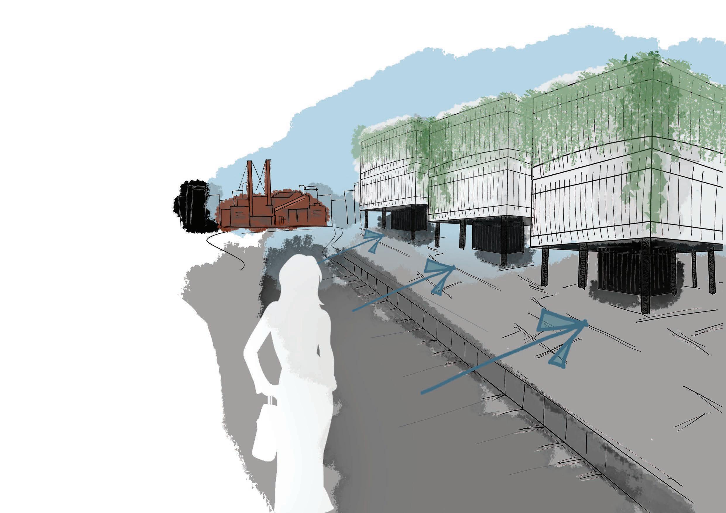
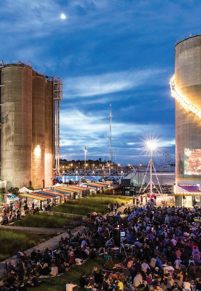
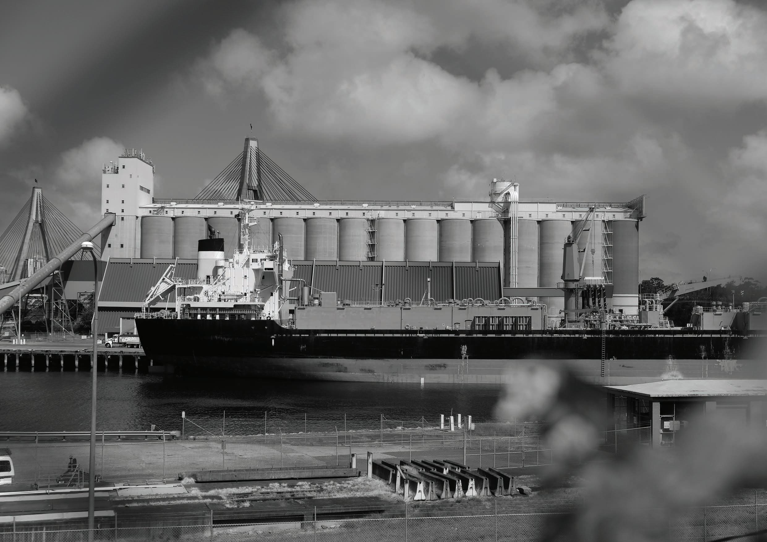
The anchor ‘All Hands on Deck’ is similar to that of ‘That Ship has Sailed’. ‘All Hands on Deck’ is centred around the White Bay Silos and allows visitors and residents of ‘The Bays’ to come up ‘close’ to the working waterfront - with a large viewing platform overlooking all the industrial activities and ship movements taking place. The following precedent images provide a snap shot as to how this would look like.
Anchor 5


Chapter 7.0 concludes INFLUX and discusses the potential future impact that INFLUX may have on ‘The Bays’ and the Sydney Harbour story.
- Koen Olthius // Architect and Founder of Dutch Firm ‘Water Studio’ “ ”
in the end we cannot fight water, we have to learn how to live with it
As we live in an age of rapid Sea Level Rise, the need to prioritise and design resilient waterfronts is everpresent. The impact which Sea Level Rise will cause on our natural and built environments will be enormous if not addressed.
By synthesising literature from a range of disciplines and drawing on examples from cities across the world,
INFLUX highlights the ‘waterfront greenway’ as a highly effective spatial strategy that can be used to address and manage Sea Level Rise at ‘The Bays’. It demonstrates how urban life does not need to be compromised to accommodate the influx of sea level at ‘The Bays’ or anywhere else in the world.
INFLUX also underlines the growing responsibility which landscape architects have in creating resilient waterfronts - optimising land to be used by both humans and non-humans in wake of different influxes of sea levels. So much so, that INFLUX will result in a 76.5% decrease in land inundated with water at ‘The Bays’. As shown in the drawings set out overleaf, a ‘do nothing’ approach will result in 51 hectares of ‘The Bays’ site being inundated with water - rendering the site impractical for any human activity. However, through adaptation strategies implemented at INFLUX, this can be reduced to 12 hectares (at a scenario of high tide for 3 metres of Sea Level Rise).
Although the design of INFLUX is site-specific to ‘The Bays’, its design interventions are usable, workable and successful examples of how to deal with Sea Level Rise in urban areas and opens up the opportunity for the design to be a precedent for future projects across Sydney Harbour and the world.
if we do nothing... if we apply INFLUX
If we follow a pathway with high emissions...by 2300 , it is projected that sea levels will rise by 3 metres
That is approximately 51 hectares of ‘The Bays’ to be inundated by Sea Level Rise.
If we apply INFLUX at ‘The Bays’ when sea level rise is projected to rise by 3 metres in 2300.
That is approximately 12 hectares of ‘The Bays’ to be inundated at high tide by Sea Level Rise.
All references are according to the UNSW Harvard Referencing Style.
Akpinar, A. (2016). ‘Factors influencing the use of urban greenways: A case study of Aydın, Turkey’, Urban Forestry & Urban Greening, Volume 16, Pages 123-131, Accessed 25 June 2021, <https://doi.org/10.1016/j.ufug.2016.02.004>.
ASPECT Studios n.d., PIRRAMA PARK, ASPECT Studios, Acccessed 24 November 2021, <https://www.aspect-studios.com/project/pirrama-park/c>.
Cechet et al. 2011, Australia’s coastline: adapting to climate change, Geoscience Australia, Acccessed 24 November 2021, <https://www.ga.gov.au/ ausgeonews/ausgeonews201103/climate.jsp>.
Crawshaw, P. (2009). ‘The Future of Greenways in Sydney’, University of New South Wales, Accessed 25 June 2021, <https://www.be.unsw.edu.au/ sites/default/files/upload/pdf/schools_and_engagement/resources/_notes/5A2_41.pdf>.
Department of Economic and Social Affairs 2015, THE 17 GOALS, The United Nations, Accessed 28 July 2021, <https://sdgs.un.org/goals>.
Luymes, D.T. & Tamminga, K. (1995). ‘Integrating public safety and use into planning urban greenways’, Landscape and urban planning, Volume 33, Pages 391-400. Accessed 25 June 2021, <https://doi.org/10.1016/0169-2046(94)02030-J>.
NSW Department of Planning, Industry and Environment 2021, DRAFT Bays West Place Strategy, NSW Government, Accessed 28 July 2021, <https://shared-drupal-s3fs.s3-ap-southeast-2.amazonaws.com/master-test/fapub_pdf/00+-+Planning+Portal+Exhibitions/ Bays+westDraft+Bays+West+Place+Strategy_low+resolution+version.pdf>.
nyc.gov 2021, Brooklyn Bridge Park, nyc.gov, Acccessed 24 November 2021, <https://www.aspect-studios.com/project/pirrama-park/>.
Tang, H & Lukenda, J. (2019). ‘Rising Seas: Adaptable Planning Strategies for Coastal Urban Greenways - Case Studies in the US and China’, Proceedings of the Fábos Conference on Landscape and Greenway Planning, Volume 6, Accessed 12 July 2021, <https://scholarworks.umass.edu/cgi/ viewcontent.cgi?article=1056&context=fabos>.
Turf Design 2021, GOSFORD LEAGUES CLUB FIELD, Turf Design, Acccessed 24 November 2021, <https://turfdesign.com/2020/12/01/gosford-leaguesclub-field/>.
United Nations Security Council 2021, Climate Change ‘Biggest Threat Modern Humans Have Ever Faced’, World-Renowned Naturalist Tells Security Council, Calls for Greater Global Cooperation, The United Nations, Acccessed 24 November 2021, <https://www.un.org/press/en/2021/sc14445.doc. htm>.