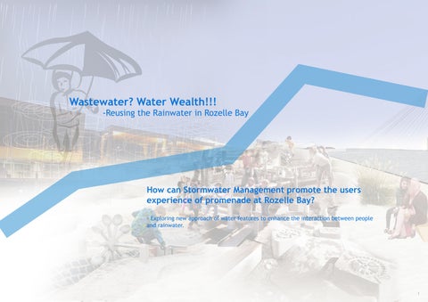
How can Stormwater Management promote the users experience of promenade at Rozelle Bay?
- Exploring new approach of water features to enhance the interaction between people and rainwater.
1.0 Framework
2.0 The Site
3.0 Site Analysis
4.0 Design Process
5.0 Detail Design
6.0 Conculsion 3-8 9-11 12-19 20-30 31-53 54-56
1.0 Framework
STRUCTURE
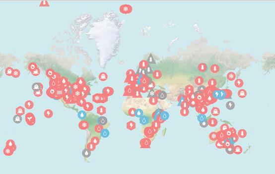
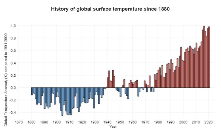
The effects of human-caused global warming are happening now, are irreversible on the timescale of people alive today, and will worsen in the decades to come.
Effects that scientists had predicted in the past would result from global climate change are now occurring: extreme weathers, accelerated sea level rise and longer, more intense heat waves (NASA, 2021).
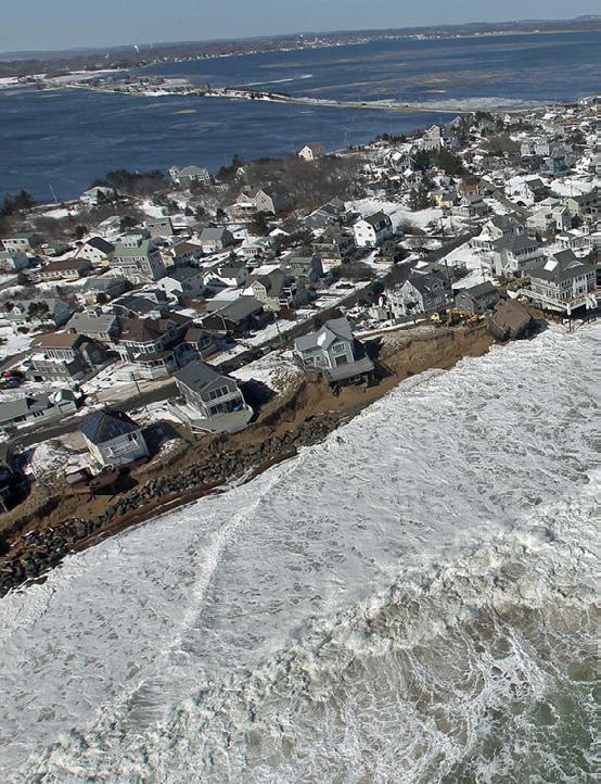
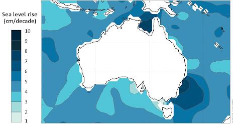
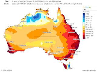
In Australia the consequences of sea level rise will include increased flooding of coastal areas and are likely to result in coastal erosion, loss of beaches, and higher storm surges that will affect coastal communities, infrastructure, industries and the environment (CSIRO, 2020).
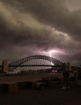
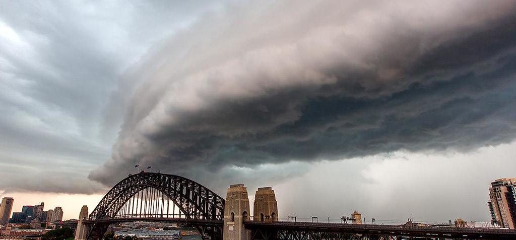
1.3 What’s the effect in Rozelle Bay?
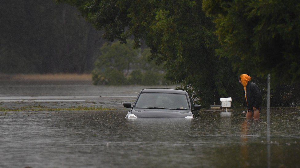
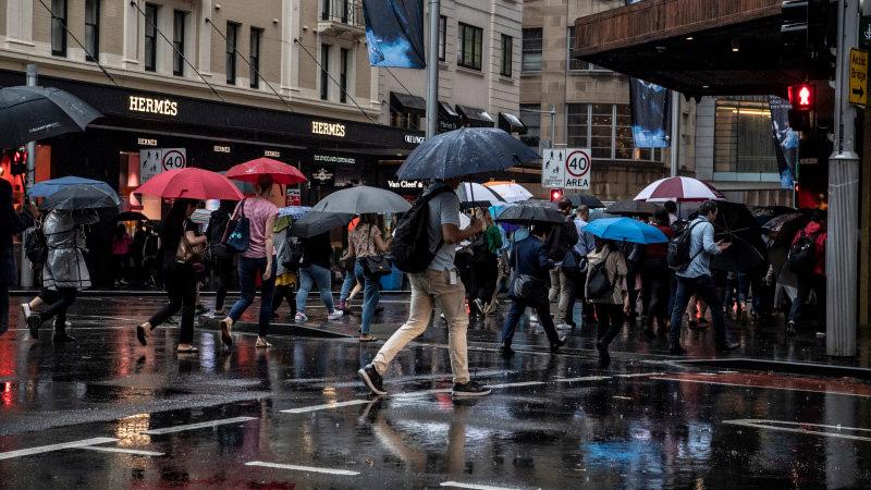
Days of torrential downpours have caused rivers and dams to overflow around Sydney - the state capital - and in south-east Queensland.
The military is being deployed to help with search and rescue, in what has been called a "one-in-50-years event". (BBC NEWS, 2021)
The latest round of wild weather has brought large hail and heavy rain as supercell thunderstorms formed over eastern Australia.
Parts of Sydney have already felt the brunt (ABC NEWS, 2021)
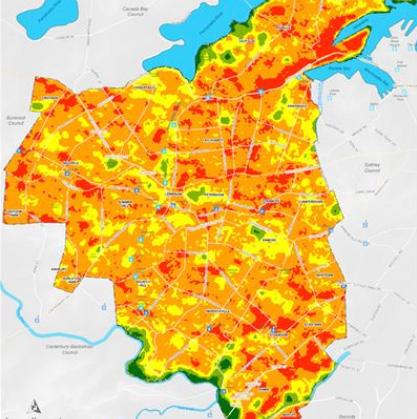
The Bays percinct is one of the hottest area in tis region, Urban heat island effect seriously affect whole site.
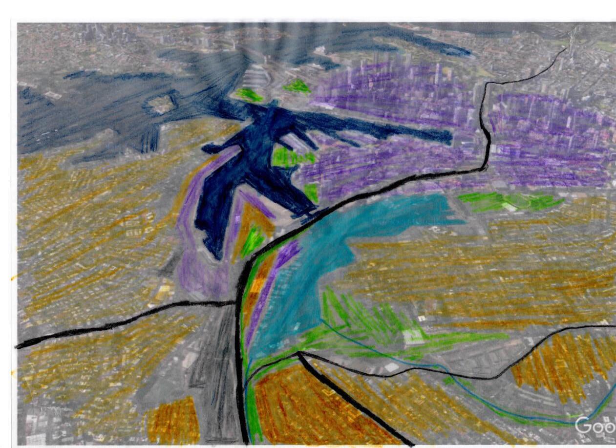
In the visible future, sea level rise’s effect will result in the many area under the water.
Sea Level Rising(4m)
Urban Heat Island Effect
How we deal with Storm water?
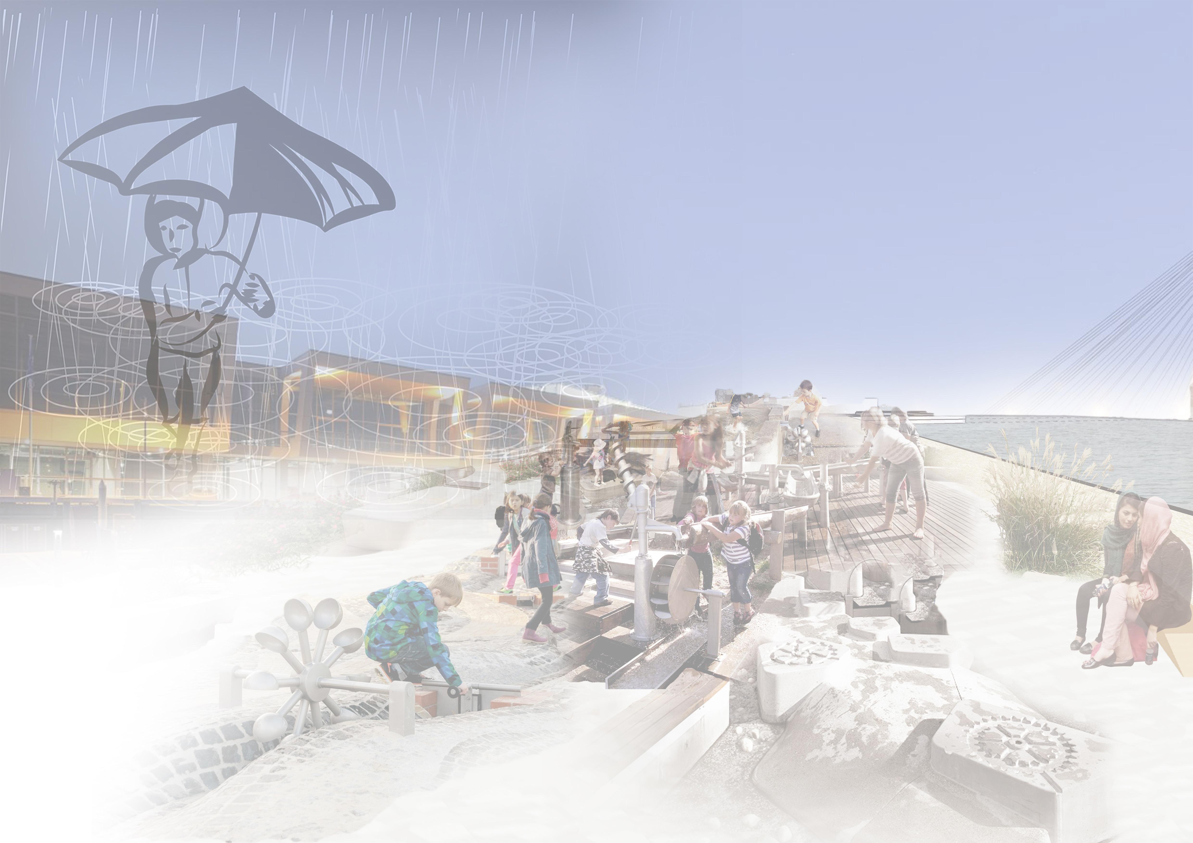
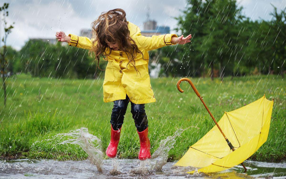
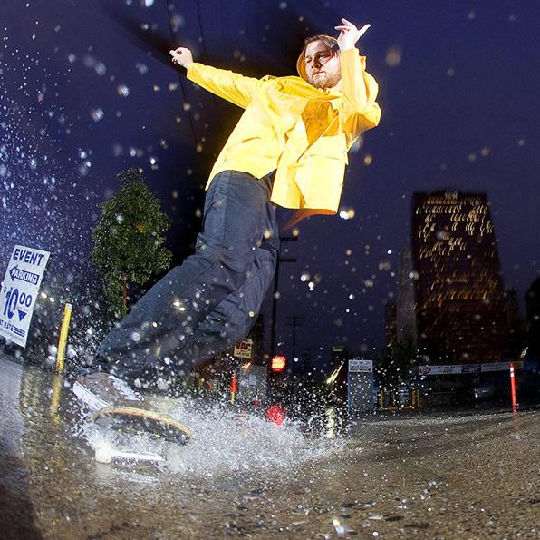
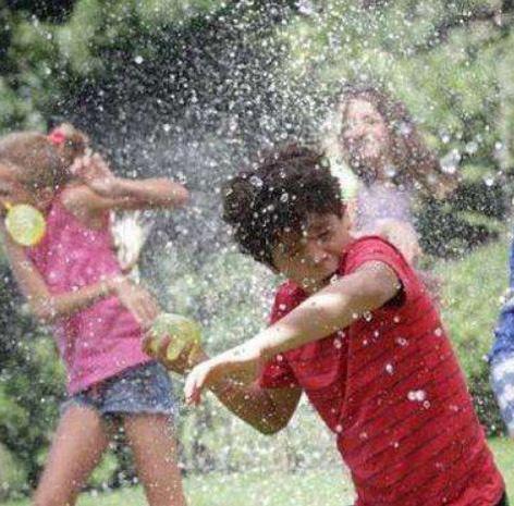
We flee the rain We play with the rain
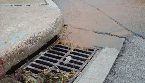
Storm runoff causing flooded sewers has been thought to be the major source of wastewater pollution to Sydney coastal waters ( Birch et al., 2015 ).
Water-logging
From the thinking of WATER 4.0, finding the balance between storm water and the anthropocene.
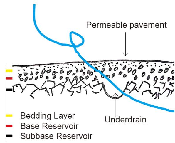
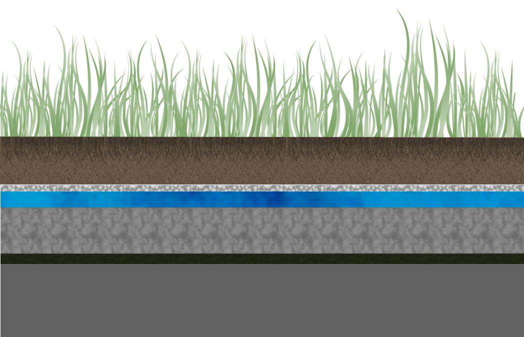
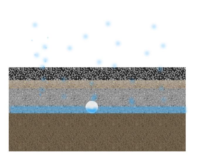
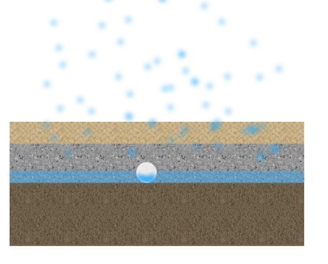
The term low impact development (LID) refers to systems and practices that use or mimic natural processes that result in the infiltration, evapotranspiration or use of stormwater in order to protect water quality (US EPA, 2021).
Sponge City Strategy bases on the LID, which is a modern storm water management approach to help solve drainage problems, fully utilise land resources and promote sustainable development (DAISY GILL, 2021).
To combat climate change, the “Sponge City” concept to be adopted in new developments for more effective drainage and rainwater reuse to enhance urban flood resilience by the principle of infiltration, retention, storage, purification, reuse and discharge (DSD, 2017).
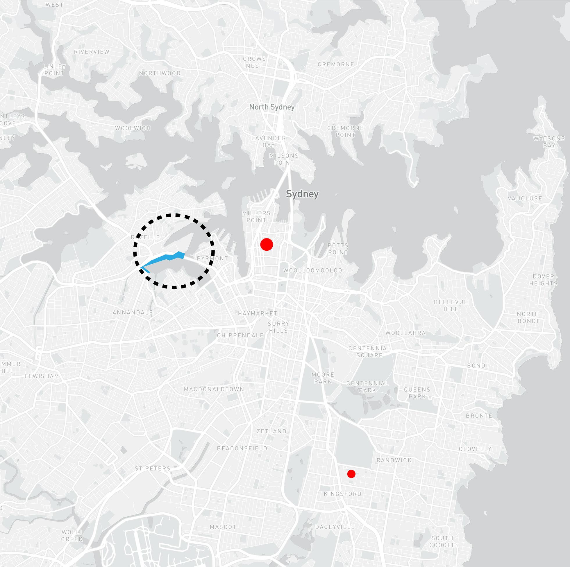
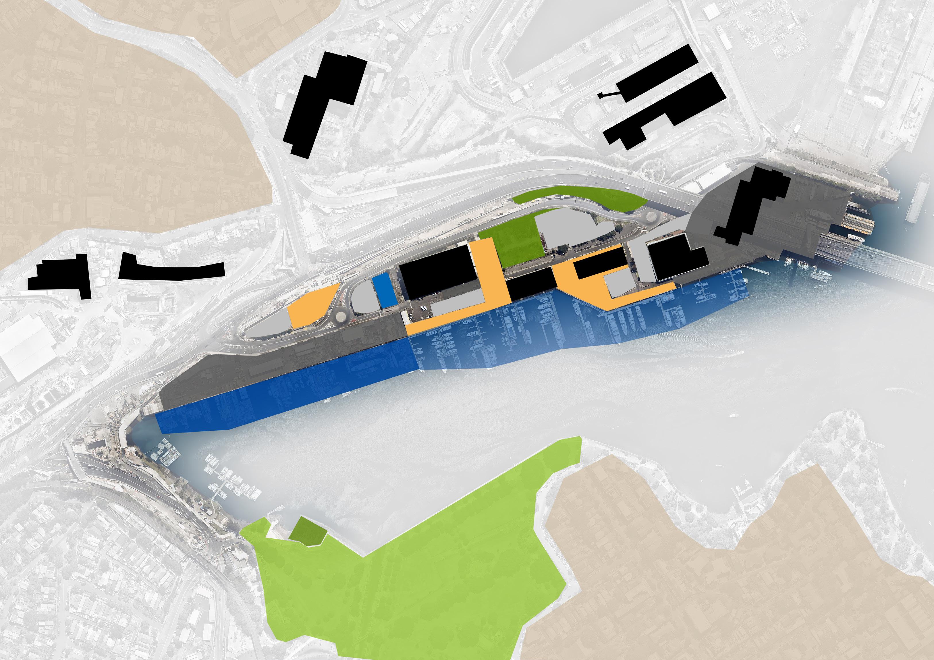
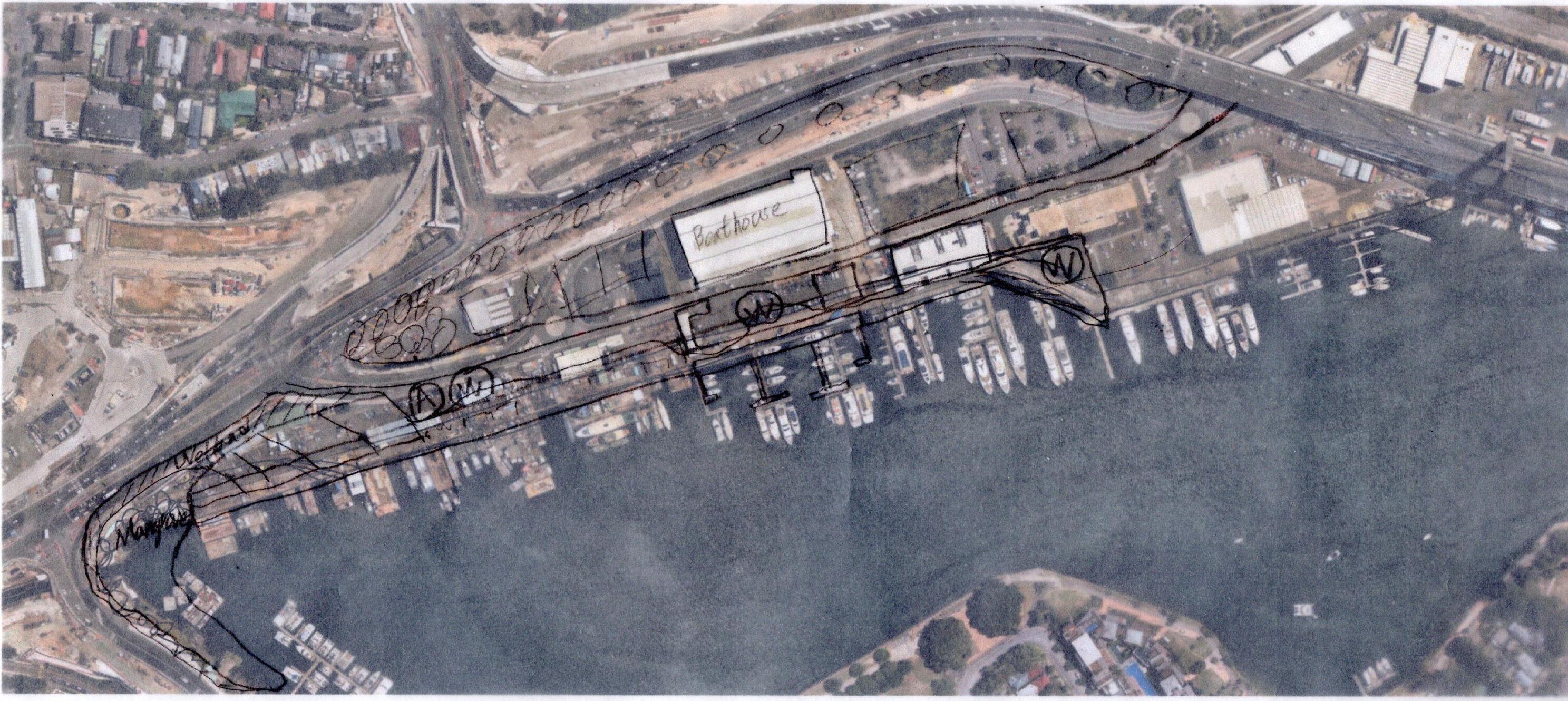
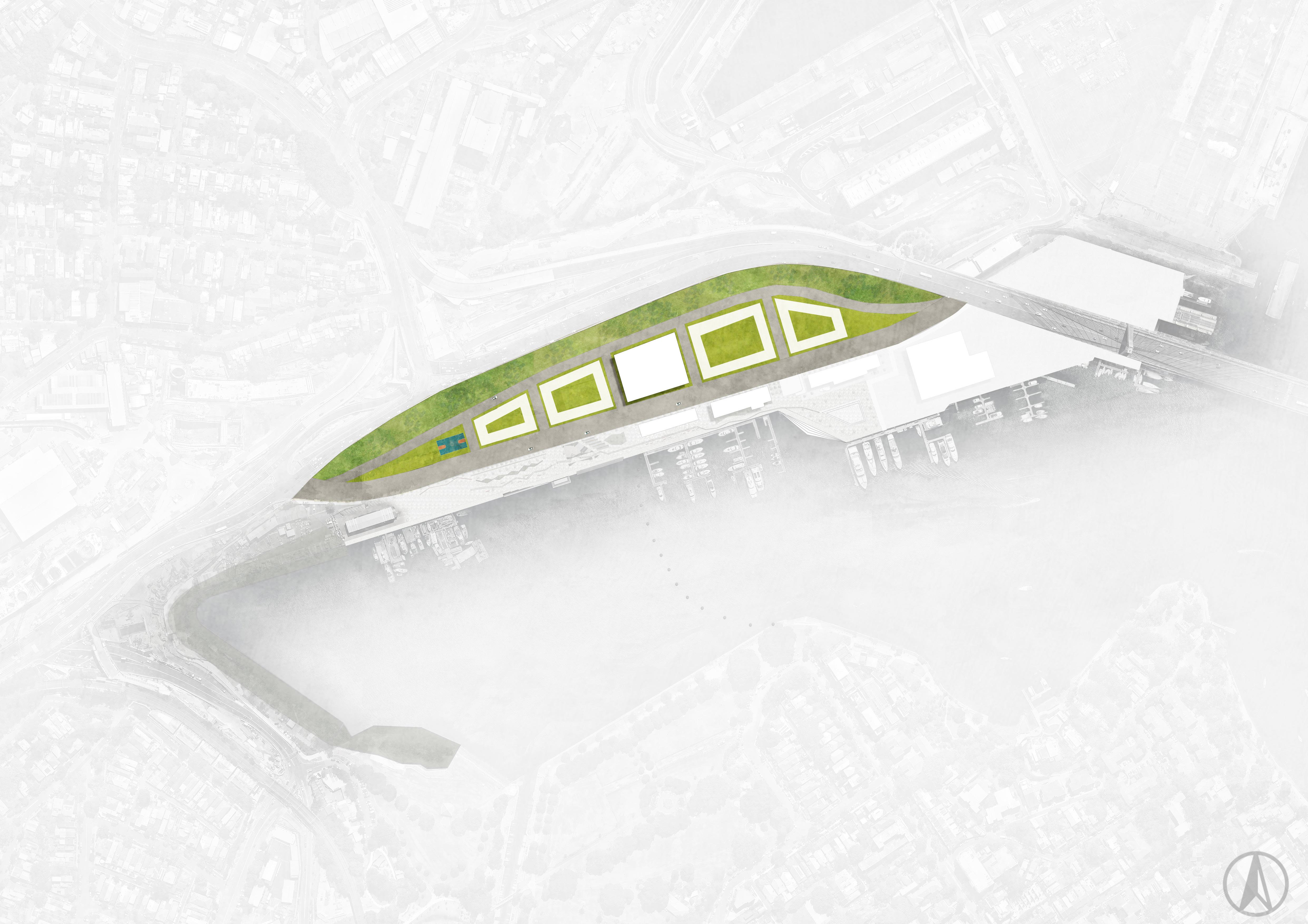
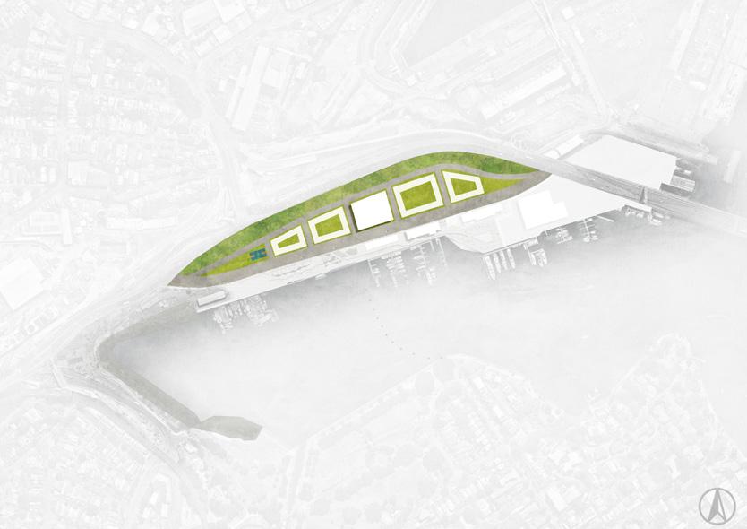
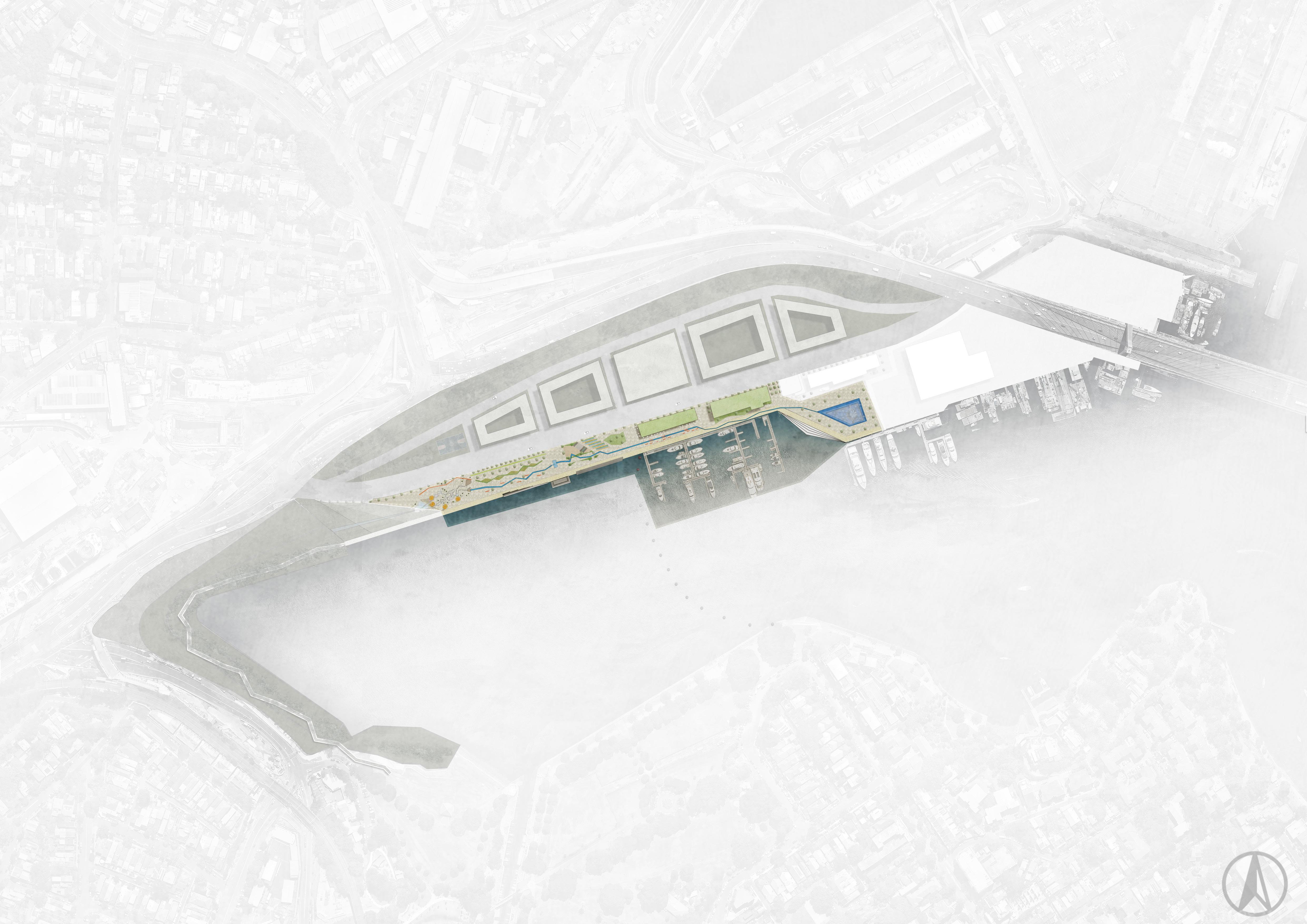
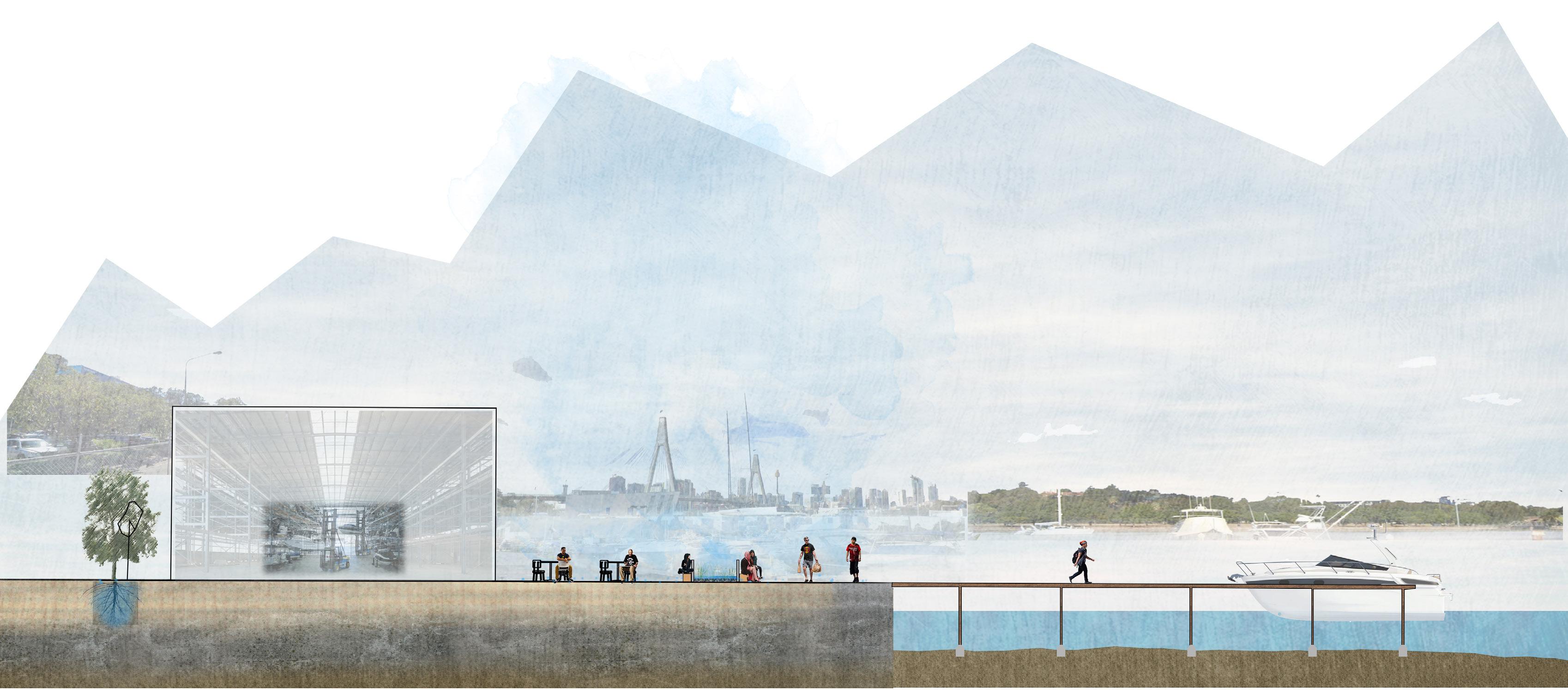
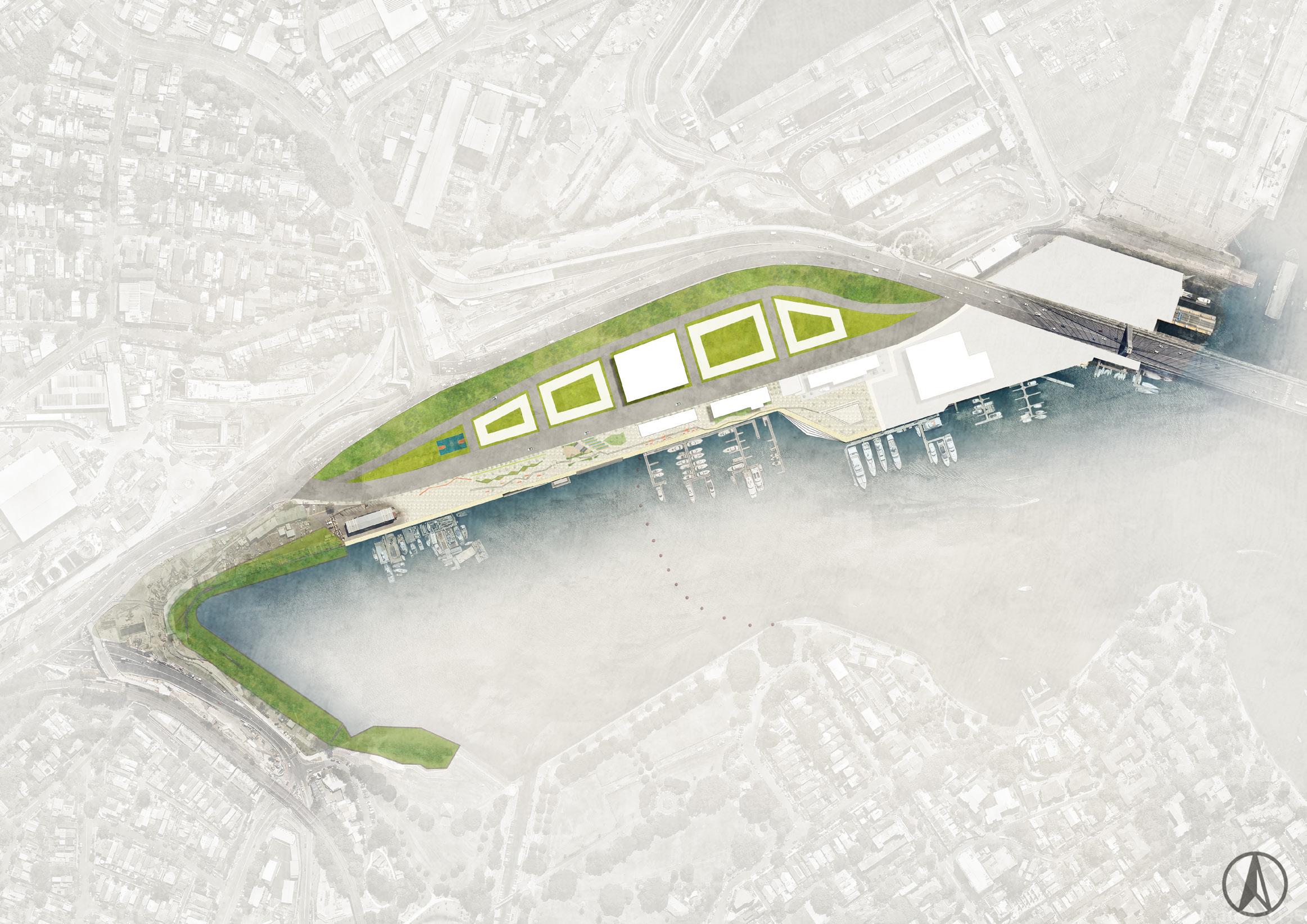
2.0 The Site
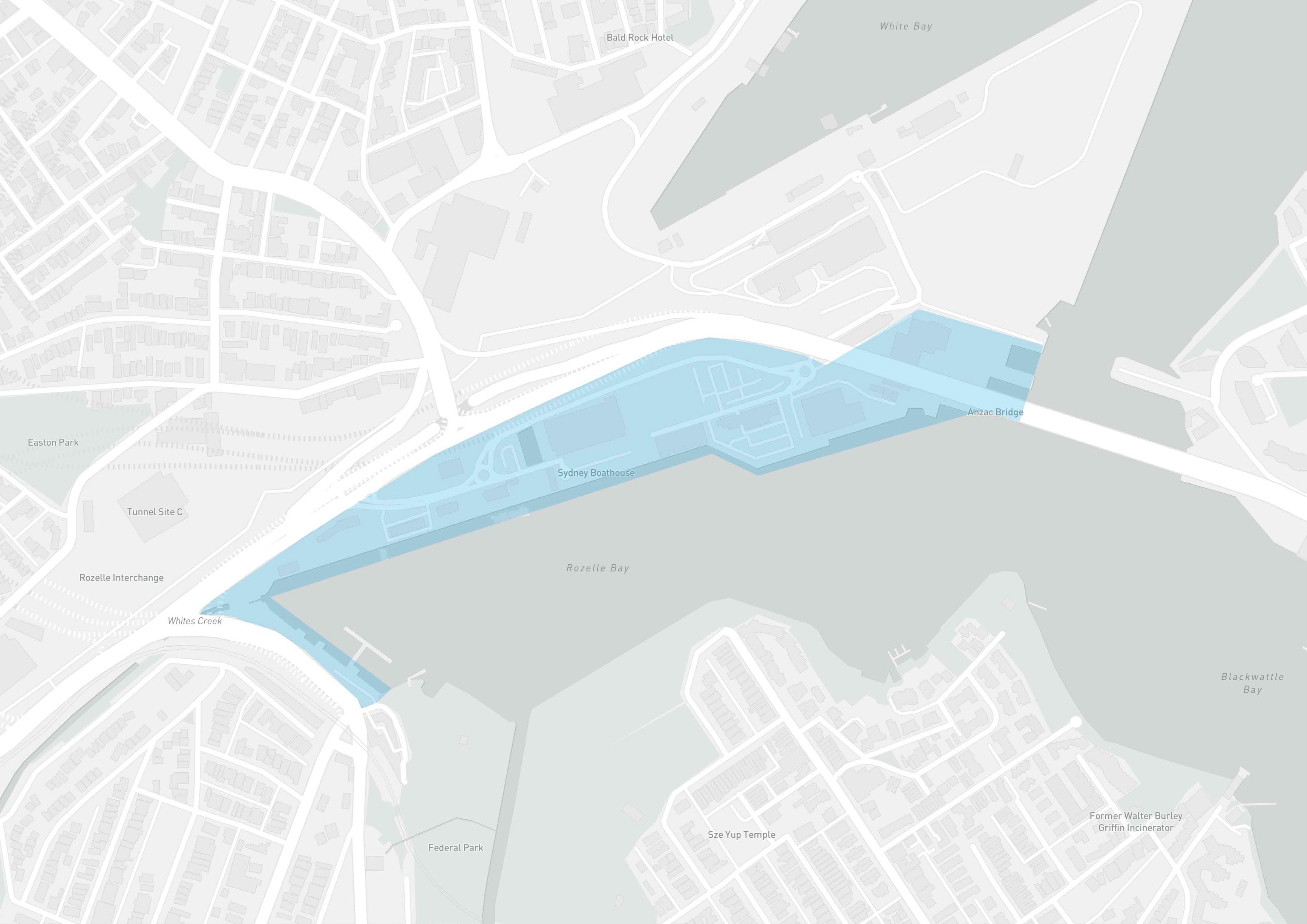
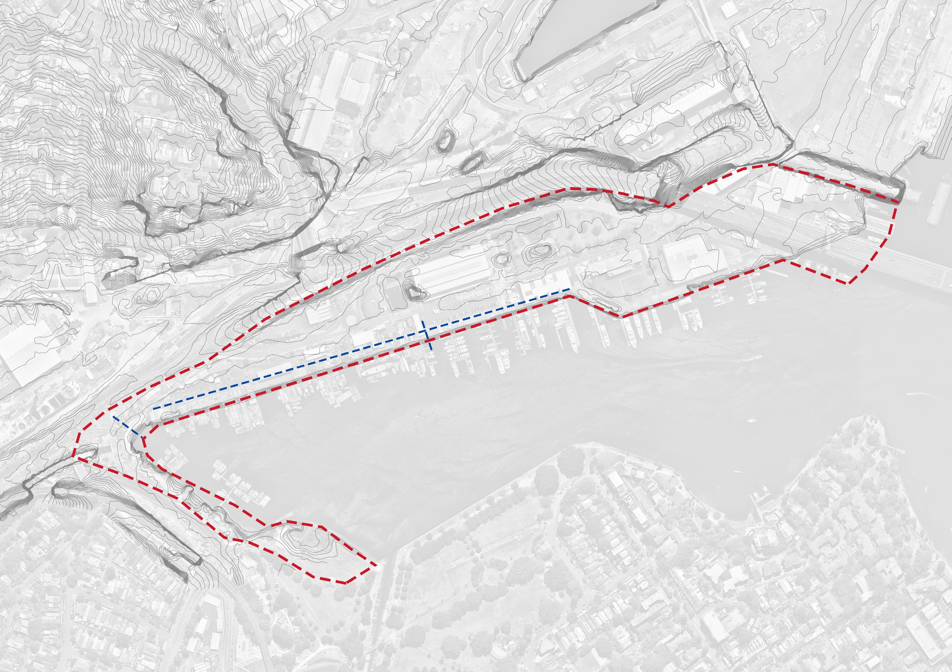
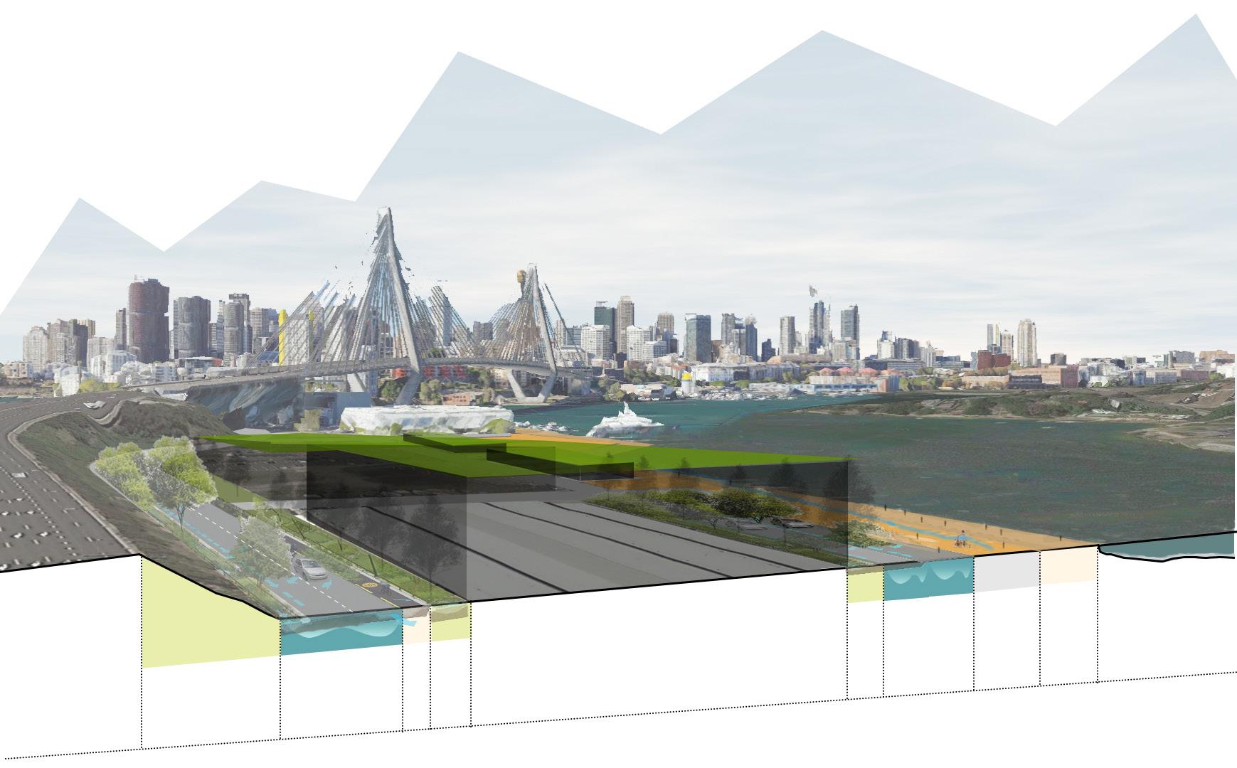
Sydney Context - Located west of Sydney CBD area, A inner bay of Sydney harbour, overlooking the city. The NSW major renew project.
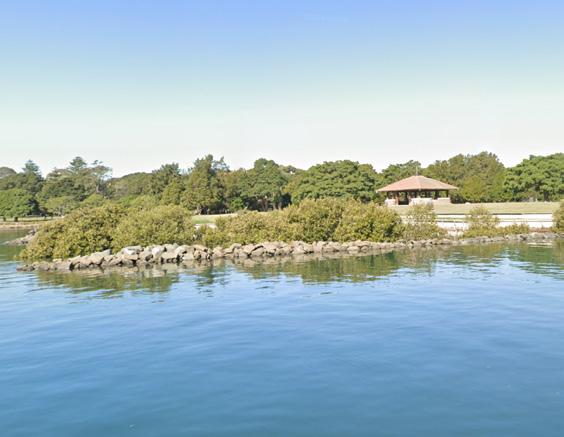
Local context - Linearly connected with Jubilee park. The other shore is fish market & Pyrmont.
Option 1: Keep the original marine area, design a new green space for site, but it is different to suit in Rozelle bay surrounding environment.
Rozelle rail yards
Option 2: The shoreline is a opportunity for public, becuase exsiting waterfront is private space, trying to develop a public waterfront place.
Option 3: Whole Rozelle Bay as a system, specific design for Rozelle bay, based on the local history, culture and site conditions, considering the issues of the site then improve it, develop the site values.
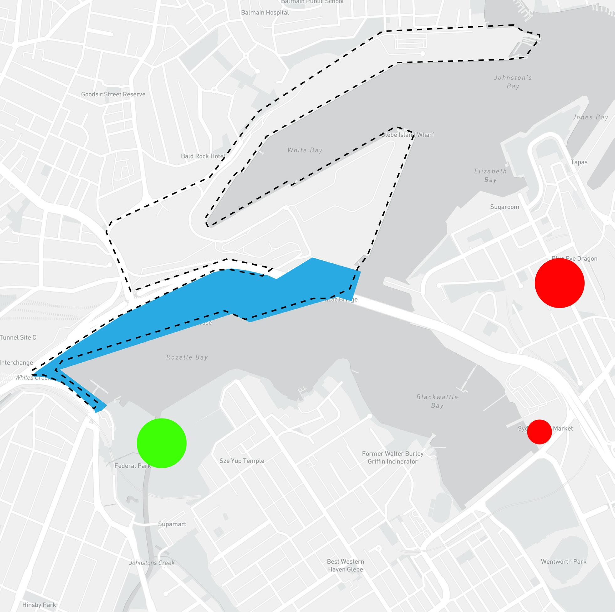
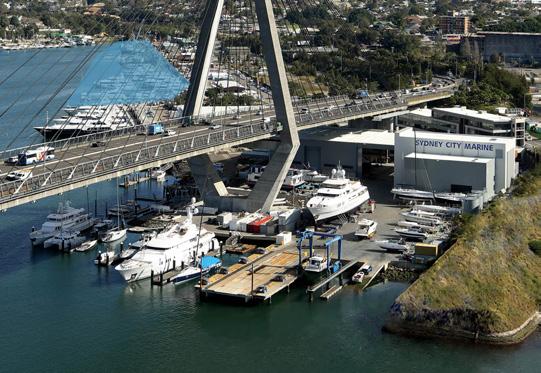
White bay power station Gleble Island Silo
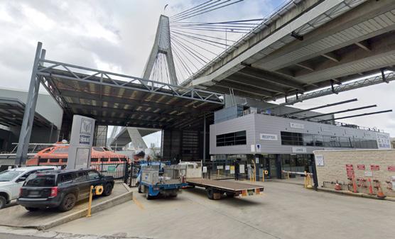
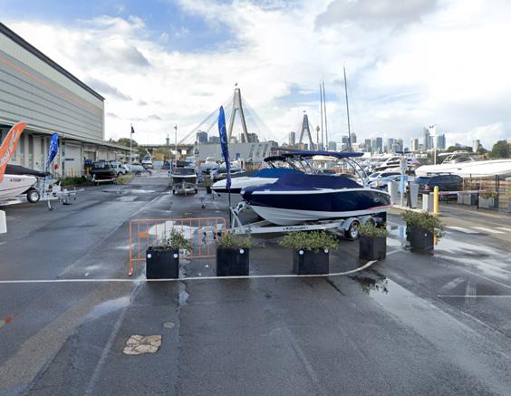
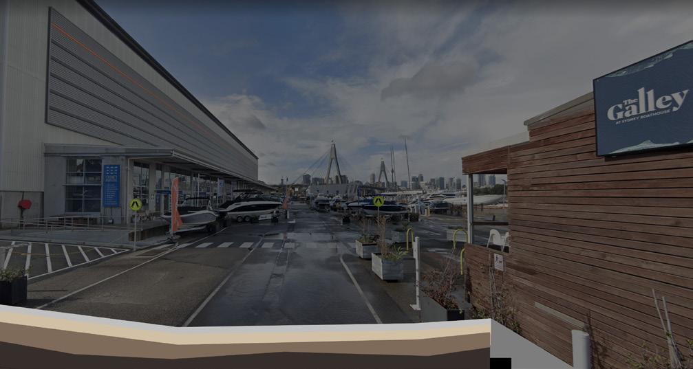
Sydney boathouse Maritime service centre
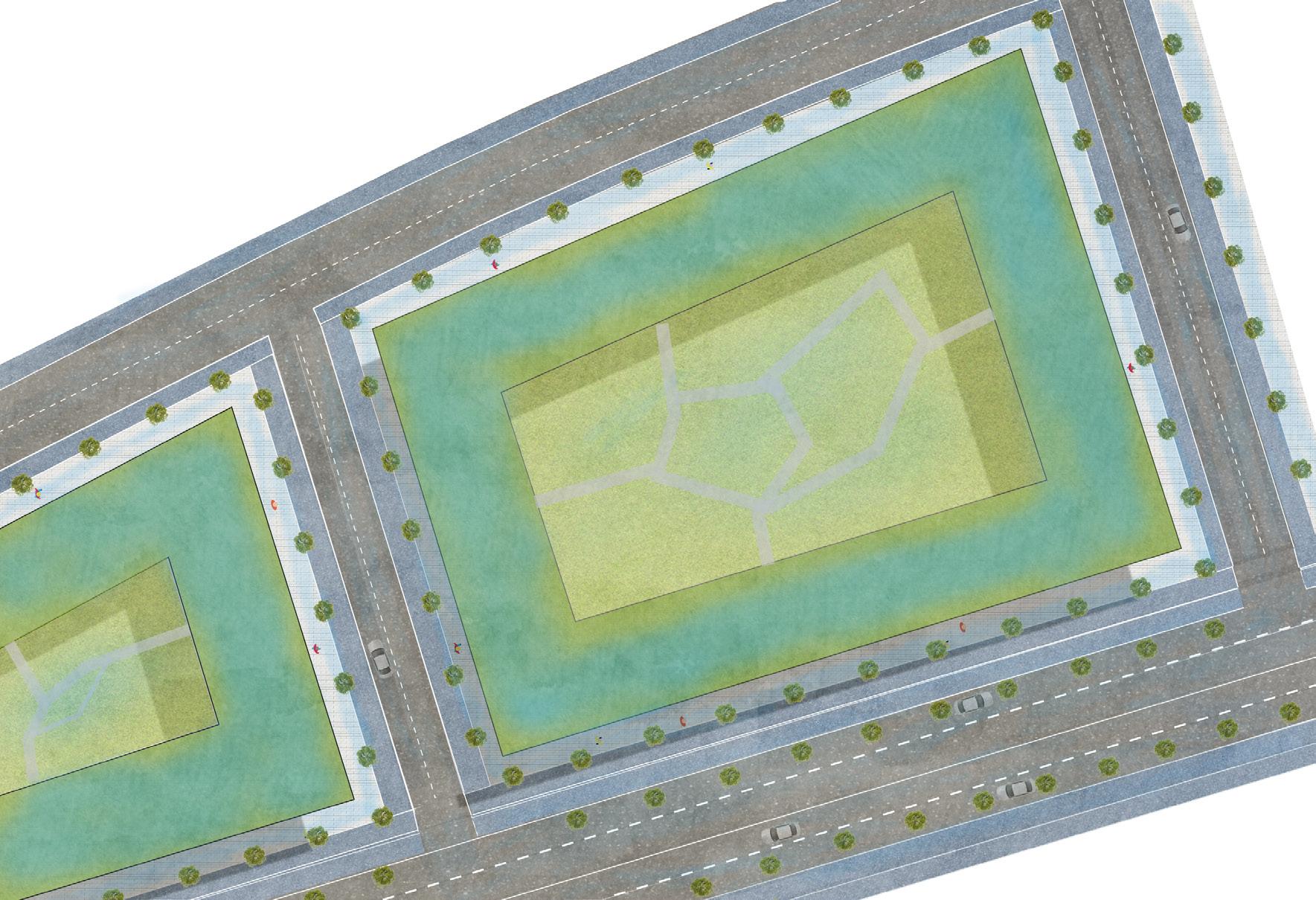
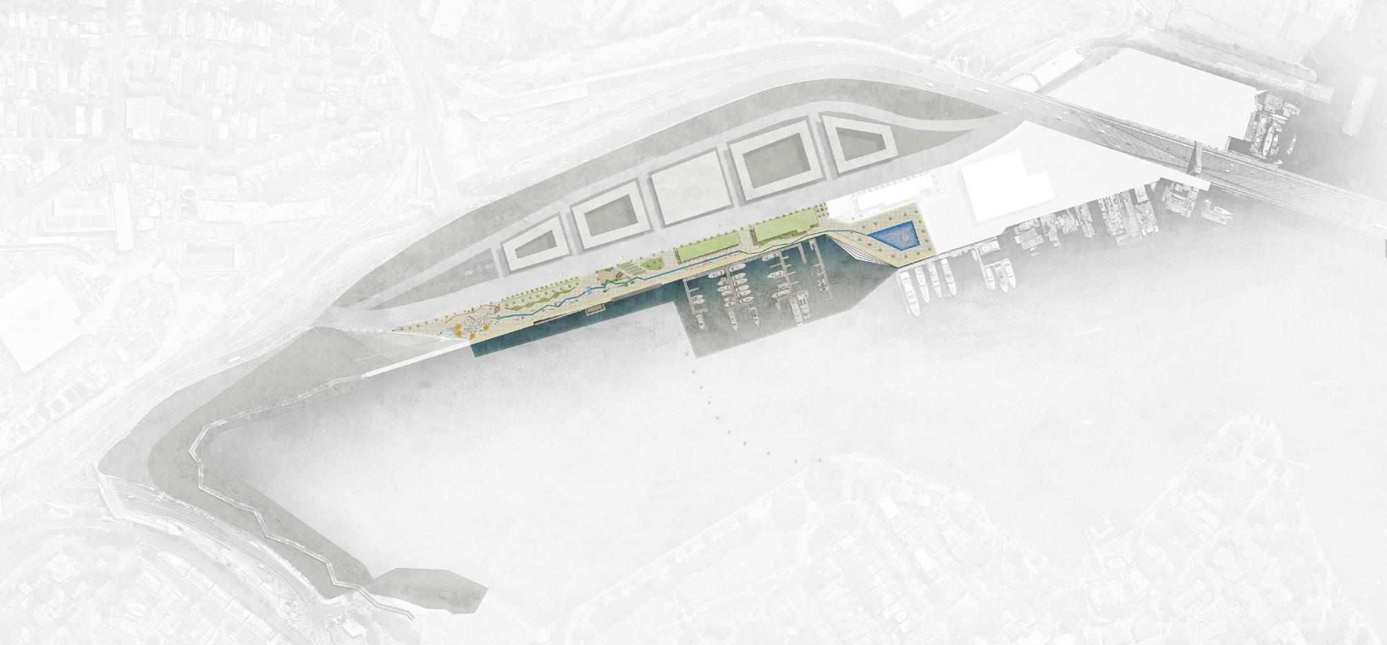
3.0 Site Analysis
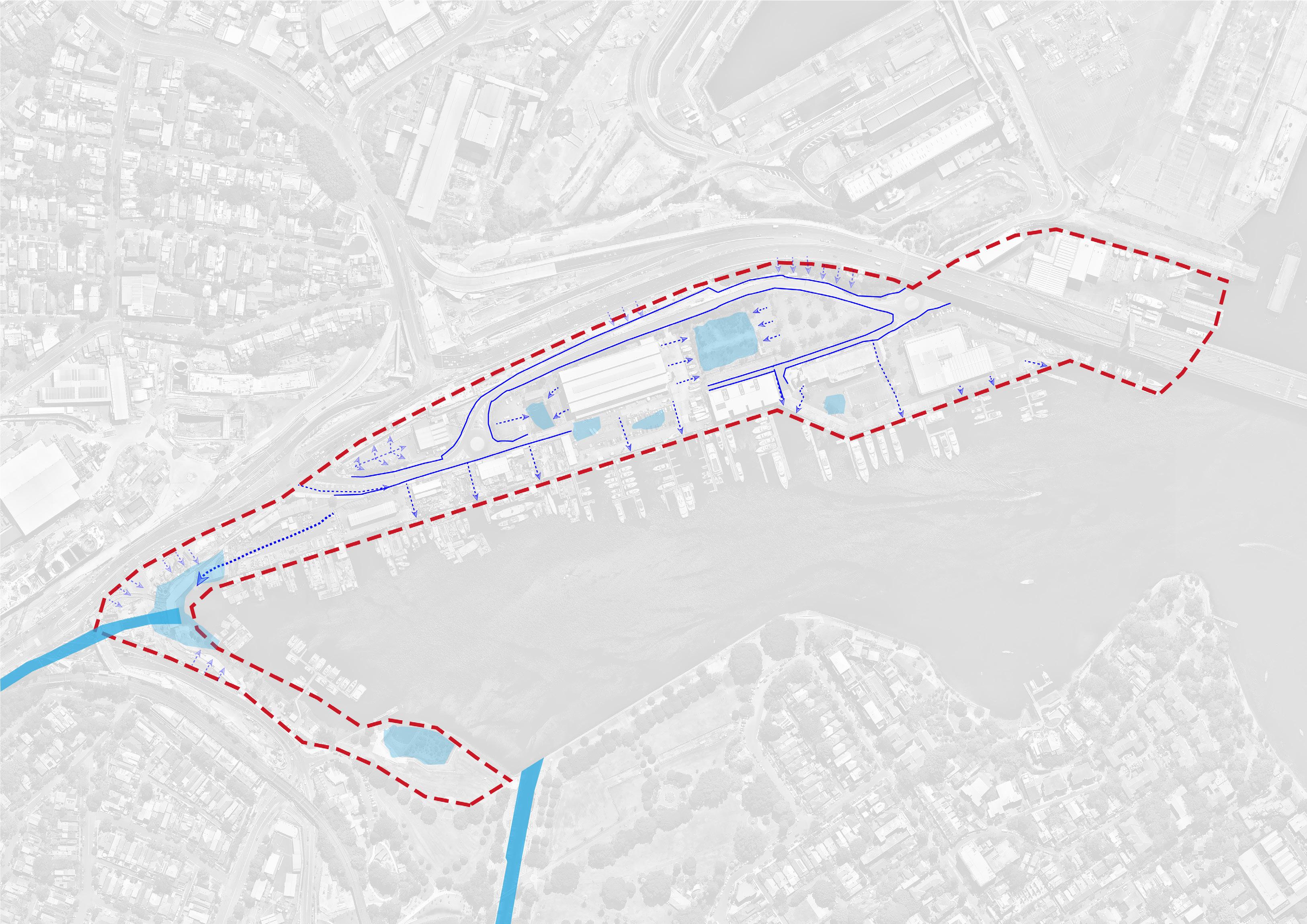
Journey of Rainfall
130 000 000 Litres
If the rain fall can be collected by 70% (Max collection efficiency 95%), there are enough water for water features.
Waterplay Days
Water play time analysis based on the weather, temperature and public resting time.
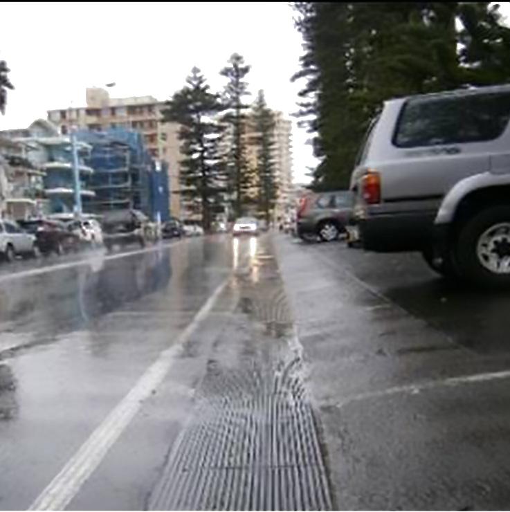
A few drainage along roads.
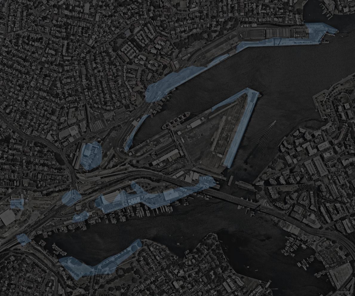
A lot of stormwater free run into the bay with toxins.
Many water logging area after rainfall, rainwater run off from surrounding cliff, high way.
Concerned area
Water-logging
Existing drainage line
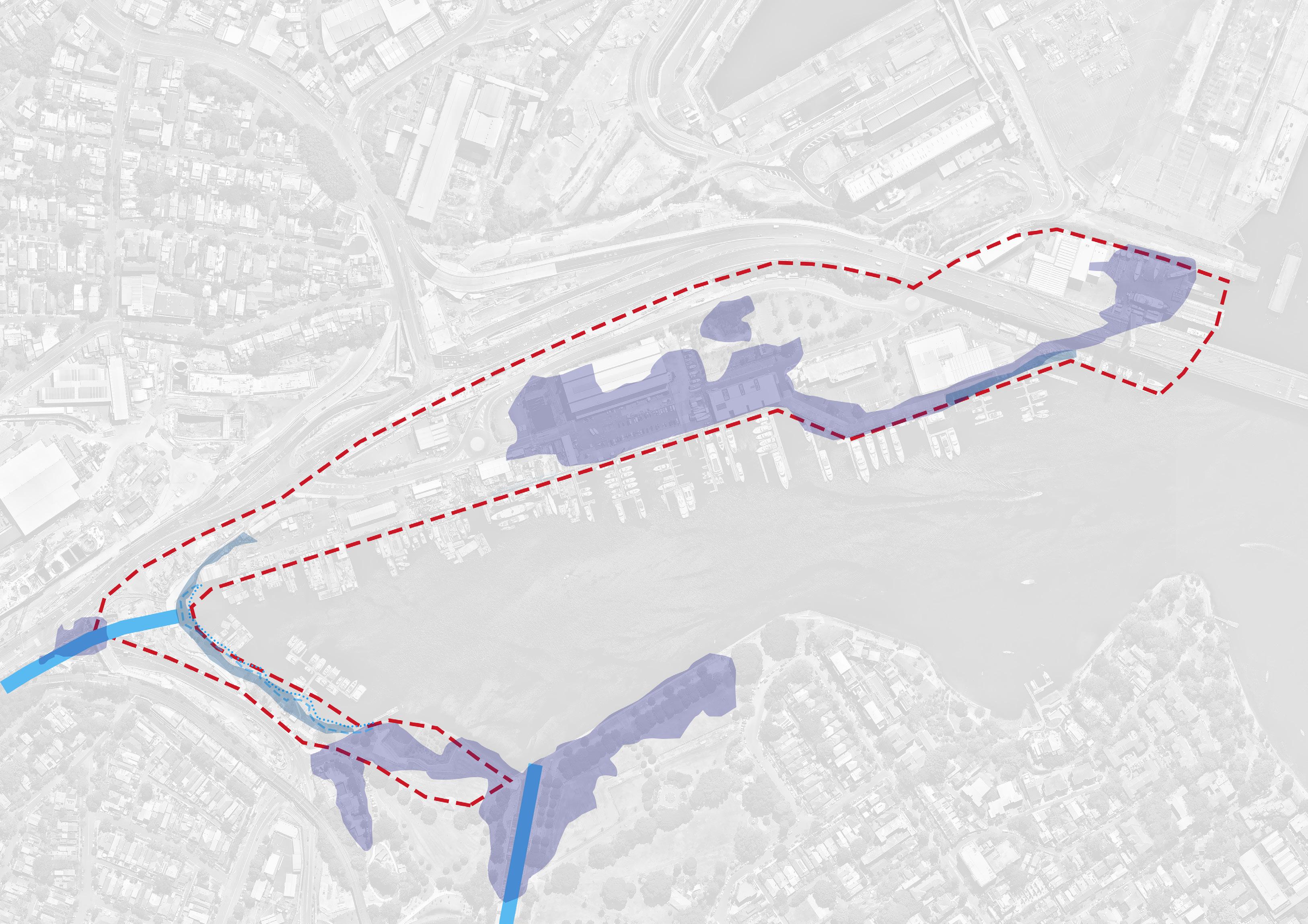
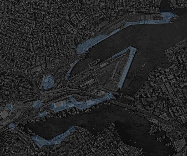
1 meter sea level rise in 70 years; in 50 years, at least 43cm rise in sea level. High tide can rise 1.5m so that it should be considered about 2m sea level rising conditions.
The whites creek outlet will be influenced which threat The Crescent road and western area of Rozelle Bay. There is requirement of landform transformation.
Long term thinking of 4 meter sea level rise maybe 200 years in the future, major area will be submersed.
Sea Level Rise
Johnstons Creek
Whites Creek
Flat, gentle slope from eastern down to western side.
There are different edge conditions.
Height difference allowed storm water run off to the road.
Existing level
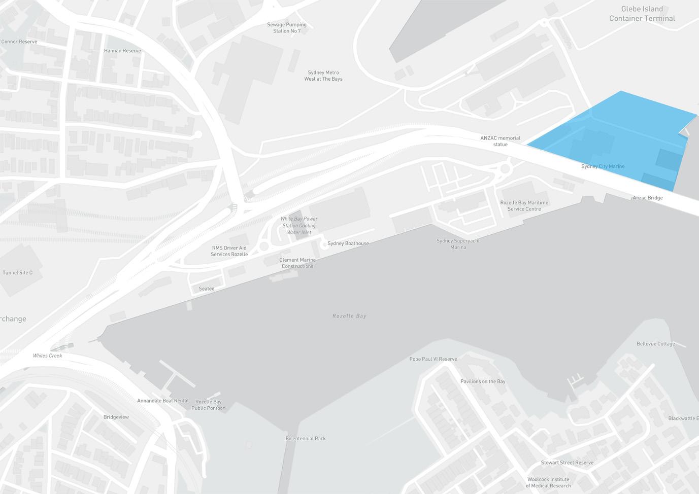
22% of the embayment shoreline currently comprised of reclaimed land in Sydney. Major of the Rozelle Bay foreshore is reclaimed and a piled wharf extends ( Mayer-Pinto et al., 2015 ).
Section A
Section B
Section C
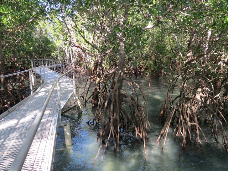
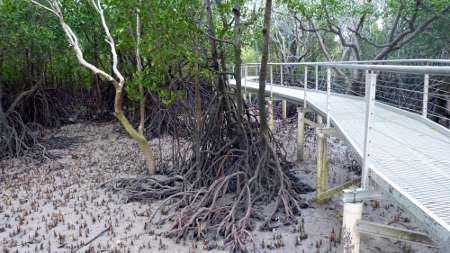
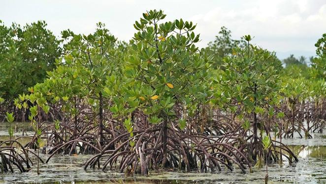
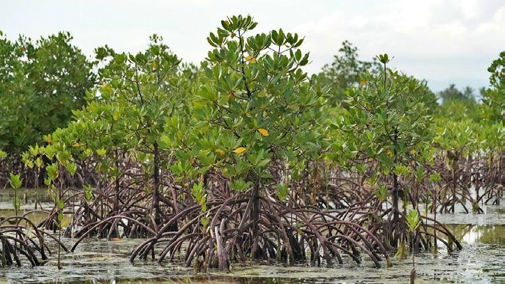
The rare mangrove habitat in Sydney habour
Semi-private space
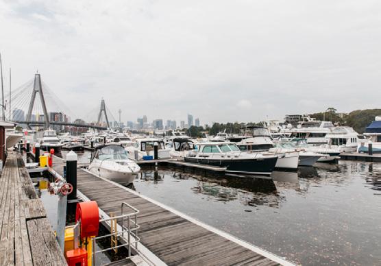
Marine activity
Private space
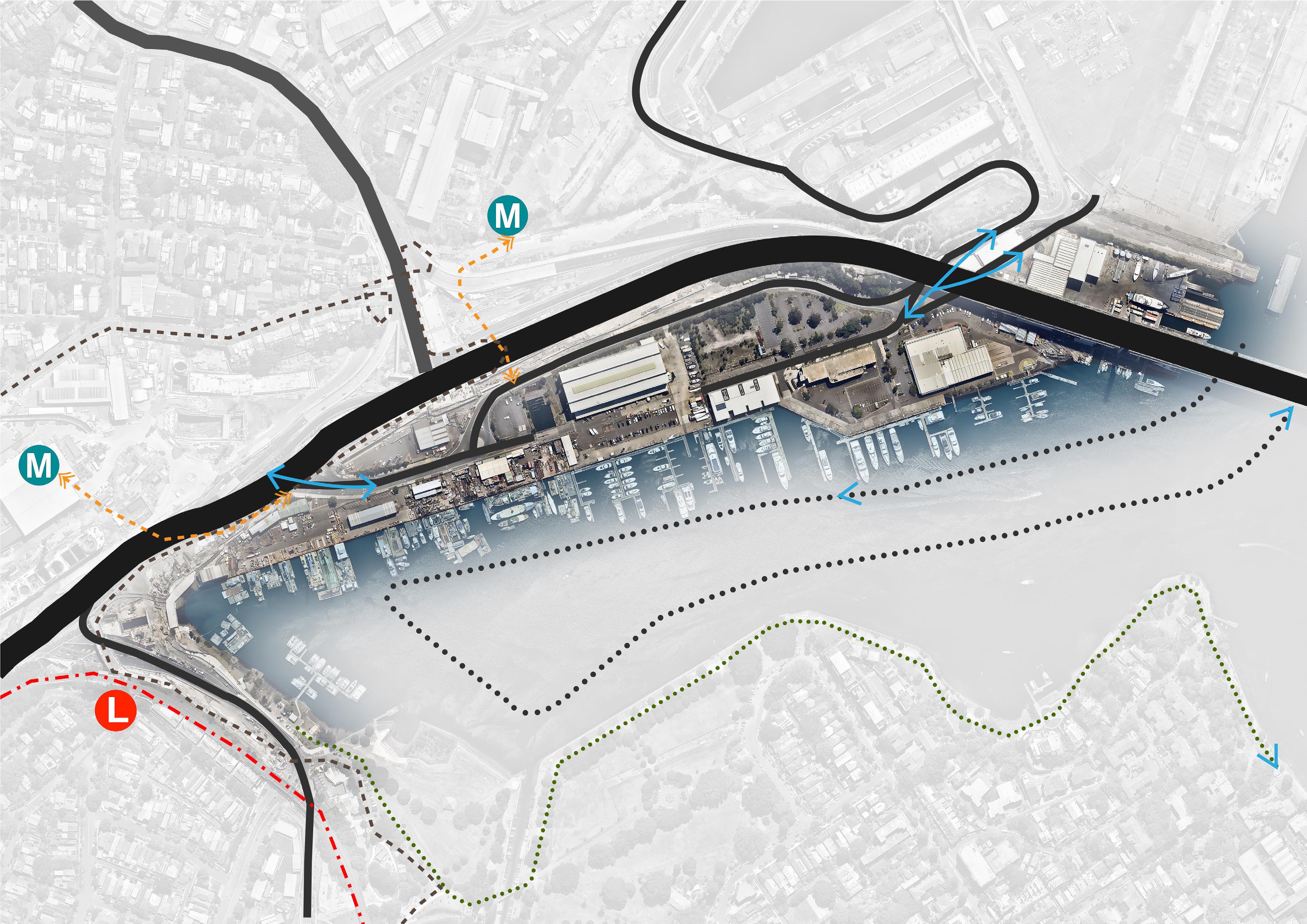
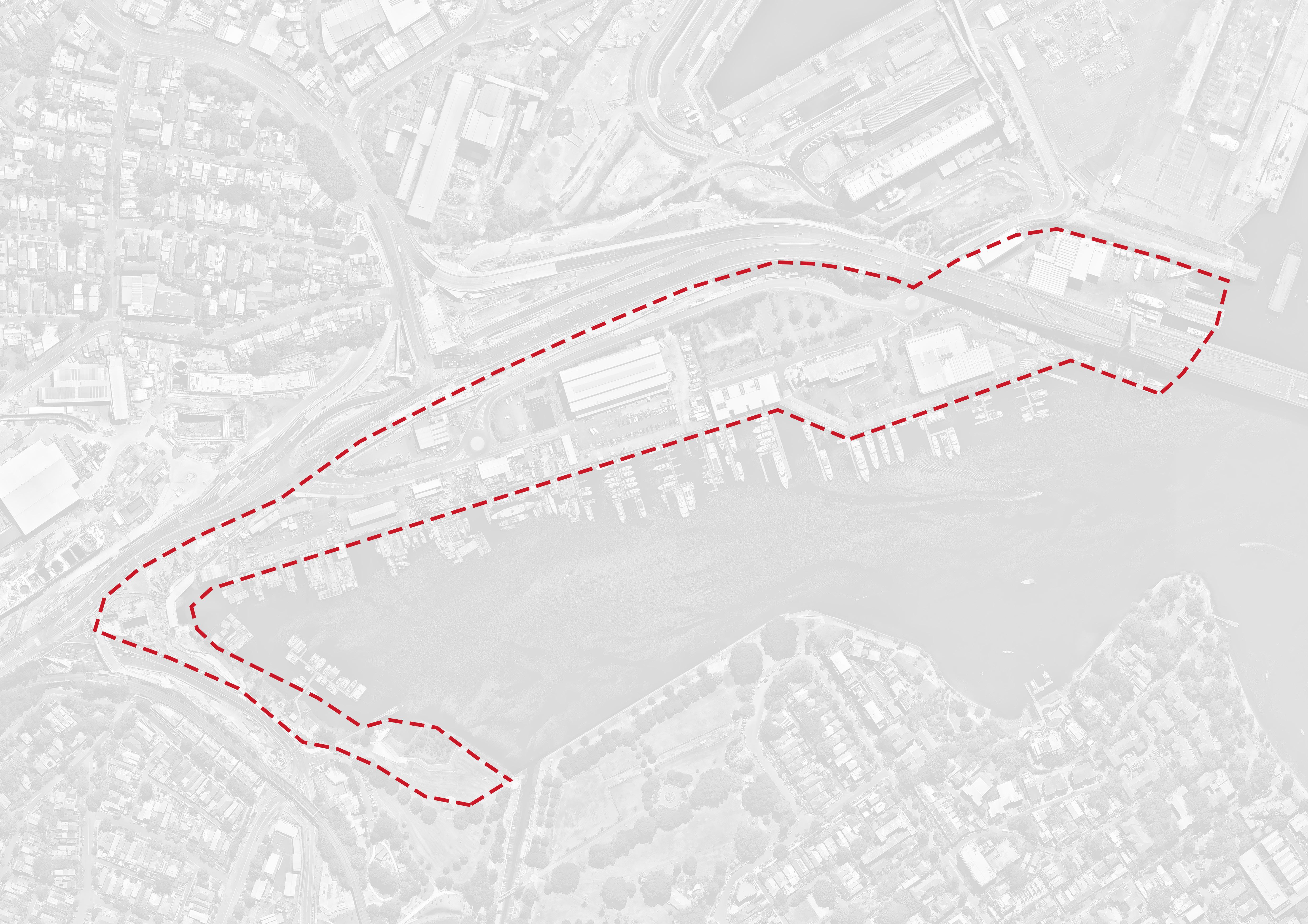
Low efficiency roads in Rozelle Bay.
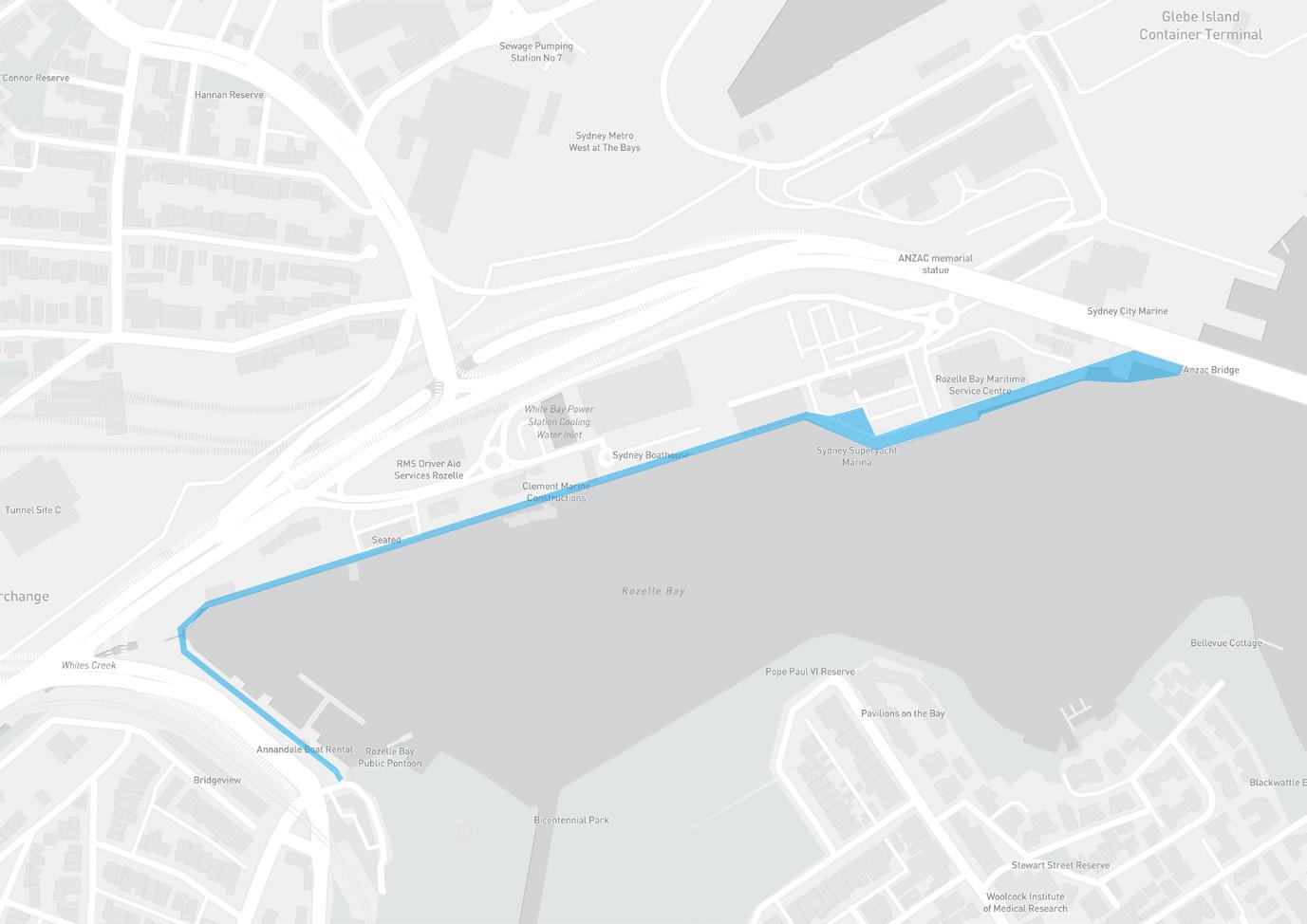
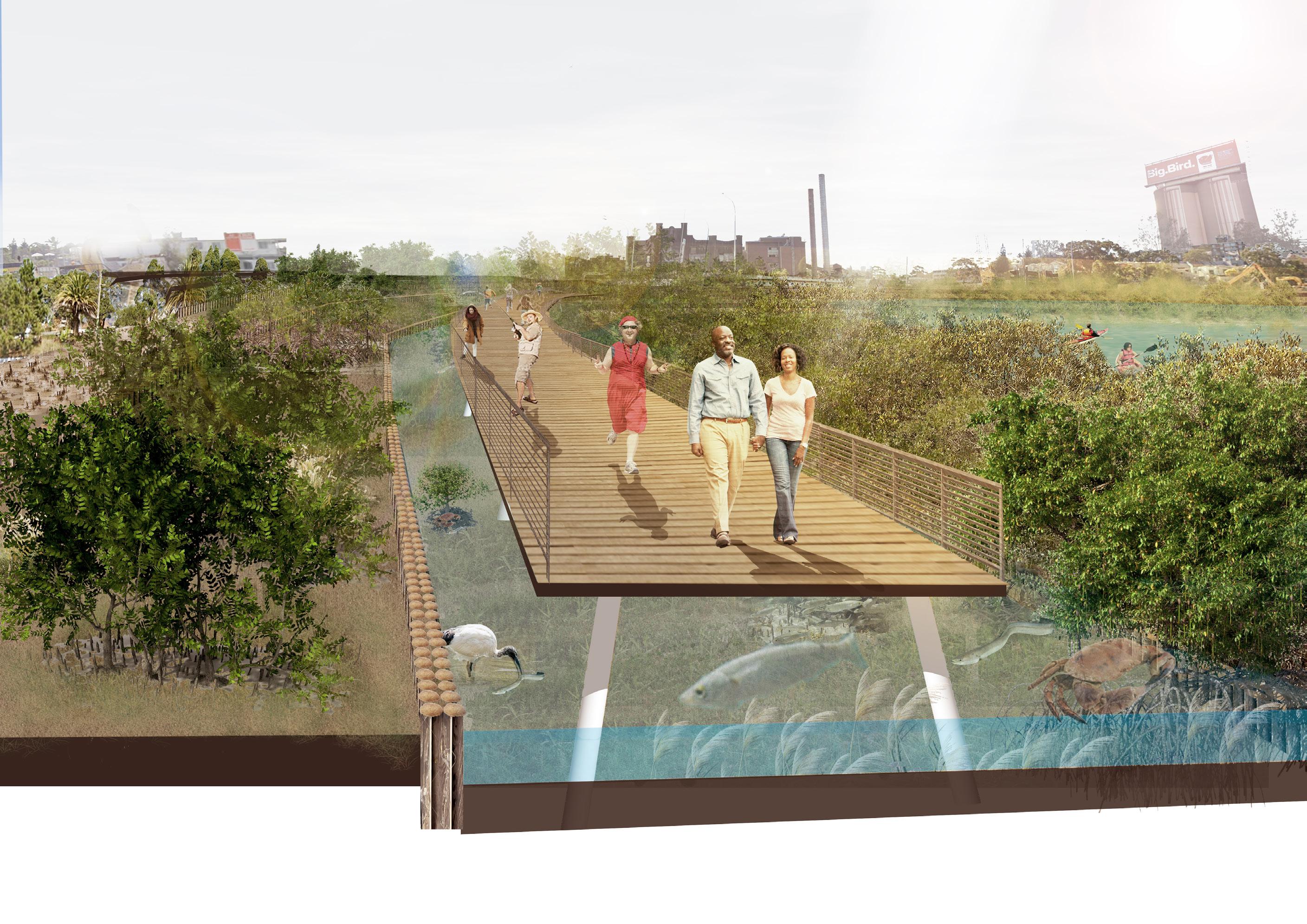
Can not walk to there from Jubilee park, opportunity for coastal walkway along the bays precinct.
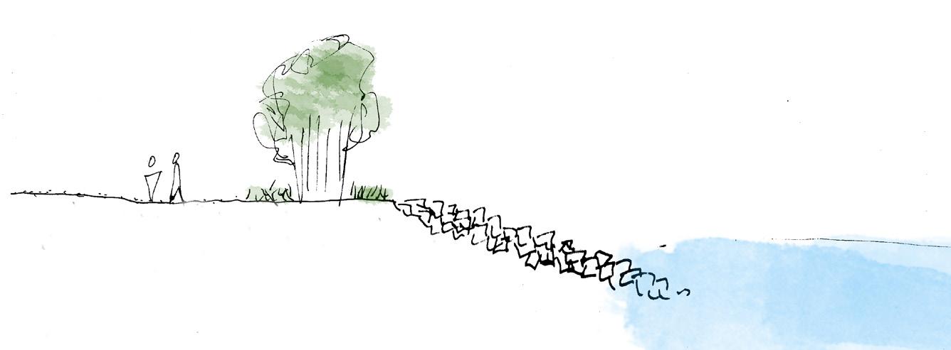
Abandoned shoreline, there is opportunity for promenade.
Too much boats go into the bay.
3.6 OPPORTUNITIES
CONSTRAINTS
Constraint
Lots of private space for marine activities along the shoreline, public can not close to the waterfront and enjoy it.
Some existing buildings can not be relocated, consider their functions with new urban propose and spatial distribution.
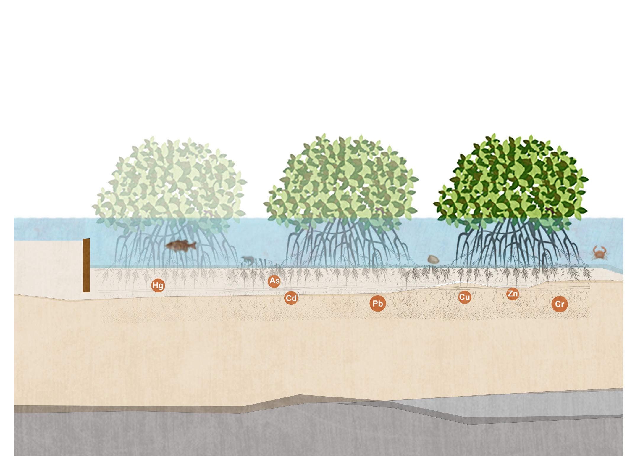
Reclaimed land toxic soil, major toxin including heavy metals, asbestos, organochlorine pesticides and Microplastics etc..., Three primary sources pollute the waters and sediments of the Harbour: stormwater, sewage overflows and leachate from contaminated reclaimed land.
Due to limited drainage infrastructure and impermeable hard surface, rainwater logging on the surface of road. Rainwater has opportunity to be treated and reused rather than flow into bay mixed with contamination.
Opportunity
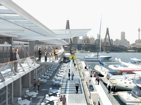
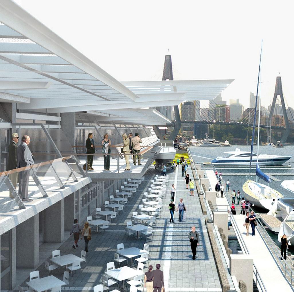
Explore the use of waterfront area, including maritime cultural experience and public activities along the shoreline.
Opportunity to construct water features collecting rainfall and reusing the rainwater, not only enhancing freshwater interaction with people, but also chance to reduce the containments, water-logging.
Mixed use development: Maritime activities staged relocation; Residential & Commercial space, Public & Private space.
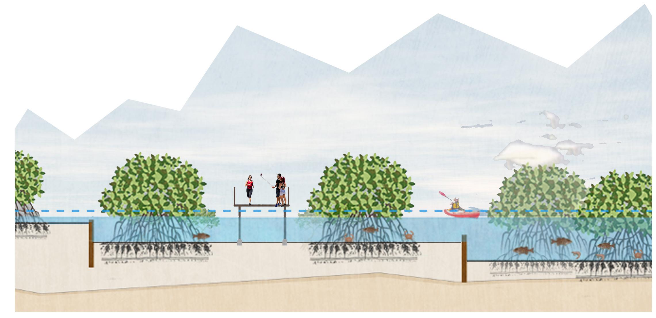
White creek outlet and geology condition suit for mangrove habitat. Opportunity to regeneration rare Sydney indigenous mangrove ecosystem. Increase the water purification and human experiences such as boardwalks, kayaking and fishing.
Potential harbour promenade connects Glebe Island and Jubilee park cross whole Rozelle shoreline.
The topography of Rozelle bay is eastern slightly higher than west which allow water flow down to the creek outlet for future mangrove habitat.
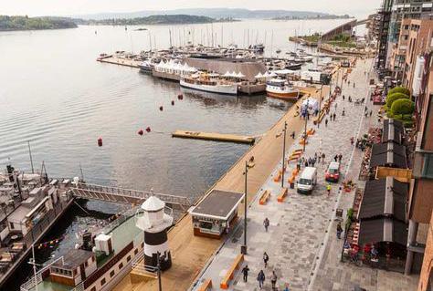
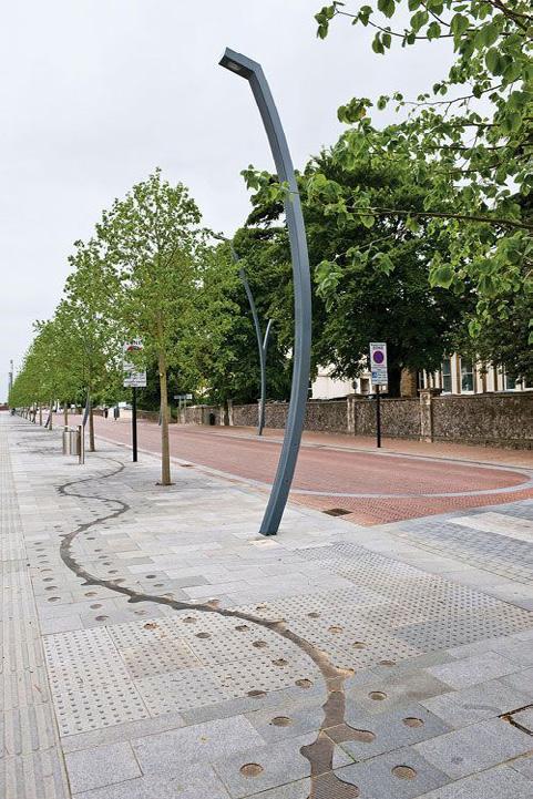
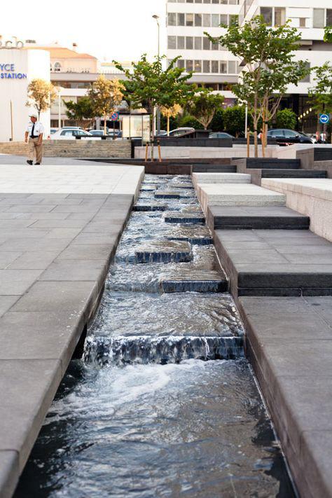
3.7 PRECEDENTS & OBJECTIVES
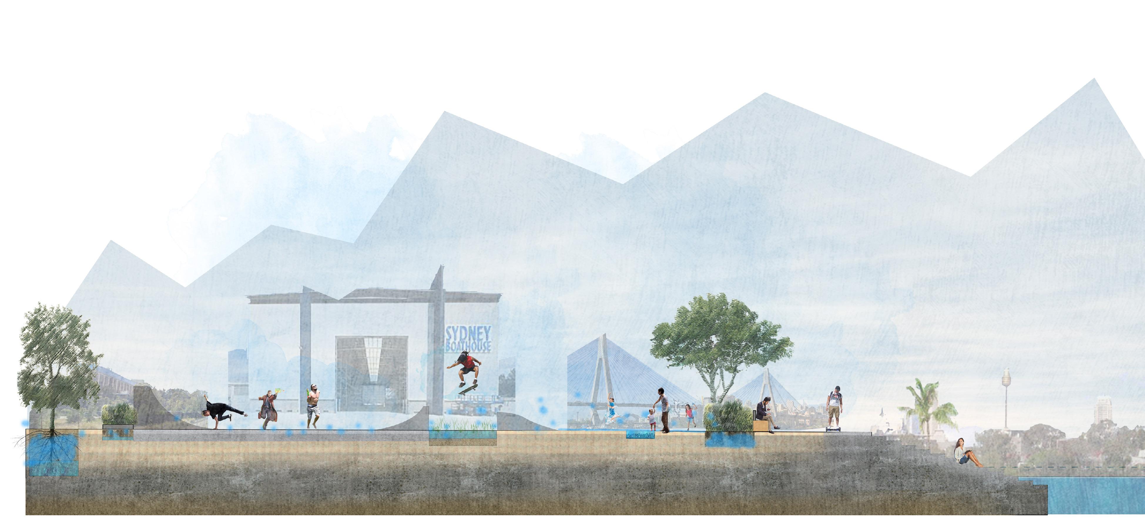
The project’s aim was to transform a former shipyard into a lively urban neighbourhood and connect Oslo to it’s forgotten waterfront. It encouraging social interaction and diversity of form along the waterfront promenade.
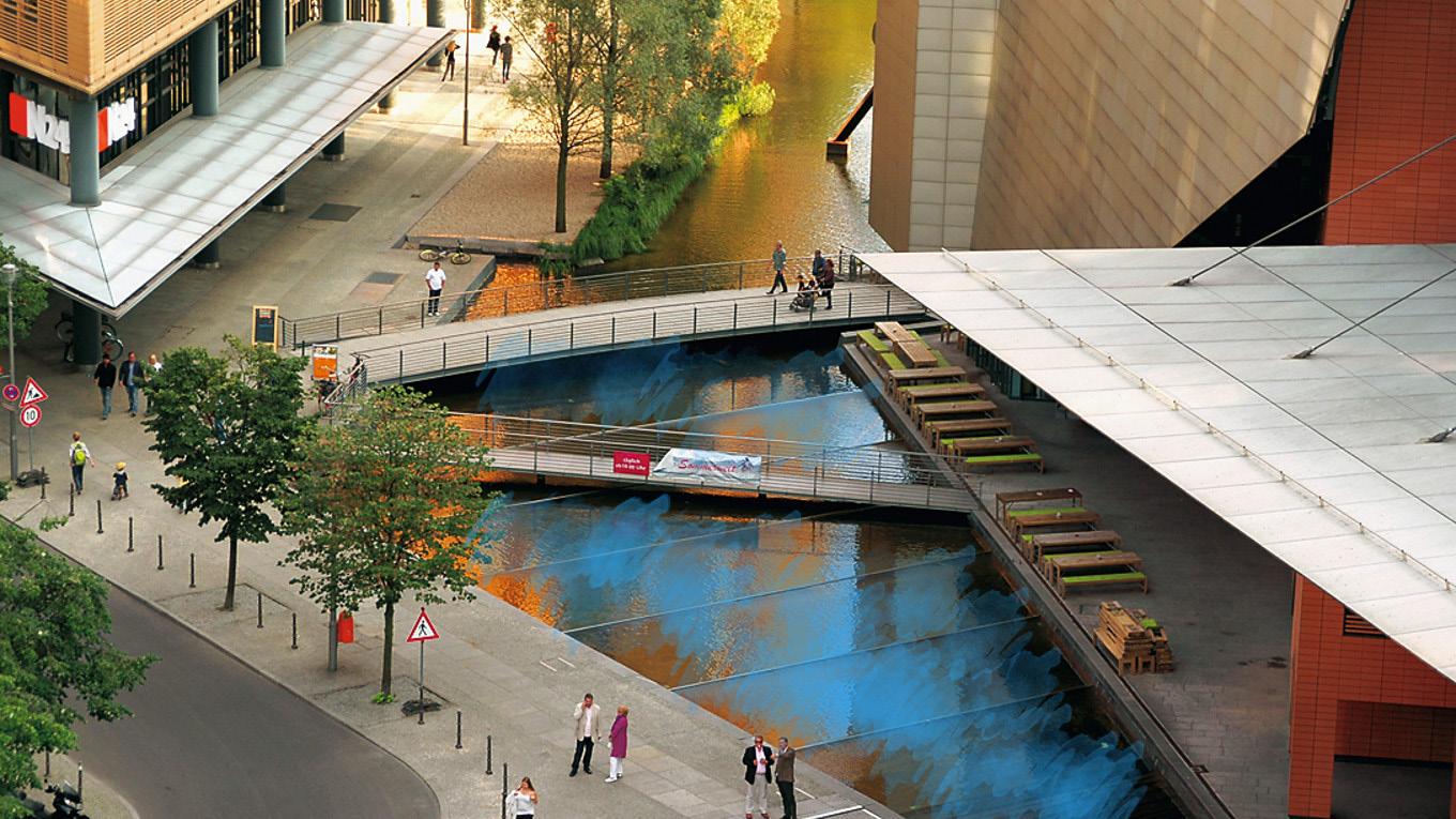
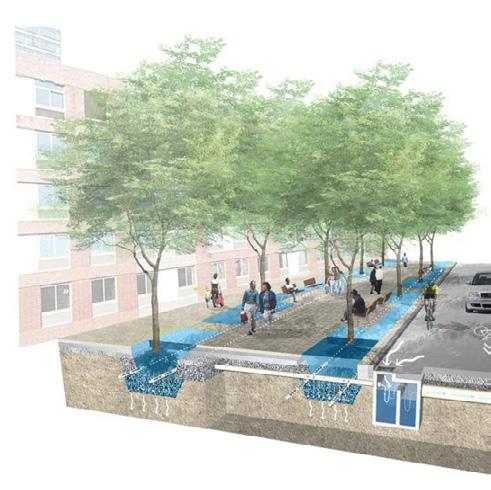
At Potsdamer Platz, a combination of green and non-green roofs harvest the annual rainfall. Excess water flows into the pools and canals of the outdoor waterscape creating an oasis for urban life. Providing multiple opportunities for people to cross and interact with the water.
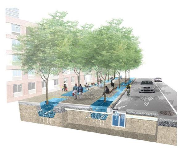
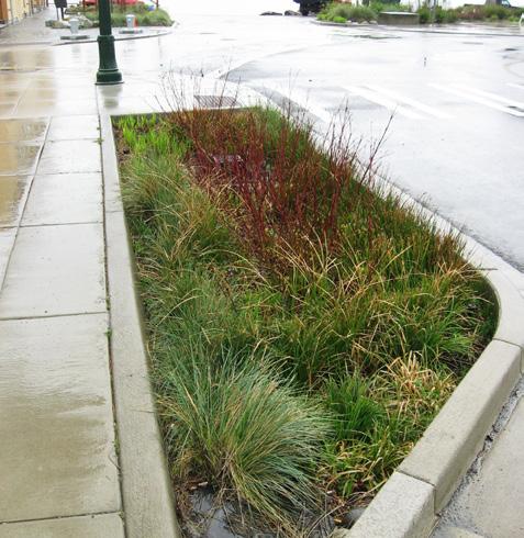
Making use of the drop from the urban road to the water level, terraces are integrated with bio-swales to catch and filtrate the storm water from the urban pavement and road, creating public spaces at different elevations.
Combining rainwater journey with promenade; give back the waterfront for public.
Enhancing interaction with water; reusing rainwater and Improve urban climate and storm water resilience.
Celebrating indigenous mangrove habitat; Reduce contamination polluting the bay.
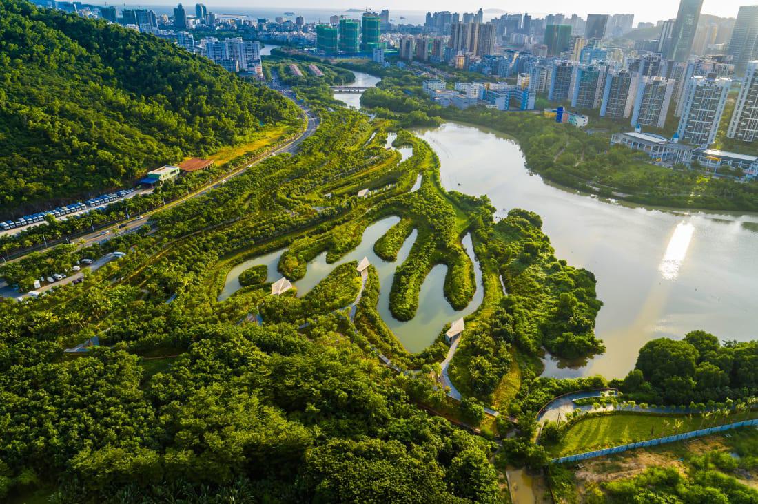
Sanya Mangrove Park, Sanya, China Turenscape, 2019
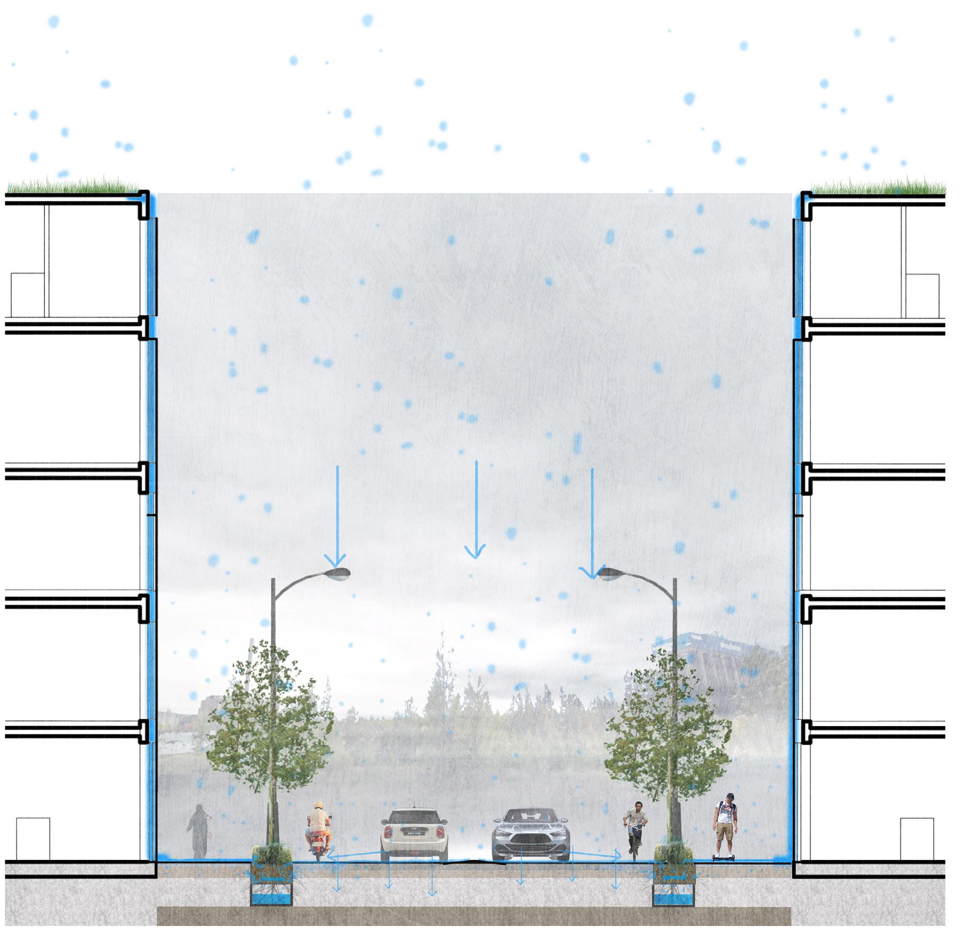
1 Heavy rainfall caused Rozelle Bay water logging already, because of regional limited drainage system and impermeable mode of construction.
2 In the future, extreme weather and global climate change will stormwater issues.
4 Goal: Improve waterlogging, stormwater issue; Enhance regional rainwater resilience; Celebrate indigenous mangrove habitat; Reduce contamination polluting the bay; Increase public activity especially interact with water (rainwater and waterfront).
3 Polluted water will bring contaminantion in soil flowing into bay, cause sea water pollution, then it’s an ecosystem vicious circle.
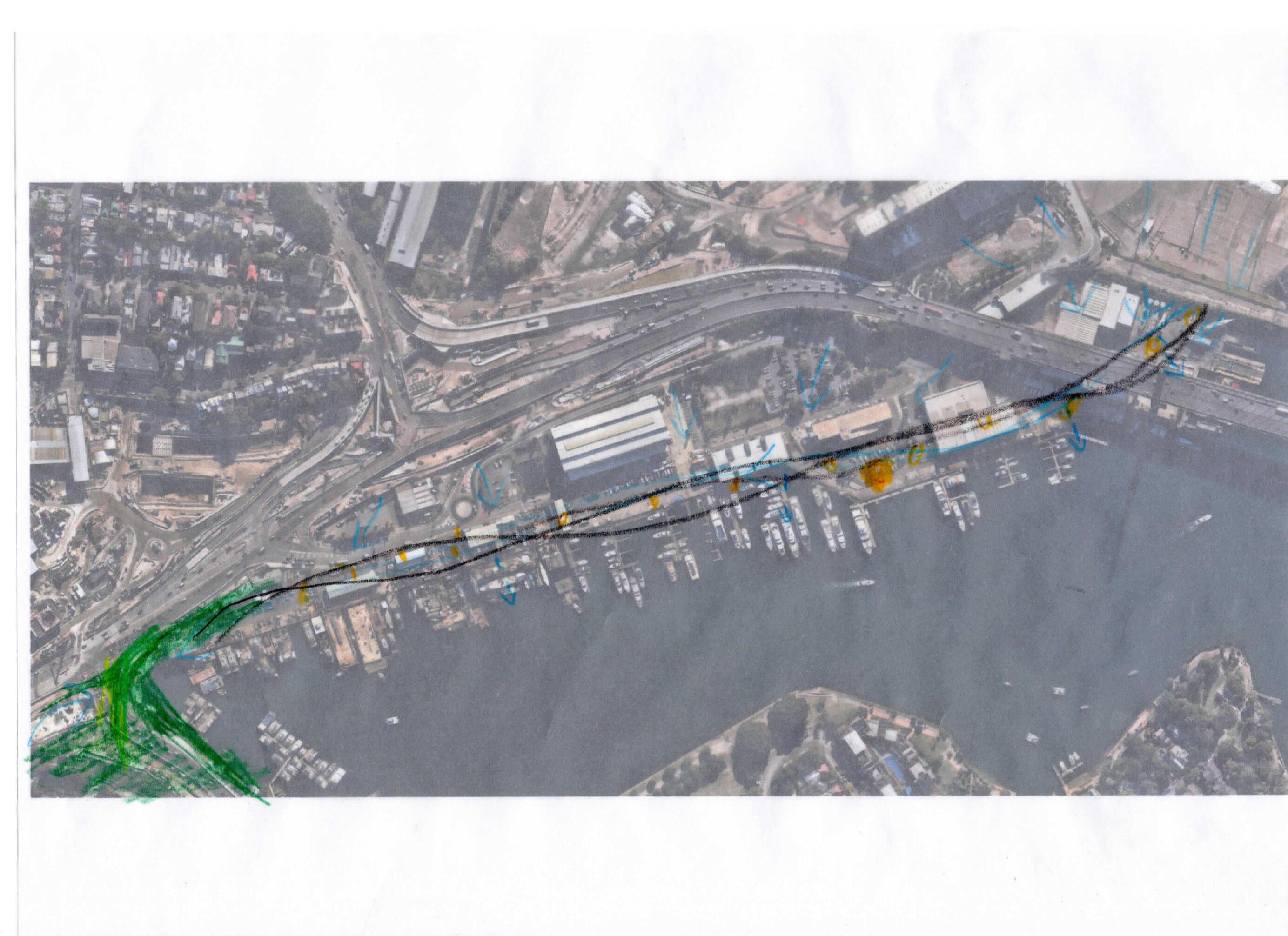
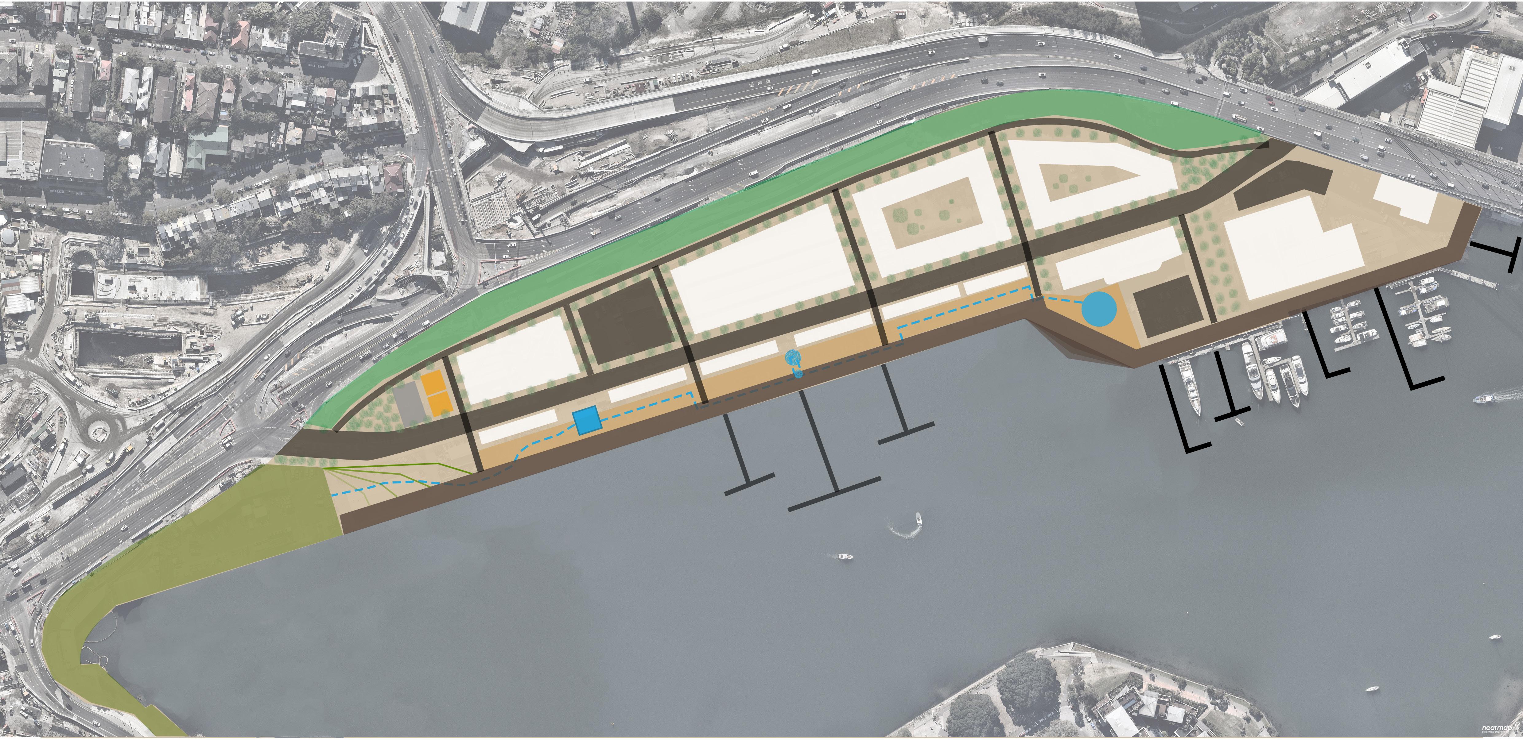
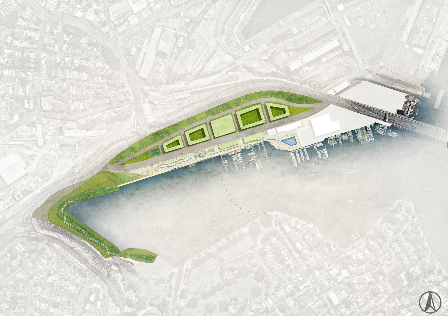
Ideal Diagram Design expression
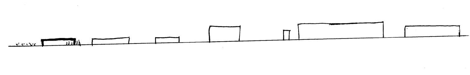
Site View
Long View of The Site
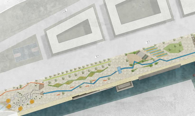
Local Stormwater Catchment
Circulation Zones
Waterfront Activity
Mangrove habitat
WSUD plant buffer for soundpoof
Mixed residential & marine are Maritime service centre Community activity area
Reserved marina
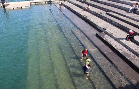
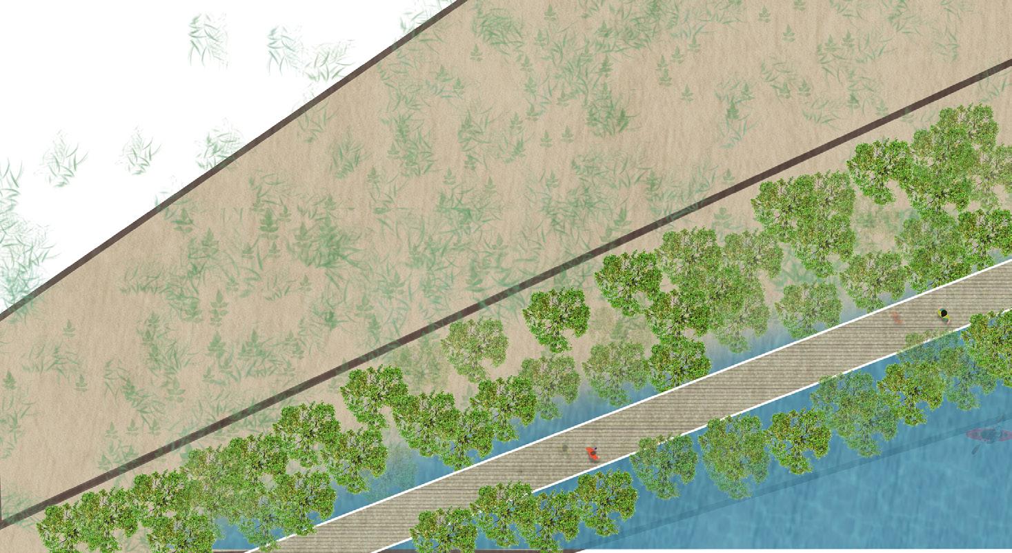
Tidal sheleves
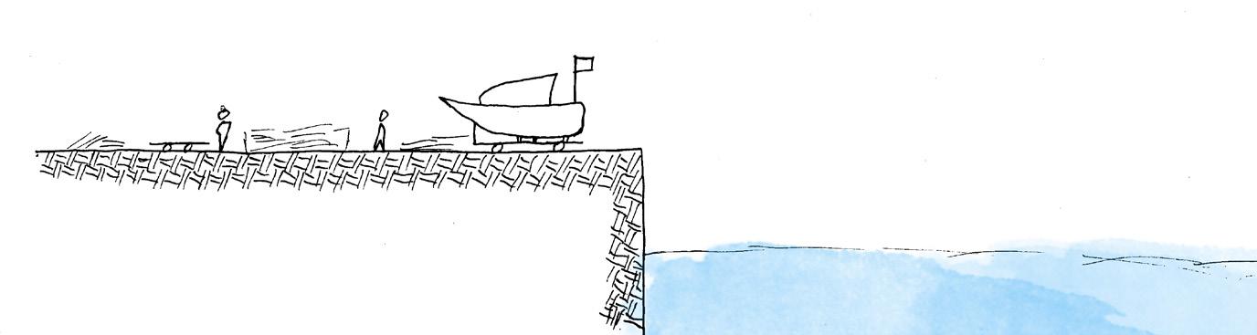
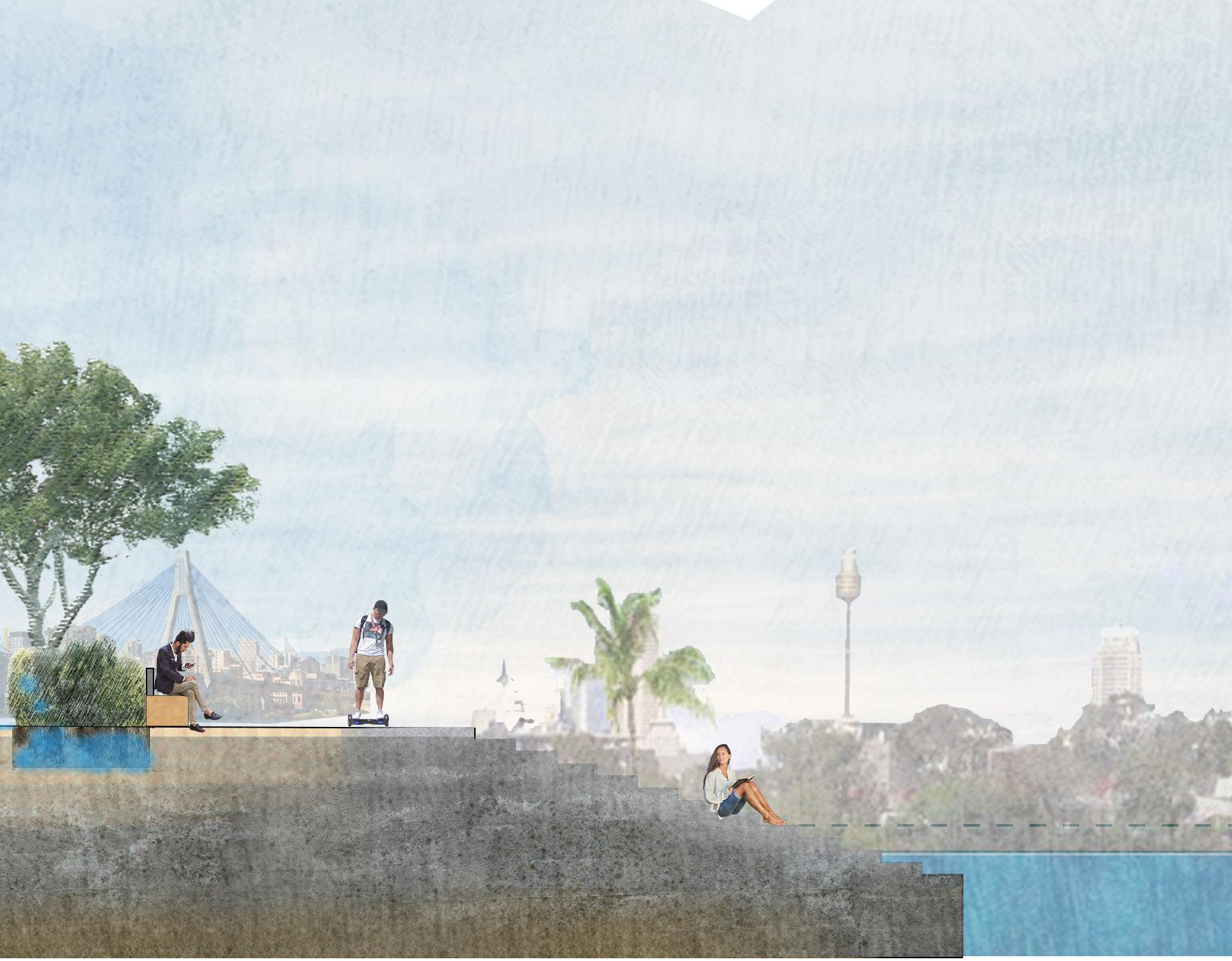
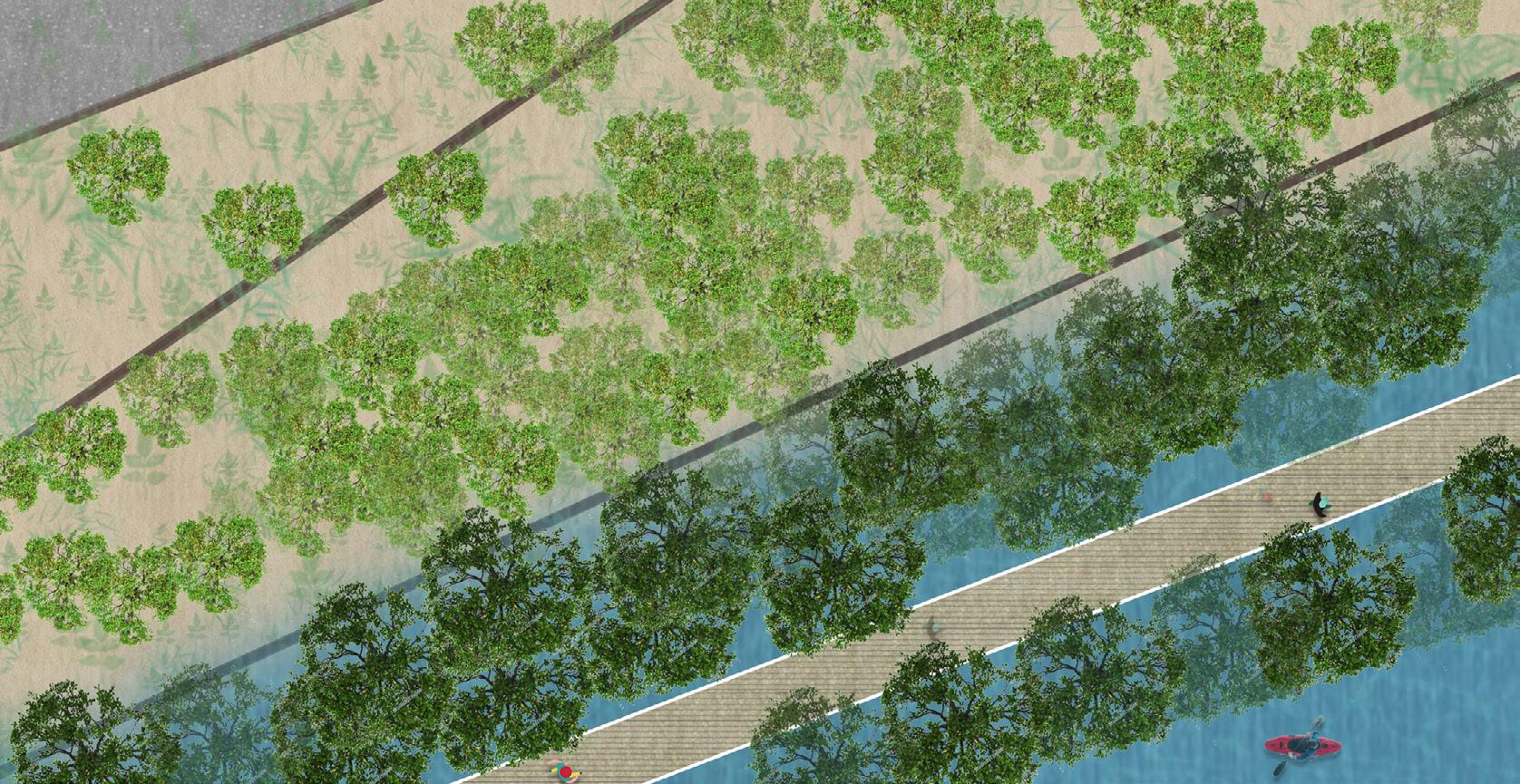
Promenade
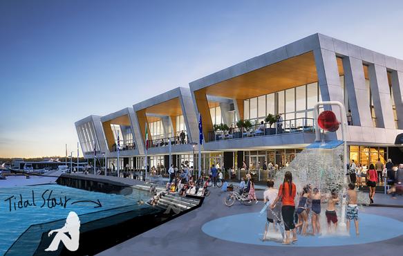
Tidal stair
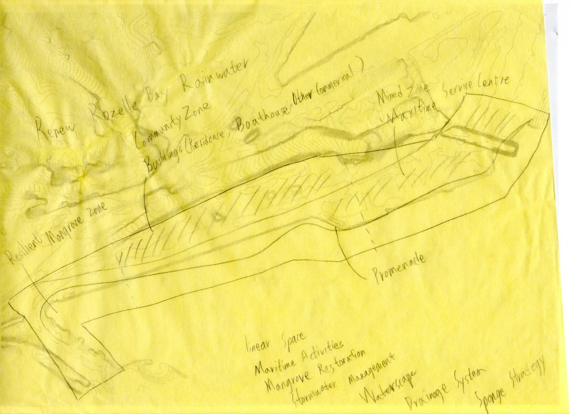
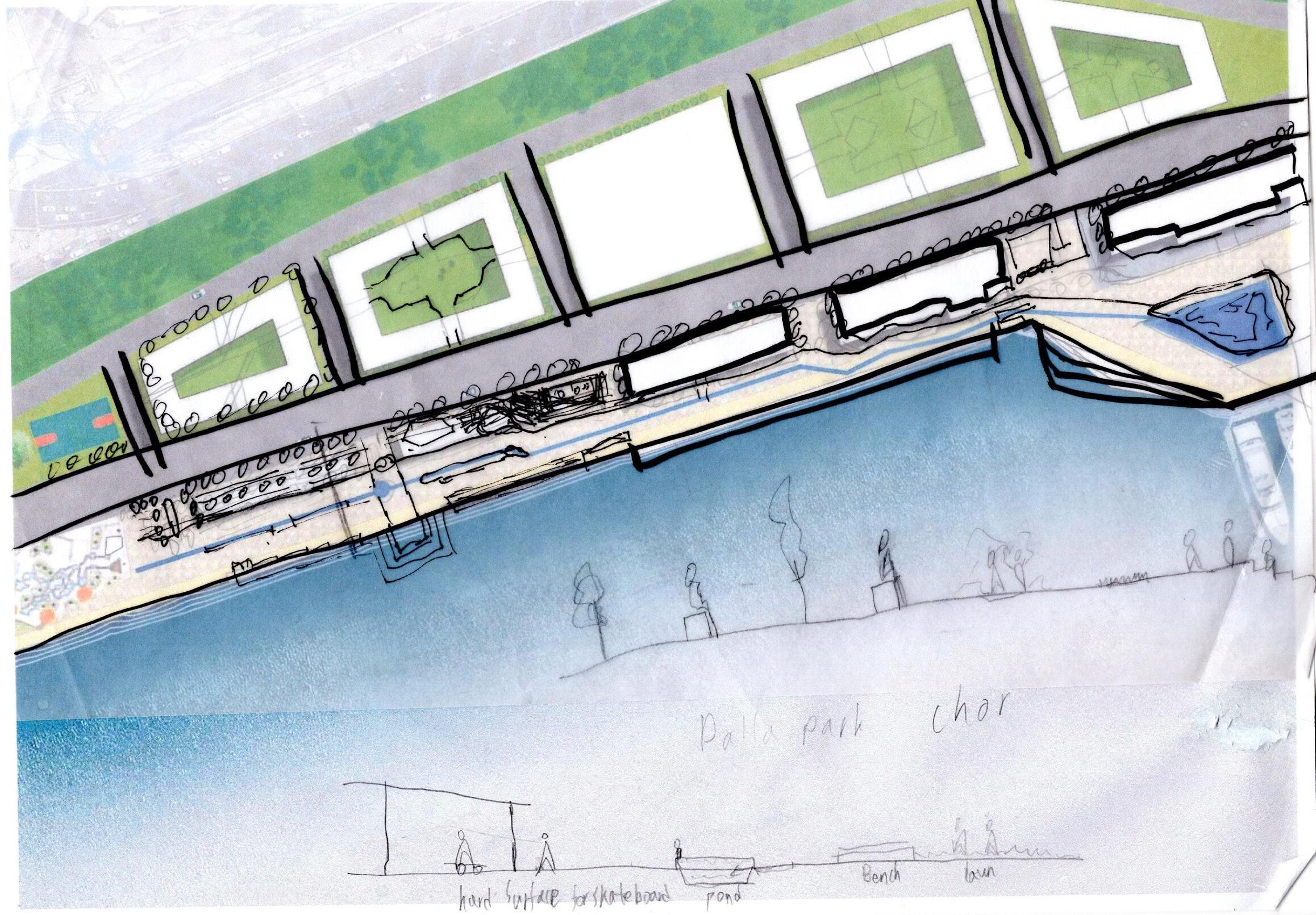
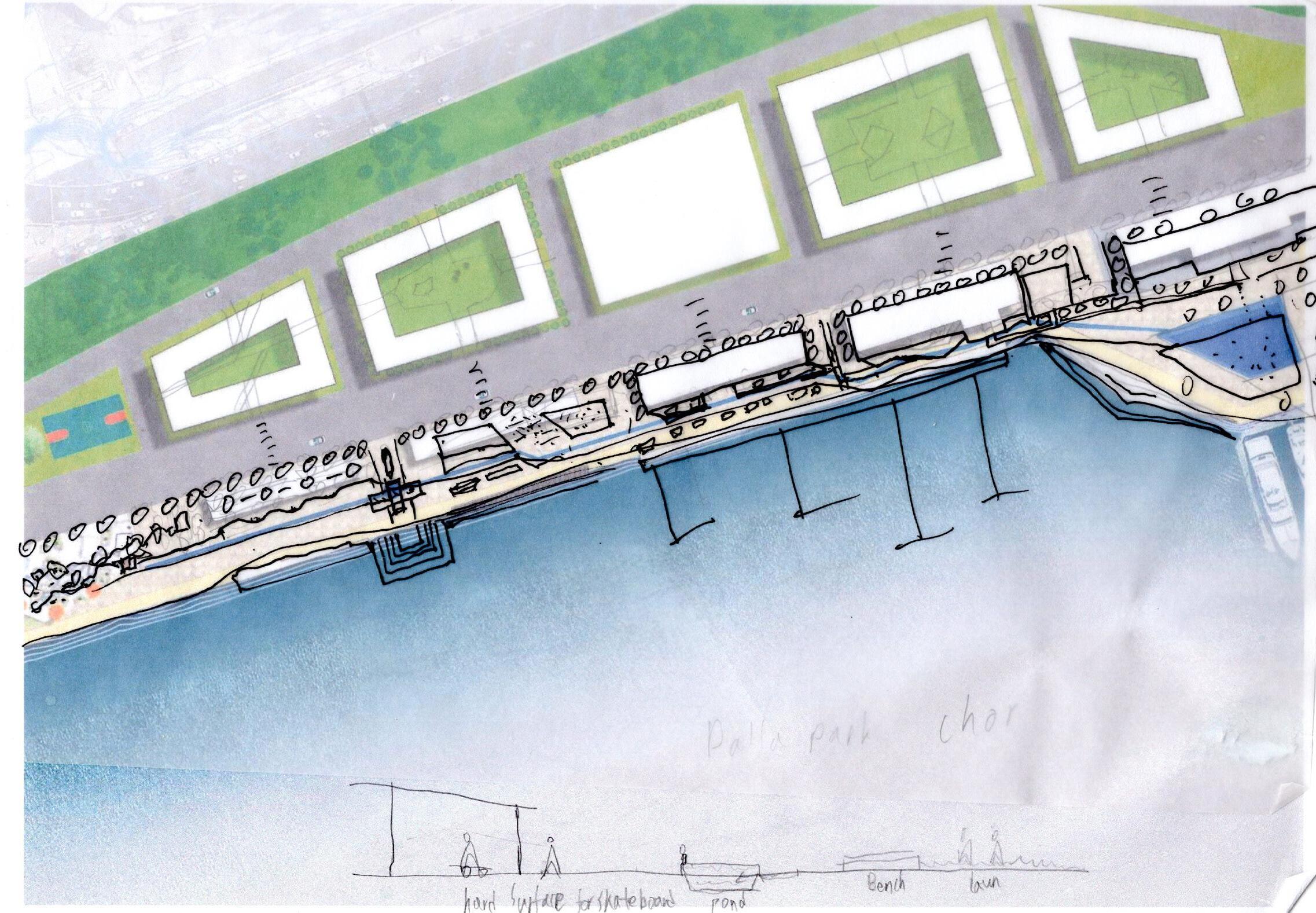
4.5 DESIGN IDEA DEVELOPMENT
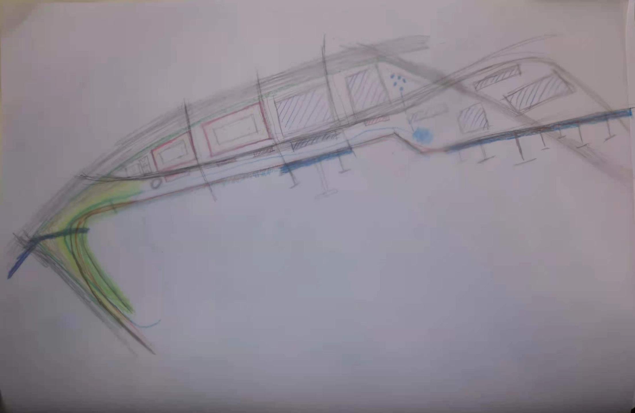
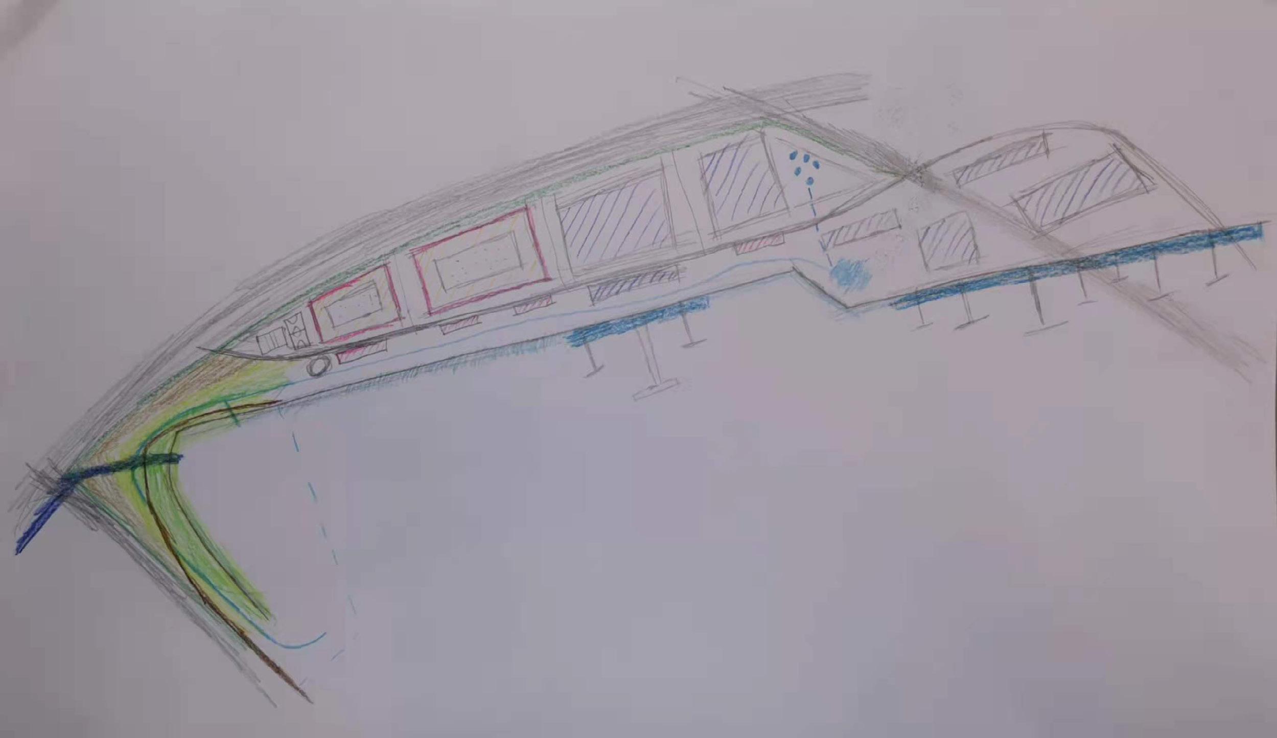
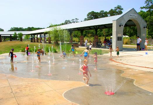
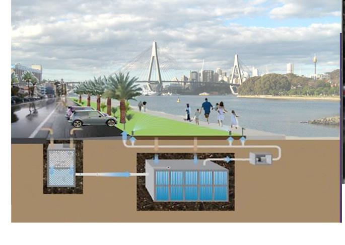
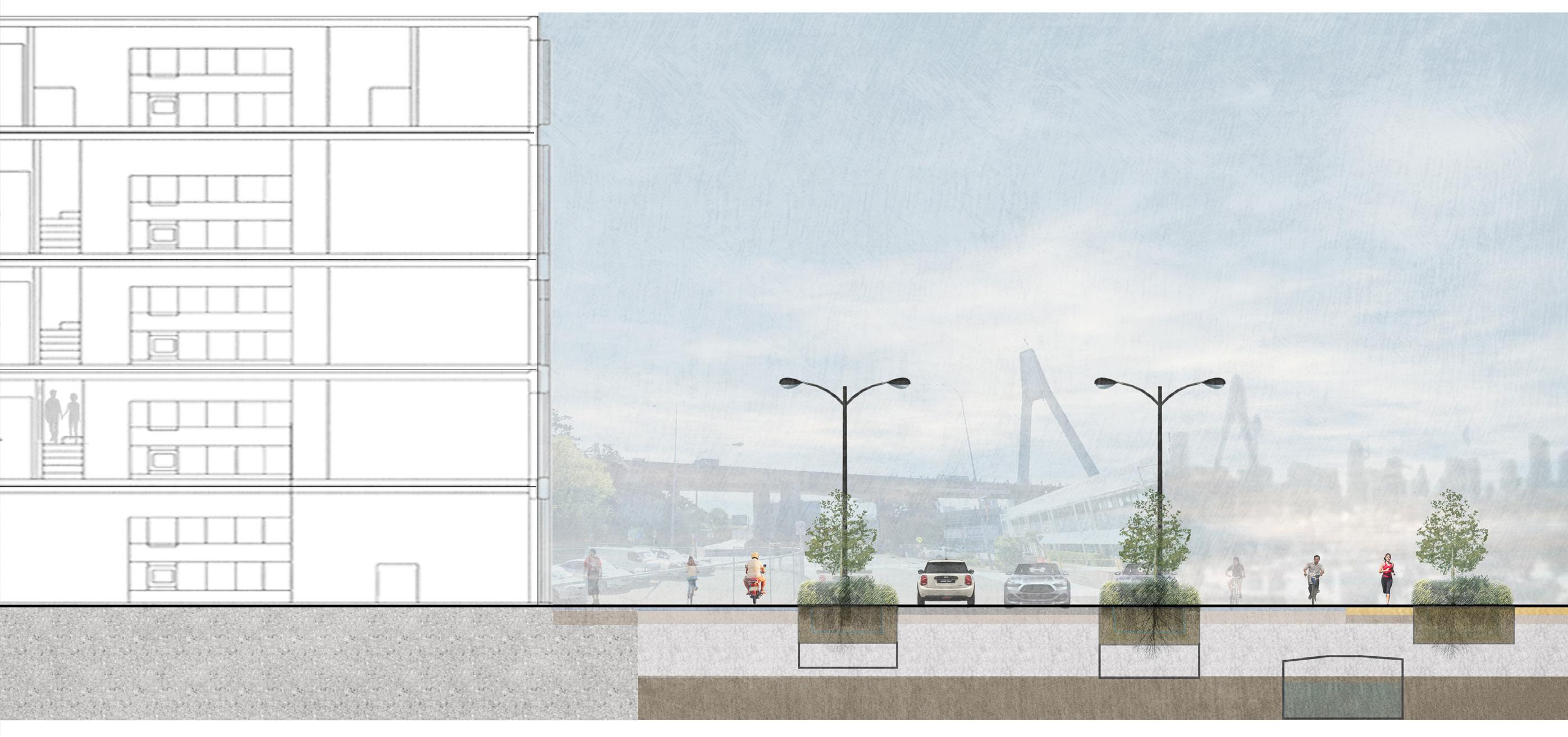
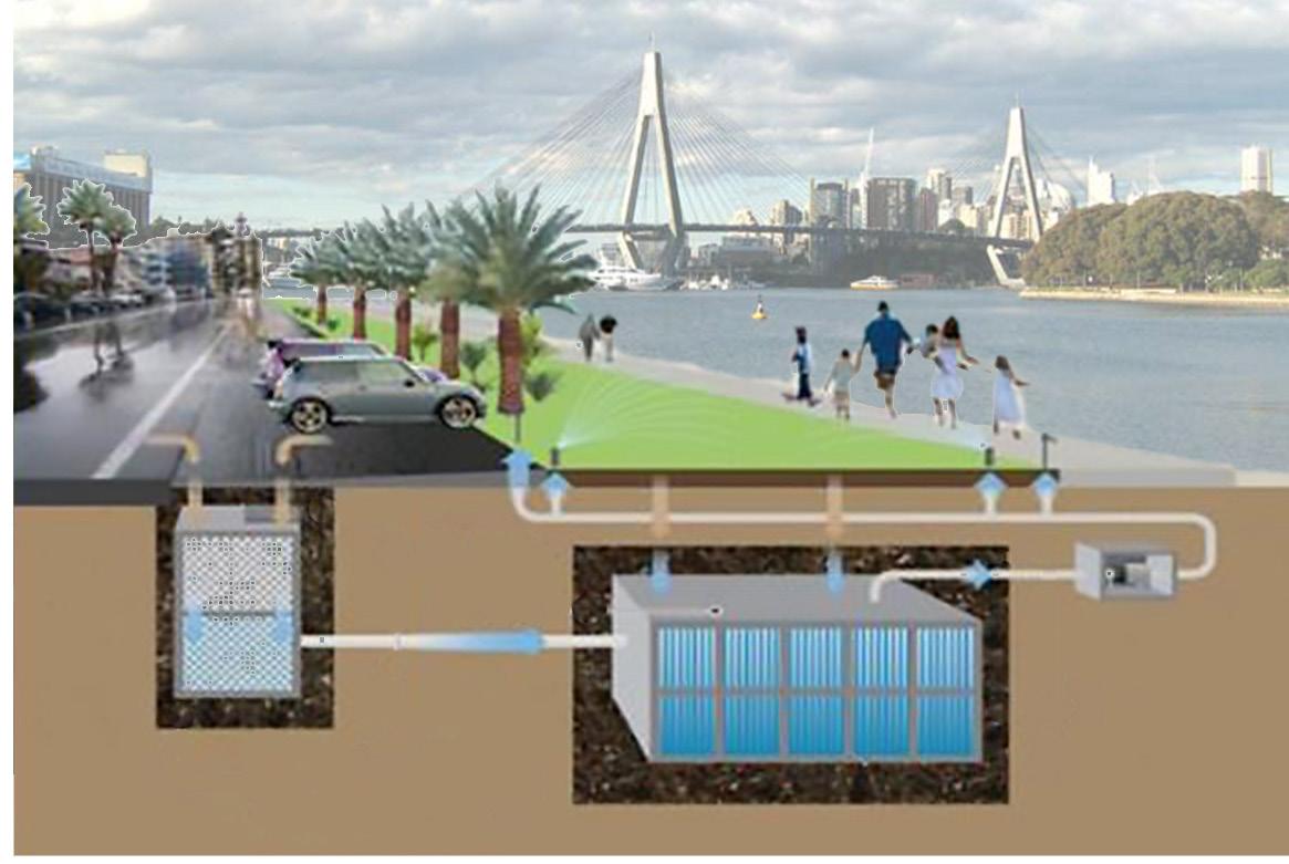
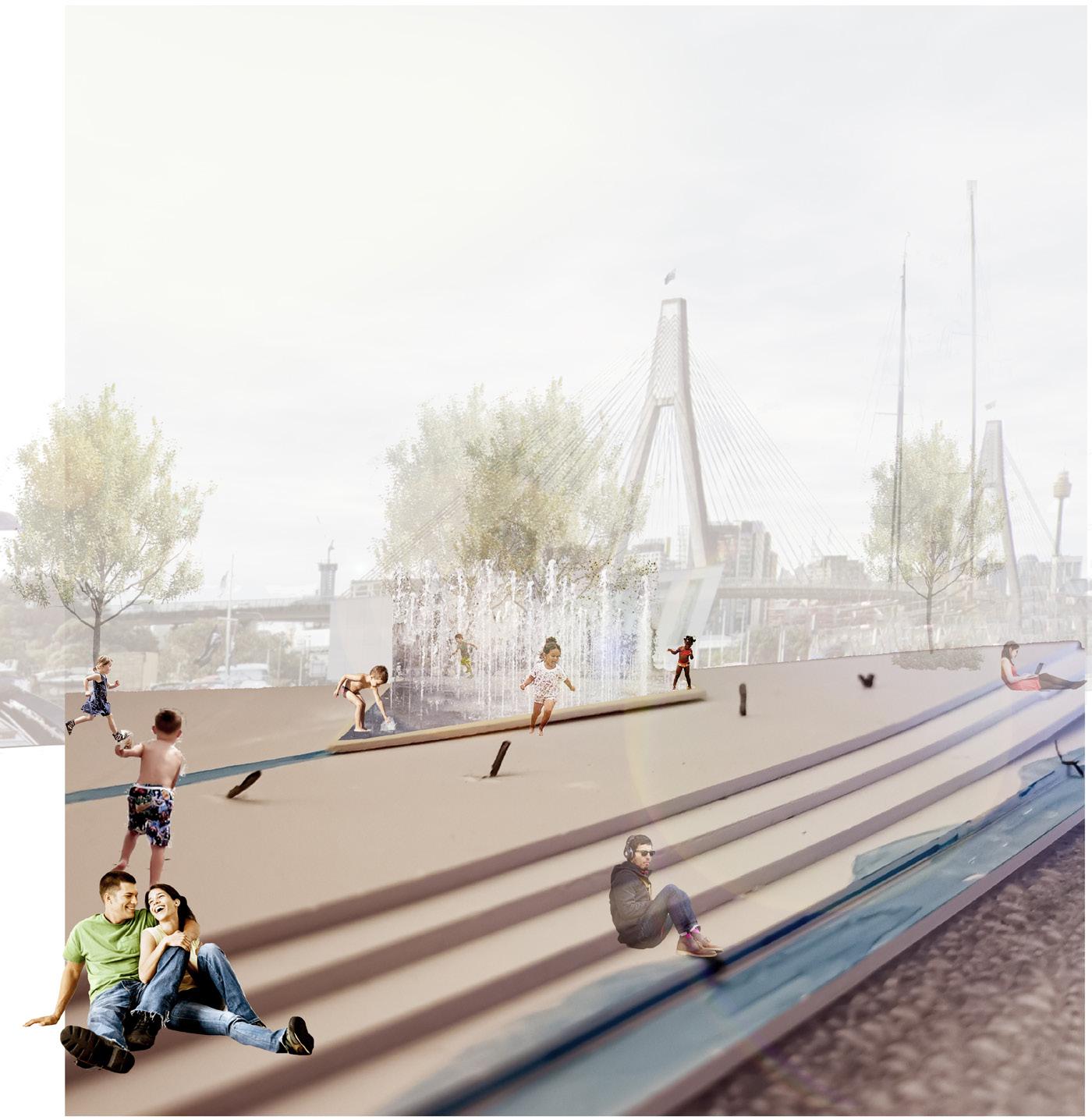
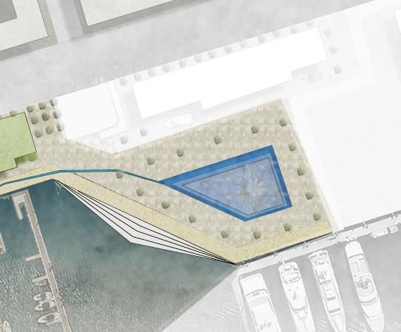
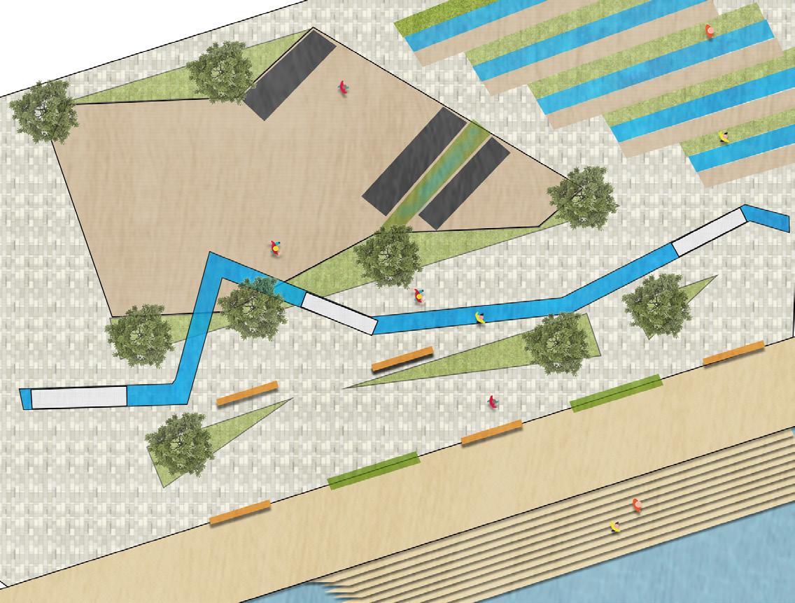
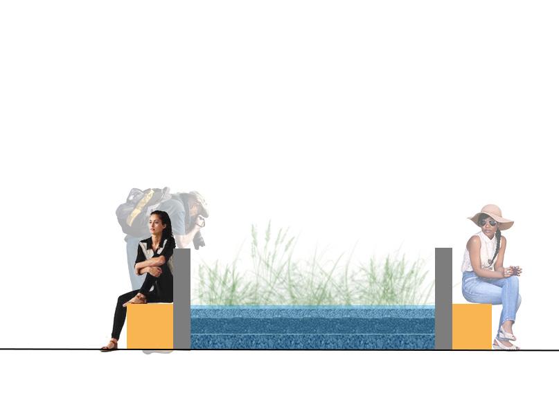
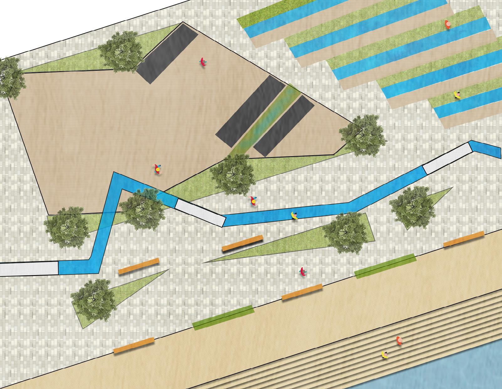
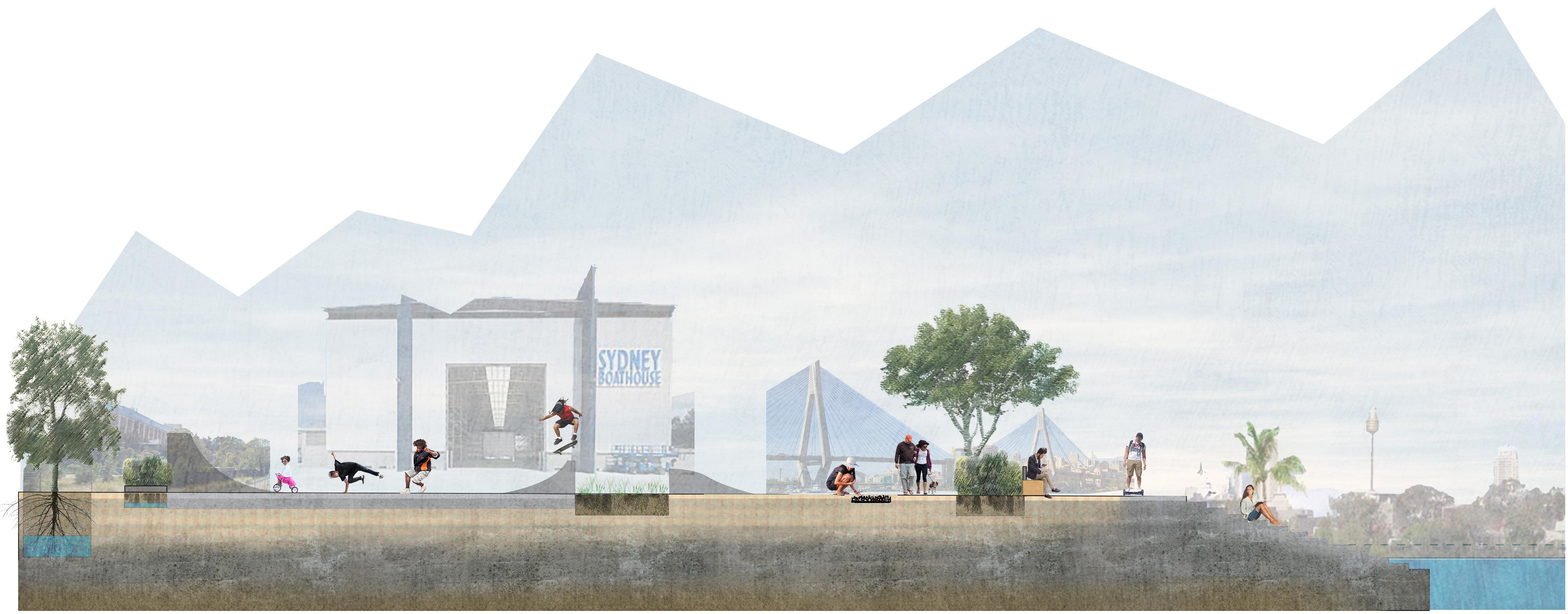
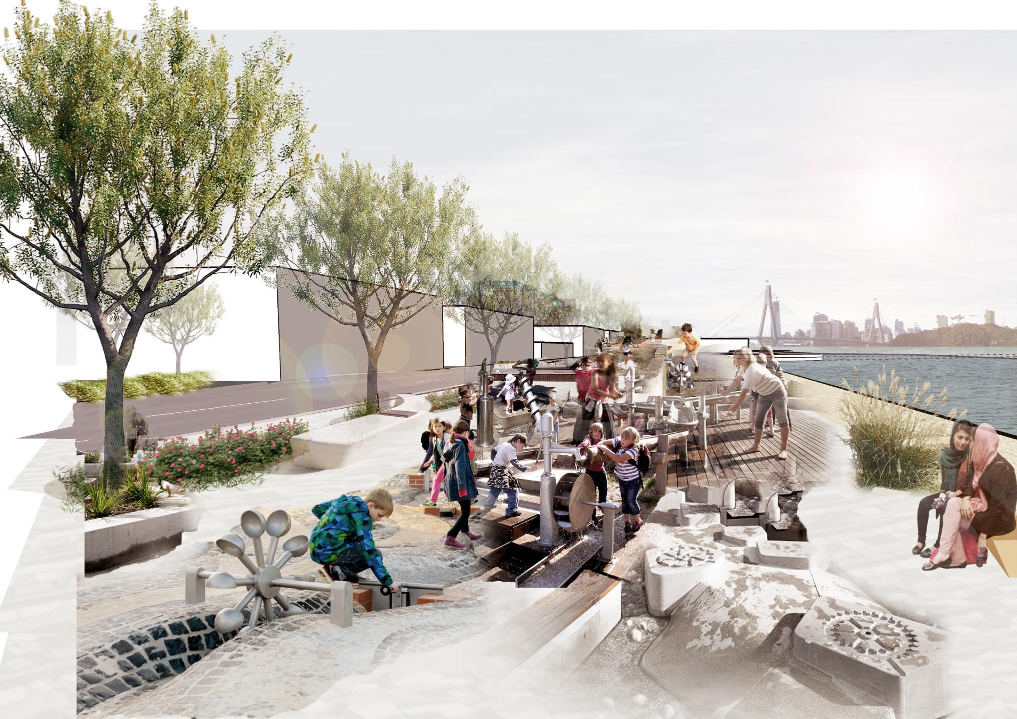
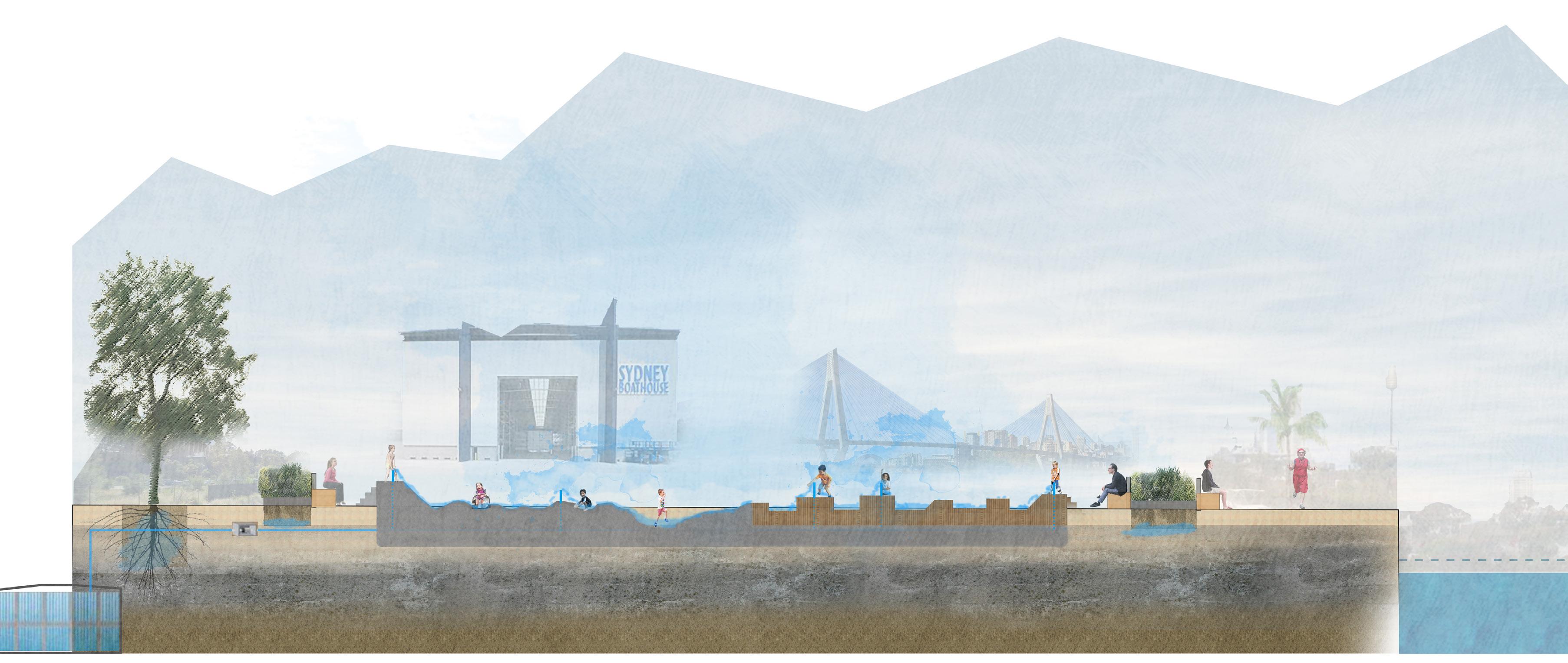
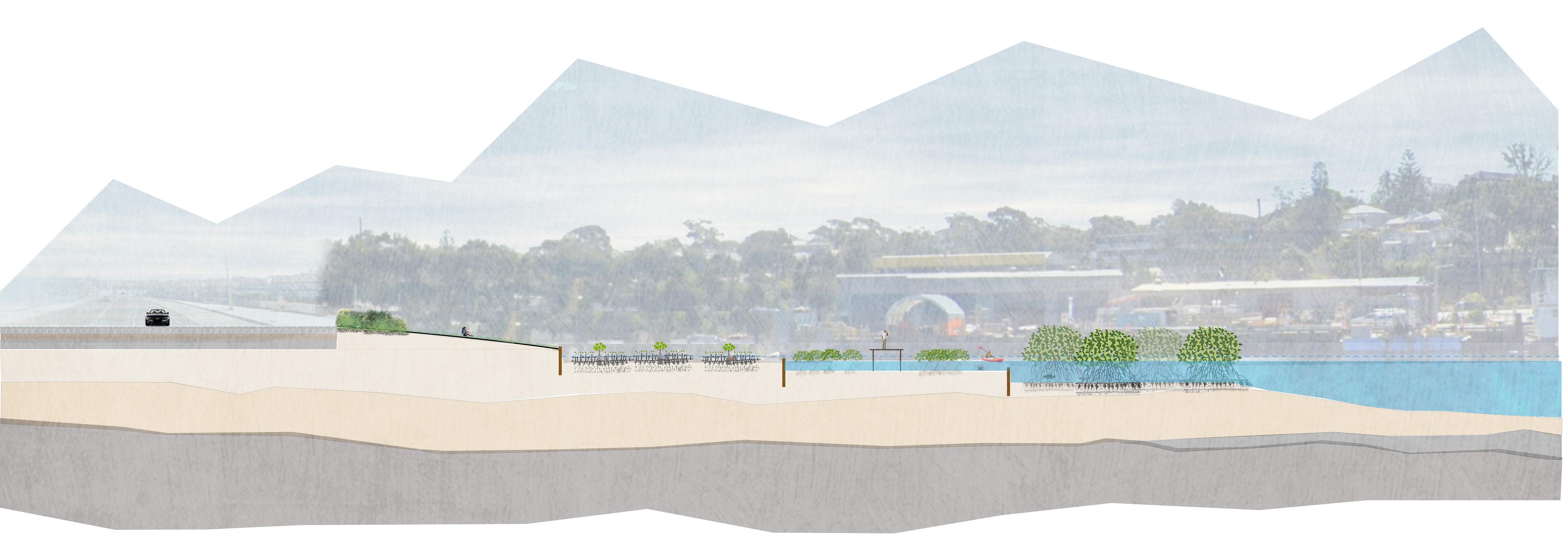
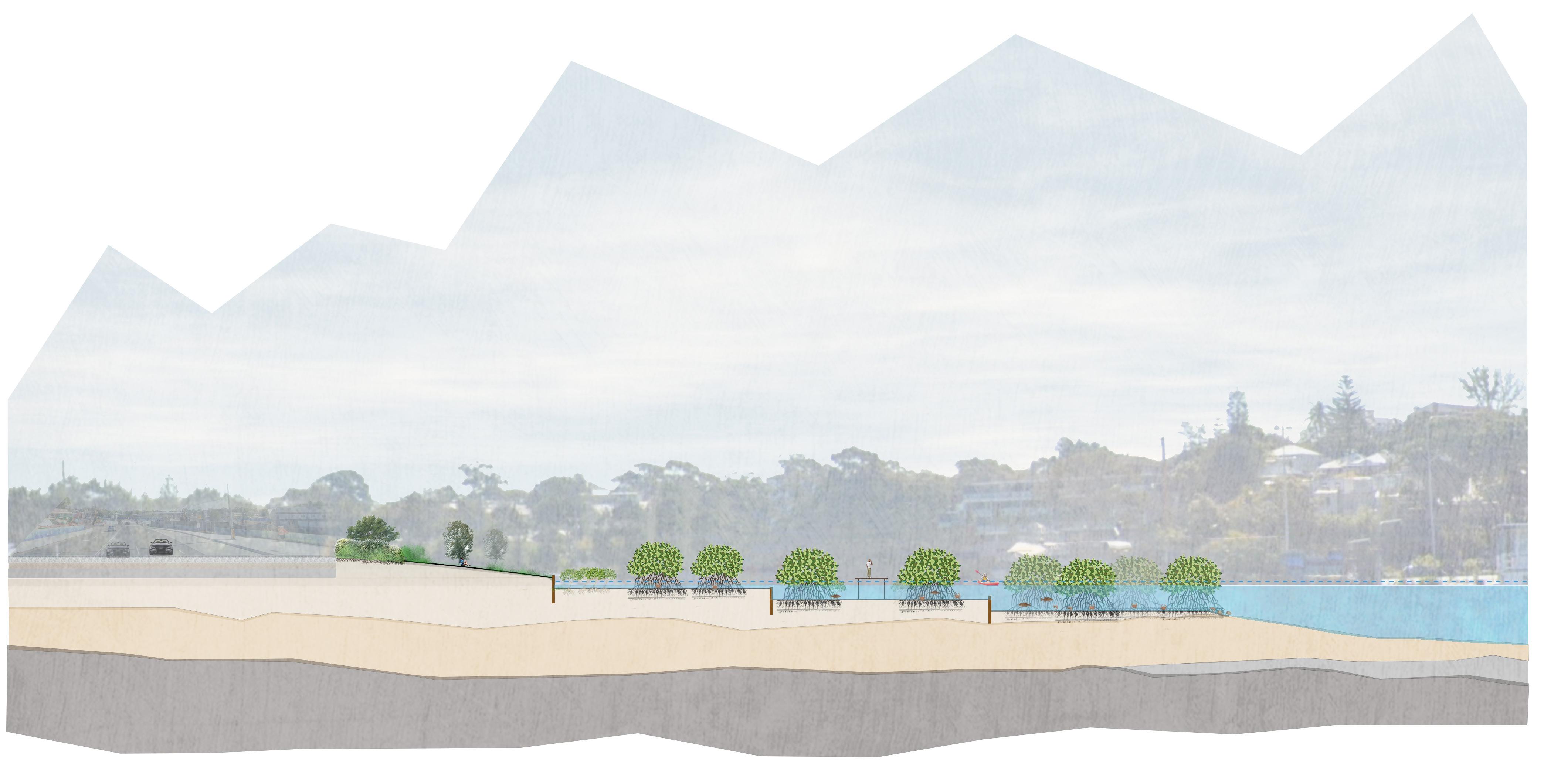
5.2 Urban waterfront (water features, shoreline): water features have two functions: 1. Waterplay for people, interactive with fresh water; 2. Treating water, filter facilities install in waterplay facility, let people know the water treatment techniques during interaction. Maritime activity – Boathouse, retain the marina at the front of Boathouse, developed maritime culture area (café, retails).
5 Developing stormwater management design based on sponge city strategy The design is divided into three parts.
5.1 Urban area (buildings, streets): collected rainwater by permeable pavements, green roof…etc.; store water, water tank under main street, water sediment for urban waterfront using (briefly introduced) Views from street to public domain.
5.3 Mangrove habitat: white creek and cleaner rainwater flow into habitat support certain salinity and mineral for mangrove, at the same time it can purify seawater and absorb pollutants, enhance intertidal ecosystem and water quality of rozelle bay.
As the highlight area of storm water reusing, the urban waterfront design is the most important part so that it had many iterations, and imporved the deetail design after discussion with tutor.
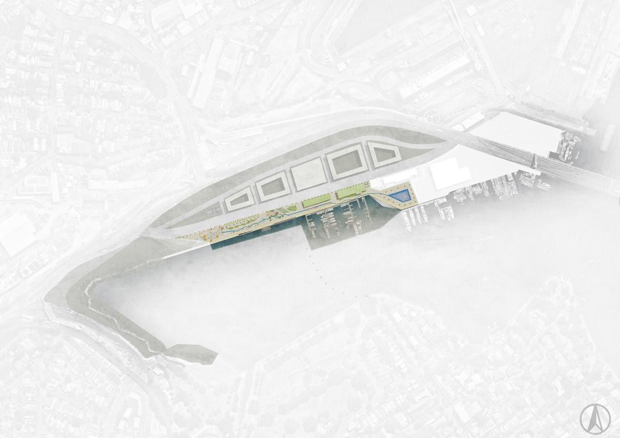
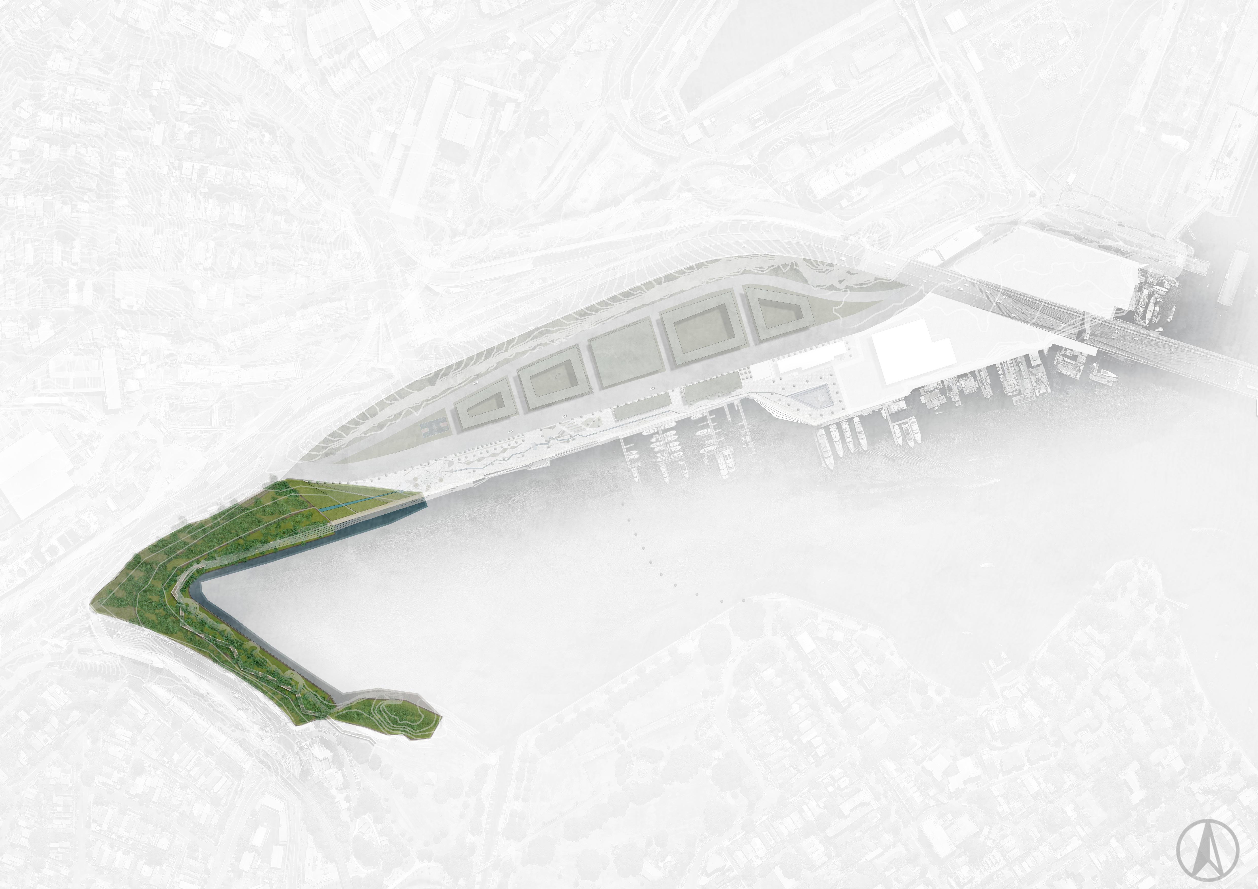
Urban area
Largest area in Rozelle Bay, early phase of construction.
Urban waterfront
Main public activity space, playing an important role when residents come in.
Ecological area
The most significant place for Rozelle Bay sustainable development. Providing storm water resilience in the future.
Stage 1: Construction
6 Stage: 6.1 Infrastructure construction (pavement, permeable street, water tank underground, maritime area relocated).
Stage 2: Development
6.2 water features and tidal stair Mangrove habitat set up (people play with fresh water).
Stage 3: Sustainability
6.3 Public activity space, healthy mangrove habitat intertidal zone, absorb contamination, clean sea water (people interacted with waterfront).
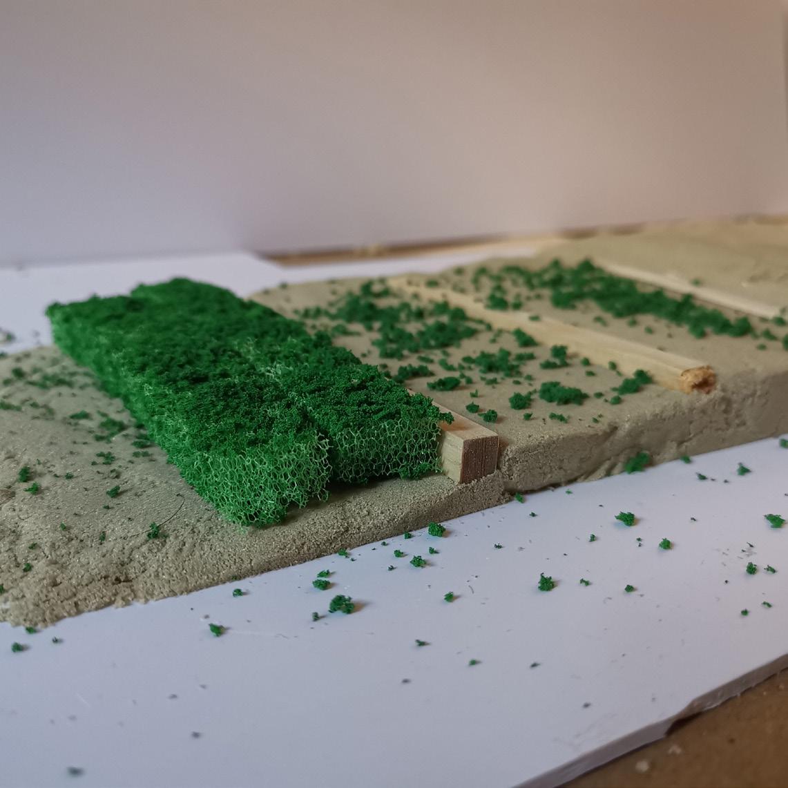
Modeling street structure, green foor, water flowing and mangrove space.
Conceptual the rainwater journey in Rozelle Bay.
Showing the stage changing at mangrove habitats.
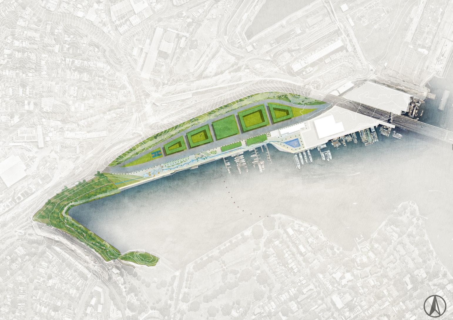
5.0 Detail Design
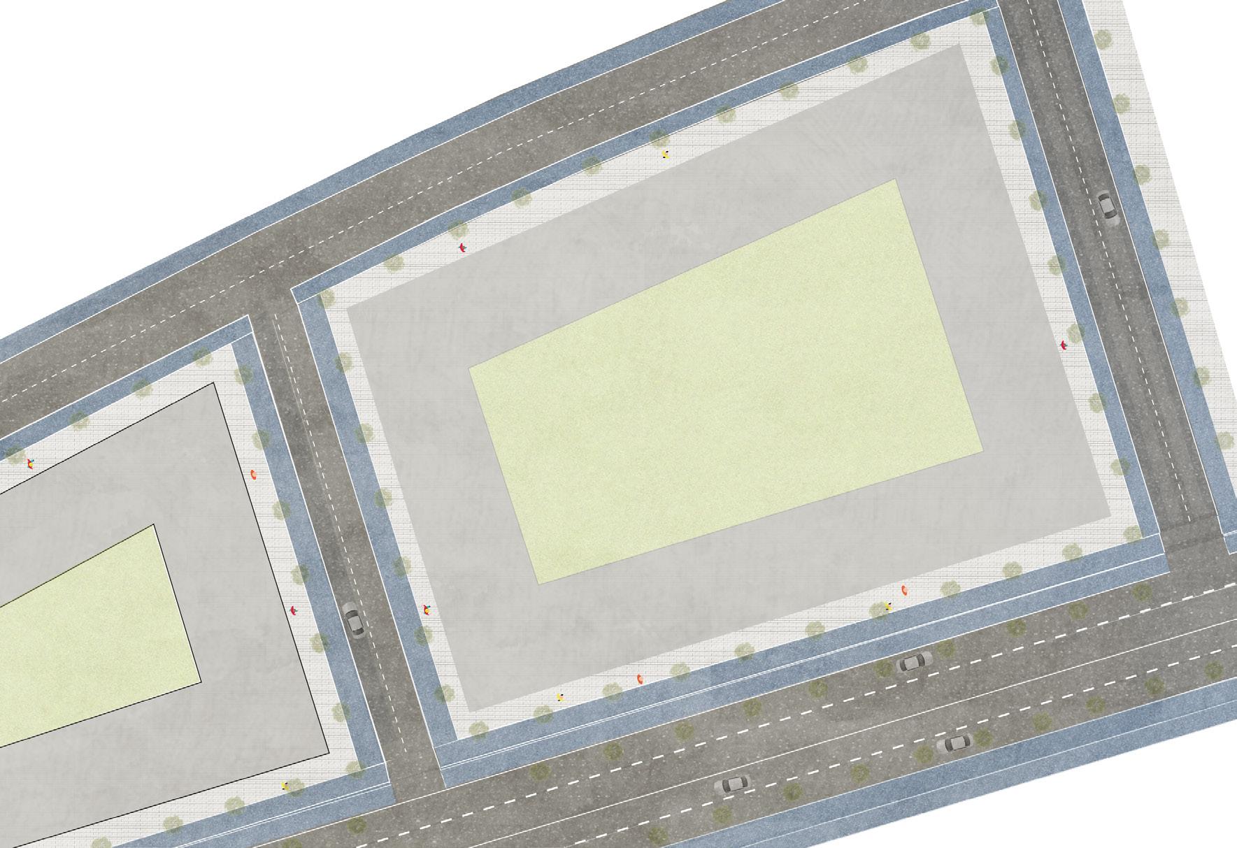
5.1 DESIGN ZONES
Urban area -let it be stored
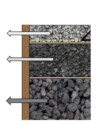
Collection and storage stormwater by green roof, permeable surface, underground water storage system.
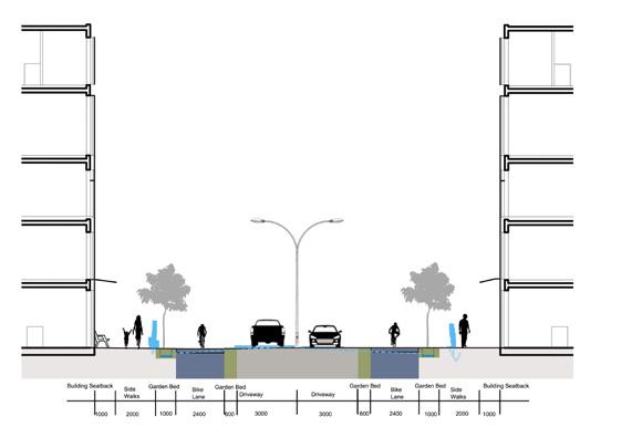
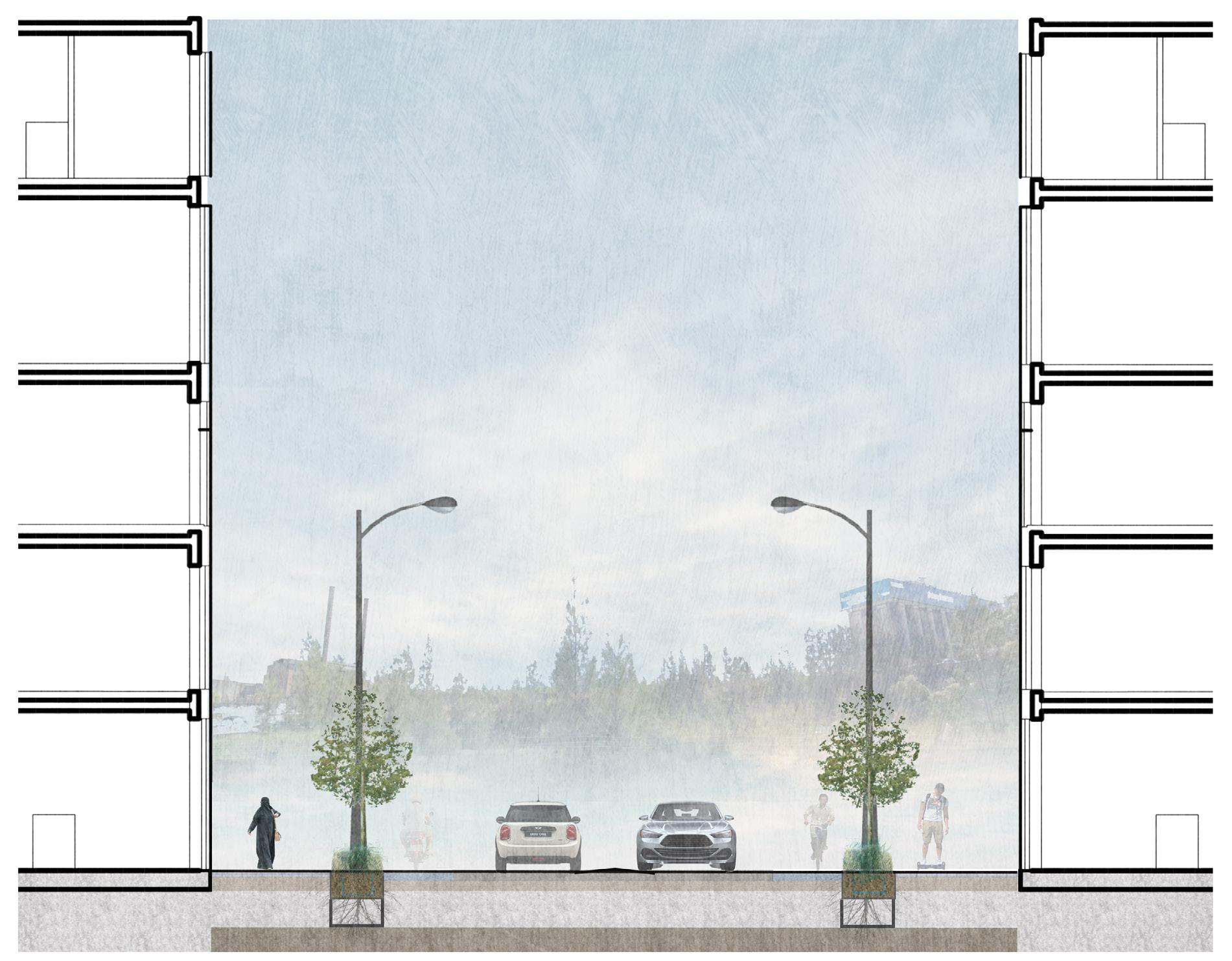
Section of 10m street
Section of 20m street
Accessibility consideration
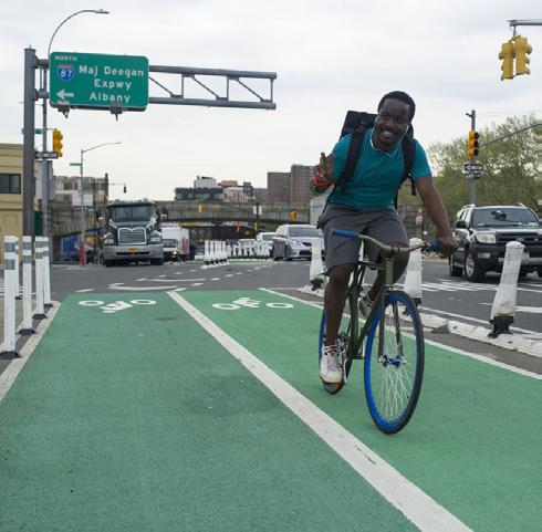
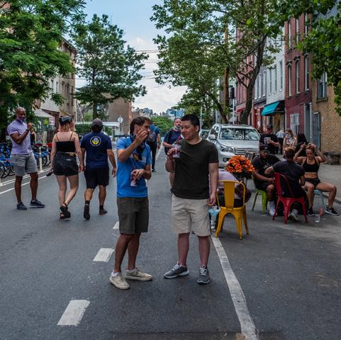
More bicycle lanes provided, encourage low-carbon transportation. Rozelle Bay maximum speed 30km/h, Street give back to pedestrian.
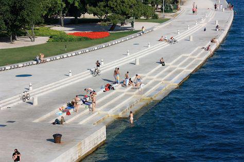
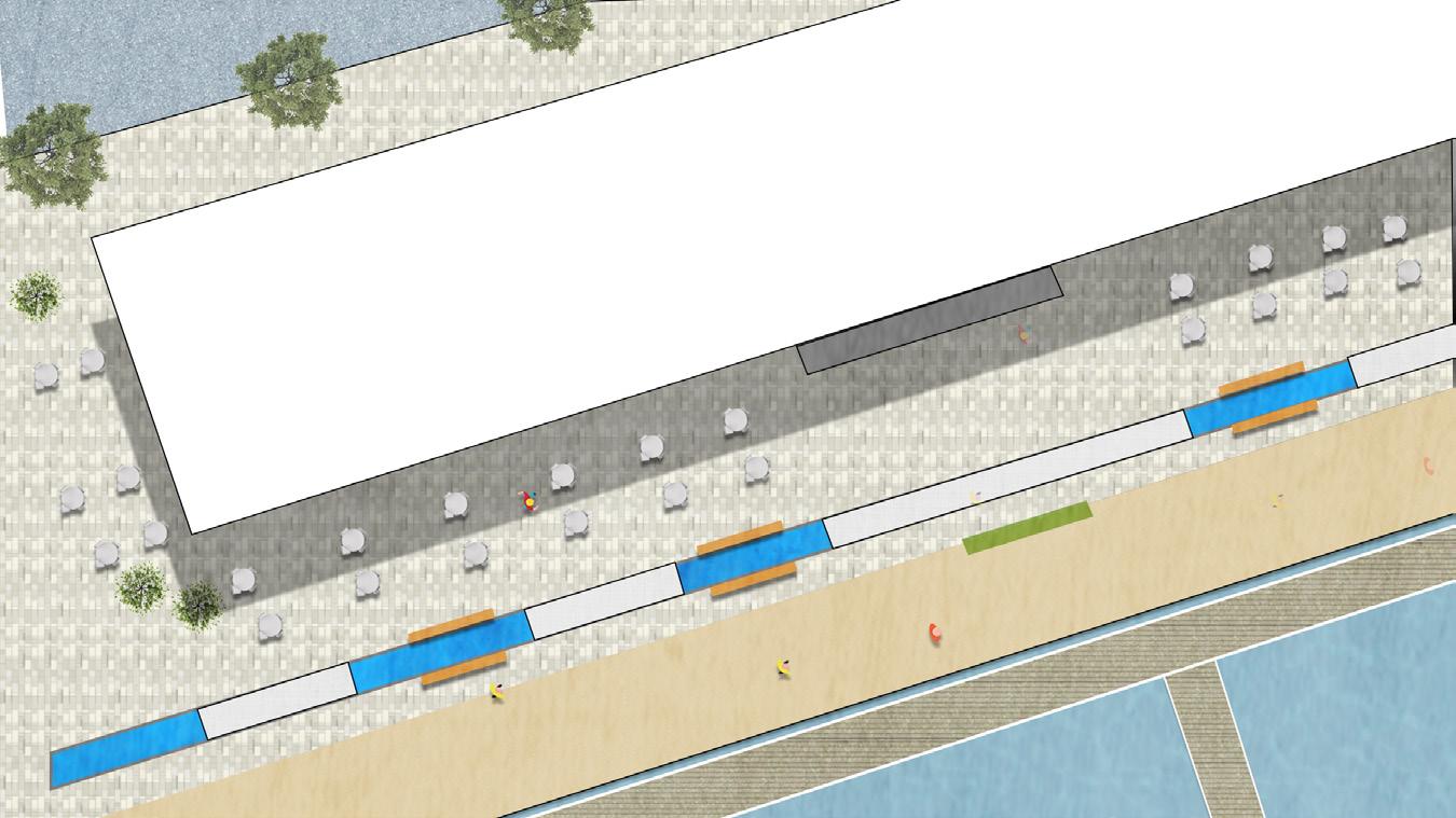
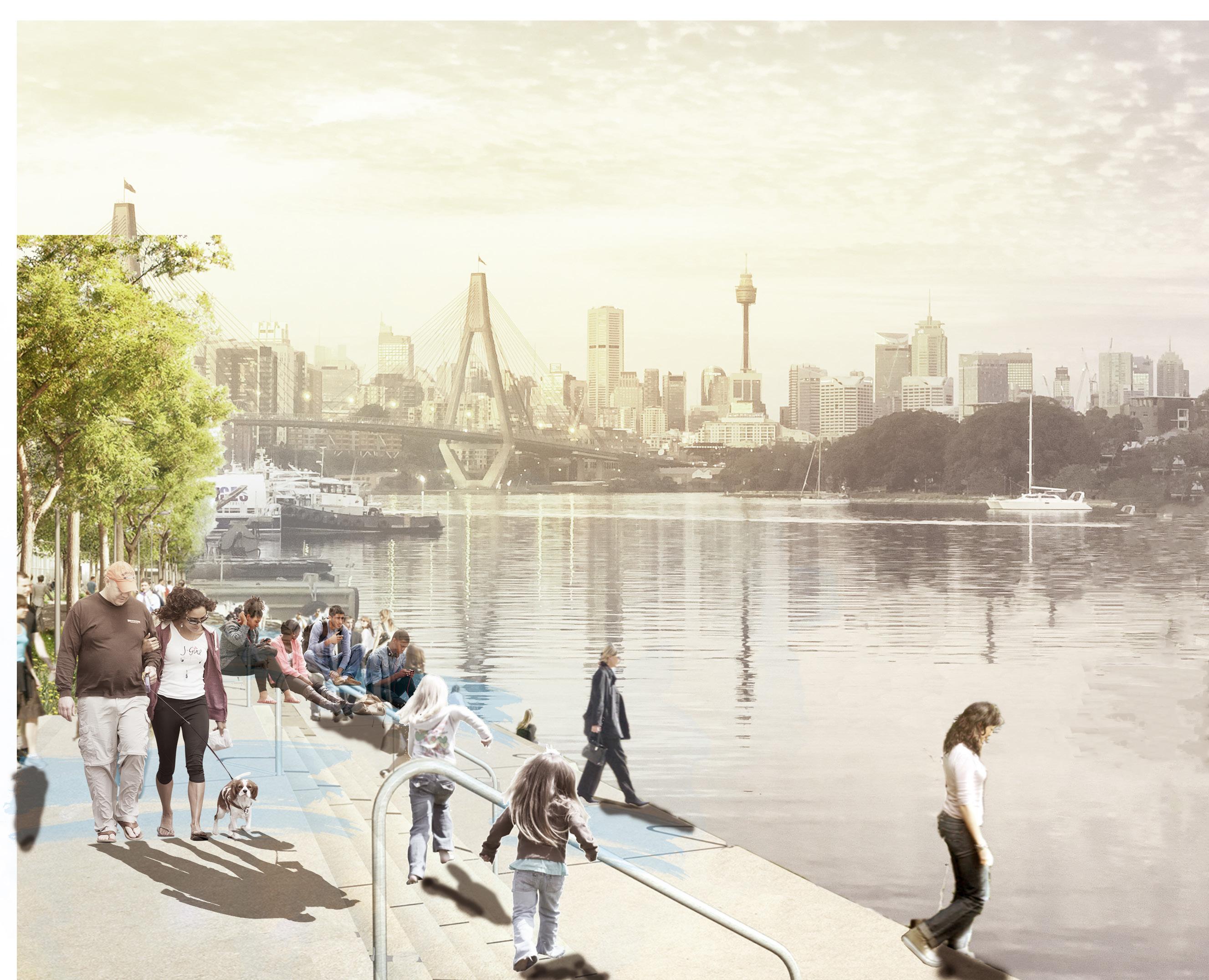
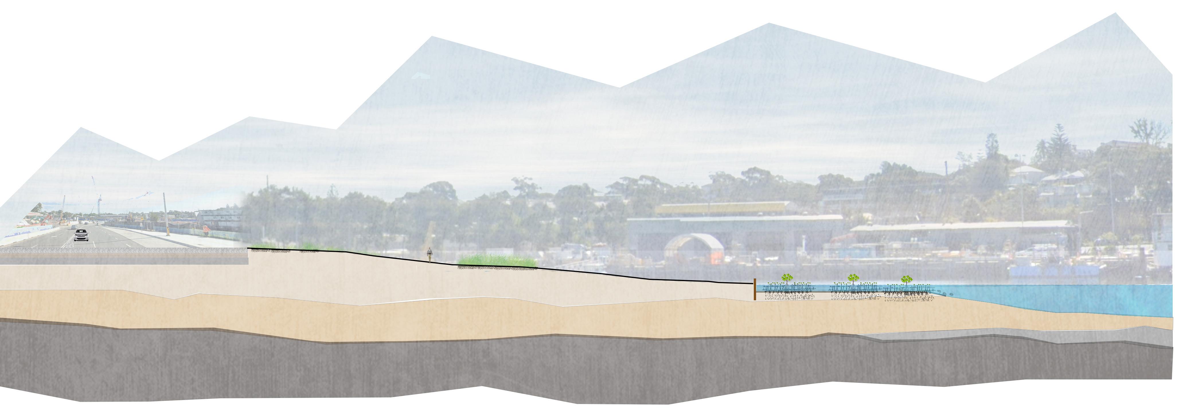
Waterfront structures are the major space for interacting with the bay.
Tidal stair
Waterfront
WATERFRONT
-let us play & go
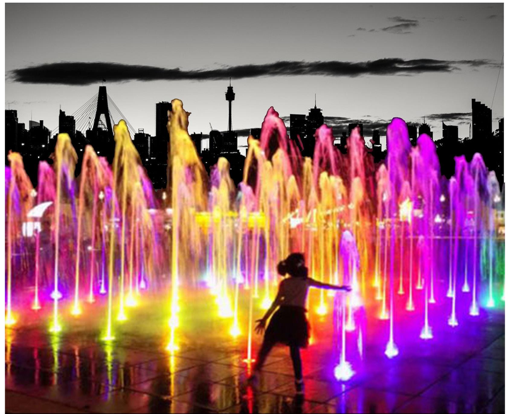
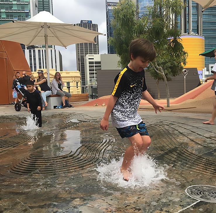
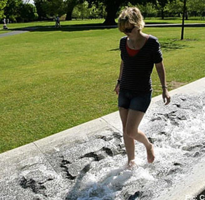
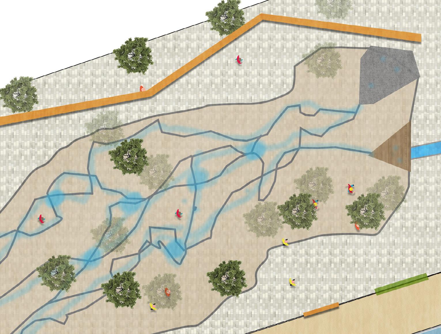
Waterplay
Garden bed separate the space
Pump
Concrete surface for elder children
Wood structure for kids
Parents look after their children
5.0 DESIGN ZONES
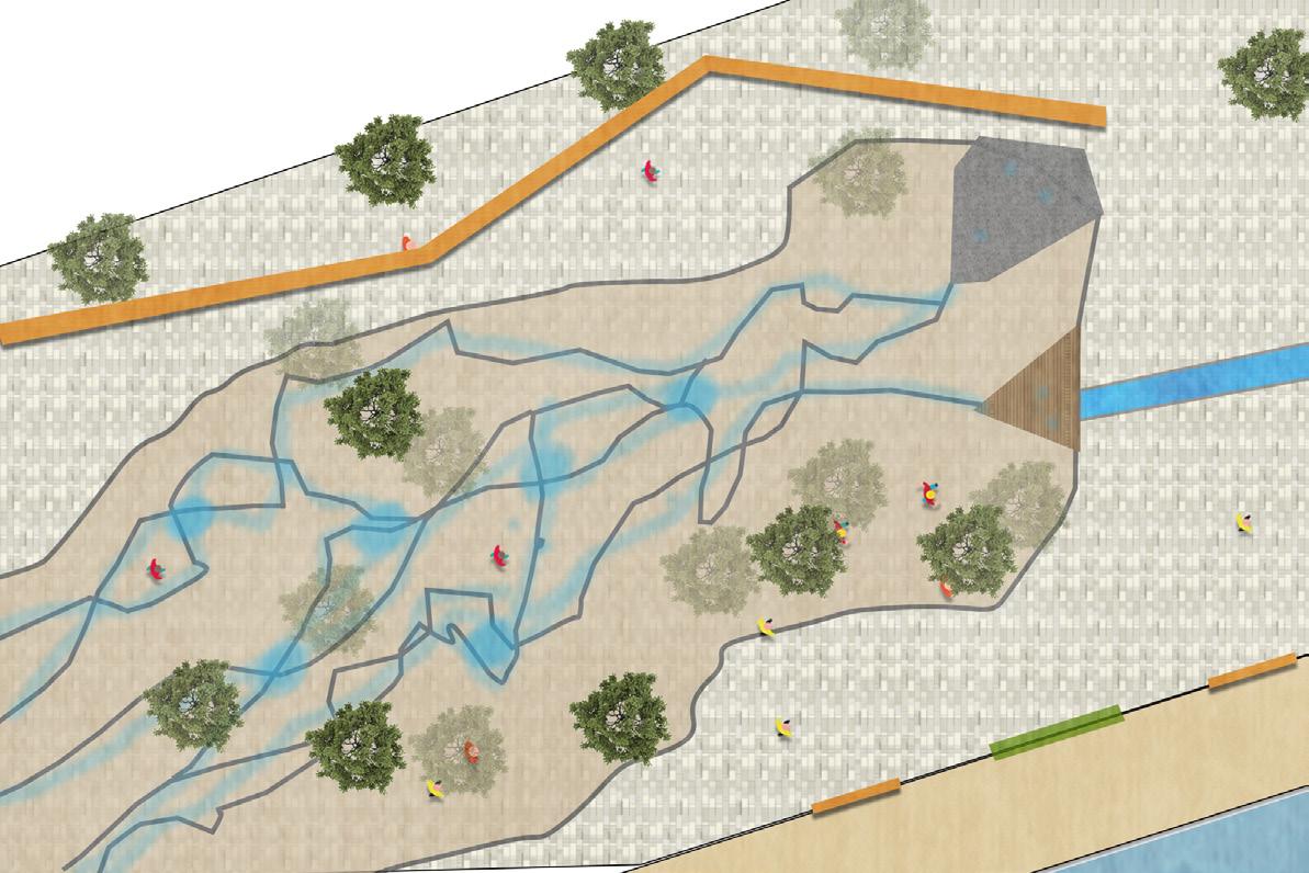
Ecological area - let it rise & grow
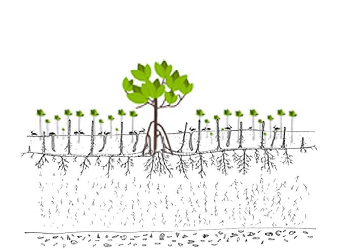
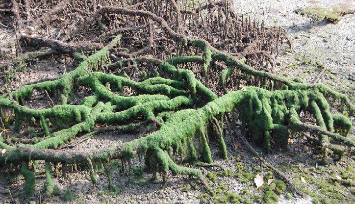
Water flow into mangrove habitat for ecosystem establishment, as well as purified rainwater by the Pneumatophores (roots).
5.3 MANGROVE HABITAT
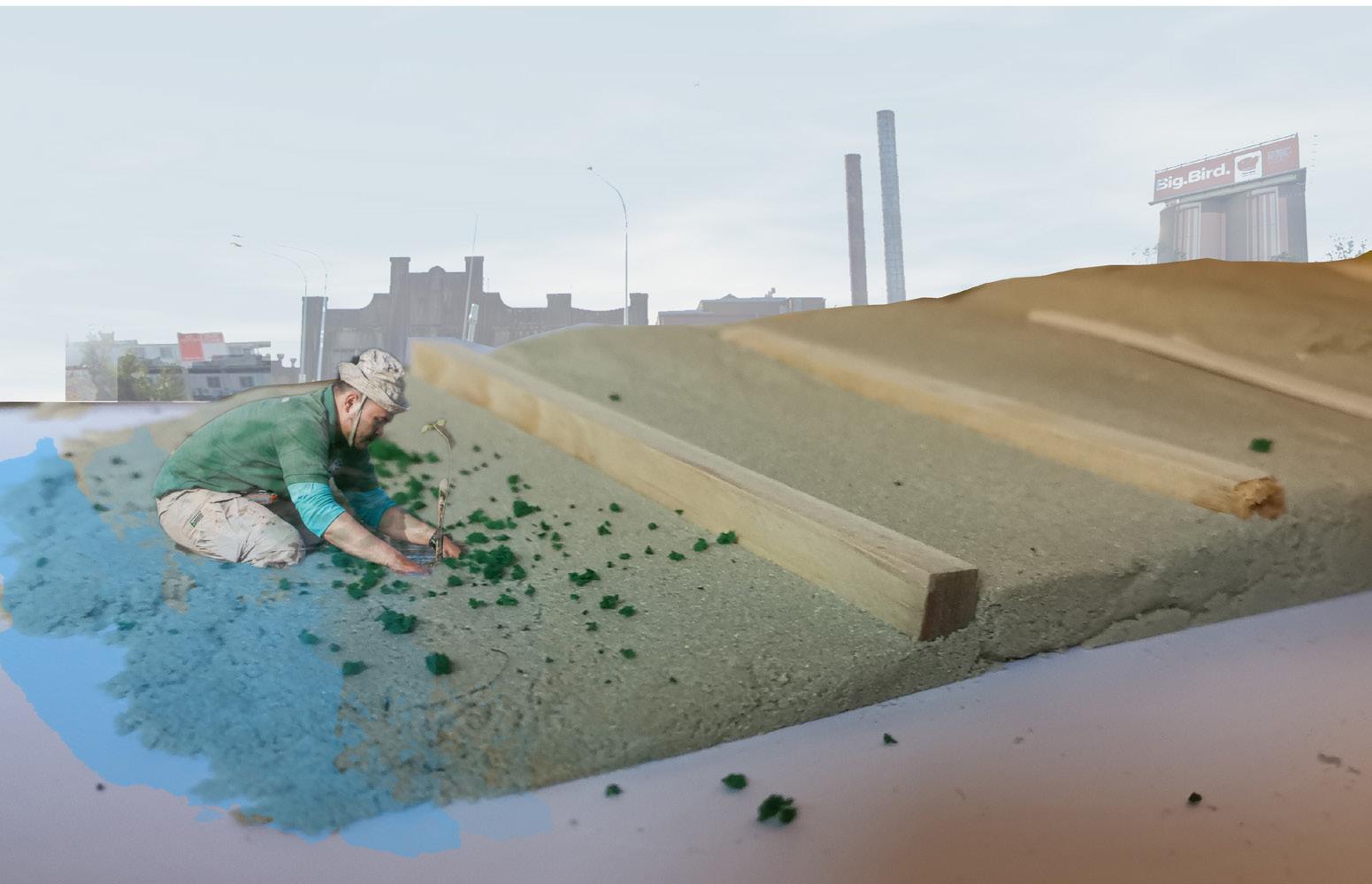
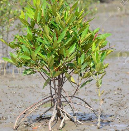
Stage 1 Cultivation
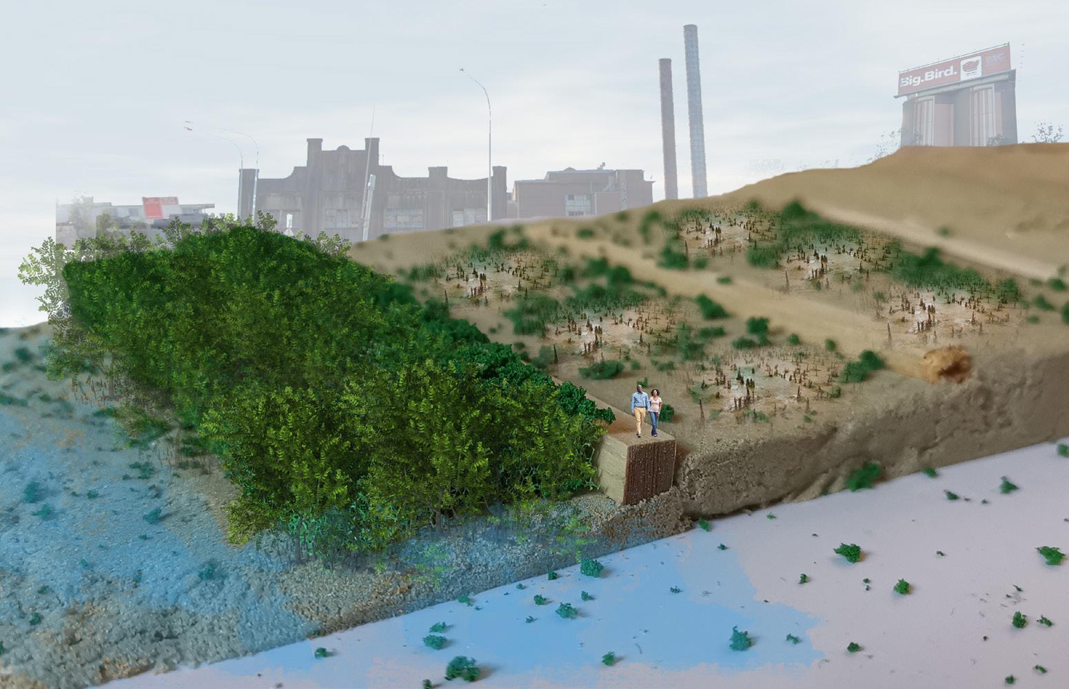
Stage 2 Growth
Stage 3 Maturity
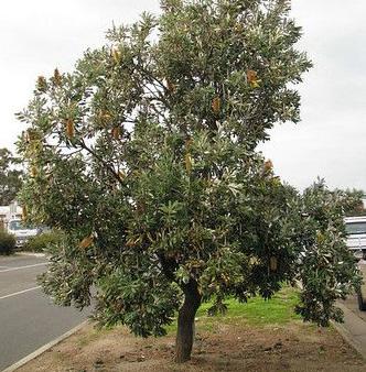
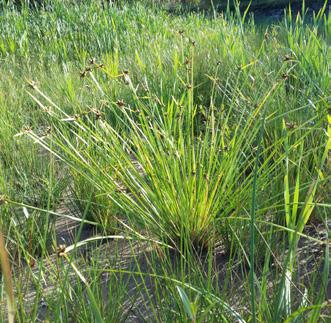
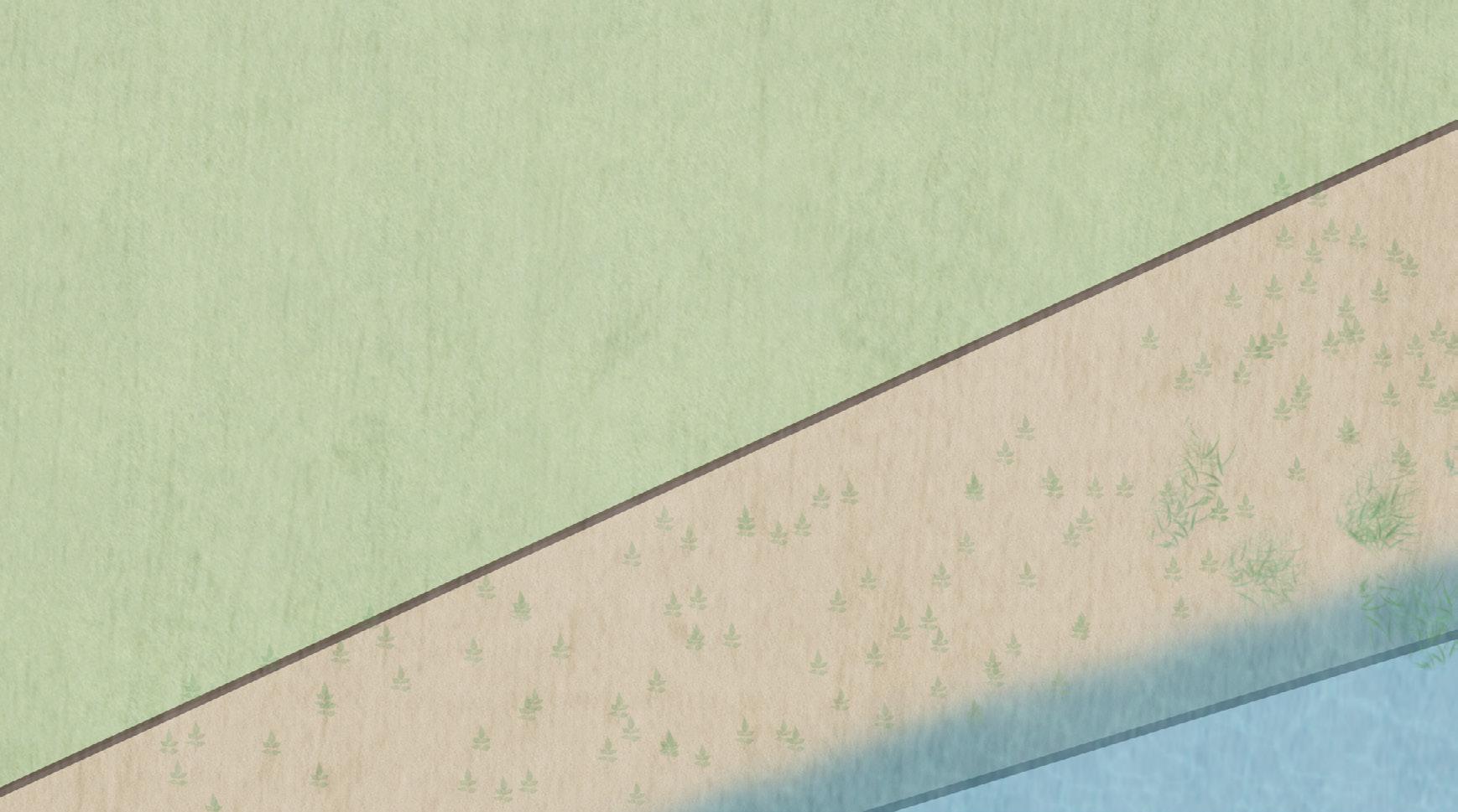
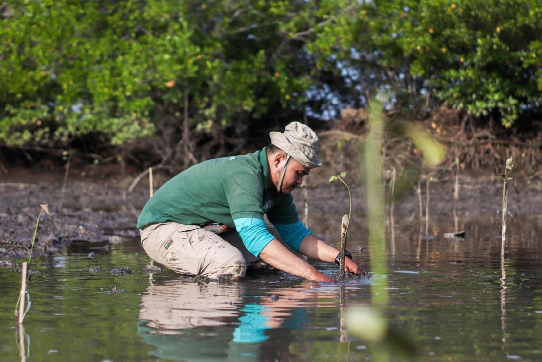
Planting grey mangrove at intertidal zone, transforming the existing landform.
Public going in, increase the experience with mangrove. Building more layer to tackle sea level rise.
More programs in this area, encouraging people enjoy with ecology.
Expanding the Jubilee park’s mangrove forest, celebrating the indigenous plants in Rozelle Bay, let people participate in the special intertidal ecosystem.
Stage 1
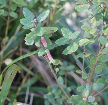
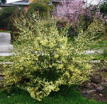
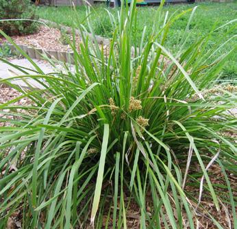
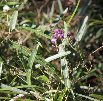
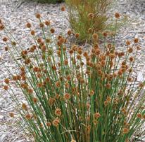
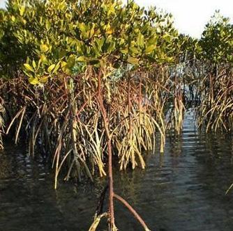
Grey mangrove Avicennia marina
5.3 MANGROVE HABITAT
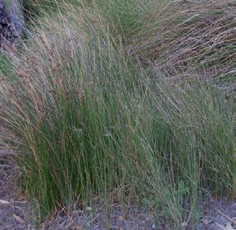
Stage 2
Their Pneumatophores help maintain water quality by removing sediment, nutrients and contaminants from stormwater runoff before it reaches the Rozelle Bay.
1:400@A3
1:150@A3
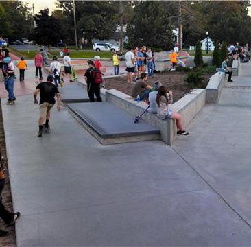
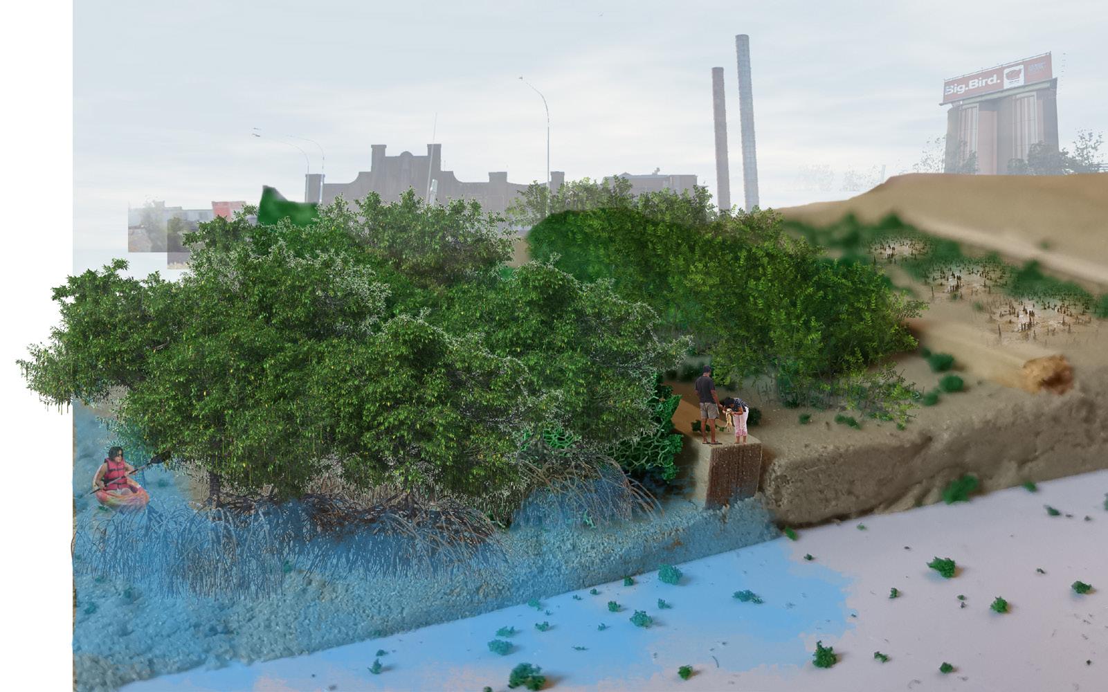
The end of Promenade, children are playing in water playground, people look after their kids, go for a strol...
5.3 MANGROVE HABITAT
Stage 3
In 70 years long term, it provides a habitat for many animals, reaches the balance of Ecological System.
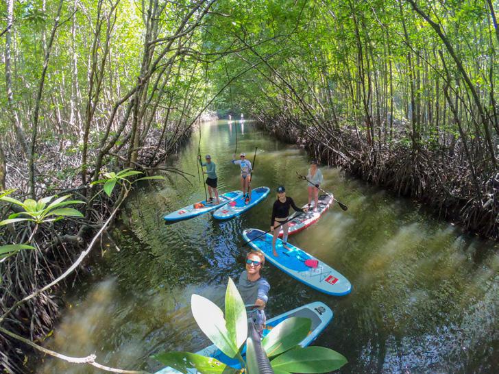
Kayak
Boardwalk
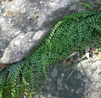
Sapling mangrove
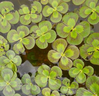
Mature mangrove
5.3 MANGROVE HABITAT
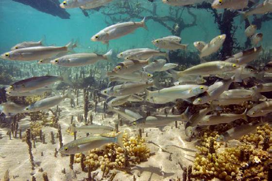
Mangrove Ecosystem food chain
Sun provides energy for vegetations to be able to practice their autotrophic nature.
Algae
Algae and Mangrove are consumed by herbivores.
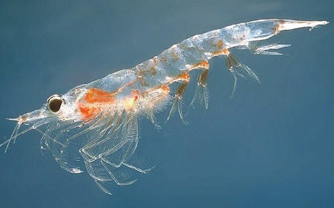
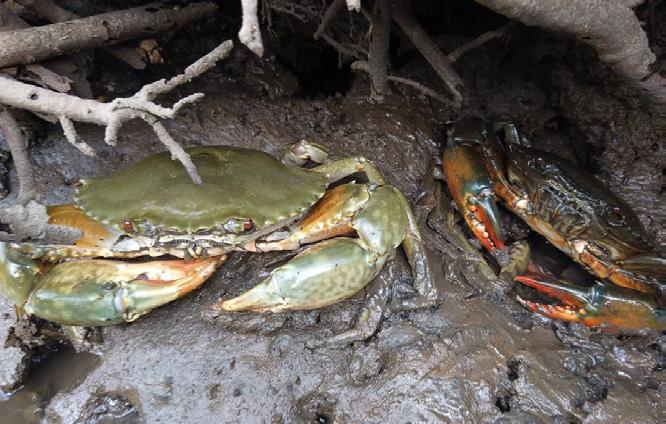
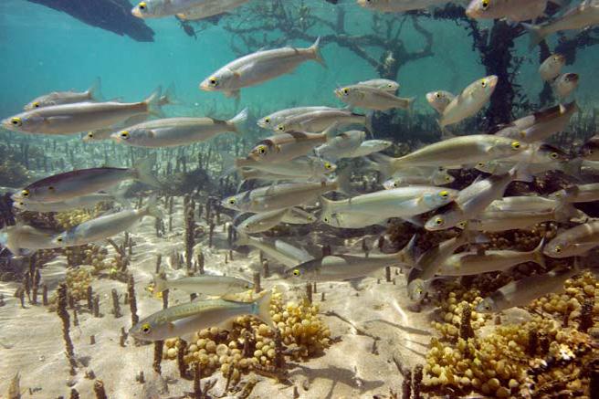
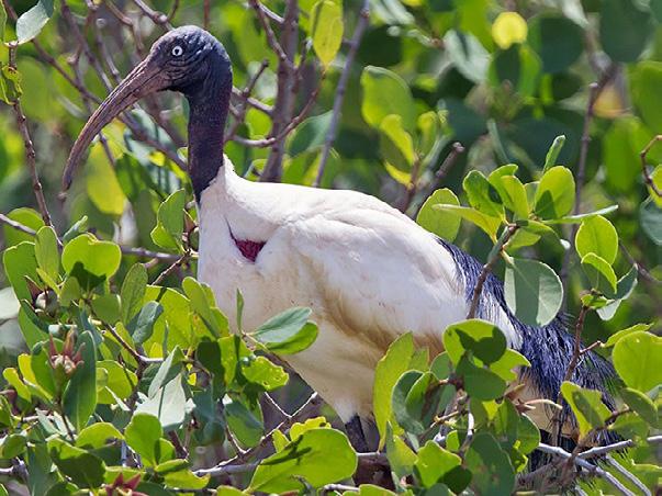
This area will be home to prawns, crabs, fishes(mullet, bream, flathead...) and many species of birds.
Zooplankton
Crab (Second degree consumer emnivore).
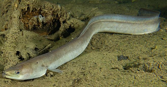
Mullet (Third consumer emnivore).
Eel (Fourth degree consumer emnivore).
Sacred Ibis
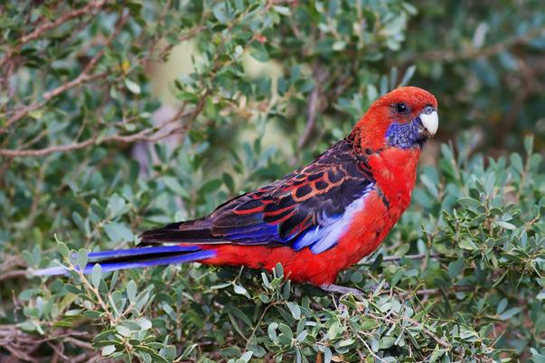
Crimson Rosella
Mangrove
Detritus: the waste material.
5.3 MANGROVE HABITAT
Stage 3
Harmony between human activities and naturla life.
Boardwalk
Kayak
6.0 Conculsion
Stage 1: Construction
Infrastructure construction (pavement, permeable street, Stormwater Reusing System, maritime area relocated).
Stage 2: Development
Water features, public activity space and tidal stair Mangrove habitat set up (people play with fresh water).
It will focus on the advantages of creating urban and landscape infrastructure that treats, exposes and celebrates the storm water. It would enhance the residents understanding and appreciation of storm water, it would improve urban heat island impacts and would flow through a range of waterscapes to the mangroves then reach the bay.